
Most snow in Houston falls in the form of flurries. The last time we saw +1 inch of snow officialy in Houston was in December of 1989. It was when we had single digit temperatures in Houston. However, Christmas Eve of 2004, some areas saw up to a foot of snow, mostly south of Houston. Of the 31 recorded snowfall events in Houston going back to 1895, snow falls about every 3 to 4 years on average. As for +1 inch (+2.54 centimeters) of snow, that happens about every 10 years. As for +2 inches (5 centimeters) of snow, it happens every 18 to 19 years. As for a 1895 type blizzard, well, my guess would be every +150 years.
http://www.wxresearch.com/snowhou.htm
2008-09 Texas Winter Weather Thread
Moderator: S2k Moderators
Forum rules
 The posts in this forum are NOT official forecast and should not be used as such. They are just the opinion of the poster and may or may not be backed by sound meteorological data. They are NOT endorsed by any professional institution or STORM2K.

The posts in this forum are NOT official forecast and should not be used as such. They are just the opinion of the poster and may or may not be backed by sound meteorological data. They are NOT endorsed by any professional institution or STORM2K.


-
southerngale

- Retired Staff

- Posts: 27418
- Joined: Thu Oct 10, 2002 1:27 am
- Location: Southeast Texas (Beaumont area)
-
JenBayles

- Category 5

- Posts: 3461
- Age: 63
- Joined: Tue Aug 26, 2003 3:27 pm
- Location: Houston, TX
- Contact:
jason, those palms will probably do much better with that thin layer of ice overnight. Ice is a great insulator unless it gets so thick and heavy that it breaks off limbs. I'm just now getting a slight layer of ice on shrub leaves and grass blades topped with snow flakes. Sounds funny when I go outside. Looks like snow but the sleet mixed in makes noise hitting on iced objects. Don't see or hear this very often!
0 likes
-
JenBayles
- Category 5
- Posts: 3461
- Age: 63
- Joined: Tue Aug 26, 2003 3:27 pm
- Location: Houston, TX
- Contact:
Winter Weather Advisory
URGENT - WINTER WEATHER MESSAGE
NATIONAL WEATHER SERVICE HOUSTON/GALVESTON TX
837 PM CST WED DEC 10 2008
...WINTER WEATHER ADVISORY IN EFFECT UNTIL MIDNIGHT CST TONIGHT...
.AN UPPER LOW MOVING ACROSS SOUTHEAST TEXAS WAS PRODUCING AREAS
OF LIGHT SNOW AND SLEET. TEMPERATURES WERE NEAR OR JUST BELOW
FREEZING MAINLY ALONG AND NORTH OF INTERSTATE 10 AT 6 PM. BRIDGES
AND OVERPASSES HAVE BEGUN TO EXPERIENCE SLICK CONDITIONS DUE TO
FREEZING OF MELTING SNOW ON THE ROADWAY. THE SNOW AND SLEET IS
EXPECTED TO END BETWEEN MIDNIGHT AND 3 AM. NO SIGNIFICANT
ACCUMULATIONS ARE EXPECTED.
TXZ163-164-176>179-195>200-210>213-111000-
/O.EXT.KHGX.WW.Y.0002.000000T0000Z-081211T1000Z/
AUSTIN-BRAZOS-BURLESON-COLORADO-GRIMES-HARRIS-HOUSTON-LIBERTY-
MADISON-MONTGOMERY-POLK-SAN JACINTO-TRINITY-WALKER-WALLER-
WASHINGTON-
INCLUDING THE CITIES OF...BELLVILLE...BRENHAM...BROOKSHIRE...
BRYAN...CALDWELL...CLEVELAND...COLDSPRING...COLLEGE STATION...
COLUMBUS...CONROE...CORRIGAN...CROCKETT...DAYTON...EAGLE LAKE...
GROVETON...HEMPSTEAD...HOUSTON...HUMBLE...HUNTSVILLE...KATY...
LAKE SOMERVILLE...LIBERTY...LIVINGSTON...MADISONVILLE...
NAVASOTA...ONALASKA...PASADENA...PRAIRIE VIEW...SEALY...
SHEPHERD...THE WOODLANDS...TOMBALL...TRINITY...WEIMAR...WILLIS
837 PM CST WED DEC 10 2008
...WINTER WEATHER ADVISORY NOW IN EFFECT UNTIL 4 AM CST
THURSDAY...
THE WINTER WEATHER ADVISORY IS NOW IN EFFECT UNTIL 4 AM CST
THURSDAY.
SURFACE TEMPERATURES HAVE DROPPED TO FREEZING ACROSS THE AREA.
LIGHT SNOW MELTING ON CONTACT WITH THE GROUND HAS BEGUN TO FREEZE
ON BRIDGES AND OVERPASSES. LIGHT ACCUMULATION OF ICE WILL OCCUR
ON ELEVATED ROADWAY SURFACE SUCH AS BRIDGES AND OVERPASSES. THE
SNOW IS EXPECTED TO END BETWEEN MIDNIGHT AND 4 AM CST.
ROADS...BRIDGES...AND OVERPASSES IN THE WARNING AREA ARE SLICK
AND HAZARDOUS. ACCUMULATION OF ICE ON ROADWAYS...BRIDGES AND
OVERPASSES WILL MAKE TRAVEL TREACHEROUS.
0 likes
-
wxman22

- Category 5
- Posts: 1902
- Joined: Mon Jan 30, 2006 12:39 am
- Location: Wichita Falls, TX
- Contact:
Re: 2008-09 Texas Winter Weather Thread
(In Spring) 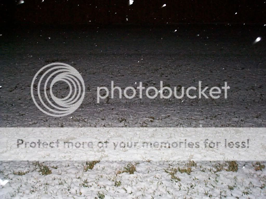

Last edited by wxman22 on Wed Dec 10, 2008 9:48 pm, edited 1 time in total.
0 likes

Re: 2008-09 Texas Winter Weather Thread
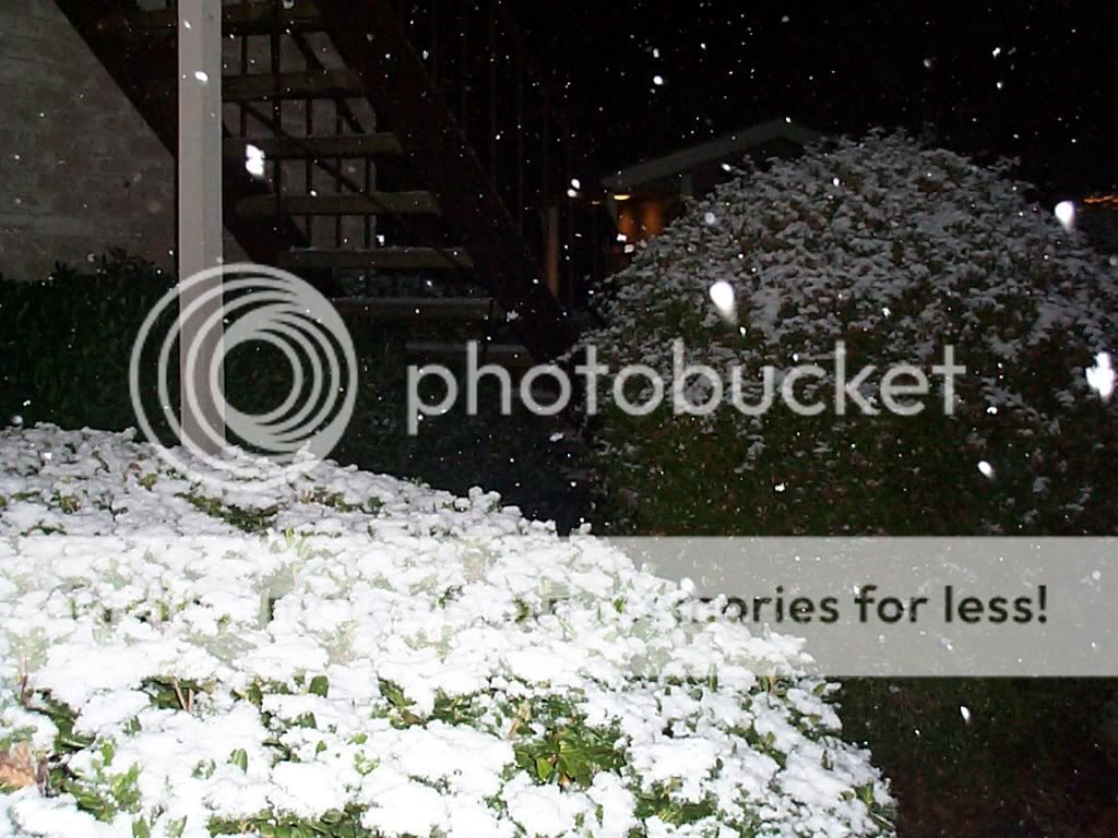
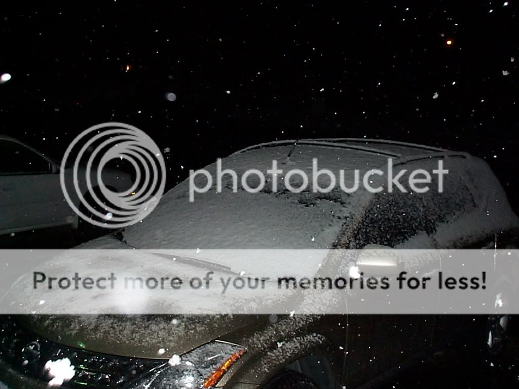
I have .5 of an inch on the grass and nearly an inch if not a little more on my truck. Have been seeing at least moderate with burst of heavy snow for the pass hour in Spring.
It has been snowing since about 330pm.
Upper low right over Harris County, snow should be ending in the next 2-3 hours. Surface temps. have fallen to freezing at many obs sites...and melting on elevated surfaces has ended.
Ice may begin to form on bridges and high flyovers.
Amazing site to see...I have not seen accumulating snow since 1989...2004 all fell south of my area.
0 likes
Re: 2008-09 Texas Winter Weather Thread
REGIONAL WEATHER ROUNDUP
NATIONAL WEATHER SERVICE LAKE CHARLES LA
800 PM CST WED DEC 10 2008
BEAUMONT LGT RAIN 34
JASPER MIX PCPN 37
LAKE CHARLES LGT RAIN 38
LAFAYETTE RAIN 40
NEW IBERIA RAIN 41
HOUSTON BUSH LGT SNOW 32
HOUSTON HOBBY LGT SNOW 33
GALVESTON MIX PCPN 34
COLLEGE STAT CLOUDY 32
CONROE CLOUDY 32
SHREVEPORT CLOUDY 37
DFW AIRPORT CLEAR 39
N.O. INTL ARPT RAIN 48
0 likes


-
southerngale
- Retired Staff
- Posts: 27418
- Joined: Thu Oct 10, 2002 1:27 am
- Location: Southeast Texas (Beaumont area)
Re:
JenBayles wrote:' gale - are you just getting rain right now?
Yeah. Anyone know why the snow stopped progressing east like it hit a brick wall? It looked soooo promising as it got REALLY close, but now the radar shows it staying well to my west, like it started going backwards. It's 32º here right now.
0 likes

Re: 2008-09 Texas Winter Weather Thread
Probably an effect of the Low wrapping up. You will get that snow in beaumont...just wait...its coming. Liken it to a hurricane wobble...the radar does NOT know all. NEVER trust the blue/pink lines. They are often wrong in marginal situations like this. Low is due south of you now, once it gets south of Lake Charles than you will be in the white stuff.
0 likes
Who is online
Users browsing this forum: No registered users and 70 guests