Six inches if it actually stuck, maybe more...

Moderator: S2k Moderators
 The posts in this forum are NOT official forecast and should not be used as such. They are just the opinion of the poster and may or may not be backed by sound meteorological data. They are NOT endorsed by any professional institution or STORM2K.

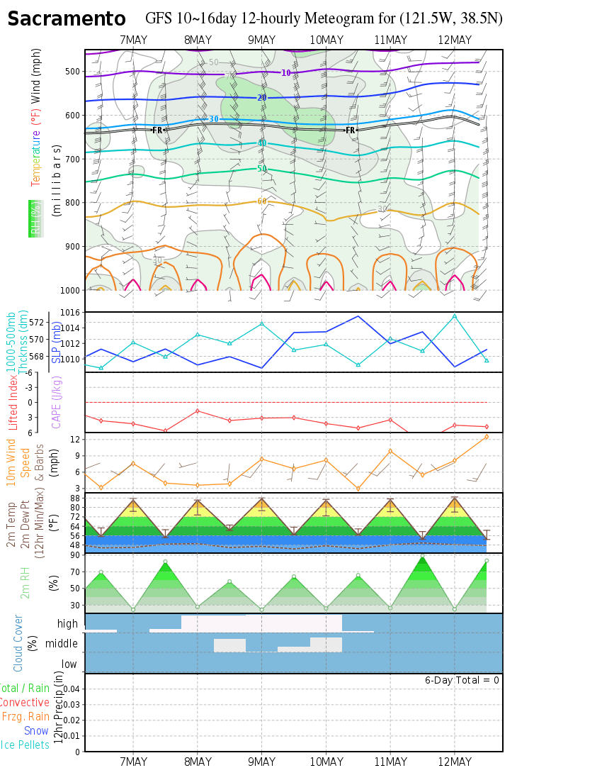
jahrmor wrote:The Sunday morning 850mb 0 degree isotherm is almost in Mexico; however, the 528 thickness line is hanging more North around Redding on this last run of NOGAPS. Not as much moisture either.
https://www.fnmoc.navy.mil/wxmap_cgi/cgi-bin/wxmap_single.cgi?area=ngp_epac&dtg=2008120912&prod=850&tau=120
https://www.fnmoc.navy.mil/wxmap_cgi/cgi-bin/wxmap_single.cgi?area=ngp_epac&dtg=2008120912&prod=prp&tau=120


Users browsing this forum: No registered users and 128 guests