Magical times.
2008-09 Texas Winter Weather Thread
Moderator: S2k Moderators
Forum rules
 The posts in this forum are NOT official forecast and should not be used as such. They are just the opinion of the poster and may or may not be backed by sound meteorological data. They are NOT endorsed by any professional institution or STORM2K.

The posts in this forum are NOT official forecast and should not be used as such. They are just the opinion of the poster and may or may not be backed by sound meteorological data. They are NOT endorsed by any professional institution or STORM2K.
-
southerngale

- Retired Staff

- Posts: 27418
- Joined: Thu Oct 10, 2002 1:27 am
- Location: Southeast Texas (Beaumont area)
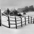
Thanks, all. So I likely had snow drifts in my yard? SO COOL!! Now if the snow would just come back, I'd measure in a variety of areas, and then take an average. Meanwhile, I guess it's safe to say that I had close to the nearest official reading. Which is way more than I ever imagined!! I think it's funny how excited we were when it first started snowing, then how excited we were when it was sticking, and then how excited we were when there was a slight accumulation, then a better accumulation, etc. We were ecstatic early in the night when we were having snowball fights. Next thing you know, there's a ton of snow everywhere and we're making a snowman!
Magical times.
Magical times.
0 likes
-
Ed Mahmoud
Re: 2008-09 Texas Winter Weather Thread
Tuesday morning looks potentially interesting per the Euro, perhaps as far South as DFW. The high is starting to push off the the East, a lee low is developing, but the front looks to be well South of the area, and assuming the shallow and stubborn airmass is slow to be pushed out, and may have to be warmed from above by rain, there could be a period of icing in Dallas.


The GFS isn't radically different, although it would seem to confine precip to Oklahoma, but its forecast temp in DFW is barely above freezing, and the location of precip and a degree or two error, especially in a model known for issues with shallow cold air mass, says Tuesday may be the best chance for a weather day for the children of the H-E-B Independent School District. My sister went to Trinity. Great football team.
The GFS isn't radically different, although it would seem to confine precip to Oklahoma, but its forecast temp in DFW is barely above freezing, and the location of precip and a degree or two error, especially in a model known for issues with shallow cold air mass, says Tuesday may be the best chance for a weather day for the children of the H-E-B Independent School District. My sister went to Trinity. Great football team.
0 likes
-
ntxweatherwatcher

- Tropical Depression

- Posts: 71
- Joined: Thu Oct 23, 2008 3:55 pm
- Location: Bedford, TX DFW
Re: 2008-09 Texas Winter Weather Thread
My kids are in HEB ISD, they would be too happy with a weather day!! 
0 likes
-
cctxhurricanewatcher

- Category 5

- Posts: 1206
- Joined: Sun Sep 12, 2004 8:53 pm
- Location: Corpus Christi, Texas
-
CaptinCrunch

- S2K Supporter

- Posts: 8777
- Age: 58
- Joined: Mon Nov 03, 2003 4:33 pm
- Location: Kennedale, TX (Tarrant Co.)
Re:
cctxhurricanewatcher wrote:Most of the NWS AFD's from the Texas offices are throwing up their arms about next weeks cold snap. Usually they seem to embrace the GFS with every run, but are holding back this time around.
thats because they always bust when rolling with the GFS BS
0 likes
-
Ed Mahmoud
Re: 2008-09 Texas Winter Weather Thread
Maybe 1040 mb plus of Canadian Comfort settling down to the Gulf Coast in 8 or 9 days (if the Euro is right) will bring excitement back to Storm2K

0 likes
-
wxman22

- Category 5
- Posts: 1902
- Joined: Mon Jan 30, 2006 12:39 am
- Location: Wichita Falls, TX
- Contact:
Re: 2008-09 Texas Winter Weather Thread
AREA FORECAST DISCUSSION
NATIONAL WEATHER SERVICE HOUSTON/GALVESTON TX
305 PM CST SAT DEC 13 2008
.DISCUSSION...
WARM ADVECTION HAS BEGUN IN EARNEST TODAY WITH STRONG SOUTHERLY
WINDS OFF THE GULF WITH A 30-40KT LLJ. SOUTHERLY WINDS SHOULD
DIMINISH SOME BUT STILL REMAIN ABOVE 10KTS OVERNIGHT WITH GULF
MOISTURE BECOMING MORE ESTABLISHED OVER SE TX. MODELS ARE IN
FAIRLY GOOD AGREEMENT IN REGARD TO SUNDAY. MIN TEMPS WILL ONLY
DROP TO THE LOW 60S WITH UPPER 70S POSSIBLE FOR MAX TEMPS.
SOUTHERLY WINDS SHOULD CONTINUE WITH A FEW SPOTTY SHOWERS. LATEST
MODEL SOUNDINGS FROM THE NAM/GFS SHOW A DECENT CAP DEVELOPING SO
THUNDERSTORM ACTIVITY LOOKS TO BE MINIMAL.
WATER VAPOR IMAGERY SHOWS A BROAD LONG WAVE TROUGH DEVELOPING
OVER THE INTER-MOUNTAIN WEST AND GREAT BASIN. LEAD SHORT IS
MOVING ACROSS THE PLAINS NOW WITH A SECOND SHORTWAVE MOVING
THROUGH THE N PLAINS. SFC ANALYSIS AT 18Z SHOWS VERY COLD AIRMASS
BOTTLED UP IN CANADA WHICH WILL BEGIN PUSHING SOUTH TOMORROW. THE
COLD FRONT IS EXPECTED TO MOVE THROUGH THE AREA ON MONDAY AND IS
THE MAIN FORECAST CHALLENGE.
THE 12Z NAM/ECMWF BOTH PUSH THE FRONT OFF THE COAST AND ATTM THIS
SEEMS TO BE THE MORE LIKELY SCENARIO. THE GFS STALLS THE FRONT AT
THE COAST BUT THE GFS SEEMS TO HAVE A HARD TIME RESOLVING THESE
SHALLOW COLD CANADIAN AIRMASSES. WITH THIS IN MIND...THE FORECAST
WILL GO MORE ALONG WITH THE NAM AND HAVE THE FRONT REACHING THE
COAST BY 6-7PM MON AND THEN STALLING ACROSS THE OFFSHORE WATERS
OF THE UPPER TX COAST. GIVEN THAT THE AIRMASS WILL ONLY BE A
COUPLE THOUSAND FEET DEEP...ISENTROPIC UPGLIDE OVER THE FRONTAL
SURFACE ON TUE WILL KEEP CLOUDS AND SOME AREAS OF RAIN IN THE
FORECAST. TEMPS ON TUE WILL BE COLDER THAN MEX GUIDANCE AND
CLOSER TO THE 12Z ECMWF TEMPS.
AFTER TUE THE FORECAST FOLLOWS THE 12Z ECMWF MORE THAN THE GFS.
FORECAST CONFIDENCE IS STILL RATHER LOW GIVEN THAT THERE HAS NOT
BEEN MUCH RUN TO RUN CONSISTENCY. THE GFS HAS BEEN FLIPPING
AROUND A LOT. REGARDLESS...THE FRONT SHOULD SLOWLY MOVE BACK
NORTH AS A WARM FRONT ON WED. THIS SHOULD BRING BACK WARMER TEMPS
AND MOISTURE FOR THE END OF THE WEEK. A FAIRLY POTENT SHORTWAVE
TROUGH WILL MOVE ACROSS THE SOUTHERN PLAINS THU NIGHT INTO FRI.
ZONAL FLOW OF THE JET WILL KEEP THIS FRONT FROM PUSHING INTO THE
AREA WITH ABOVE NORMAL TEMPS EXPECTED. AGAIN WITH MOISTURE BACK
IN THE AREA...WILL HOLD ONTO SOME 20-30 PERCENT POPS WITH WARM
ADVECTION SHOWERS POSSIBLE. OF PARTICULAR INTEREST IS WHAT THE
ECMWF DOES FOR NEXT WEEKEND. IT SHOWS A VERY STRONG SFC RIDGE
BUILDING INTO THE PLAINS WITH AN ARCTIC FRONT PUSHING THROUGH.
THIS FRONT MAY PUSH THROUGH SAT BUT WILL WAIT FOR SOME MORE
CONSISTENCY IN THE ECMWF BEFORE JUMPING ON IT. THE GFS DOES NOT
BRING THIS FRONT SOUTH BUT STALLS IT. THE GFS HOWEVER DOES NOT
HAVE GOOD UPPER LEVEL SUPPORT FOR THE FRONT WHEREAS THE ECMWF
DOES. STILL PLENTY OF TIME TO WAIT AND SEE ON THIS POSSIBLE
0 likes
-
southerngale
- Retired Staff
- Posts: 27418
- Joined: Thu Oct 10, 2002 1:27 am
- Location: Southeast Texas (Beaumont area)


-
srainhoutx

- S2K Supporter
- Posts: 6919
- Age: 68
- Joined: Sun Jan 14, 2007 11:34 am
- Location: Haywood County, NC
- Contact:
Re: 2008-09 Texas Winter Weather Thread
Looking at obs and reading AFD's around the S Plains and TX, the front is barreling into N TX, OK and points NE with around 40 degree drop in temps in about a 75 mile range. Looks as if the NAM is performing a little better in the near term. ECMWF continues to "advertise" a BIG cool down next weekend. Enjoy the warmer weather today as I suspect tomorrow will feel a bit different around here. Artic Front shows up nicely on WV Loop this morning as it dives S into the TX Panhandle/OK...
http://www.srh.noaa.gov/tropical/satpix ... v_loop.php

http://www.srh.noaa.gov/tropical/satpix ... v_loop.php
0 likes
-
Ed Mahmoud
Re: 2008-09 Texas Winter Weather Thread
12z GFS holds some promise for delayed start to school, although when precip stops falling and when surface temps hit freezing may not line up right.
1st number is air temp, celcius, second is 850 temp, the number with a decimal point is inches liquid equivalent. No precip shown in the 12 hours following 12Z Monday, suggesting precip had ended sometime earlier.
This far out, this is more for trend purposes than actually saying Monday school may be delayed until a couple hours after sunrise.
Euro has a Canadian high poking down to HOU then.

1st number is air temp, celcius, second is 850 temp, the number with a decimal point is inches liquid equivalent. No precip shown in the 12 hours following 12Z Monday, suggesting precip had ended sometime earlier.
This far out, this is more for trend purposes than actually saying Monday school may be delayed until a couple hours after sunrise.
Code: Select all
SUN 18Z 21-DEC   5.9     9.2    1023      89      71    0.05     576     558
MON 00Z 22-DEC   3.8     7.8    1024      91      95    0.08     575     556
MON 12Z 22-DEC  -0.5     5.3    1030      85      52    0.11     577     553
Euro has a Canadian high poking down to HOU then.
0 likes
-
jasons2k

- Storm2k Executive

- Posts: 8290
- Age: 52
- Joined: Wed Jul 06, 2005 12:32 pm
- Location: The Woodlands, TX
Re: 2008-09 Texas Winter Weather Thread
This is what Jeff Lindner had to say:
Big weather change on the way as very cold yet shallow arctic air mass will arrive on Monday.
South winds will continue to howl through this evening before weakening tonight. Frequent gusts of 30-40mph will continue.
Will completely disregard all GFS guidance and go below all other available guidance...the models just do not grasp the depth or intensity of this very cold air. Will also speed up frontal timing faster than most guidance as the front is making very good progress this afternoon under its good density.
Well advertised arctic air intrusion for the past 2 weeks will arrive into SE TX early Monday. Arctic boundary currently over far NW TX will clear most of N TX by 600am Monday and then slides across SE TX during the day. Very shallow 1,000-2,000 foot thick air mass will undercut warm southerly flow just above the surface and ooze off the coast Monday evening. Highs in the mid 70's will be reached prior to the frontal passage then a rapid temp. fall of 20-25 degrees with the front with temps. falling into the 40's by Monday afternoon.
Overrunning commences after the front passes as fast moving short waves cross the area. Will disregard models showing cold dome eroding northward on Tuesday. Feel the shallow air mass will hold tough and not erode against increasing southerly flow. Expect low clouds, fog and drizzle along with temperatures nearly steady in the 30's and 40's Tuesday and into Wednesday. Warm front may mix northward on Thursday ahead of a secondary arctic push for late Friday or Saturday however I am not sure this will in fact ever happen and it is possible that we stay in the cold sector the entire time. It should be noted the GFS shows 80 on Wednesday for IAH...I think 50 would be the max...maybe even the 40's. This boundary may usher in much colder air mass with even the GFS showing sub-freezing surface layer late next week with lots of moisture.
Will maintain all liquid precip. this week...unless I am not going cold enough Tuesday...across the N...and this is very possible. If temperatures are about 5-10 degrees colder Tuesday we could see freezing rain/freezing drizzle Tuesday AM across our N and NW counties. Since the guidance is useless...upstream temperature trends Monday will help dictate this potential.
Next weekend bears close watch as overrunning and another shallow arctic air mass could result in a better chance of freezing precipitation across the area from Saturday into the early part of the following week.
Stay tuned...lots of changes on the way.
0 likes
-
Extremeweatherguy

- Category 5
- Posts: 11095
- Joined: Mon Oct 10, 2005 8:13 pm
- Location: Florida
OKLAHOMA CITY
18z GFS prediction for 7pm this evening = 45F
18z NAM prediction for 7pm this evening = 50F
Actual 7pm Temp. = 27F
Wow, those are some major busts! The NAM was 23-degrees too warm, while the GFS was 18-degrees too warm.
**Corrected after southerngale pointed out a small error. **
**
18z GFS prediction for 7pm this evening = 45F
18z NAM prediction for 7pm this evening = 50F
Actual 7pm Temp. = 27F
Wow, those are some major busts! The NAM was 23-degrees too warm, while the GFS was 18-degrees too warm.
**Corrected after southerngale pointed out a small error.
Last edited by Extremeweatherguy on Sun Dec 14, 2008 8:18 pm, edited 1 time in total.
0 likes
-
Portastorm

- Storm2k Moderator

- Posts: 9954
- Age: 63
- Joined: Fri Jul 11, 2003 9:16 am
- Location: Round Rock, TX
- Contact:
Re:
Extremeweatherguy wrote:OKLAHOMA CITY
18z GFS prediction for 7pm this evening = 45F
18z NAM prediction for 7pm this evening = 50F
Actual 7pm Temp. = 27F
Wow, those are some major busts! The GFS was 23-degrees too warm, while the NAM was 18-degrees too warm.
That is quite eye opening EWG! I wonder how the 0z runs of both the NAM and GFS will do with points further south. It'll be interesting to see if they ingest the real-time data at all. I doubt it but one can always hope. Meanwhile, you better put another log on the fire!
0 likes
-
southerngale
- Retired Staff
- Posts: 27418
- Joined: Thu Oct 10, 2002 1:27 am
- Location: Southeast Texas (Beaumont area)
Re:
Extremeweatherguy wrote:OKLAHOMA CITY
18z GFS prediction for 7pm this evening = 45F
18z NAM prediction for 7pm this evening = 50F
Actual 7pm Temp. = 27F
Wow, those are some major busts! The GFS was 23-degrees too warm, while the NAM was 18-degrees too warm.
Point made, but you mixed those two up.
If they can't get what's actually occurring the same day correct, it's easy to see why they can be quite useless much of the time.
Hope you get some snow to go with that cold weather!!
Cowboys time! Check back later!

0 likes
-
mysterymachinebl
- Tropical Depression
- Posts: 56
- Age: 53
- Joined: Tue Dec 18, 2007 12:19 pm
- Location: Littleton, Co
Re: 2008-09 Texas Winter Weather Thread
The NWS is still forecasting a low of 35 for here....but one of the meteorologists on tv says mid to upper 20's. I think in the 20's is more believable the way the temps have been falling just to our north.
0 likes
-
Ed Mahmoud
-
cheezyWXguy

- Category 5
- Posts: 6282
- Joined: Mon Feb 13, 2006 12:29 am
- Location: Dallas, TX
Re: 2008-09 Texas Winter Weather Thread
Well, the front passed through when the temp was 69 degrees at 910 or so, and now at 1020, its 39. Not bad...
0 likes
Who is online
Users browsing this forum: No registered users and 45 guests