ENSO Updates (2007 thru 2023)

This is the general tropical discussion area. Anyone can take their shot at predicting a storms path.

Moderator: S2k Moderators

Forum rules

The posts in this forum are NOT official forecasts and should not be used as such. They are just the opinion of the poster and may or may not be backed by sound meteorological data. They are NOT endorsed by any professional institution or STORM2K. For official information, please refer to products from the National Hurricane Center and National Weather Service.

Help Support Storm2K
Message
Author
Jim Hughes
Category 3
Category 3
Posts: 825
Joined: Sun Jul 24, 2005 1:52 pm
Location: Martinsburg West Virginia

Re: ENSO Updates

#561 Postby Jim Hughes » Sun Jun 22, 2008 10:47 am

cycloneye wrote:Image

http://www.bom.gov.au/climate/enso/soi.dt3

:uarrow: :uarrow: :uarrow: :uarrow: :uarrow:

The Southern Occilation Index has been tanking into negative territory for the past month but now it has rised to above the zero line and now is positive meaning El Nino trying to appear in the pacific is not going to occur for the rest of 2008 as some latest analysis from the Aussies and Climate Prediction center haved said in their past updates for ENSO.


The graph clearly shows that it is better to look at the SOI behavior over the long run, then the short run. In other words it can take five steps forward, and then three steps back. So this type of continual pattern, whether it be -/+, will eventually show us what type of state we are in. Or at the very least give us a good hint.

We obviously are no longer in a true La Nina mode, equatorial wise, even if some other atmospheric variables, that are away from the equator, are pointing this way. Because some of this stuff is related to the -PDO and other things.
0 likes   

User avatar
cycloneye
Admin
Admin
Posts: 145313
Age: 68
Joined: Thu Oct 10, 2002 10:54 am
Location: San Juan, Puerto Rico

Re: ENSO Updates

#562 Postby cycloneye » Sun Jun 22, 2008 12:07 pm

POAMA ENSO Model:

Image

POAMA Model

This important ENSO model does not show any crossing to El Nino fresholds values as of the latest updates thru the end of this year.
0 likes   

User avatar
cycloneye
Admin
Admin
Posts: 145313
Age: 68
Joined: Thu Oct 10, 2002 10:54 am
Location: San Juan, Puerto Rico

Re: ENSO Updates=BoM 7/2/08 Update=Neutral thru end of 2008

#563 Postby cycloneye » Wed Jul 02, 2008 12:02 pm

The neutral ENSO pattern across the equatorial Pacific consolidated during the past fortnight. In particular, there was some reversal of the warming trend in the eastern Pacific, with ocean temperatures there now slightly cooler than a fortnight ago. Previous warming in this region had been in part due to weakened Trade Winds, but the Trades have returned to near normal across the equatorial Pacific. In addition, the SOI remains close to zero and cloudiness is above average in the region of the date-line for the first time since February, all suggesting neutral conditions have become firmly established.

http://www.bom.gov.au/climate/enso/

:uarrow: :uarrow: :uarrow: :uarrow:

The aussies say it will be neutral thru the end of this year.
0 likes   

User avatar
P.K.
Professional-Met
Professional-Met
Posts: 5149
Joined: Thu Sep 23, 2004 5:57 pm
Location: Watford, England
Contact:

Re: ENSO Updates=BoM 7/2/08 Update=Neutral thru end of 2008

#564 Postby P.K. » Wed Jul 02, 2008 12:40 pm

That is still the 18/6/08 update. They haven't updated it today as planned.
0 likes   

User avatar
cycloneye
Admin
Admin
Posts: 145313
Age: 68
Joined: Thu Oct 10, 2002 10:54 am
Location: San Juan, Puerto Rico

Re: ENSO Updates=BoM 7/2/08 Update=Neutral thru end of 2008

#565 Postby cycloneye » Wed Jul 02, 2008 12:44 pm

P.K. wrote:That is still the 18/6/08 update. They haven't updated it today as planned.


Oh boy,thanks Peter for letting us know about the no release.I know it was today so I took it and posted.From now on I will look at the dates. :)
0 likes   

User avatar
cycloneye
Admin
Admin
Posts: 145313
Age: 68
Joined: Thu Oct 10, 2002 10:54 am
Location: San Juan, Puerto Rico

Re: ENSO Updates

#566 Postby cycloneye » Thu Jul 03, 2008 12:12 pm

The Aussies say Neutral thru the end of 2008.

Neutral ENSO conditions are now firmly established in the tropical Pacific. Over the past two weeks most indicators of ENSO have weakened further. Sea surface temperatures are now close to normal (generally within 1°C) across the entire basin, including close to the dateline where the last remnants of the La Niña had persisted. The Trade Winds have moderated further, cloudiness near the dateline has been near-normal and the SOI has also been in the neutral range since May. Temperatures in the sub-surface of the tropical Pacific Ocean have also moderated in the centre and west of the basin but weak warming has occurred in the east. All ENSO indicators are now neutral.

http://www.bom.gov.au/climate/enso/
0 likes   

User avatar
cycloneye
Admin
Admin
Posts: 145313
Age: 68
Joined: Thu Oct 10, 2002 10:54 am
Location: San Juan, Puerto Rico

Re: ENSO Updates

#567 Postby cycloneye » Thu Jul 10, 2008 8:30 am

Neutral ENSO is what Climate Prediction Center is forecasting to last thru the fall.

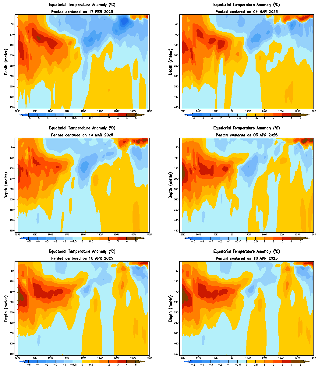
A transition from La Niña to ENSO-neutral conditions occurred during June 2008, as sea surface temperatures (SSTs) returned to near-average across the central and east-central equatorial Pacific Ocean (Fig. 1). Also, positive SST anomalies continued in the eastern equatorial Pacific. Consistent with this pattern, the latest weekly SST index was -0.1oC in the Niño-3.4 region, and +0.4oC in the Niño 1+2 region (Fig. 2). The subsurface oceanic heat content (average temperatures in the upper 300m of the ocean, Fig. 3) and patterns of subsurface temperature anomalies (Fig. 4) also reflected the transition to ENSO-neutral conditions. Positive heat content anomalies were associated with above-average temperatures at thermocline depth across the entire equatorial Pacific, while small negative subsurface temperature anomalies persisted near the Date Line between the surface and 75m depth.

Similar to past transitions, La Niña continues to linger in the atmospheric circulation, but with diminishing strength. Enhanced low-level easterly winds and upper-level westerly winds remain across the central equatorial Pacific, while convection continues to be suppressed in the central equatorial Pacific and slightly enhanced over the far western Pacific. Collectively, these atmospheric and oceanic anomalies are consistent with a return from La Niña to ENSO-neutral.


http://www.cpc.ncep.noaa.gov/products/a ... odisc.html
0 likes   

User avatar
cycloneye
Admin
Admin
Posts: 145313
Age: 68
Joined: Thu Oct 10, 2002 10:54 am
Location: San Juan, Puerto Rico

Re: ENSO Updates=CPC 8/7/08 Update=Neutral thru the fall

#568 Postby cycloneye » Thu Aug 07, 2008 8:07 am

For some of the members that are somewhat worried that El Nino will spoil the 2008 season,here is the good news for you from Climate Prediction Center August update,No El Nino thru the fall months.


Synopsis: ENSO-neutral conditions are expected to continue through the Northern Hemisphere Fall 2008.

ENSO-neutral conditions continued during July 2008, as sea surface temperatures (SSTs) in the central equatorial Pacific Ocean remained near-average (Fig. 1, bottom). As is typical with ENSO-neutral conditions, atmospheric and oceanic indicators were mixed, with certain areas in the equatorial Pacific Ocean suggesting a lingering influence of La Niña and others reflecting an increase in above-average temperatures, particularly in the eastern Pacific.

From west to east, the latest weekly SST index values range from -0.3°C in the Niño-4 region to +0.9°C in the Niño 1+2 region (Fig. 2). The subsurface oceanic heat content (average temperatures in the upper 300m of the ocean, Fig. 3) has also increased in response to positive temperature anomalies along the thermocline (Fig. 4). However, a weak, shallow region of below-average temperatures still remains near the International Date Line.

The atmospheric circulation over the western and central tropical Pacific continues to reflect some aspects of La Niña. Enhanced low-level easterly winds and upper-level westerly winds persist in this region, while convection remains generally suppressed over the central Pacific. In contrast, the eastern equatorial Pacific features weak-to-average low-level easterly winds and average precipitation. Despite recent increases in SST anomalies, the actual SSTs are not warm enough to support convection (Fig. 1, top). Collectively, these atmospheric and oceanic anomalies are consistent with ENSO-neutral conditions.

Most of the recent dynamical and statistical SST forecasts for the Niño 3.4 region indicate ENSO-neutral conditions (-0.5 to 0.5 in the Niño-3.4 region) will continue into the Northern Hemisphere Spring 2009 (Fig. 5). However, due to the positive heat content anomalies in the Pacific Ocean, the development of El Niño cannot be ruled out during the later part of the year, although chances remain low. Based on current atmospheric and oceanic conditions, recent trends, and model forecasts, ENSO-neutral conditions are expected to continue through the Northern Hemisphere Fall 2008.

http://www.cpc.ncep.noaa.gov/products/a ... odisc.html

0 likes   

User avatar
HURAKAN
Professional-Met
Professional-Met
Posts: 46086
Age: 38
Joined: Thu May 20, 2004 4:34 pm
Location: Key West, FL
Contact:

#569 Postby HURAKAN » Thu Aug 07, 2008 8:42 am

Not good news at all. For the Atlantic neutral is just as bad as La Niña.
0 likes   

User avatar
cycloneye
Admin
Admin
Posts: 145313
Age: 68
Joined: Thu Oct 10, 2002 10:54 am
Location: San Juan, Puerto Rico

Re: ENSO Updates=CPC 8/7/08 Update=Neutral thru the fall

#570 Postby cycloneye » Thu Aug 07, 2008 8:49 am

To clarify,when I say good news,I mean those of us who like to track longtrackers without affecting land. :)
0 likes   

User avatar
HURAKAN
Professional-Met
Professional-Met
Posts: 46086
Age: 38
Joined: Thu May 20, 2004 4:34 pm
Location: Key West, FL
Contact:

#571 Postby HURAKAN » Thu Aug 07, 2008 8:51 am

Yes Luis, I understood your point and for tracking fans is good news. Bad news referring to the pattern setting up for the rest of the season.
0 likes   

User avatar
cycloneye
Admin
Admin
Posts: 145313
Age: 68
Joined: Thu Oct 10, 2002 10:54 am
Location: San Juan, Puerto Rico

Re: ENSO Updates

#572 Postby cycloneye » Thu Sep 25, 2008 7:48 am

Those who thought that the extended lull in the Atlantic Basin in this month after Ike was caused by a resurgence of El Nino,well not so.Read below the latest update from the Australians on this.

Neutral Thru End of the Year
0 likes   

User avatar
cycloneye
Admin
Admin
Posts: 145313
Age: 68
Joined: Thu Oct 10, 2002 10:54 am
Location: San Juan, Puerto Rico

Re: ENSO Updates

#573 Postby cycloneye » Thu Oct 09, 2008 9:29 am

The latest Climate Prediction Center forecast of October shows Neutral Conditions prevailing in the Pacific Ocean going into the early part of 2009.

ENSO-neutral conditions continued during September 2008, as sea surface temperatures (SSTs) remained near-average in the east-central equatorial Pacific Ocean. SSTs remained slightly below-average in the central Pacific, and slightly above-average in the eastern Pacific (Fig. 1). From west to east, the latest weekly SST index values range from -0.2°C in the Niño-4 region to +0.3°C in the Niño 1+2 region (Fig. 2). The subsurface oceanic heat content (average temperatures in the upper 300m of the ocean, Fig. 3) continued to decrease in response to the strengthening of negative temperature anomalies at thermocline depth in the east-central Pacific (Fig. 4).

Although ENSO-neutral conditions have been in place since June 2008, the atmospheric circulation over the western and central tropical Pacific continues to reflect lingering aspects of La Niña. The MJO accentuated this signal during early-to-mid September, and suppressed it during the latter part of the month. The combined monthly average signal featured enhanced low-level easterly winds and upper-level westerly winds in the central Pacific, with convection enhanced over Indonesia and suppressed over the central Pacific. Overall, the ocean-atmosphere system remains consistent with ENSO-neutral conditions.

Most of the dynamical and statistical SST forecasts for the Niño 3.4 region indicate a continuation of ENSO-neutral conditions (-0.5°C to 0.5°C in the Niño-3.4 region) into the first half of 2009 (Fig. 5). While the model spread continues to include possibilities ranging from El Niño to La Niña, the recent decrease in subsurface and surface temperatures favors a return to La Niña over the development of El Niño. However, based on current atmospheric and oceanic conditions, recent trends, and model forecasts, ENSO-neutral conditions are expected to continue into early 2009.


http://www.cpc.ncep.noaa.gov/products/a ... odisc.html
0 likes   

User avatar
cycloneye
Admin
Admin
Posts: 145313
Age: 68
Joined: Thu Oct 10, 2002 10:54 am
Location: San Juan, Puerto Rico

Re: ENSO Updates

#574 Postby cycloneye » Sun Nov 09, 2008 3:29 pm

November ENSO forecast from Climate Prediction Center:

No change from the october forecast and that is neutral ENSO thru the first 3 months of 2009.

Synopsis: ENSO-neutral conditions are expected to continue into early 2009.

ENSO-neutral conditions continued during October 2008, as equatorial sea surface temperatures (SSTs) were near-average across much of the Pacific Ocean, except for small areas of below-average SSTs in the east-central Pacific and off the coast of South America (Fig. 1). Correspondingly, the latest weekly SST index values were near-average in all Niño regions except for Niño-1+2 (-0.8°C, Fig. 2). Subsurface oceanic heat content anomalies (average temperatures in the upper 300m of the ocean, Fig. 3) became less negative due to the eastward shift of positive temperature anomalies at thermocline depth to ~160°W, but anomalies remained negative in the eastern half of the Pacific (Fig. 4).

The atmospheric winds and convection patterns exhibited a high degree of week-to-week variability across the tropical Pacific during October in response to the Madden-Julian Oscillation (MJO). The cumulative effects of the MJO were above-average convection over Indonesia, and enhanced low-level easterly winds, enhanced upper-level westerly winds, and suppressed convection over the western equatorial Pacific. Overall, the ocean-atmosphere system remains consistent with ENSO-neutral conditions.

A majority of the SST forecasts indicate a continuation of ENSO-neutral conditions (-0.5°C to 0.5°C in the Niño-3.4 region) into the first half of 2009 (Fig. 5). Several dynamical models suggest the development of a La Niña during Northern Hemisphere Winter 2008-09. This outcome becomes more likely if the current MJO were to stall in a location that favors enhanced low-level easterlies and increased upwelling in the east-central and eastern Pacific. However, it is rare for La Niña to develop late in the year. Therefore, based on current atmospheric and oceanic conditions and recent trends, ENSO-neutral conditions are expected to continue into early 2009.


http://www.cpc.ncep.noaa.gov/products/a ... odisc.html
0 likes   

User avatar
cycloneye
Admin
Admin
Posts: 145313
Age: 68
Joined: Thu Oct 10, 2002 10:54 am
Location: San Juan, Puerto Rico

Re: ENSO Updates=CPC December Update=Neutral to La Nina

#575 Postby cycloneye » Thu Dec 11, 2008 11:44 am

Synopsis: ENSO-neutral or La Niña conditions are equally likely through early 2009.

ENSO-neutral conditions continued during November 2008, although equatorial sea surface temperatures (SSTs) remained below-average across much of the central and eastern Pacific Ocean (Fig. 1). Correspondingly, the latest weekly SST index values were -0.9°C in Niño-1+2, -0.3°C in Niño 3, -0.5°C in Niño 3.4, and -0.4°C in Niño 4 (Fig. 2). The subsurface oceanic heat content anomalies (average temperatures in the upper 300m of the ocean, Fig. 3) became increasingly negative as below-average temperatures at thermocline depth expanded throughout the central and eastern Pacific (Fig. 4).

Low-level easterly winds and upper-level westerly winds expanded and strengthened across the equatorial Pacific Ocean during the month. Also, convection remained enhanced near Indonesia and suppressed near the International Date Line. However, in recent months intraseasonal variability has contributed to episodic strengthening and weakening of convection over Indonesia. Overall, the ocean-atmosphere system during November remained consistent with ENSO-neutral conditions, but exhibited several atmospheric characteristics typical of weak La Niña conditions.

A majority of the SST forecasts indicate ENSO-neutral conditions (Niño-3.4 index of -0.5°C to 0.5°C) will continue into the first half of 2009. Several models, including the NOAA Climate Forecast System (CFS), suggest the development of La Niña during December 2008- March 2009 (Fig. 5). The recent strengthening of the low-level easterlies over the equatorial Pacific suggests the possibility of additional anomalous cooling of the SSTs. However, the magnitude of cooling remains uncertain and it is possible the La Niña threshold will not be met (3-month average of the Niño-3.4 index less than or equal to
-0.5°C). Therefore, based on current observations and recent trends, ENSO-neutral or La Niña conditions are equally likely through early 2009.

Image

http://www.cpc.ncep.noaa.gov/products/a ... odisc.html
0 likes   

User avatar
HURAKAN
Professional-Met
Professional-Met
Posts: 46086
Age: 38
Joined: Thu May 20, 2004 4:34 pm
Location: Key West, FL
Contact:

#576 Postby HURAKAN » Thu Dec 11, 2008 1:26 pm

More to confirm the likelihood of an active 2009 hurricane season.
0 likes   

User avatar
Just Joshing You
Category 2
Category 2
Posts: 512
Joined: Sat Nov 03, 2007 10:29 am
Location: Nova Scotia

#577 Postby Just Joshing You » Thu Dec 11, 2008 7:49 pm

So, La Nina conditions equal an above average Hurricane Season?
0 likes   

RL3AO
Moderator-Pro Met
Moderator-Pro Met
Posts: 16308
Joined: Thu Jun 14, 2007 10:03 pm
Location: NC

Re:

#578 Postby RL3AO » Thu Dec 11, 2008 10:57 pm

Just Joshing You wrote:So, La Nina conditions equal an above average Hurricane Season?


Usually.
0 likes   

User avatar
cycloneye
Admin
Admin
Posts: 145313
Age: 68
Joined: Thu Oct 10, 2002 10:54 am
Location: San Juan, Puerto Rico

Re: ENSO Updates

#579 Postby cycloneye » Wed Jan 14, 2009 6:56 am

Cool waters may haved peaked.Read the latest forecast from the Australians.

The central and eastern equatorial Pacific Ocean cooled further during December. This brings the Pacific Ocean into line with atmospheric indicators, a number of which have been approaching La Niña levels since October 2008. These include enhanced trade winds, suppressed cloudiness near the dateline, and a strongly positive SOI, which currently (January 12) has an approximate 30-day value of +14 .

However, most current model outlooks, and a build-up of warmer sub-surface water in the western equatorial Pacific, suggest that the cooler conditions in the Pacific may not persist beyond summer 2009. The most likely scenario is for the central and eastern Pacific to warm over the coming months and hence remain neutral.

http://www.bom.gov.au/climate/enso/
0 likes   

User avatar
HURAKAN
Professional-Met
Professional-Met
Posts: 46086
Age: 38
Joined: Thu May 20, 2004 4:34 pm
Location: Key West, FL
Contact:

#580 Postby HURAKAN » Wed Jan 14, 2009 7:39 am

Looks like it will be an active 2009 hurricane season.
0 likes   


Return to “Talkin' Tropics”

Who is online

Users browsing this forum: No registered users and 36 guests