Severe weather over Spain,France and Italy
Moderator: S2k Moderators
Forum rules
The posts in this forum are NOT official forecast and should not be used as such. They are just the opinion of the poster and may or may not be backed by sound meteorological data. They are NOT endorsed by any professional institution or STORM2K.
- Crostorm
- Category 5
- Posts: 2060
- Age: 49
- Joined: Mon Dec 25, 2006 3:51 pm
- Location: Croatia-Europe
- Contact:
Severe weather over Spain,France and Italy
Forecast Update
Valid: Fri 23 Jan 2009 14:00 to Sat 24 Jan 2009 06:00 UTC
Issued: Fri 23 Jan 2009 14:06
Forecaster: TUSCHY
SYNOPSIS
Please refer to the outlook, issued at Thu 22 Jan 2009 20:36 UTC.
DISCUSSION
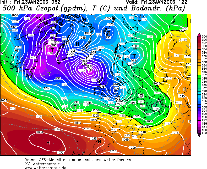
... NW/N-Spain and SW-France...
GFS/GME and UKMO all retarded the forward propagation of this depression somewhat, which made some adjustments necessary over SE-France.
The majority of the models now agrees in the passage of a strong/intense extratropical depression, which crosses the S-Bay of Biscay between 21Z-06Z and makes landfall just around 06Z over the W-central coast of France. Latest GOES-12 IR/VIS image has this feature now somewhere around 45°N/20°W and enhanced convection along the gradually evolving cold front is present as a dry slot approaches from the west, increasing the likelihood that GFS is on track with modest CAPE release along the cold front.
NW-Spain was included into the level-2 as the active cold front passes by and severe to damaging winds mix down to the surface. This risk continues eastwards along the cold front.
The SE Bay of Biscay and parts of SW-France were upgraded as the environment becomes supportive for an organized line of storms, crossing the level-3 area from the west at 00Z onwards. A combination of an eastward moving, intense vorticity lobe beneath aforementioned dry slot and the cold front itself should assist in the development of some moderate instability and a squalline, probably possessing a line echo wave pattern, is forecast. Forecast soundings (GFS) also indicate abundant CAPE release between 750-500hPa, also increasing below 3km. The main threat will be a widespread damaging wind gust risk with this line of storms as convective gusts likely exceed 33m/s. Otherwise, LCLs around 600m, LL shear of 25-30m/s, aforementioned LL CAPE release and intense directional shear also point to a significant tornado risk and strong tornadoes are possible.
Between 03Z-06Z, attention also turns to the approaching occlusion. As a result of the slow down and the earlier occlusion process of the depression, the back-bent occlusion now remains more displaced to the north, affecting the region around Bordeaux. Deep convection is likely with that activity as mid-/upper levels cool down and a sharp north-south wind shear gradient sets-up. Strong directional shear just onshore persists, so tornadoes and severe wind gusts are possible, especially if this occlusion runs a bit more to the south than currently thought. The risk continues after 06Z.
... The rest of the highlighted areas ...
The level-1 along the coastal areas of SW/W-Turkey and NE-Greece was downgraded as shear and instability start to relax.
The level-1 over E-France was re-issued as numerous convective lines evolved with gusts of 20-25m/s. This activity also diminishes during the next few hours
0 likes
Re: Severe weather over Spain,France and Italy
Do the French have internet accessible radar?
0 likes
- Crostorm
- Category 5
- Posts: 2060
- Age: 49
- Joined: Mon Dec 25, 2006 3:51 pm
- Location: Croatia-Europe
- Contact:
Re: Severe weather over Spain,France and Italy
Ed Mahmoud wrote:Do the French have internet accessible radar?
This already happend!
I was watching all night on Croatia forum
http://crometeo.net/phpbb/viewtopic.php ... sc&start=0
And
http://www.ukweatherworld.co.uk/forum/f ... 42&start=1
Last edited by Crostorm on Sat Jan 24, 2009 9:14 am, edited 1 time in total.
0 likes
Re: Severe weather over Spain,France and Italy
Ed Mahmoud wrote:Do the French have internet accessible radar?
For example http://france.meteofrance.com/
A french television station is TF1
News from spain http://www.20minutos.es/noticia/445487/ ... barcelona/
0 likes
- Pedro Fernández
- Tropical Storm
- Posts: 233
- Age: 46
- Joined: Mon Dec 31, 2007 7:24 am
- Location: Costa Tropical (Granada, Spain).
- Contact:
Hi there! You can also take a look to this link:
http://www.cazatormentas.net/foro/temas ... 9/new/#new
0 likes
- tropicana
- Category 5
- Posts: 8056
- Joined: Sat Sep 27, 2003 6:48 pm
- Location: Niagara Falls, Ontario, Canada
- Contact:
Re: Severe weather over Spain,France and Italy
At one point Friday, London's Heathrow Airport reported barometric pressures to 967mb.
In Barcelona Spain this morning, pressures dropped to 987mb and winds were sustained to 40mph.
Paric France reported pressures of 982mb but only 14mph sustained winds at best.
-justin-
In Barcelona Spain this morning, pressures dropped to 987mb and winds were sustained to 40mph.
Paric France reported pressures of 982mb but only 14mph sustained winds at best.
-justin-
0 likes
-
- Professional-Met
- Posts: 33399
- Joined: Tue Mar 07, 2006 11:57 pm
- Location: Deep South, for the first time!
That is definitely one bad storm. Unfortunately we are hearing little about it in the local news. That is like a solid hurricane making landfall.
One thought: to get people better tuned to international events and since this folder is quite small, the Global Weather and US Weather folders should be merged into a single folder called "Weather Events Discussion".
0 likes
-
- Category 5
- Posts: 3420
- Joined: Sun Apr 11, 2004 5:51 pm
- Location: East Longmeadow, MA, USA
Who is online
Users browsing this forum: No registered users and 1 guest