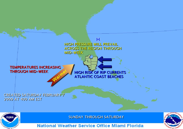
Latest NWS Miami Discussion....warmer (to above normal even) and continued on the mainly dry side through next week:
SHORT TERM...TONIGHT THROUGH SUNDAY...AN UPPER LVL RIDGE WILL
BUILD OVER GULF OF MEX/FLORIDA PENINSULA WHILE A SFC RIDGE OVR ERN
U.S. MOVES EAST OVER THE ATLANTIC...THE RESULT...A WARMING AND
CONTINUING DRYING TREND THROUGH THE WEEKEND. WE MAY SEE ONE MORE
"COOL" NIGHT TONIGHT OVER THE INTERIOR DUE TO RADIATIVE COOLING,
BUT EVEN THERE WE WILL SEE MORE SEASONAL VALUES COME SUNDAY. WL
NOT MENTION PRECIP AT ALL DURING THIS PERIOD.
WEDNESDAY THROUGH FRIDAY...A SLIGHT INCREASE IN THE CHANCES FOR
RAIN MAY BE EXPECTED AS A RATHER VIGOROUS SHORT WAVE SHOVES THE
UPPER RIDGE OUT OF THE LOCAL AREA THEREBY DIMINISHING THE
SUBSIDENCE. WARM CONDITIONS (ACTUALLY A FEW DEGREES ABOVE NORMAL)
WILL CONTINUE DUE TO A PREVAILING SOUTHERLY FLOW, HOWEVER GFS SHOWS A
COLD FNT ASSOCIATED WITH THE SHORT WAVE MENTIONED ABOVE MAKING IT
AS FAR SOUTH AS JUST NORTH OF LAKE OKEECHOBEE BY FRIDAY. HOWEVER,
GFS THEN STALL THE FRNT AS MOST OF THE ENERGY IS TRANSFERED
NORTHEAST. WL INDICATE A 10-20% CHANCE OF RAIN DURING THIS PERIOD,
BUT THINK THAT 20% WL EVEN BE A STRETCH
gatorcane wrote:jinftl wrote:Great image of onshore flow (with corresponding cirrus deck of clouds) starting to move over south florida....say goodbye to lows in the 30's and 40's and even 50's along the immediate coast tonight....forecast low in Miami is a more seasonable 60F tonight. Dewpoints across se fl have risen to the 45-50 deg range...and rising.
technically they are stratocumulus clouds (not cirrus) that are being generated from arctic air moving over relatively warmer waters. But you are right, now that the flow is onshore (and strong mind you), low temps will be 60+ near the coast for the forseeable future with mid 50s inland creeping up to the 60s by end of weekend.