 The posts in this forum are NOT official forecast and should not be used as such. They are just the opinion of the poster and may or may not be backed by sound meteorological data. They are NOT endorsed by any professional institution or
Check out these hotlinked images which will change in about 22 hours.


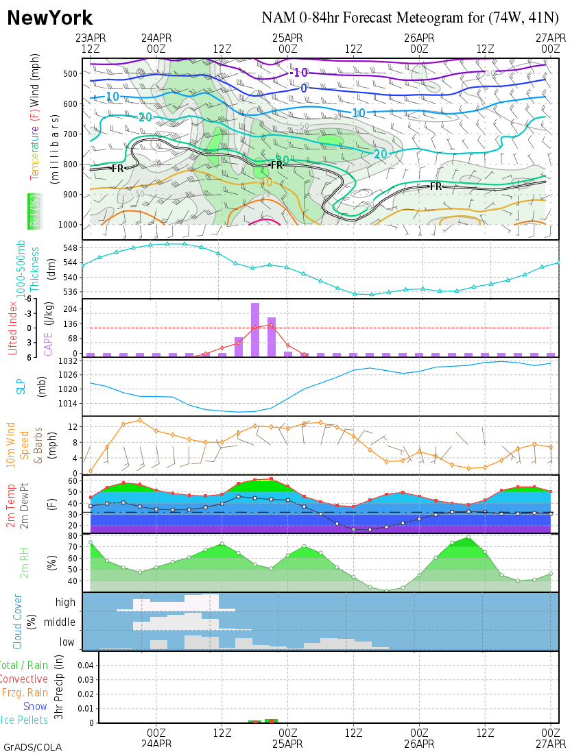
Now, LaGaurdia isn't he perfect spot for what I am trying to show, but here is a meteogram, good until about Midnight.
Now, the NAM model may be on crack, and as I said, a genuine tree and power line snapping ice storm on Long Island is hard to pull off.
The GFS is a bit drier, and it has lighter precip changing from rain straight to snow, although it shows surface temps between 1 and 2º C at 2 meters, and because of the coarser resolution of the global model, maybe, just maybe, it would show some freezing rain if it could as well.
BTW, NAM also suggests some precip falling in SE New England with a gap between the 850 mb freezing/thickness lines and surface freezing line.
NAM loop with magic thickness and 850 mb temps, but not surface temps.
NAM loop with wind directions and surface freezing line, but not magic thicknesses
Edit thread title because rare and exciting ice storm seems unlikely, instead, not quite as rare, but equally exciting with fewer people freezing in dark homes, event seems likely.


