Coral Sea: HAMISH - Tropical Cyclone
Moderator: S2k Moderators
-
Squarethecircle
- Category 5

- Posts: 2165
- Joined: Fri Oct 19, 2007 4:00 pm
- Location: Fairfax, VA
-
CrazyC83
- Professional-Met

- Posts: 34316
- Joined: Tue Mar 07, 2006 11:57 pm
- Location: Deep South, for the first time!
Re:
Squarethecircle wrote:Since the storm looks to be weakening, I hope that the JTWC will revise this storm up to 140 knots (as T-numbers indicated), a-la Cyclone Sidr.
Has the 1800Z best track intensity been listed? It was probably at 1800Z when it peaked (my guess is 145 kt).
0 likes
-
Squarethecircle
- Category 5
- Posts: 2165
- Joined: Fri Oct 19, 2007 4:00 pm
- Location: Fairfax, VA
Re: Re:
CrazyC83 wrote:Squarethecircle wrote:Since the storm looks to be weakening, I hope that the JTWC will revise this storm up to 140 knots (as T-numbers indicated), a-la Cyclone Sidr.
Has the 1800Z best track intensity been listed? It was probably at 1800Z when it peaked (my guess is 145 kt).
I have absolutely no idea. I'm confused as to when they're putting up the 2100Z.
0 likes
-
Grifforzer
- Category 1

- Posts: 418
- Joined: Thu Feb 26, 2009 11:27 pm
-
Squarethecircle
- Category 5
- Posts: 2165
- Joined: Fri Oct 19, 2007 4:00 pm
- Location: Fairfax, VA
Re:
Grifforzer wrote:NRL Track for Hamish (1800z 07Mar)
18P HAMISH 090307 1800 19.3S 149.9E SHEM 130 926
---
and there is no 2100 UTC advisory from the JTWC. The next advisory is at 0300 UTC.
Every half day? Why so long?
0 likes
-
Grifforzer
- Category 1
- Posts: 418
- Joined: Thu Feb 26, 2009 11:27 pm
-
Crostorm

- Category 5
- Posts: 2060
- Age: 51
- Joined: Mon Dec 25, 2006 3:51 pm
- Location: Croatia-Europe
- Contact:
Re: Coral Sea: HAMISH - Severe Tropical Cyclone
Here are few pictures from Marine in Mackay MO(Weatherzone Forums)
http://forum.weatherzone.com.au/cgi-bin ... 0705;p=133
http://forum.weatherzone.com.au/cgi-bin ... 0705;p=133
0 likes
-
Squarethecircle
- Category 5
- Posts: 2165
- Joined: Fri Oct 19, 2007 4:00 pm
- Location: Fairfax, VA


-
LSU2001

- S2K Supporter

- Posts: 1711
- Age: 58
- Joined: Sat Sep 11, 2004 11:01 pm
- Location: Cut Off, Louisiana
Re: Coral Sea: HAMISH - Severe Tropical Cyclone
[quote="Crostorm"]Here are few pictures from Marine in Mackay MO(Weatherzone Forums)

can anyone photoshop this storm into an image of Katrina as she was making landfall. I don't have the know how to do this but I would really like to compare the two size wise.
Thanks in advance,
Tim
can anyone photoshop this storm into an image of Katrina as she was making landfall. I don't have the know how to do this but I would really like to compare the two size wise.
Thanks in advance,
Tim
0 likes
-
Squarethecircle
- Category 5
- Posts: 2165
- Joined: Fri Oct 19, 2007 4:00 pm
- Location: Fairfax, VA
-
Crostorm
- Category 5
- Posts: 2060
- Age: 51
- Joined: Mon Dec 25, 2006 3:51 pm
- Location: Croatia-Europe
- Contact:
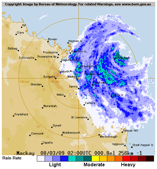
IDQP0005
Australian Government Bureau of Meteorology
Queensland
Tropical Cyclone Warning Centre
Media: Transmitters serving the area between Mackay and Gladstone are requested
to USE the Standard Emergency Warning Signal before broadcasting the following
warning.
TOP PRIORITY FOR
TROPICAL CYCLONE ADVICE NUMBER 21
Issued by the Bureau of Meteorology, Brisbane
Issued at 10:47am on Sunday the 8th of March 2009
A Cyclone WARNING remains current for coastal and island communities from Bowen
to Bundaberg. A Cyclone WATCH remains current for coastal and island communities
from Bundaberg to Tewantin.
Severe Tropical Cyclone Hamish, a CATEGORY 5 CYCLONE, is located off the north
Queensland coast and at 10:00 am EST was estimated to be 175 kilometres
northeast of Mackay and 335 kilometres north of Yeppoon, moving south southeast
at 19 kilometres per hour.
Severe Tropical Cyclone Hamish poses a very significant threat to coastal and
island communities between Bowen and Bundaberg. The cyclone is expected to
maintain a south-southeast track parallel to the coast during the next 24 to 48
hours.
Damaging wind gusts are expected to affect coastal and island communities
between Bowen and Bundaberg during the next 24 hours.
Destructive winds are expected to affect exposed coastal and island communities
between Mackay and Gladstone during the next 24 hours.
Damaging winds are not expected to develop about coastal and island communities
between Bundaberg and Tewantin during the next 24 hours, however they may
develop within 48 hours.
As the cyclone moves to the south-southeast, sea levels are expected to be
elevated above the normal tide along the coastline south of the cyclone. Large
waves may produce minor flooding along the foreshore. People living in areas
likely to be affected by this flooding should take measures to protect their
property as much as possible and be prepared to help their neighbours.
Heavy rainbands associated with Severe Tropical Cyclone Hamish are likely to
cause some flooding in smaller coastal rivers and streams between Mackay and
Yeppoon during today and into Monday. Heavy rainfalls are likely to affect the
coastal streams between Yeppoon to Maryborough during Monday and Tuesday. A
separate Flood Warning has been issued for these areas.
Details of Severe Tropical Cyclone Hamish at 10:00 am EST:
.Centre located near...... 20.1 degrees South 150.5 degrees East
.Location accuracy........ within 28 kilometres
.Recent movement.......... towards the south southeast at 19 kilometres per hour
.Wind gusts near centre... 295 kilometres per hour
.Severity category........ 5
.Central pressure......... 925 hectoPascals
People between Bowen and Bundaberg should immediately commence or continue
preparations, especially securing boats and property.
People between Bundaberg and Tewantin should consider what action they will need
to take if the cyclone threat increases. If you are unsure about the actions to
be taken, information is available from your local government or local State
Emergency Service.
The next advice will be issued by 2:00 pm EST Sunday 08 March.
This warning is also available through TV and Radio Broadcasts; the Bureau's
website at http://www.bom.gov.au or call 1300 659 212. The Bureau and the State
Emergency Service would appreciate this warning being broadcast regularly.
0 likes

Re: Coral Sea: HAMISH - Severe Tropical Cyclone
Sustained at 70 mph near the coast. What a powerhouse cyclone. This cyclone brings back memories of Rita, Katrina, and Charley.
08/10:00am 25.2 SE 61kts - 988.2
08/10:00am 25.2 SE 61kts - 988.2
0 likes
Re: Coral Sea: HAMISH - Severe Tropical Cyclone
70 mph is amazing as the eyewall is close to the shore. Hamish is wrapped up like Andrew.
0 likes
Re: Coral Sea: HAMISH - Severe Tropical Cyclone
Watching the coastal obs as Hamish is just offshore.
http://www.bom.gov.au/products/IDQ60701 ... 4371.shtml
http://www.bom.gov.au/products/IDQ60701 ... 4371.shtml
0 likes
-
srainhoutx

- S2K Supporter
- Posts: 6919
- Age: 68
- Joined: Sun Jan 14, 2007 11:34 am
- Location: Haywood County, NC
- Contact:
Re: Coral Sea: HAMISH - Severe Tropical Cyclone
What an amazing cyclone. Does bring back memories of Andrew offshore from S FL.
0 likes


Who is online
Users browsing this forum: No registered users and 31 guests