Australian Government Bureau of Meteorology
Queensland
Tropical Cyclone Warning Centre
Media: This message is issued daily for the information of interested parties.
Media are NOT required to broadcast this message.
TROPICAL CYCLONE OUTLOOK
for the Coral Sea West of Longitude 160 East
Issued at 2:37pm on Wednesday the 18th of March 2009
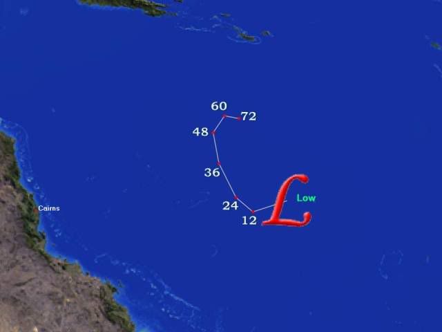
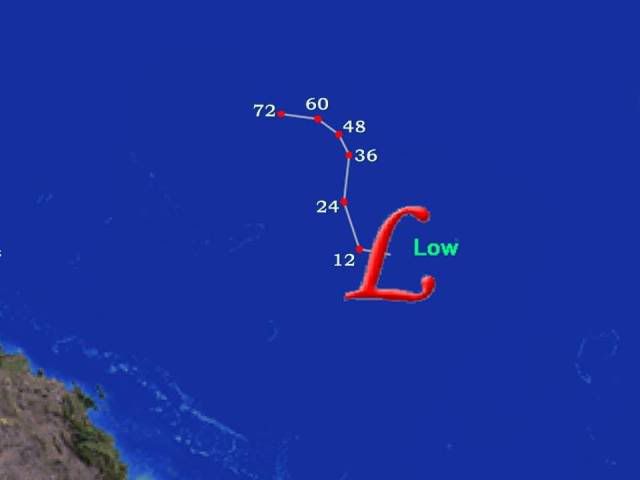
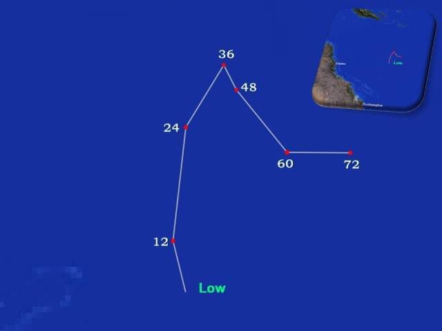
The monsoon trough extends across far northern Cape York Peninsula and the
northern Coral Sea. A small low is embedded in the trough just south of Port
Moresby, and is not expected to develop significantly. Another broader low lies
over the northeast Coral Sea near 13S 157E. Environmental conditions are likely
to become more favourable for the development of this low late this week. Over
the weekend, an upper trough moving into the Coral Sea is likely to capture the
system and move it to the southeast, well off the Queensland coast.
The probability of this system becoming a tropical cyclone over the next three
days is:
Thursday: Low
Friday: Moderate
Saturday: High
Tropical Cyclone outlooks issued by Brisbane can be accessed through the
Bureau's Home Page http://www.bom.gov.au.
Please note that the Darwin Regional Forecasting Centre issues Tropical Cyclone
Outlooks that cover the Gulf of Carpentaria. Refer to the Northern Region and
Gulf 3 day outlook at http://www.bom.gov.au/weather/cyclone/tc-outlooks.shtml.