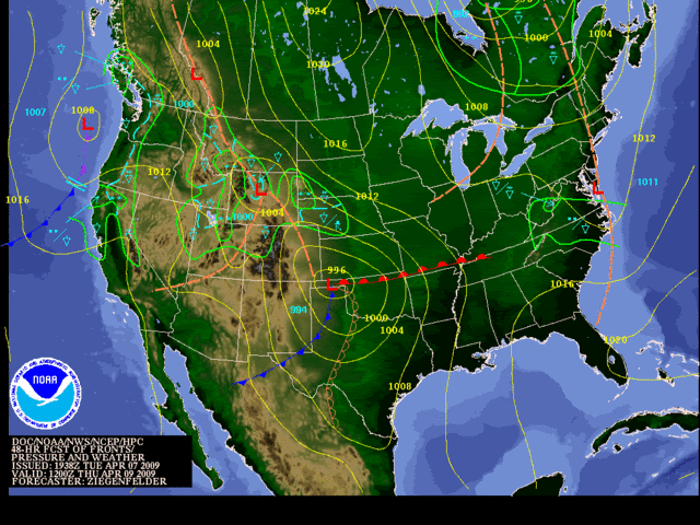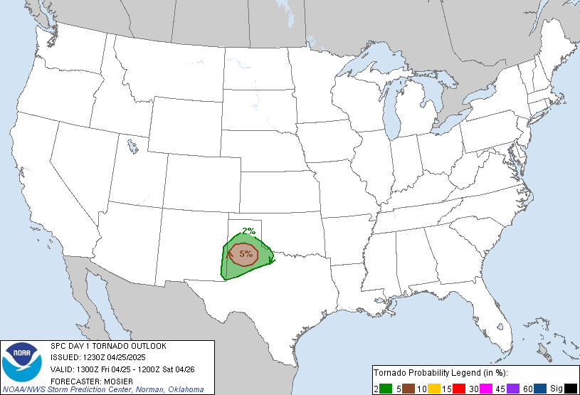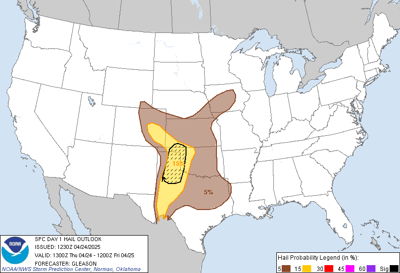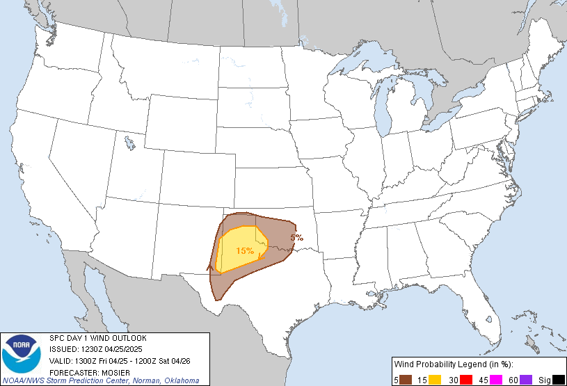
Severe Weather Potential - Thursday 9th - Sunday 12th April

U.S. & Caribbean Weather Discussions and Severe Weather Events

Moderator: S2k Moderators

Forum rules

The posts in this forum are NOT official forecast and should not be used as such. They are just the opinion of the poster and may or may not be backed by sound meteorological data. They are NOT endorsed by any professional institution or STORM2K.

Help Support Storm2K
Message
Author
User avatar
Meso
Category 5
Category 5
Posts: 1609
Age: 38
Joined: Mon Aug 09, 2004 12:14 pm
Location: South Africa
Contact:

Severe Weather Potential - Thursday 9th - Sunday 12th April

#1 Postby Meso » Tue Apr 07, 2009 2:19 pm

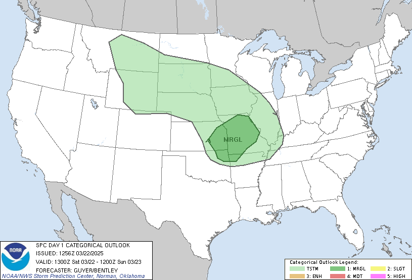
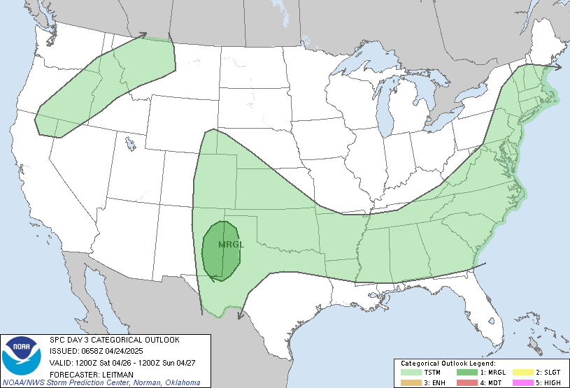
Looks like there may be some possible tornadic action this coming weekend, starting with a system on Thursday which has pretty good instability and moisture, the CAPE is forecast to be around 2000 from Eastern Oklahoma through East and South East Texas with some good LIs in Oklahoma and dew points in the 60s thanks to some return flow. SPC has issued a Slight area for this day.

Image

Things continue to look good with Friday holding not too much, but some possible storms popping up, SPC doesn't feel the need to issue anything for Friday yet though.

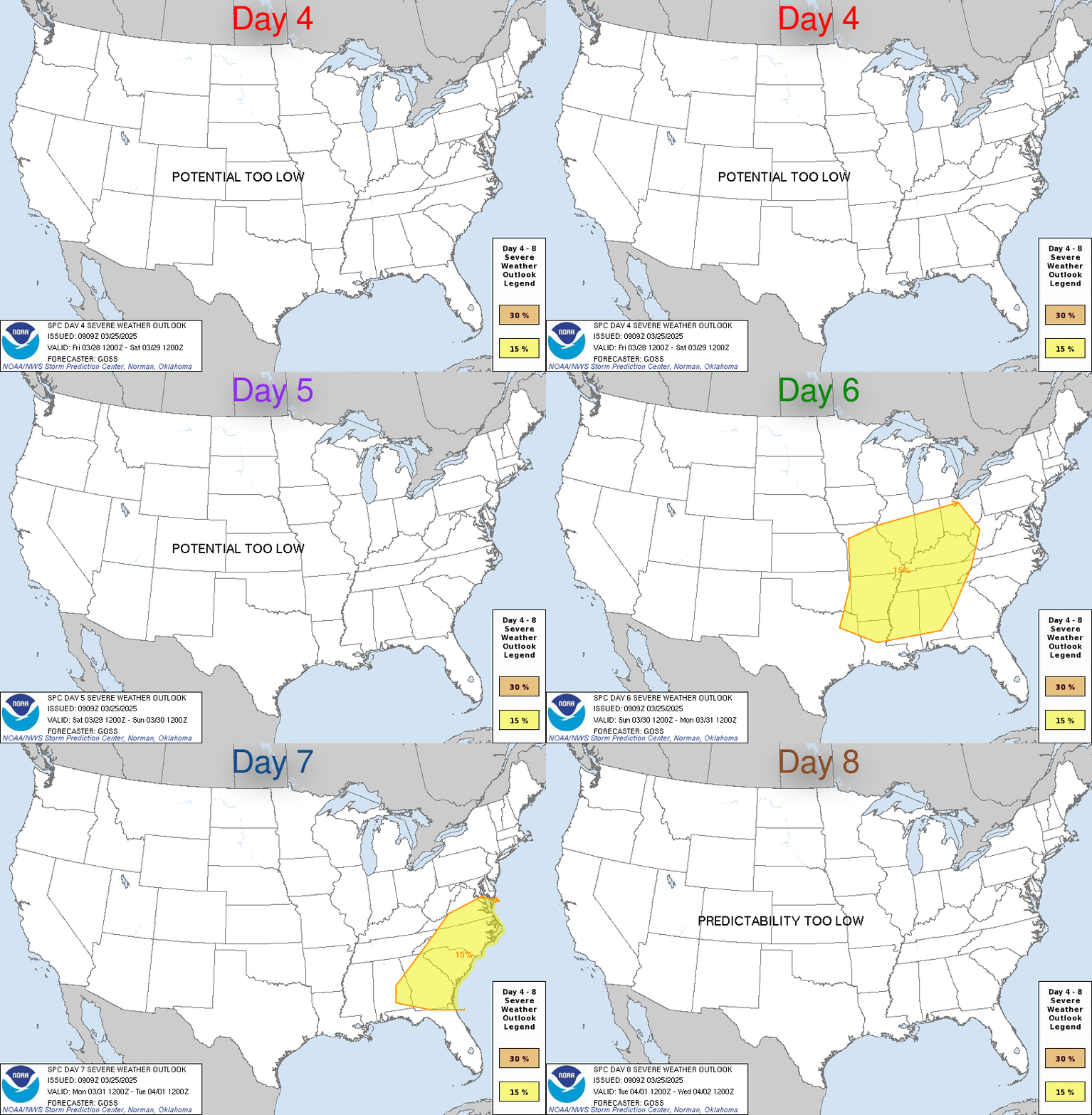
Saturday to Sunday is the next big system, SPC already have these days mentioned in their write ups for today. The timing of the system isn't yet set with the models having jumped around a bit but there is another strong system moving in late Saturday to Sunday for Texas, Oklahoma and Kanas with a fairly low instability but extremely high shear environment. The 500mb winds are at 90kt per the GFS for Saturday thanks to a strong jet. The moisture for Saturday isn't looking too great further north but Texas holds potential per the 12z GFS, but we know it often underestimates return flow.
Image

Definitely something to keep an eye on over the next few days.
0 likes   

Ed Mahmoud

Re: Severe Weather Potential - Thursday 9th - Sunday 12th April

#2 Postby Ed Mahmoud » Tue Apr 07, 2009 2:33 pm

That is a potentially spooky sounding for Shreveport Thursday evening...

Image
0 likes   

User avatar
HURAKAN
Professional-Met
Professional-Met
Posts: 46086
Age: 38
Joined: Thu May 20, 2004 4:34 pm
Location: Key West, FL
Contact:

#3 Postby HURAKAN » Tue Apr 07, 2009 6:22 pm

Image

In 48 hrs
0 likes   

User avatar
Ptarmigan
Category 5
Category 5
Posts: 5313
Joined: Wed Aug 16, 2006 9:06 pm

Re: Severe Weather Potential - Thursday 9th - Sunday 12th April

#4 Postby Ptarmigan » Tue Apr 07, 2009 8:13 pm

Ed Mahmoud wrote:That is a potentially spooky sounding for Shreveport Thursday evening...

Image


Why so?
0 likes   

RL3AO
Moderator-Pro Met
Moderator-Pro Met
Posts: 16308
Joined: Thu Jun 14, 2007 10:03 pm
Location: NC

Re: Severe Weather Potential - Thursday 9th - Sunday 12th April

#5 Postby RL3AO » Tue Apr 07, 2009 8:28 pm

Ptarmigan wrote:
Ed Mahmoud wrote:That is a potentially spooky sounding for Shreveport Thursday evening...

Image


Why so?


Nice wind profile and good mid level lapse rates are a few reasons.
0 likes   

User avatar
vbhoutex
Storm2k Executive
Storm2k Executive
Posts: 29096
Age: 73
Joined: Wed Oct 09, 2002 11:31 pm
Location: Cypress, TX
Contact:

Re: Severe Weather Potential - Thursday 9th - Sunday 12th April

#6 Postby vbhoutex » Tue Apr 07, 2009 9:46 pm

Our local OCM's are alluding to a good possibility of severe here on Easter. :x Can't have an Easter egg hunt for the kiddies(and big kids :ggreen: )if it is storming.
0 likes   

User avatar
srainhoutx
S2K Supporter
S2K Supporter
Posts: 6919
Age: 67
Joined: Sun Jan 14, 2007 11:34 am
Location: Haywood County, NC
Contact:

Re: Severe Weather Potential - Thursday 9th - Sunday 12th April

#7 Postby srainhoutx » Tue Apr 07, 2009 9:59 pm

I am a bit concerned about the Saturday evening/Easter Sunday Morning threat. It will be worth watching as the event gets a bit closer. I know many folks have plans ahead for the weekend. :wink:
0 likes   

User avatar
srainhoutx
S2K Supporter
S2K Supporter
Posts: 6919
Age: 67
Joined: Sun Jan 14, 2007 11:34 am
Location: Haywood County, NC
Contact:

Re: Severe Weather Potential - Thursday 9th - Sunday 12th April

#8 Postby srainhoutx » Wed Apr 08, 2009 9:17 am

Easter Sunday looks to offer some problems in the latest SPC Update for Central TX and points E as guidance has slowed the progression of the storm by around 12 hours...
DAY 4-8 CONVECTIVE OUTLOOK
NWS STORM PREDICTION CENTER NORMAN OK
0341 AM CDT WED APR 08 2009

VALID 111200Z - 161200Z

...DISCUSSION...
ACTIVE WEATHER PATTERN WILL CONTINUE INTO MID-NEXT WEEK. SHORTWAVE
ENERGY OVER THE ERN PAC WILL CONTINUE TO DIG SWD AS CLOSED LOWS
ALONG THE WEST CST...THEN EJECT ENE TO THE CNTRL/SRN PLNS. THE
SECOND SYSTEM WILL ARRIVE ALONG THE HIGH PLNS BY LATE SATURDAY...BUT
RECENT TRENDS HAVE BEEN FOR THE MEDIUM RANGE GUIDANCE TO SLOW THIS
SYSTEM DOWN. 00Z ECMWF IS PREFERRED AS THE GFS APPEARS TO BE ON THE
FAST SIDE OF THE MODEL GUIDANCE ENVELOPE.

RICH LLVL MOISTURE WILL HAVE GATHERED OVER THE WRN GULF BASIN BY THE
WEEKEND AND IS EXPECTED TO SURGE NW INTO TX SATURDAY/SATURDAY NIGHT.
LARGER SCALE HEIGHT FALLS BEGIN TO EDGE ONTO THE W TX HIGH PLNS
INVOF THE DRYLINE VERY LATE SATURDAY...SO WIDESPREAD SVR STORMS MAY
NOT MATERIALIZE ON DAY 4 /SAT-SAT NITE/ AS ONCE EXPECTED.
RATHER...ISOLD SVR STORMS WILL PROBABLY EXPAND ENE FROM W TX INTO OK
BY SUNDAY MORNING.

HIGHER END SVR POTENTIAL NOW APPEARS LIKELY FROM CNTRL/ERN TX EWD
TOWARD THE LWR MS VLY ON DAY 5 /SUNDAY-SUNDAY NITE/.
WHILE
CLOUDS/ELEVATED CONVECTION BECOMES COMMONPLACE GENERALLY NORTH OF
THE RED RVR...AIR MASS SHOULD DESTABILIZE ACROSS THE WARM SECTOR
SUNDAY AFTN/EVE. TSTMS SHOULD DEVELOP ALONG/E OF THE
DRYLINE/SFC-LOW TRACK ACROSS CNTRL TX. MAGNITUDE OF
MOISTURE...STEEP LAPSE RATES IN THE MID-LVLS AND 60-80 KTS OF SWLY
H5 FLOW WILL LIKELY LEAD TO NUMEROUS SVR STORMS WITH LARGE
HAIL...DMGG WIND GUSTS AND TORNADOES. THIS ACTIVITY WILL PROBABLY
ADVANCE E AS FAR AS THE LWR MS VLY BY EARLY SUNDAY WITH THE STRONGER
TSTMS FEEDING ON THE NRN EDGE OF THE HIGHER THETA-E AIR MASS.

BEYOND SUNDAY...MODEL PREDICTABILITY BECOMES LOW WITH RESPECT TO THE
HANDLING OF THE CYCLONE AS IT PROGRESSES EWD. THUS...A SVR OTLK IS
NOT YET JUSTIFIED FOR NEXT WEEK.

..RACY.. 04/08/2009
0 likes   

Ed Mahmoud

Re: Severe Weather Potential - Thursday 9th - Sunday 12th April

#9 Postby Ed Mahmoud » Wed Apr 08, 2009 9:48 am

I'll pay more attention to Day 4 and Day 5 tomorrow, the SWODY2 Outlook makes me thing tomorrow's SWODY1 will upgrade Arkansas and immediate vicinity to a MODERATE RISK.


Latest WRF doesn't show much precip tomorrow in the highest probability area, but while I used to trust the ETA, I don't trust the WRF all that much, and want to see the 12Z GFS.
0 likes   

Ed Mahmoud

Re: Severe Weather Potential - Thursday 9th - Sunday 12th April

#10 Postby Ed Mahmoud » Wed Apr 08, 2009 11:31 am

Looks like dryline is just East of DFW before activity starts, probably sparing the Metroplex any problems tomorrow.

Image

For Resurrection Sunday (I like how most languages use a name for Easter derived from the Hebrew word for Passover, while our English word, 'Easter', has pagan origins) the forecast path of the upper low and surface low through Texas implies stronger wind shear, plus less likelihood of a cap advected off the Mexican highland.

Image

Lack of low level instability around my neighborhood late Easter afternoon would imply a reduced tornado threat, but mid level lapse rates are high, which might favor hail, and plenty manly low level winds, which would suggest an otherwise run of the mill garden variety storm could produce damaging wind gusts.

Of course, days away, a little more sunshine than the GFS is predicting and a bit more warming might provide enough low level instability to allow tornadoes, but that sounding looks more like a straight line wind/hail sounding, with the high precipitable water telling me precip loading might favor wind over hail.

Image
0 likes   

Ed Mahmoud

Re: Severe Weather Potential - Thursday 9th - Sunday 12th April

#11 Postby Ed Mahmoud » Wed Apr 08, 2009 11:41 am

SE Texas/Louisiana severe Sunday per Euro-

Good directional shear, the 30 to 40 knot low level jet predicted should be good enough for some severe, but I have seen stronger LLJs. All comes down to instability, I imagine, and whether there is low level instability.

Image

Image
0 likes   

User avatar
Meso
Category 5
Category 5
Posts: 1609
Age: 38
Joined: Mon Aug 09, 2004 12:14 pm
Location: South Africa
Contact:

#12 Postby Meso » Wed Apr 08, 2009 5:48 pm

I hear Eastern Oklahoma isn't the greatest place to chase which is putting some chasers off, but there may be a small period of activity in central Oklahoma tomorrow during the slightly earlier hours should there not be too much of a CAP present.

Later on in the day if I stayed in the U.S I would probably head to Texas later on tomorrow with some good CAPE, LIs and very nice dew points forecast. North East of Waco would be my call, somewhere near the TX, Ok and Arkansas. Don't know what the terrain is like out that way, but it looks to be best for Dew Points and CAPE when combining such factors.

Though if storms to get popping up in Oklahoma they seem most likely to produce some tornadoes with the wind profiles.
0 likes   

User avatar
Extremeweatherguy
Category 5
Category 5
Posts: 11095
Joined: Mon Oct 10, 2005 8:13 pm
Location: Florida

#13 Postby Extremeweatherguy » Wed Apr 08, 2009 7:20 pm

I'll be down in Houston this weekend. It will be interesting to see if we get any strong storms in that region on Sunday.
0 likes   

Ed Mahmoud

Re:

#14 Postby Ed Mahmoud » Wed Apr 08, 2009 9:13 pm

Meso wrote:I hear Eastern Oklahoma isn't the greatest place to chase which is putting some chasers off, but there may be a small period of activity in central Oklahoma tomorrow during the slightly earlier hours should there not be too much of a CAP present.

Later on in the day if I stayed in the U.S I would probably head to Texas later on tomorrow with some good CAPE, LIs and very nice dew points forecast. North East of Waco would be my call, somewhere near the TX, Ok and Arkansas. Don't know what the terrain is like out that way, but it looks to be best for Dew Points and CAPE when combining such factors.

Though if storms to get popping up in Oklahoma they seem most likely to produce some tornadoes with the wind profiles.


Strictly from a visibility standpoint, I'd guess (having only watched chase shows on TV, never doing it for real) West of I-35 in Texas and Oklahoma, where it is drier and there are a lot fewer trees, and better visibility, all else being equal, would be preferred, and I think the lower overall humidity increases the chance of LP supercells.


I've watched videos on YouTube of people chasing possible tornadoes in HP storms, and I'd hate to be in a blinding rain with hail with the chance of a tornado nearby.
0 likes   

Ed Mahmoud

Re: Severe Weather Potential - Thursday 9th - Sunday 12th April

#15 Postby Ed Mahmoud » Wed Apr 08, 2009 9:19 pm

Sort of OT

South African tornadoes and monthly occurence

Image

Image
0 likes   

Ed Mahmoud

Re: Severe Weather Potential - Thursday 9th - Sunday 12th April

#16 Postby Ed Mahmoud » Wed Apr 08, 2009 9:34 pm

New 0Z NAM simulated radar shows a single cell trying to break the cap way down between Shiner and Columbus.

Image

Not sure how, looking at SGR and IAH forecast skew-Ts (BTW, behind the dryline with SW winds the WRF is predicting toasty temps around 30º) a pronounced cap at 850 mb, and CINH around -200 J/Kg.


I'd like to see the GFS, but bedtime is near.

12Z GFS showed cap holding generally South of College Station/Huntsville area.
0 likes   

User avatar
Meso
Category 5
Category 5
Posts: 1609
Age: 38
Joined: Mon Aug 09, 2004 12:14 pm
Location: South Africa
Contact:

#17 Postby Meso » Thu Apr 09, 2009 2:04 am

Chasers seem to be picking SE Kansas today, a short period of some good dew points before the system moves over and some good wind profiles should give a window of tornadic potential.

Regarding the South African tornadoes, despite the slightly decent amount that we get there are less than 5 storm chasers throughout the country, I'll be heading up to Gauteng for three weeks this November to go chase.
0 likes   

User avatar
Dave
Retired Staff
Retired Staff
Posts: 13442
Age: 74
Joined: Tue Aug 01, 2006 3:57 pm
Location: Milan Indiana
Contact:

#18 Postby Dave » Thu Apr 09, 2009 8:51 am

PUBLIC SEVERE WEATHER OUTLOOK
NWS STORM PREDICTION CENTER NORMAN OK
0622 AM CDT THU APR 09 2009

...SEVERE THUNDERSTORMS EXPECTED OVER PARTS OF THE CNTRL
PLAINS...SRN PLAINS AND OZARKS THIS AFTERNOON AND EVENING...

THE NWS STORM PREDICTION CENTER IN NORMAN OK IS FORECASTING THE
DEVELOPMENT OF NUMEROUS SEVERE STORMS WITH THE POTENTIAL FOR A FEW
STRONG TORNADOES OVER PARTS OF THE CNTRL PLAINS...SRN
PLAINS...OZARKS THIS AFTERNOON AND EVENING.

THE AREAS MOST LIKELY TO EXPERIENCE THIS ACTIVITY INCLUDE

NORTHWEST ARKANSAS
SOUTHEAST KANSAS
SOUTHWEST MISSOURI
NORTHEAST OKLAHOMA

ELSEWHERE...SEVERE STORMS ARE ALSO POSSIBLE ACROSS PARTS OF THE SRN
PLAINS...CNTRL PLAINS...MID-MS VALLEY AND OZARK REGION

A WELL-DEVELOPED SPRING STORM SYSTEM OVER THE SOUTHERN PLAINS TODAY
WILL RESULT IN A RISK OF SEVERE THUNDERSTORMS ALONG A CORRIDOR FROM
SRN KS ACROSS NE OK INTO SW MO AND NW AR THIS AFTERNOON AND EVENING.
SEVERE THUNDERSTORMS ARE EXPECTED TO DEVELOP RAPIDLY THIS AFTERNOON
ALONG A WARM FRONT ORIENTED EAST TO WEST ACROSS THE MODERATE RISK
AREA AND ALONG A COLD FRONT/DRYLINE SWD ACROSS NERN OK AND NW AR.
LOW-LEVEL MOISTURE WILL CONTINUE TO RETURN NWD INTO THE REGION TODAY
AND A MODERATELY UNSTABLE AIRMASS SHOULD BE PRESENT SOUTHEAST OF A
SFC LOW AND WARM FRONT BY MID-AFTERNOON.

WINDS ALOFT WILL QUICKLY INCREASE TODAY AS AN UPPER-LEVEL JET MOVES
INTO THE REGION FROM THE WEST. AS VERTICAL SHEAR
INCREASES...SUPERCELLS WILL BECOME AN INCREASING CONCERN DURING THE
AFTERNOON AND THE STRONGER STORMS SHOULD BE CAPABLE OF PRODUCING
TORNADOES. SOME TORNADOES THAT OCCUR WITH THE MORE INTENSE AND
PERSISTENT SUPERCELLS COULD BE STRONG FIRST BEGINNING IN SRN KS AND
NERN OK EXPANDING SEWD ACROSS NW AR AND SW MO BY EARLY EVENING.

THOSE IN THE THREATENED AREA ARE URGED TO REVIEW SEVERE WEATHER
SAFETY RULES AND TO LISTEN TO RADIO...TELEVISION AND NOAA WEATHER
RADIO FOR POSSIBLE WATCHES...WARNINGS AND STATEMENTS LATER TODAY.
ADDITIONALLY...STATE AND LOCAL EMERGENCY MANAGERS ARE MONITORING
THIS DEVELOPING SITUATION.

STATE AND LOCAL EMERGENCY MANAGERS ARE MONITORING THIS DEVELOPING
SITUATION. THOSE IN THE THREATENED AREA ARE URGED TO REVIEW SEVERE
WEATHER SAFETY RULES AND TO LISTEN TO RADIO...TELEVISION...AND NOAA
WEATHER RADIO FOR POSSIBLE WATCHES...WARNINGS...AND STATEMENTS LATER
TODAY.

..BROYLES/HART/HURLBUT.. 04/09/2009
0 likes   

User avatar
Dave
Retired Staff
Retired Staff
Posts: 13442
Age: 74
Joined: Tue Aug 01, 2006 3:57 pm
Location: Milan Indiana
Contact:

#19 Postby Dave » Thu Apr 09, 2009 8:54 am

Image

Image

Image

Image
0 likes   

User avatar
Dave
Retired Staff
Retired Staff
Posts: 13442
Age: 74
Joined: Tue Aug 01, 2006 3:57 pm
Location: Milan Indiana
Contact:

#20 Postby Dave » Thu Apr 09, 2009 9:26 am

Image
0 likes   


Return to “USA & Caribbean Weather”

Who is online

Users browsing this forum: txtwister78, wxman22 and 57 guests