Astounding how the panhandle is dealing with flooding while at the same time, latest U.S. Drought Monitor report shows drought conditions worsening on parts of the peninsula (expansion of D2 - Severe Drought conditions - see Drought Thread for maps, etc) and Lake O drops to below 12' for the first time this year.
National Drought Summary -- April 7, 2009
The Southeastern and Mid-Atlantic States: Another round of heavy rains tracked across the Southeast, bringing totals of 3 to 6 inches or more across southern Alabama, southern Georgia and northern Florida. This has led to some marked changes in southern Georgia and northern Florida on this week’s map. Both D0 and D1 have been removed from these areas, leaving eastern Tennessee and the western Carolinas in D0 and D1 after the removal of D2 from upstate South Carolina. After good rains only a few weeks ago, southern Florida has slipped back again with the expansion of D2 for all areas below Lake Okeechobee except for the extreme southeastern coast around Ft. Lauderdale, which remains in D1 for now. Temperatures also ran well above normal across southern Florida last week. This, coupled with the drought, has also served to exacerbate the fire potential across this region.
Florida Weather
Moderator: S2k Moderators
Forum rules

The posts in this forum are NOT official forecast and should not be used as such. They are just the opinion of the poster and may or may not be backed by sound meteorological data. They are NOT endorsed by any professional institution or STORM2K.

Re: Florida Weather Thread: Cool Wx ahead
I'm still sticking to my guns with Lake O going down to 9 to 10 ft by mid to late May.
0 likes
-
tropicana

- Category 5

- Posts: 8056
- Joined: Sat Sep 27, 2003 6:48 pm
- Location: Niagara Falls, Ontario, Canada
- Contact:
Re: Florida Weather Thread: Cool Wx ahead
also 55F at Key West FL last night, that reading beat the old record for April 9 by 4 degrees! That old record stood since 1988.
Also quite possibly the last temp in the 50s at this location for the season.
-justin-
Also quite possibly the last temp in the 50s at this location for the season.
-justin-
0 likes
Re: Florida Weather Thread: Cool Wx ahead
Time is running out for too many nights below 60...or days below 70 in Key West.
Looking at the daily temp stats, the latest date on the calendar that a nightime low below 60 deg took place was on April 30, 1992. After that 4/30 date, you have to go all the way to October 29 to get the next below 60 record low temp (set in 1892). That is a 6 month chunk of the year where no temp below 60 is going to happen....if history is any indication.
As far as daytime maximum not reaching 70, the latest occurence of that on Key West was on April 21 (year=1901). You have to go all the way to November 5 to get the next time that Key West sees a daytime record low maximum below 70 (in 1965). Equates to 6.5 months in a row where Key West will see at least 70 deg during day....pretty remarkable for any location in the U.S. (except for Hawaii).
tropicana wrote:also 55F at Key West FL last night, that reading beat the old record for April 9 by 4 degrees! That old record stood since 1988.
Also quite possibly the last temp in the 50s at this location for the season.
-justin-
0 likes
-
gatorcane

- S2K Supporter

- Posts: 23708
- Age: 48
- Joined: Sun Mar 13, 2005 3:54 pm
- Location: Boca Raton, FL
Winds have shifted to E and SE at 10-15mph at all SE Florida metro hubs this evening....and with that wind blowing in right over the Gulf Stream currently running around 78F, its going to be a struggle to dip much below 70F right along the immediate coast with around 60F inland where less ocean influence will exist.
What a difference one day makes where these same locations saw mid 40s inland to lower 50s along the coast just 36 hours prior.
What a difference one day makes where these same locations saw mid 40s inland to lower 50s along the coast just 36 hours prior.
0 likes
-
JonathanBelles
- Professional-Met

- Posts: 11430
- Age: 35
- Joined: Sat Dec 24, 2005 9:00 pm
- Location: School: Florida State University (Tallahassee, FL) Home: St. Petersburg, Florida
- Contact:
-
Tampa Bay Hurricane

- Category 5
- Posts: 5597
- Age: 38
- Joined: Fri Jul 22, 2005 7:54 pm
- Location: St. Petersburg, FL
Re: Florida Weather Thread:warming, have/have nots in rain conti
Currently 82*F and humid at my house.
0 likes
-
JonathanBelles
- Professional-Met
- Posts: 11430
- Age: 35
- Joined: Sat Dec 24, 2005 9:00 pm
- Location: School: Florida State University (Tallahassee, FL) Home: St. Petersburg, Florida
- Contact:
Re: Florida Weather Thread:warming, have/have nots in rain conti
Steamy today thru Wednesday...then slightly cooler and drier air moves in.....overall, much warmer week than last week...with lowest low temps across south florida dropping to the seasonable mid 60's.
NWS Forecast for: Miami FL
Issued by: National Weather Service Miami - South Florida
Last Update: 11:54 am EDT Apr 13, 2009
--------------------------------------------------------------------------------
This Afternoon: Mostly sunny, with a high near 85.
Tonight: Partly cloudy, with a low around 74.
Tuesday: A 20 percent chance of showers and thunderstorms after 2pm. Mostly cloudy, with a high near 90.
Tuesday Night: A slight chance of showers before 2am. Mostly cloudy, with a low around 71. Chance of precipitation is 20%.
Wednesday: A 30 percent chance of showers and thunderstorms after 9am. Mostly cloudy, with a high near 86.
Wednesday Night: Partly cloudy, with a low around 66. .
Thursday: Sunny, with a high near 81.
Thursday Night: Partly cloudy, with a low around 65.
Friday: Mostly sunny, with a high near 80.
Friday Night: Partly cloudy and breezy, with a low around 67.
Saturday: Mostly sunny, with a high near 81.
Saturday Night: Partly cloudy, with a low around 69.
Sunday: Mostly sunny, with a high near 83.
0 likes
-
Tampa Bay Hurricane
- Category 5
- Posts: 5597
- Age: 38
- Joined: Fri Jul 22, 2005 7:54 pm
- Location: St. Petersburg, FL
Re: Florida Weather Thread:warming, have/have nots in rain conti
Very warm and humid, 85*F at my house, humidity 60%, heat index 89*F
0 likes
-
Tampa Bay Hurricane
- Category 5
- Posts: 5597
- Age: 38
- Joined: Fri Jul 22, 2005 7:54 pm
- Location: St. Petersburg, FL
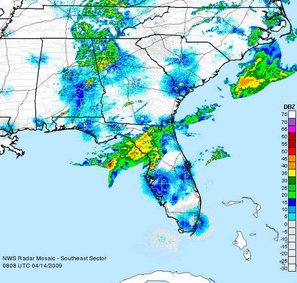
Squall Line Moving towards Florida's west coast:
Best View: http://www.accuweather.com/enhanced-rad ... 1&zipChg=1
http://www.ssd.noaa.gov/goes/east/gmex/loop-rb.html
Based on cloud temperatures on the Infrared, a potent
convective cluster has formed over the northeast gulf.
When you click radar you see the line gets cut off due to no radar
feed over the central gulf. Rest assured, there is a juicy squall forming.
http://www.accuweather.com/maps-satelli ... =1&large=1
An impressive bow echo is about 150 miles west of the nature coast (just
north of Tampa). North Florida and Tallahassee are getting pummelled with
a deluge of flooding rain:
http://www.wunderground.com/radar/radbl ... rainsnow=0
0 likes
-
JonathanBelles
- Professional-Met
- Posts: 11430
- Age: 35
- Joined: Sat Dec 24, 2005 9:00 pm
- Location: School: Florida State University (Tallahassee, FL) Home: St. Petersburg, Florida
- Contact:
-
Tampa Bay Hurricane
- Category 5
- Posts: 5597
- Age: 38
- Joined: Fri Jul 22, 2005 7:54 pm
- Location: St. Petersburg, FL
Line of storms dissappated- BUST!!!
BUT there is HOPE!!!!
A large supercell cluster is about 200 miles west of
Tampa Bay and should arrive by 630 AM in the morning
ROCK AND ROLL BABY!!!! Let's GET SOME ACTION COME
ON!!!!!!!!!!!!
Also, with daytime heating and temperatures in the low
90s south florida could see some big storms tomorrow- as in
severe. Very cold pocket of air aloft tommorrow will fuel
severe thunderstorms over South Florida.
0 likes
-
Tampa Bay Hurricane
- Category 5
- Posts: 5597
- Age: 38
- Joined: Fri Jul 22, 2005 7:54 pm
- Location: St. Petersburg, FL

-
Tampa Bay Hurricane
- Category 5
- Posts: 5597
- Age: 38
- Joined: Fri Jul 22, 2005 7:54 pm
- Location: St. Petersburg, FL
-
Ed Mahmoud
Re:
Tampa Bay Hurricane wrote:The large thunderstorm cluster on the long range
base radar out of Tampa is about 200 miles offshore
but it is moving quickly towards shore- should arrive by about
630 AM if I am extrapolating movement right. Anyway- it looks
like a very heavy rain core is associated with this cluster.
0 likes
Return to “USA & Caribbean Weather”
Who is online
Users browsing this forum: No registered users and 23 guests