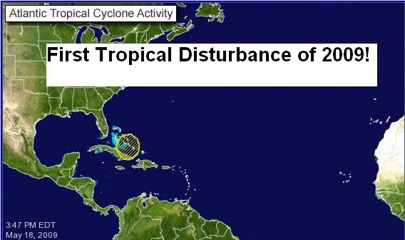
GOM: INVEST 90L
Moderator: S2k Moderators

dr Steve Lyons made his 1st preatlantic season appearance. He thought the setup was interesting enough to follow and keep an eye on. He thinks there is a small chance of development. Well I guess the nhc does too afterall they did say 30%. So we all are getting our practice for the season in. Nows the time for preparation.
0 likes
-
Derek Ortt
Re:
robbielyn wrote:dr Steve Lyons made his 1st preatlantic season appearance. He thought the setup was interesting enough to follow and keep an eye on. He thinks there is a small chance of development. Well I guess the nhc does too afterall they did say 30%. So we all are getting our practice for the season in. Nows the time for preparation.
did lyon's specify the Gulf area or the east cuba area for development?
0 likes


-
hurricanefloyd5

- Category 5

- Posts: 1659
- Age: 45
- Joined: Sun May 02, 2004 10:53 am
- Location: Spartanburg
- Contact:
Re: INVEST 90L North of Cuba
there is a surface low this this system but it's weak at the surface but still at the surface!!!!!!!!
0 likes
-
cycloneye

- Admin

- Posts: 149508
- Age: 69
- Joined: Thu Oct 10, 2002 10:54 am
- Location: San Juan, Puerto Rico
Re: Invest 90L Models
Derek,is GFDL always overagressive on their first runs? I think the 00z run will have more data to feed the model.Same goes to HWRF.
0 likes
-
Aric Dunn
- Category 5
- Posts: 21238
- Age: 43
- Joined: Sun Sep 19, 2004 9:58 pm
- Location: Ready for the Chase.
- Contact:
Re: INVEST 90L North of Cuba
wxman57 wrote:Quite a few surface obs in the area - there is no "weak surface low". I see straight SE flow from the DR to southern FL. Any circulation is aloft in the mid levels.
i would suggest re examining that data and comparing with other tools, remember local effects around cuba i.e sea breezes could be giving the appearance of no surface feature, but does not say in anyway whats so ever that there is "no" low.. first off the weak low (determined by the NHC) is just that weak and local effects could easily and have many times in the past hidden the evidence with surface observations alone, thats when satellite and other analysis comes in.
also why would you look from DR with such a small weak circ DR would be pointless..
but hey will see ...
Last edited by Aric Dunn on Mon May 18, 2009 7:10 pm, edited 1 time in total.
0 likes
-
cycloneye
- Admin
- Posts: 149508
- Age: 69
- Joined: Thu Oct 10, 2002 10:54 am
- Location: San Juan, Puerto Rico
Re: INVEST 90L North of Cuba
Long paragrafh for Gulf of Mexico at 8 PM TWD.
TWDAT
TROPICAL WEATHER DISCUSSION
NWS TPC/NATIONAL HURRICANE CENTER MIAMI FL
805 PM EDT MON MAY 18 2009
TROPICAL WEATHER DISCUSSION FOR NORTH AMERICA...CENTRAL
AMERICA...GULF OF MEXICO...CARIBBEAN SEA...NORTHERN SECTIONS
OF SOUTH AMERICA...AND ATLANTIC OCEAN TO THE AFRICAN COAST
FROM THE EQUATOR TO 32N. THE FOLLOWING INFORMATION IS BASED
ON SATELLITE IMAGERY...METEOROLOGICAL ANALYSIS...WEATHER
OBSERVATIONS...AND RADAR.
BASED ON 1800 UTC SURFACE ANALYSIS AND SATELLITE IMAGERY THROUGH
2245 UTC.
..DISCUSSION...
GULF OF MEXICO...
A DEEP LAYER TROUGH OVER THE E CONUS AND E GULF IS ASSOCIATED
WITH A SURFACE COLD OVER THE E GULF THAT EXTENDS FROM THE SOUTH
FLORIDA PENINSULA NEAR 26N82W TO 26N83W. FARTHER TO THE SW...A
NEWLY-DEVELOPED 1010 MB SURFACE LOW IS LOCATED NEAR 25N85W...
WITH A SURFACE TROUGH EXTENDING FROM 26N84W TO THE SURFACE LOW
TO 22N85W. THIS SURFACE LOW IS LOCATED BENEATH THE SOUTHWESTERN
PORTION OF THE DEEP LAYER TROUGH THAT EXTENDS INTO THE E GULF.
LOW LEVEL CONVERGENCE NEAR THE LOW...TROUGH...AND COLD FRONT IS
SUPPORTING SCATTERED SHOWERS AND THUNDERSTORMS OVER THE GULF
FROM 23N-29N E OF 87W...INCLUDING THE CENTRAL AND SOUTH FLORIDA
PENINSULA...THE STRAITS OF FLORIDA...THE FLORIDA KEYS...AND W
CUBA. THIS SHOWER AND THUNDERSTORM ACTIVITY IS BEING ENHANCED BY
UPPER LEVEL DIFFLUENCE BETWEEN THE AFOREMENTIONED DEEP TROUGH
AND AN UPPER LEVEL RIDGE OVER THE SW NORTH ATLC. DURING THE NEXT
DAY...THE SURFACE LOW IS FORECAST TO MOVE EASTWARD AND BE
LOCATED OVER THE FLORIDA KEYS NEAR 25N81W AS A 1009 MB SURFACE
LOW AT 19/1800 UTC. HOWEVER...THE FUTURE DEVELOPMENT AND TRACK
OF THE LOW REMAIN UNCERTAIN...THOUGH COMPUTER MODEL GUIDANCE
SUGGESTS THAT WINDS WILL INCREASE AROUND THE LOW...WHICH WILL
AFFECT PORTIONS OF THE GULF OF MEXICO. ACROSS THE WEST GULF...
DEEP LAYER DRY AIR...AS WELL AS SUBSIDENCE WITH CONFLUENT UPPER
LEVEL NORTHWESTERLY FLOW...ARE RESULTING IN GENERALLY FAIR
WEATHER CONDITIONS. ALSO...N TO NE SURFACE WINDS ARE OCCURRING
ACROSS THE W GULF...WITH WIND SPEEDS UP TO 25 KT ACROSS PORTIONS
OF THE NW GULF.
0 likes

-
hurricanefloyd5
- Category 5
- Posts: 1659
- Age: 45
- Joined: Sun May 02, 2004 10:53 am
- Location: Spartanburg
- Contact:
Re:
mikef55 wrote:I agree there is some kind of weak low level circulation NHC has stated that have to wait and see 30 percent still something and looking forward to see how this develops
I agree as well for now
0 likes
-
cycloneye
- Admin
- Posts: 149508
- Age: 69
- Joined: Thu Oct 10, 2002 10:54 am
- Location: San Juan, Puerto Rico
Re: Invest 90L Models
0 likes


-
cycloneye
- Admin
- Posts: 149508
- Age: 69
- Joined: Thu Oct 10, 2002 10:54 am
- Location: San Juan, Puerto Rico
Re:
HURAKAN wrote:I find it interesting for the Atlantic to have its first invest before the EPAC. Not very common.
Yeah,its very quiet in the EPAC.With things more favorable for more EPAC activity than the Atlantic this year one would think EPAC would start roaring.
0 likes
-
cycloneye
- Admin
- Posts: 149508
- Age: 69
- Joined: Thu Oct 10, 2002 10:54 am
- Location: San Juan, Puerto Rico
Re: Invest 90L Models
439
WHXX01 KWBC 190029
CHGHUR
TROPICAL CYCLONE GUIDANCE MESSAGE
NWS TPC/NATIONAL HURRICANE CENTER MIAMI FL
0029 UTC TUE MAY 19 2009
DISCLAIMER...NUMERICAL MODELS ARE SUBJECT TO LARGE ERRORS.
PLEASE REFER TO NHC OFFICIAL FORECASTS FOR TROPICAL CYCLONE
AND SUBTROPICAL CYCLONE INFORMATION.
ATLANTIC OBJECTIVE AIDS FOR
DISTURBANCE INVEST (AL902009) 20090519 0000 UTC
...00 HRS... ...12 HRS... ...24 HRS. .. ...36 HRS...
090519 0000 090519 1200 090520 0000 090520 1200
LAT LON LAT LON LAT LON LAT LON
BAMS 22.4N 76.0W 24.4N 76.6W 26.3N 77.4W 27.4N 79.4W
BAMD 22.4N 76.0W 25.1N 75.1W 27.8N 76.1W 29.4N 77.8W
BAMM 22.4N 76.0W 24.8N 75.6W 27.2N 76.1W 28.8N 77.7W
LBAR 22.4N 76.0W 24.6N 75.2W 27.1N 74.5W 29.1N 73.8W
SHIP 25KTS 33KTS 41KTS 46KTS
DSHP 25KTS 33KTS 41KTS 46KTS
...48 HRS... ...72 HRS... ...96 HRS. .. ..120 HRS...
090521 0000 090522 0000 090523 0000 090524 0000
LAT LON LAT LON LAT LON LAT LON
BAMS 28.2N 82.3W 29.2N 87.9W 28.9N 91.4W 28.6N 93.3W
BAMD 30.5N 80.2W 32.1N 85.0W 33.0N 87.9W 33.6N 89.7W
BAMM 29.7N 80.3W 31.3N 85.8W 31.9N 89.3W 32.3N 91.7W
LBAR 30.2N 73.3W 31.7N 72.8W 33.3N 71.5W 35.1N 68.0W
SHIP 50KTS 48KTS 46KTS 43KTS
DSHP 50KTS 30KTS 27KTS 27KTS
...INITIAL CONDITIONS...
LATCUR = 22.4N LONCUR = 76.0W DIRCUR = 350DEG SPDCUR = 8KT
LATM12 = 21.0N LONM12 = 75.7W DIRM12 = 354DEG SPDM12 = 10KT
LATM24 = 18.9N LONM24 = 75.6W
WNDCUR = 25KT RMAXWD = 35NM WNDM12 = 20KT
CENPRS = 1010MB OUTPRS = 1011MB OUTRAD = 90NM SDEPTH = S
RD34NE = 0NM RD34SE = 0NM RD34SW = 0NM RD34NW = 0NM
0 likes
-
Category 5

- Category 5
- Posts: 10074
- Age: 36
- Joined: Sun Feb 11, 2007 10:00 pm
- Location: New Brunswick, NJ
- Contact:
Re: INVEST 90L North of Cuba
Call me crazy, but looking at this over the last several hours, I do not see why this qualifies as an area of interest.
No surface low, no convection, not a very favorable environment at all, and a front nearby.
No surface low, no convection, not a very favorable environment at all, and a front nearby.
Last edited by Category 5 on Mon May 18, 2009 7:34 pm, edited 1 time in total.
0 likes

-
cycloneye
- Admin
- Posts: 149508
- Age: 69
- Joined: Thu Oct 10, 2002 10:54 am
- Location: San Juan, Puerto Rico
Re: Invest 90L Models
Code: Select all
                   *   ATLANTIC SHIPS INTENSITY FORECAST       *
                    *      GOES DATA AVAILABLE                  *
                    *      OHC  DATA AVAILABLE                  *
                    *      INVEST  AL902009  05/19/09  00 UTC   *

TIME (HR)          0     6    12    18    24    36    48    60    72    84    96   108   120
V (KT) NO LAND    25    28    33    38    41    46    50    49    48    46    46    43    43
V (KT) LAND       25    28    33    38    41    46    50    36    30    28    27    27    27
V (KT) LGE mod    25    26    27    28    28    27    28    26    26    27    27    27    27

SHEAR (KT)        28    39    27    28    32    29    30    24    20    23    30    28    26
SHEAR DIR        263   260   238   215   226   252   250   288   268   286   270   284   279
SST (C)         26.1  26.0  25.8  25.4  25.0  25.4  24.8  24.2  25.0  24.6  24.4  23.6  22.6
POT. INT. (KT)   114   115   113   109   105   109   105   100   105   101    99    93    87
ADJ. POT. INT.   104   105   102    99    94    96    94    89    91    87    85    80    76
200 MB T (C)   -55.9 -56.7 -57.2 -56.4 -56.9 -58.2 -57.8 -58.3 -58.2 -58.4 -58.0 -57.8 -57.8
TH_E DEV (C)       7     5     5     4     3     2     4     1     4     1     6     2     9
700-500 MB RH     70    72    72    72    72    64    51    55    54    54    51    52    54
GFS VTEX (KT)      5     7     9    11    11    10    13    11     8     8     6     5  LOST
850 MB ENV VOR    58    66    67   101    98    59    35    17    12    -6    -1   -43   -21
200 MB DIV        78    68    81   137    88    47    -3    29    -1   -19   -16    -9     6
LAND (KM)        140   265   390   431   396   284    85   -82  -100  -114  -167  -184  -260
LAT (DEG N)     22.4  23.6  24.8  26.0  27.2  28.8  29.7  30.6  31.3  31.7  31.9  32.0  32.3
LONG(DEG W)     76.0  75.8  75.6  75.9  76.1  77.7  80.3  83.4  85.8  87.7  89.3  90.6  91.7
STM SPEED (KT)    10    12    12    12    11    11    13    12    10     7     6     5     4
HEAT CONTENT       0     0     0     0     0     0     0     0     0     0     0     0     0

  FORECAST TRACK FROM BAMM      INITIAL HEADING/SPEED (DEG/KT):350/  8      CX,CY:   0/  8
  T-12 MAX WIND:  20            PRESSURE OF STEERING LEVEL (MB):  751  (MEAN=624)
  GOES IR BRIGHTNESS TEMP. STD DEV.  50-200 KM RAD:  13.0 (MEAN=14.5)
  % GOES IR PIXELS WITH T < -20 C    50-200 KM RAD:  29.0 (MEAN=65.0)

                        INDIVIDUAL CONTRIBUTIONS TO INTENSITY CHANGE
                         6   12   18   24   36   48   60   72   84   96  108  120
                        ----------------------------------------------------------
  SAMPLE MEAN CHANGE     1.   2.   3.   4.   6.   8.   9.  11.  11.  12.  13.  13.
  SST POTENTIAL          0.   0.   0.   0.   2.   5.   9.  13.  15.  16.  16.  17.
  VERTICAL SHEAR MAG     1.   3.   4.   5.   5.   2.  -4.  -6.  -9. -10. -12. -14.
  VERTICAL SHEAR DIR     0.   0.   0.   0.   0.   1.   1.   2.   2.   3.   4.   5.
  PERSISTENCE            1.   1.   2.   2.   2.   2.   2.   2.   1.   1.   0.   0.
  200/250 MB TEMP.       1.   2.   3.   5.   8.  12.  16.  19.  23.  26.  28.  31.
  THETA_E EXCESS         0.  -1.  -2.  -3.  -4.  -6.  -8. -11. -15. -17. -20. -21.
  700-500 MB RH          0.   0.   0.  -1.  -1.  -1.  -1.  -1.  -1.  -1.  -2.  -2.
  GFS VORTEX TENDENCY    0.   1.   2.   3.   3.   5.   4.   1.   1.  -1.  -1.  -2.
  850 MB ENV VORTICITY   0.   0.   1.   1.   2.   2.   2.   2.   1.   1.   1.   0.
  200 MB DIVERGENCE      0.   1.   2.   3.   4.   4.   5.   4.   3.   2.   2.   1.
  ZONAL STORM MOTION     0.   0.   0.   0.  -1.  -1.  -1.  -2.  -2.  -3.  -3.  -3.
  STEERING LEVEL PRES    0.   0.   0.  -1.  -1.  -2.  -1.  -2.  -3.  -2.  -2.  -2.
  DAYS FROM CLIM. PEAK   0.   0.   0.   0.   0.  -1.  -1.  -1.  -1.  -1.   0.  -1.
  GOES PREDICTORS       -1.  -1.  -1.  -2.  -3.  -4.  -5.  -5.  -6.  -6.  -5.  -4.
  OCEAN HEAT CONTENT     0.   0.   0.   0.   0.   0.  -1.  -1.  -1.  -1.   0.   0.
                        ----------------------------------------------------------
  TOTAL CHANGE           3.   8.  13.  16.  21.  25.  24.  23.  21.  21.  18.  18.

   ** 2009 ATLANTIC RI INDEX AL902009     INVEST 05/19/09  00 UTC **
           ( 30 KT OR MORE MAX WIND INCREASE IN NEXT 24 HR)

 12 HR PERSISTENCE (KT):   5.0 Range:-45.0 to  30.0 Scaled/Wgted Val:  0.7/  1.4
 850-200 MB SHEAR (KT) :  30.9 Range: 26.2 to   3.2 Scaled/Wgted Val:  0.0/  0.0
 D200 (10**7s-1)       :  90.4 Range:-21.0 to 140.0 Scaled/Wgted Val:  0.7/  1.0
 POT = MPI-VMAX (KT)   :  75.8 Range: 33.5 to 126.5 Scaled/Wgted Val:  0.5/  0.3
 850-700 MB REL HUM (%):  74.8 Range: 56.0 to  85.0 Scaled/Wgted Val:  0.6/  0.4
 % area w/pixels <-30 C:  16.0 Range: 16.0 to 100.0 Scaled/Wgted Val:  0.0/  0.0
 STD DEV OF IR BR TEMP :  13.0 Range: 30.6 to   3.2 Scaled/Wgted Val:  0.6/  1.0
 Heat content (KJ/cm2) :   0.0 Range:  0.0 to 130.0 Scaled/Wgted Val:  0.0/  0.0

 Prob of RI for 25 kt RI threshold=    18% is   1.4 times the sample mean(12.3%)
 Prob of RI for 30 kt RI threshold=     3% is   0.3 times the sample mean( 8.0%)
 Prob of RI for 35 kt RI threshold=     1% is   0.3 times the sample mean( 4.8%)

   ##         ANNULAR HURRICANE INDEX (AHI) AL902009     INVEST 05/19/09  00 UTC         ##
   ## STORM NOT ANNULAR, SCREENING STEP FAILED, NPASS=4 NFAIL=3                          ##
   ## AHI=  0   (AHI OF 100 IS BEST FIT TO ANN. STRUC., 1 IS MARGINAL, 0 IS NOT ANNULAR) ##
   ##     ANNULAR INDEX RAN NORMALLY
0 likes
-
Rainband
Re: INVEST 90L in the Southern Bahamas
first named storm?? Thats what Dennis Phillips just said
0 likes

Re: INVEST 90L in the Southern Bahamas
Rainband wrote:first named storm?? Thats what Dennis Phillips just said
Excuse my ignorance whose Dennis Phillips?
0 likes
Who is online
Users browsing this forum: No registered users and 47 guests