GOM Low:
Moderator: S2k Moderators


HURAKAN wrote:TROPICAL WEATHER DISCUSSION
NWS TPC/NATIONAL HURRICANE CENTER MIAMI FL
805 PM EDT THU MAY 21 2009
...DISCUSSION...
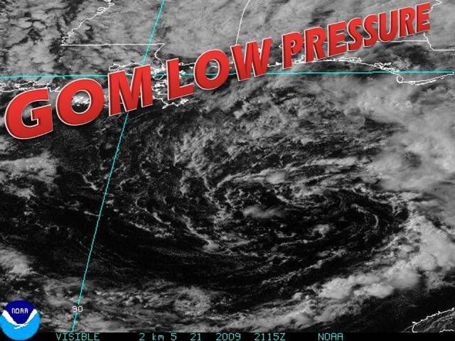
GULF OF MEXICO...
A DEEP LAYER TROUGH IS PRESENT ACROSS THE GULF WITH AN UPPER
LEVEL LOW NEAR 27N86W AND AN ASSOCIATED 1006 MB SURFACE LOW NEAR
26N86W. LOW LEVEL CONVERGENCE NEAR THE SURFACE LOW...AS WELL AS
UPPER LEVEL DIFFLUENCE E OF THE UPPER LOW...ARE SUPPORTING
SCATTERED SHOWERS AND THUNDERSTORMS ACROSS THE GULF N OF 23N E
OF 87W....INCLUDING THE W FLORIDA PENINSULA. THE TIGHT SURFACE
PRESSURE GRADIENT BETWEEN THE SURFACE LOW AND A SURFACE RIDGE
OVER THE SE CONUS IS SUPPORTING WIND SPEEDS OF 20 TO 30 KT
AROUND THE LOW ACROSS N PORTIONS OF THE MIDDLE AND E GULF. THE
SURFACE LOW IS FORECAST TO MOVE NORTHWESTWARD DURING THE NEXT
DAY AND BE LOCATED NEAR 27N89W AS A 1008 MB SURFACE LOW AT
22/1800 UTC. THE WINDS AROUND THE LOW ARE FORECAST TO BECOME
LIGHTER THIS WEEKEND AS THE PRESSURE GRADIENT AROUND THE LOW
RELAXES. ACROSS THE W GULF...SUBSIDENCE ASSOCIATED WITH
NORTHWESTERLY FLOW ALOFT IS SUPPORTING GENERALLY FAIR WEATHER
CONDITIONS...WITH UPPER LEVEL MOISTURE AND HIGH LEVEL CLOUDS
STREAMING SOUTHEASTWARD. NORTHERLY WINDS UP TO 20 KT ARE
OCCURRING ACROSS THE W GULF.


Stormcenter wrote:This is possibly going to be a serious rain maker for some along the northern GOM and that's probably about it.
It's still not doing much right now when it comes to development.
AREA FORECAST DISCUSSION...UPDATED
NATIONAL WEATHER SERVICE MOBILE AL
715 PM CDT THU MAY 21 2009
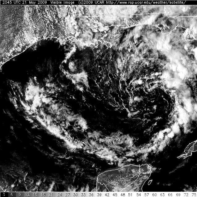
.UPDATE...A BROAD AND LARGE CYCLONIC CIRCULATION DEFINES LOW PRES
THIS EVENING THAT RESIDES OVER THE CENTRAL/EASTERN GULF. A LARGE
AREA OF CLOUDS WAS ROTATING WWD ACROSS THE NRN GULF COAST AND
SE WITH CLUSTERS OF COLD CLOUD TOPS=>SHWRS/TSTMS NOTED ON THE N AND
ERN SIDE OF THE CIRCULATION...WELL REMOVED FROM THE CENTER OF LOWEST
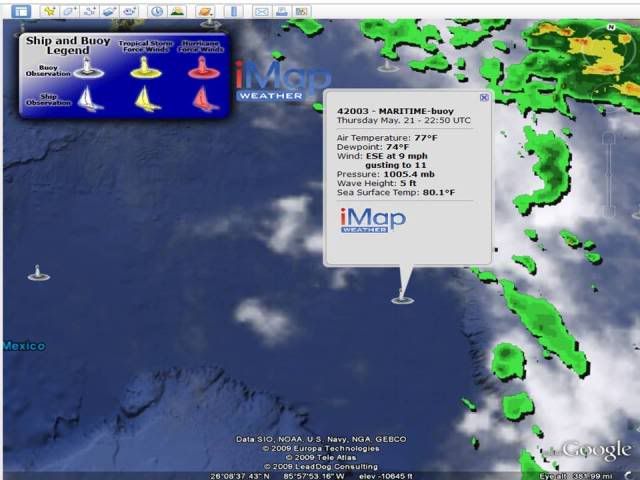
PRESSURE WHICH WAS 1005 MB...ABOUT 300 MILES SSE OF MOBILE. RADAR
TRENDS CARRYING OVER FROM THE AFTN HAS SHOWN MORE IN THE WAY OF
SHWRS AS THE DEEP LYR MOISTURE PROFILES HAVE INCREASED. WITH WHAT IS
OUT THERE ON THE RADAR SCOPE...RADAR RAINFALL ANALYSIS PRODUCTS
INDICATES VERY GOOD RAINFALL EFFICIENCY WITH ESTIMATES OF A QUARTER
TO JUST UNDER A HALF INCH OF RAIN FALLING WHERE WE SEE PASSAGE OF
HIGHER REFLECTIVITIES 40DBZ+. NOT ANTICIPATING ANY SVR WX IN THE
SHORT TERM. /10
baygirl_1 wrote:The local NWS and TV mets are telling us just to expect a lot of rain. As Allen Sealls said, "No Commotion in the Ocean!" That's good because I really don't want to worry about tropical stuff just yet. We did have a pretty good rain shower, no thunder, roll through a little while ago. The updated area forecast discussion explains the low pretty well, I think:AREA FORECAST DISCUSSION...UPDATED
NATIONAL WEATHER SERVICE MOBILE AL
715 PM CDT THU MAY 21 2009
.UPDATE...A BROAD AND LARGE CYCLONIC CIRCULATION DEFINES LOW PRES
THIS EVENING THAT RESIDES OVER THE CENTRAL/EASTERN GULF. A LARGE
AREA OF CLOUDS WAS ROTATING WWD ACROSS THE NRN GULF COAST AND
SE WITH CLUSTERS OF COLD CLOUD TOPS=>SHWRS/TSTMS NOTED ON THE N AND
ERN SIDE OF THE CIRCULATION...WELL REMOVED FROM THE CENTER OF LOWEST
PRESSURE WHICH WAS 1005 MB...ABOUT 300 MILES SSE OF MOBILE. RADAR
TRENDS CARRYING OVER FROM THE AFTN HAS SHOWN MORE IN THE WAY OF
SHWRS AS THE DEEP LYR MOISTURE PROFILES HAVE INCREASED. WITH WHAT IS
OUT THERE ON THE RADAR SCOPE...RADAR RAINFALL ANALYSIS PRODUCTS
INDICATES VERY GOOD RAINFALL EFFICIENCY WITH ESTIMATES OF A QUARTER
TO JUST UNDER A HALF INCH OF RAIN FALLING WHERE WE SEE PASSAGE OF
HIGHER REFLECTIVITIES 40DBZ+. NOT ANTICIPATING ANY SVR WX IN THE
SHORT TERM. /10
I'm more concerned about just how much rain we're going to get. The Hazardous Weather Outlook warns us to expect heavy rainfall with amounts from 4-7 inches. So much for any yardwork or beach activities this weekend.
http://forecast.weather.gov/showsigwx.php?warnzone=ALZ061&warncounty=ALC097&firewxzone=ALZ061&local_place1=3+Miles+WNW+Tillmans+Corner+AL&product1=Hazardous+Weather+Outlook


Users browsing this forum: No registered users and 56 guests