GFS/NAM Develop a Closed Low in the GOM End of This Week
Moderator: S2k Moderators
Forum rules

The posts in this forum are NOT official forecasts and should not be used as such. They are just the opinion of the poster and may or may not be backed by sound meteorological data. They are NOT endorsed by any professional institution or STORM2K. For official information, please refer to products from the National Hurricane Center and National Weather Service.
-
brunota2003

- S2K Supporter

- Posts: 9476
- Age: 35
- Joined: Sat Jul 30, 2005 9:56 pm
- Location: Stanton, KY...formerly Havelock, NC
- Contact:
-
floridasun78
- Category 5

- Posts: 3755
- Joined: Sun May 17, 2009 10:16 pm
- Location: miami fl


Re: GFS Develops a Closed Low in the GOM This Week
Should bring some nasty weather to Fla west coast around mid morning. IF it doesn't wan.

0 likes
-
Rainband
Re: GFS Develops a Closed Low in the GOM This Week
what the heck is that, just got home and saw this comma coming towards us 
0 likes

-
wyq614

- Category 3

- Posts: 827
- Age: 37
- Joined: Sun Dec 02, 2007 12:32 am
- Location: Beijing, China (Hometown: Qingdao, China, 36.06N 120.43E)
- Contact:
CARIBBEAN SEA...
A 1008 MB LOW IS ALONG THE COAST OF N COLOMBIA NEAR 9N76W.
SCATTERED MODERATE TO ISOLATED STRONG CONVECTION IS FROM 5N-10N
BETWEEN 76W-79W. A TROPICAL WAVE IS OVER CENTRAL AMERICA
PRODUCING SIGNIFICANT CONVECTION W OF THE TROUGH AXIS. SEE
TROPICAL WAVE SECTION ABOVE. FRESH TRADEWINDS ARE OVER THE
CARIBBEAN SEA. SCATTERED SHOWERS ARE OVER PANAMA...COSTA
RICA...NICARAGUA...HISPANIOLA... AND PUERTO RICO. IN THE UPPER
LEVELS...NW FLOW EXTENDS FROM THE YUCATAN PENINSULA TO TRINIDAD.
CONSIDERABLE UPPER LEVEL MOISTURE IS OVER THE SW AND NE
CARIBBEAN. EXPECT STRONGEST CONVECTION TO BE OVER THE SW
CARIBBEAN AND CUBA OVER THE NEXT 24 HOURS.
http://www.nhc.noaa.gov/text/refresh/MI ... 2329.shtml?
This thing will come to W Cuba, too....
Amanecerá parcialmente nublado en gran parte del país principalmente en la costa norte occidental y en el extremo oriental. Al final de la mañana estará nublado en el occidente y después del mediodía en el resto del país, con numerosos chubascos y tormentas eléctricas que pueden ser fuertes en algunas localidades, principalmente en la región occidental.
http://www.insmet.cu/asp/genesis.asp?TB ... o/ptrd.txt
0 likes
-
Emmett_Brown

- Category 5
- Posts: 1433
- Joined: Wed Aug 24, 2005 9:10 pm
- Location: Sarasota FL
Re:
O Town wrote:Looks like its twin is following right behind. More rain in Floridas future. *sigh*
It's almost like Texas has started generating tropical waves or something... on Satellite, it looks a lot like the mid level waves that come off of Africa. But, if you look at the water vapor image, it's clear that an upper level trough is kicking off the activity.
http://www.goes.noaa.gov/HURRLOOPS/huwvloop.html
0 likes
-
gatorcane

- S2K Supporter
- Posts: 23708
- Age: 48
- Joined: Sun Mar 13, 2005 3:54 pm
- Location: Boca Raton, FL
Re: GFS Develops a Closed Low in the GOM This Week
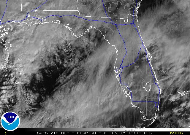
Cool shot of what looks to be this blob putting "feelers" out over the West Coast of Florida...kindaof creepy:
0 likes


-
OuterBanker
- S2K Supporter
- Posts: 1761
- Joined: Wed Feb 26, 2003 10:53 am
- Location: Nags Head, NC
- Contact:
-
Tampa Bay Hurricane

- Category 5
- Posts: 5597
- Age: 38
- Joined: Fri Jul 22, 2005 7:54 pm
- Location: St. Petersburg, FL

Re: GFS Develops a Closed Low in the GOM This Week
http://www.ssd.noaa.gov/goes/east/gmex/loop-vis.html
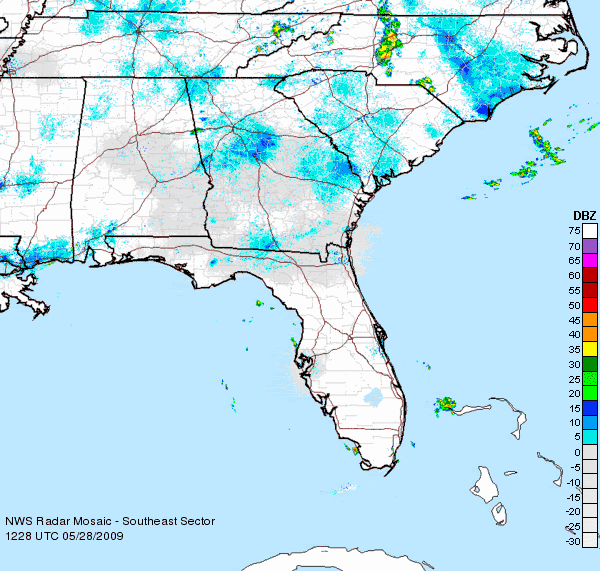
looks like a low is initialized in the gulf ......any chance for any type of strengthening
looks like a low is initialized in the gulf ......any chance for any type of strengthening
0 likes
Who is online
Users browsing this forum: hurricanes1234, wwizard and 69 guests