The posts in this forum are NOT official forecasts and should not be used as such. They are just the opinion of the poster and may or may not be backed by sound meteorological data. They are NOT endorsed by any professional institution or STORM2K. For official information, please refer to products from the National Hurricane Center and National Weather Service.
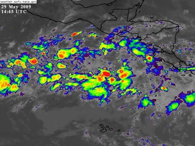
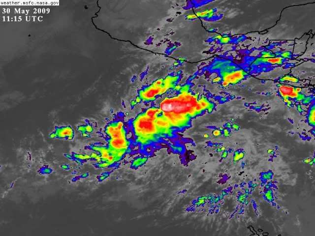
There is a lot of convection there but it seems only the CMC is really bullish about it doing much. Still wouldn't be too surprising if it does go on to develop.
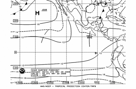
057 ABPZ20 KNHC 301147 TWOEP TROPICAL WEATHER OUTLOOK NWS TPC/NATIONAL HURRICANE CENTER MIAMI FL 500 AM PDT SAT MAY 30 2009
FOR THE EASTERN NORTH PACIFIC...EAST OF 140 DEGREES WEST LONGITUDE..
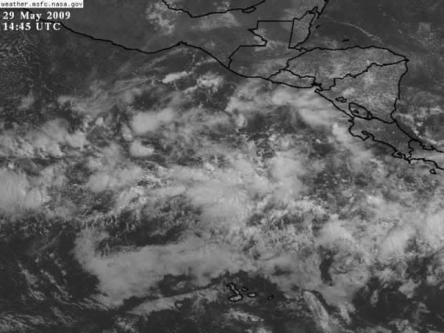
SHOWERS AND THUNDERSTORMS HAVE INCREASED IN ASSOCIATION WITH AN AREA OF DISTURBED WEATHER LOCATED SEVERAL HUNDRED MILES SOUTH-SOUTHEAST OF ACAPULCO MEXICO. SOME GRADUAL DEVELOPMENT OF THIS SYSTEM IS POSSIBLE OVER THE NEXT COUPLE DAYS AS IT MOVES WESTWARD AT 5 TO 10 MPH. THERE IS A LOW CHANCE...LESS THAN 30 PERCENT...OF THIS SYSTEM BECOMING A TROPICAL CYCLONE DURING THE NEXT 48 HOURS.
TROPICAL CYCLONE FORMATION IS NOT EXPECTED DURING THE NEXT 48 HOURS.