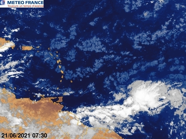
Disturbance In Eastern Caribbean.

This is the general tropical discussion area. Anyone can take their shot at predicting a storms path.

Moderator: S2k Moderators

Forum rules

The posts in this forum are NOT official forecasts and should not be used as such. They are just the opinion of the poster and may or may not be backed by sound meteorological data. They are NOT endorsed by any professional institution or STORM2K. For official information, please refer to products from the National Hurricane Center and National Weather Service.

Help Support Storm2K
Message
Author
User avatar
Gustywind
Category 5
Category 5
Posts: 12334
Joined: Mon Sep 03, 2007 7:29 am
Location: Baie-Mahault, GUADELOUPE

#101 Postby Gustywind » Sat Aug 08, 2009 6:53 am

This thing is forecast to reach the Windwards and southern Leewards Islands Monday night into Tuesday as a perturbed area given our Pro Mets of Meteo-France. Numerous showers and scattered tstorms have been forecasted in this period, but let's wait and see a bit if this verifies or not...
Image

Image


Image
0 likes   

User avatar
Gustywind
Category 5
Category 5
Posts: 12334
Joined: Mon Sep 03, 2007 7:29 am
Location: Baie-Mahault, GUADELOUPE

#102 Postby Gustywind » Sat Aug 08, 2009 6:57 am

000
AXNT20 KNHC 081041
TWDAT

TROPICAL WEATHER DISCUSSION
NWS TPC/NATIONAL HURRICANE CENTER MIAMI FL
805 AM EDT SAT AUG 08 2009

TROPICAL WEATHER DISCUSSION FOR NORTH AMERICA...CENTRAL
AMERICA...GULF OF MEXICO...CARIBBEAN SEA...NORTHERN SECTIONS
OF SOUTH AMERICA...AND ATLANTIC OCEAN TO THE AFRICAN COAST
FROM THE EQUATOR TO 32N. THE FOLLOWING INFORMATION IS BASED
ON SATELLITE IMAGERY...METEOROLOGICAL ANALYSIS...WEATHER
OBSERVATIONS...AND RADAR.

BASED ON 0600 UTC SURFACE ANALYSIS AND SATELLITE IMAGERY THROUGH
1015 UTC.

...TROPICAL WAVES...

TROPICAL WAVE EXTENDS ALONG 9N21W JUST W OF THE CAPE VERDE
ISLANDS TO 18N29W MOVING W NEAR 15 KT. WAVE REMAINS EMBEDDED
WITH A MOISTURE MAXIMUM OBSERVED IN TOTAL PRECIPITABLE WATER
IMAGERY. THERE IS NO DEEP CONVECTION ASSOCIATED WITH THE WAVE
BUT ISOLATED SHOWERS ARE WITHIN 120 NM EITHER SIDE OF THE WAVE
AXIS FROM 13N-16N.

TROPICAL WAVE IS ALONG 40W/41W S OF 16N MOVING W NEAR 15 KT.
WAVE IS MOVING THROUGH AN AREA OF DRY STABLE AIR AND THE
LOCATION IS BASED ON CONTINUITY WITH NO ASSOCIATED SHOWERS OR
DEEP CONVECTION.

TROPICAL WAVE IS ALONG 57W/58W S OF 15N MOVING W NEAR 15 KT.
WAVE REMAINS IN AN AREA BENEATH AN UPPER RIDGE THUS MASKING THE
WAVE SIGNATURE AND THE CONVECTION MAY BE ASSOCIATED MORE WITH
THE ITCZ THAN THE WAVE ITSELF. SCATTERED MODERATE/ISOLATED
STRONG CONVECTION IS WITHIN 60/75 NM OF LINE FROM 13N54W TO
11N59W.

TROPICAL WAVE IS ALONG 75W S OF 19N MOVING W NEAR 15 KT. WAVE IS
NOW ALONG THE TRAILING EDGE OF A MOISTURE MAXIMUM OBSERVED IN
TOTAL PRECIPITABLE WATER IMAGERY. SCATTERED SHOWERS/ISOLATED
THUNDERSTORMS ARE W OF THE WAVE FROM 14N-16N BETWEEN 76W-79W.

TROPICAL WAVE IS ALONG 93W/94W S OF 21N MOVING W 15-20 KT.
WAVE REMAINS WITHIN A BROAD AREA OF DEEP LAYER MOISTURE AS NOTED
ON TOTAL PRECIPITABLE WATER IMAGERY THAT COVERS THE GULF OF
MEXICO AND INTO THE E PACIFIC REGION. SCATTERED SHOWERS/ISOLATED
THUNDERSTORMS ARE OVER THE BAY OF CAMPECHE S OF 21N TO OVER
MEXICO BETWEEN THE WAVE AXIS AND 97W WITH ISOLATED SHOWERS S OF
24N BETWEEN 89W-93W INCLUDING THE YUCATAN PENINSULA.

...ITCZ...

THE ITCZ AXIS IS CENTERED ALONG 13N15W 9N31W 13N50W 10N63W. A
NEAR STATIONARY SURFACE TROUGH IS EMBEDDED WITHIN THE ITCZ
EXTENDING FROM 15N46W TO 8N51W WITH SCATTERED MODERATE/ISOLATED
STRONG CONVECTION W OF THE TROUGH AXIS WITHIN 120 NM OF LINE
FROM 15N49W TO 11N53W. SCATTERED MODERATE/ISOLATED STRONG
CONVECTION HAS MOVED OFF W AFRICA WITHIN 75/90 NM OF LINE FROM
12N20W TO THE COAST NEAR 10N14W. SCATTERED CLUSTERS OF SCATTERED
MODERATE CONVECTION ARE WITHIN 75 NM OF 10N BETWEEN 43W-47W.

...DISCUSSION...

GULF OF MEXICO...
AN UPPER LEVEL TROUGH EXTENDS ACROSS THE GULF OF MEXICO FROM AN
UPPER LOW OVER MOBILE ALABAMA THROUGH 25N95W TO A SECOND UPPER
LOW CENTERED OVER E/CENTRAL MEXICO NEAR 22N99W. A SURFACE TROUGH
EXTENDS JUST TO THE SE OF THIS UPPER TROUGH FROM NEAR
JACKSONVILLE FLORIDA ALONG 28N86W TO 25N90W WITH CLUSTERS OF
SCATTERED SHOWERS/ISOLATED THUNDERSTORMS FROM 25N-30N BETWEEN
83W-90W. ISOLATED SHOWERS/THUNDERSTORMS DOT THE REMAINDER OF THE
W GULF. A BROAD UPPER RIDGE EXTENDS FROM THE OVER THE YUCATAN
PENINSULA OVER THE REMAINDER OF THE E GULF.

CARIBBEAN SEA...
AN UPPER RIDGE OVER THE YUCATAN PENINSULA INTO THE E GULF OF
MEXICO COVERS THE W CARIBBEAN...WITH AN UPPER TROUGH OVER THE
CENTRAL CARIBBEAN...AND A SECOND UPPER RIDGE OVER THE E
CARIBBEAN. THE UPPER LEVEL DIFFLUENCE OVER THE W/CENTRAL
CARIBBEAN IS GENERATING SCATTERED SHOWERS/ISOLATED THUNDERSTORMS
FROM S OF 12N TO OVER PANAMA BETWEEN 77W-81W AND S OF 17N W OF
81W TO INLAND OVER CENTRAL AMERICA. THE CARIBBEAN E OF 75W IS
DOMINATED BY DRY STABLE AIR LIMITING SHOWER ACTIVITY. FRESH TO
STRONG TRADE WINDS CONTINUE ACROSS MUCH OF THE E AND CENTRAL
CARIBBEAN.

ATLANTIC OCEAN...
AN UPPER RIDGE IS OVER THE W ATLC ANCHORED OVER THE N BAHAMA
ISLANDS WITH A NARROW UPPER TROUGH TO THE E EXTENDING THROUGH
32N63W THROUGH THE WINDWARD PASSAGE AND OVER THE CENTRAL
CARIBBEAN. THIS COMBINATION IS PROVIDING UPPER LEVEL DIFFLUENCE
TO GENERATE CLUSTERS OF SCATTERED SHOWERS/ISOLATED THUNDERSTORMS
WITHIN 75/90 NM OF LINE FROM THE BAHAMAS NEAR 24N76W TO BEYOND
32N68W. A SURFACE TROUGH IS BENEATH THE UPPER RIDGE EXTENDING
FROM 29N73W TO OVER THE BAHAMAS NEAR 25N77W BUT IS NOT
GENERATING ANY SIGNIFICANT WEATHER. A LARGE UPPER LOW IS IN THE
CENTRAL ATLC NEAR 28N46W WITH A SURFACE TROUGH EXTENDING 31N47W
TO 25N44W. SCATTERED SHOWERS AND POSSIBLE ISOLATED THUNDERSTORMS
ARE ALONG THE N PERIPHERY OF THE UPPER LOW WITHIN 75 NM OF LINE
FROM 32N45W TO 27N52W AND ISOLATED SHOWERS WITHIN 90 NM EITHER
SIDE OF THE SURFACE TROUGH. THE REMAINDER OF THE ATLC REMAINS
TRANQUIL THIS MORNING WITH A BROAD AREA OF SAHARAN DUST COVERING
THE AREA E OF 42W AND FROM 60W-72W.

$$
WALLACE
0 likes   

User avatar
wxman57
Moderator-Pro Met
Moderator-Pro Met
Posts: 22951
Age: 67
Joined: Sat Jun 21, 2003 8:06 pm
Location: Houston, TX (southwest)

Re: Disturbance East Of Windward Islands.

#103 Postby wxman57 » Sat Aug 08, 2009 8:13 am

NHC still doesn't see it. They're mentioning some imperceptible feature embedded in the ITCZ at 57-58W and not the main wave at 51-52W.
0 likes   

User avatar
Gustywind
Category 5
Category 5
Posts: 12334
Joined: Mon Sep 03, 2007 7:29 am
Location: Baie-Mahault, GUADELOUPE

Re: Disturbance East Of Windward Islands.

#104 Postby Gustywind » Sat Aug 08, 2009 8:16 am

wxman57 wrote:NHC still doesn't see it. They're mentioning some imperceptible feature embedded in the ITCZ at 57-58W and not the main wave at 51-52W.

Surely but let's wait for the next weather forecast things can change quickly than predicted...
0 likes   

User avatar
wxman57
Moderator-Pro Met
Moderator-Pro Met
Posts: 22951
Age: 67
Joined: Sat Jun 21, 2003 8:06 pm
Location: Houston, TX (southwest)

Re: Disturbance East Of Windward Islands.

#105 Postby wxman57 » Sat Aug 08, 2009 9:51 am

Fortunately, I don't have to wait for a forecast, as I've been making my own for 30 years now (plus another 15 years as an amateur). Just made a surface plot with satellite overlay (below). What we have here is no more than a typical tropical wave of moderate amplification. Little chance of development if it continues tracking westward. Better chance of development if it moves north of the Caribbean in 4-5 days.

Image
0 likes   

Sanibel
Category 5
Category 5
Posts: 10375
Joined: Mon Aug 30, 2004 11:06 pm
Location: Offshore SW Florida

Re: Disturbance East Of Windward Islands.

#106 Postby Sanibel » Sat Aug 08, 2009 10:17 am

I knew when I was typing "showtime folks" last night that I would regret it. Can't blame me though a big red IR burst was happening like some of the impressive satellite presentations this wave had by Africa. It could refire again but 2009 is likely presenting another ghost disturbance.
0 likes   

User avatar
wxman57
Moderator-Pro Met
Moderator-Pro Met
Posts: 22951
Age: 67
Joined: Sat Jun 21, 2003 8:06 pm
Location: Houston, TX (southwest)

Re: Disturbance East Of Windward Islands.

#107 Postby wxman57 » Sat Aug 08, 2009 10:21 am

Sanibel wrote:I knew when I was typing "showtime folks" last night that I would regret it. Can't blame me though a big red IR burst was happening like some of the impressive satellite presentations this wave had by Africa. It could refire again but 2009 is likely presenting another ghost disturbance.


I think it'll be "showtime" pretty soon now. Probably by the end of next week. NAO will be turning positive, trades decreasing, water warm enough. Ana isn't far away. I think the models are seeing the change in their long-range outlooks.
0 likes   

Sanibel
Category 5
Category 5
Posts: 10375
Joined: Mon Aug 30, 2004 11:06 pm
Location: Offshore SW Florida

Re: Disturbance East Of Windward Islands.

#108 Postby Sanibel » Sat Aug 08, 2009 10:27 am

I can tell the switch is slowly flickering on because convection is sticking in the Gulf over water and the SE tradewinds finally kicked in and stayed. (Plus it is that climatological time)
0 likes   

User avatar
gatorcane
S2K Supporter
S2K Supporter
Posts: 23689
Age: 47
Joined: Sun Mar 13, 2005 3:54 pm
Location: Boca Raton, FL

Re: Disturbance East Of Windward Islands.

#109 Postby gatorcane » Sat Aug 08, 2009 10:50 am

wxman57 wrote:
Sanibel wrote:I knew when I was typing "showtime folks" last night that I would regret it. Can't blame me though a big red IR burst was happening like some of the impressive satellite presentations this wave had by Africa. It could refire again but 2009 is likely presenting another ghost disturbance.


I think it'll be "showtime" pretty soon now. Probably by the end of next week. NAO will be turning positive, trades decreasing, water warm enough. Ana isn't far away. I think the models are seeing the change in their long-range outlooks.


agreed I am also seeing the long-range models starting to indicate real possibilities of development in their long-range forecasts. The only exception is the ECMWF which hasn't shown much but I do think it will come on board soon.

It is almost that time of year afterall.
0 likes   

User avatar
tailgater
S2K Supporter
S2K Supporter
Posts: 3339
Joined: Sun Jul 11, 2004 9:13 pm
Location: St. Amant La.

Re: Disturbance East Of Windward Islands.

#110 Postby tailgater » Sat Aug 08, 2009 11:55 am

Now showing best 850 vorticity in the last 5 days

Image
0 likes   

floridasun78
Category 5
Category 5
Posts: 3755
Joined: Sun May 17, 2009 10:16 pm
Location: miami fl

Re: Disturbance East Of Windward Islands.

#111 Postby floridasun78 » Sat Aug 08, 2009 11:59 am

tailgater wrote:Now showing best 850 vorticity in the last 5 days

Image

i saw that
0 likes   

Sanibel
Category 5
Category 5
Posts: 10375
Joined: Mon Aug 30, 2004 11:06 pm
Location: Offshore SW Florida

Re: Disturbance East Of Windward Islands.

#112 Postby Sanibel » Sat Aug 08, 2009 12:51 pm

I wouldn't doubt that we'll get another "bluff burst" tonight.
0 likes   

Ed Mahmoud

Re: Disturbance East Of Windward Islands.

#113 Postby Ed Mahmoud » Sat Aug 08, 2009 3:33 pm

0 likes   

User avatar
gatorcane
S2K Supporter
S2K Supporter
Posts: 23689
Age: 47
Joined: Sun Mar 13, 2005 3:54 pm
Location: Boca Raton, FL

#114 Postby gatorcane » Sat Aug 08, 2009 3:38 pm

popping convection again today, possibly on its way to an invest if this keeps up. Early to mid August systems like this area for development.

Image

:darrow: :darrow: Wind shear has really dropped of in the Eastern Caribbean so conditions are favorable for development of this system as it moves W or WNW at 15 mph over the next couple of days.

Image
Last edited by gatorcane on Sat Aug 08, 2009 3:45 pm, edited 3 times in total.
0 likes   

User avatar
Blown Away
S2K Supporter
S2K Supporter
Posts: 10140
Joined: Wed May 26, 2004 6:17 am

Re: Disturbance East Of Windward Islands.

#115 Postby Blown Away » Sat Aug 08, 2009 3:40 pm

IMO, the potential is better now than has been over the past few days. Nice loop Ed, thanks. :D This wave has been predicted to move in the general direction of the NE Caribbean and the shear on that path is not to bad, so shear should not be a problem over the next few days.
0 likes   

floridasun78
Category 5
Category 5
Posts: 3755
Joined: Sun May 17, 2009 10:16 pm
Location: miami fl

#116 Postby floridasun78 » Sat Aug 08, 2009 3:54 pm

i see on shear map that shear droping in that area but still high in carribbean
0 likes   

User avatar
gatorcane
S2K Supporter
S2K Supporter
Posts: 23689
Age: 47
Joined: Sun Mar 13, 2005 3:54 pm
Location: Boca Raton, FL

Re:

#117 Postby gatorcane » Sat Aug 08, 2009 3:58 pm

floridasun78 wrote:i see on shear map that shear droping in that area but still high in carribbean


When I look at the WV loop at the TUTT configuration I see the TUTT that was across the Eastern Caribbean retrograding westward and fizzling out now leaving favorable conditions in the Eastern and soon Central Caribbean. This wave shows signs of moving WNW so should end up in the NE Caribbean in a few days (may not move into the Central Caribbean where the shear is higher)

posting.php?mode=quote&f=31&p=1899110
Last edited by gatorcane on Sat Aug 08, 2009 4:01 pm, edited 4 times in total.
0 likes   

User avatar
KWT
Category 5
Category 5
Posts: 31415
Joined: Tue Aug 17, 2004 11:02 am
Location: UK!!!

#118 Postby KWT » Sat Aug 08, 2009 3:58 pm

I believe models are forecasting shear to increase a lot in the next 24-36hrs in the Caribbean sea, as wxman57 has said before it needs to gain latitude. Though I'm not sure if thats still the case?

Saying that it looks decent enough for a invest and if the shear stays lower then forecasted then it certainly has a chance.

If it can head WNW then thats its best shot as others have said, could have 2 invests in the next 24hrs.
Last edited by KWT on Sat Aug 08, 2009 4:00 pm, edited 1 time in total.
0 likes   

User avatar
HURAKAN
Professional-Met
Professional-Met
Posts: 46086
Age: 38
Joined: Thu May 20, 2004 4:34 pm
Location: Key West, FL
Contact:

#119 Postby HURAKAN » Sat Aug 08, 2009 4:00 pm

Image

Tendency
0 likes   

User avatar
gatorcane
S2K Supporter
S2K Supporter
Posts: 23689
Age: 47
Joined: Sun Mar 13, 2005 3:54 pm
Location: Boca Raton, FL

#120 Postby gatorcane » Sat Aug 08, 2009 4:01 pm

NHC is likely to mention this area in their next update -- code yellow would make sense.
0 likes   


Return to “Talkin' Tropics”

Who is online

Users browsing this forum: Google Adsense [Bot], StormWeather and 206 guests