Possible Gulf Develpoment Next Weekend???
Moderator: S2k Moderators
Forum rules

The posts in this forum are NOT official forecasts and should not be used as such. They are just the opinion of the poster and may or may not be backed by sound meteorological data. They are NOT endorsed by any professional institution or STORM2K. For official information, please refer to products from the National Hurricane Center and National Weather Service.
-
CYCLONE MIKE
- Category 5

- Posts: 2183
- Joined: Tue Aug 31, 2004 6:04 pm
- Location: Gonzales, LA
Re: Possible Gulf Develpoment Next Weekend???
Was just about to post the same thing. At least this goes into a little better discussion into what factors are supposed to come together. Guys it is the wave in the central atlantic around 44w that we need to watch. Seems fairly confident it will strengthen and make it into the gulf as a strong wave. From there anybodys best guess. We just need to model watch and see if anything starts to latch on to this scenario. Sunday is not that long away.
0 likes
-
nashrobertsx
- Tropical Depression

- Posts: 85
- Joined: Fri Aug 15, 2008 3:55 pm
-
srainhoutx

- S2K Supporter

- Posts: 6919
- Age: 68
- Joined: Sun Jan 14, 2007 11:34 am
- Location: Haywood County, NC
- Contact:
Re: Possible Gulf Develpoment Next Weekend???
Normally I would not post the morning e-mail from Jeff Lindner in the Talking Tropics area, but there is some consensus among New Orleans forecaster as well as Jeff regarding some form of GOM activity as early as this weekend...
Highly moist air mass remains over the region with PWS in excess of 2.0 inches at most locations. Morning radar and first few visible satellite images show scattered showers and thunderstorms over the nearshore waters with some activity as far inland as Needville in Fort Bend County. Deep southerly flow remains in progress and once trigger temps in the mid 80’s are reached expected numerous showers and thunderstorms to focus across the central and western portions of the region in the area of deepest moisture. Not sure upper ridging has built enough yet the limit rain chances and I suspect we will see as much coverage today as on Sunday…then a pronounce drying trend into mid week.
Upper ridge will build over the area Tuesday-Thursday with high temperatures returning to the upper 90’s/low 100’s. KCLL has now seen 41-100 degree days this summer! Ridge does not gain a strong foothold…nor did it last week and rain chances return starting Friday into next weekend as the ridge moves westward opening the door for an upper trough to cut off over the NW Gulf. This feature actually intensifying as it moves inland over S TX with deep tropical moisture surging back into SE TX late Friday. Will likely see a return of active seabreeze convection Friday into next weekend. Additionally, tropical wave near 45W this morning will be entering into the SE Gulf of Mexico by late next weekend. GFS has been hinting at some development with this wave as it reaches the Gulf with synoptic scale features showing downstream upper level high pressure positioned over the central and eastern Gulf supporting a favorable upper air environment.
99L:
Atlantic tropics heading toward a significant increase in activity per forecast models and favorable wet phase of MJO pattern….ie note upswing in EPAC and CPAC (TS Felicia heading for Hawaii) Additionally, ITCZ has crept northward of late and easterly trades from Africa toward the Lesser Antilles Islands in the Mean Development Region have greatly weakened along with significant moistening of the air mass off the coast of Africa and well west into the tropical Atlantic.
A strong tropical wave with an associated area of elongated low pressure is currently passing just south of the Cape Verde Islands. Visible and IR images show a fairly well defined system with broad surface low pressure and modest convection near and surrounding the broad circulation. The convection is not well organized and there is little banding features noted. Morning Quickscat satellite overpass showed impressive 40-45kt unflagged vectors on the southern side of the circulation however the overall rotation is broad and not well defined. There also appears to be a slight hint at SW wind shear as upper level moisture is streaming NE away from the system. Given all this, there still is decent potential for TD #2 to come within the next 48 hours as supported by nearly all of the global model guidance. General track guidance maintains a modest sub-tropical ridge north of the system allowing a WNW track for the next several days. This will allow the system to gain some latitude over time increasing the chances for a recurve out to sea.
FWIW, the global models especially the GFS develop the next 2 waves coming off of Africa with the next wave coming off at a very low latitude and tracking almost due west and growing into a strong tropical cyclone as it approaches the Leeward Islands in 9-13 days. We shall see…this is the most guidance action to date for the 2009 season. While we are in an El Nino period…such periods have been very unkind to the Gulf coast and there is growing evidence that El Nino does not as greatly affect Gulf of Mexico activity as much as the deep eastern Atlantic.
0 likes
-
Stormcenter
- S2K Supporter
- Posts: 6689
- Joined: Wed Sep 03, 2003 11:27 am
- Location: Houston, TX
Re: Possible Gulf Develpoment Next Weekend???
I have to see that to believe it this far out.
Way too many things have to come into play
for this to all pan out. I'm not boarding up just yet.
Way too many things have to come into play
for this to all pan out. I'm not boarding up just yet.
0 likes

Re: Possible Gulf Develpoment Next Weekend???
Maybe the convection by Panama will pull NW and become that system that was being predicted in the NW Carribean?
0 likes

Re: Possible Gulf Develpoment Next Weekend???
Snippet from the Tallahassee NWS AFD:
LOOKING AHEAD TO THE WEEKEND...THE MODELS INDICATE RISING UPPER
HEIGHTS AS THE SUBTROPICAL RIDGE BUILDS BACK OVER THE REGION.
ALTHOUGH CONFIDENCE IS VERY LOW THROUGH THIS PORTION OF THE
FORECAST...THE ECMWF AND GFS BOTH SHOW A BROAD SWATH OF DEEP LAYER
MOISTURE ASSOCIATED WITH A WEAK TROPICAL WAVE TRACKING NORTHWEST
TOWARD THE GULF COAST AND AROUND THE RIDGE AXIS SUNDAY THROUGH
MONDAY TIME FRAME.
0 likes
Re: Possible Gulf Develpoment Next Weekend???
What is the High Pressure ridge going to do next week? I know it will be over the Western half of the U.S. by the weekend but if it decides to shift back East, that could make it very interesting for the Gulf Coast should something develop.
0 likes

Re: Possible Gulf Develpoment Next Weekend???
Next weekend the Bermuda ridge will be over the US east coast.
0 likes
-
Ed Mahmoud
Re: Possible Gulf Develpoment Next Weekend???
I looped the GFS 850 mb vorticity wind out past the resolution lobotomy. Nothing in the Gulf, nada, zed, zero. Squat.
A little after the lobotomy, but less than 10 days to interesting weather in Puerto Rico...

The less model time elapses after the resolution lobotomy, the less the model goes off to la-la land, by my figuring.
So things could get interesting in the USVI and Sint Maarten.
A little after the lobotomy, but less than 10 days to interesting weather in Puerto Rico...
The less model time elapses after the resolution lobotomy, the less the model goes off to la-la land, by my figuring.
So things could get interesting in the USVI and Sint Maarten.
0 likes
Re: Possible Gulf Develpoment Next Weekend???
They are talking about the tropical wave that the Euro and GFS bring into the eastern GOM next weekend into early next week, a very, very small vorticity (barely noticeable) is shown on the 12z gfs, making landfall on the northern central gulfcoast, it probably will be nothing, but something to keep an eye on because sypnotic set up will steer anything in the northern Caribbean towards the north central gulfcoast late weekend into next weekend.


0 likes
-
lrak

- S2K Supporter
- Posts: 1770
- Age: 59
- Joined: Thu Jun 21, 2007 2:48 pm
- Location: Corpus Christi, TX
Re: Possible Gulf Develpoment Next Weekend???
Does this possible scenario include any rain chances for Corpus Christi or Brownsville TX? I don't care about waves anymore weez all dried up down here, I final got a crack in the drywall  And I've got a super duper rebar slab I thought would weather any drought.
Rain please please stay and never go away, we're drying up day by day and pain is opening my wallet everyday!
Rain please please stay and never go away, we're drying up day by day and pain is opening my wallet everyday!
0 likes
-
Stormcenter
- S2K Supporter
- Posts: 6689
- Joined: Wed Sep 03, 2003 11:27 am
- Location: Houston, TX
Re: Possible Gulf Develpoment Next Weekend???
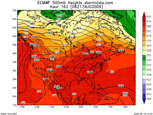
That (EURO)looks more like the NE GOM and not the North Central.
0 likes

Re: Possible Gulf Develpoment Next Weekend???
Ivan...whats up buddy long time my weather friend... ..
code yellow on the little guy near the windwards might be your little system....
code yellow on the little guy near the windwards might be your little system....
0 likes
-
Ivanhater

- Storm2k Moderator

- Posts: 11221
- Age: 39
- Joined: Fri Jul 01, 2005 8:25 am
- Location: Pensacola
Re: Possible Gulf Develpoment Next Weekend???
ROCK wrote:Ivan...whats up buddy long time my weather friend...
code yellow on the little guy near the windwards might be your little system....
Hey Rock! Hasn't felt like summer with nothing to track. Glad things are starting to heat up. These little systems are just appetizers I'm afraid, with what the models are showing coming off Africa soon
0 likes
Re: Possible Gulf Develpoment Next Weekend???
Ivanhater wrote:ROCK wrote:Ivan...whats up buddy long time my weather friend...
code yellow on the little guy near the windwards might be your little system....
Hey Rock! Hasn't felt like summer with nothing to track. Glad things are starting to heat up. These little systems are just appetizers I'm afraid, with what the models are showing coming off Africa soon
Oh I agree....but you might want to check the sat view....just in case...
0 likes
Re: Possible Gulf Develpoment Next Weekend???
[quote="Stormcenter"]That (EURO)looks more like the NE GOM and not the North Central.[/quote]
What exactly does the Euro show? Tally NWS AFD only mentions a possibility of some tropical moisture next weekend. I haven't seen any model showing a potential Closed Low in the Gulf anytime in the next 10 - 14 days. Am I missing something?
What exactly does the Euro show? Tally NWS AFD only mentions a possibility of some tropical moisture next weekend. I haven't seen any model showing a potential Closed Low in the Gulf anytime in the next 10 - 14 days. Am I missing something?
0 likes
-
Ed Mahmoud
Re: Possible Gulf Develpoment Next Weekend???
N2Storms wrote:Stormcenter wrote:That (EURO)looks more like the NE GOM and not the North Central.
What exactly does the Euro show? Tally NWS AFD only mentions a possibility of some tropical moisture next weekend. I haven't seen any model showing a potential Closed Low in the Gulf anytime in the next 10 - 14 days. Am I missing something?
No.
Boredome rules, especially as 99L looks slow to develop...
0 likes
-
Stormcenter
- S2K Supporter
- Posts: 6689
- Joined: Wed Sep 03, 2003 11:27 am
- Location: Houston, TX
Re: Possible Gulf Develpoment Next Weekend???
You know things are slow in the tropics when the "highlights" are an invest (not a TD or better) that is days and days from any land mass and a phantom low that some models are
predicting to form in the GOM early next week.
predicting to form in the GOM early next week.
Ed Mahmoud wrote:N2Storms wrote:Stormcenter wrote:That (EURO)looks more like the NE GOM and not the North Central.
What exactly does the Euro show? Tally NWS AFD only mentions a possibility of some tropical moisture next weekend. I haven't seen any model showing a potential Closed Low in the Gulf anytime in the next 10 - 14 days. Am I missing something?
No.
Boredome rules, especially as 99L looks slow to develop...
0 likes
Who is online
Users browsing this forum: gib, hurricanes1234, JaviT, USTropics, WaveBreaking and 287 guests