ATL: TROPICAL STORM BILL (03L)
Moderator: S2k Moderators
-
HURAKAN

- Professional-Met

- Posts: 46084
- Age: 39
- Joined: Thu May 20, 2004 4:34 pm
- Location: Key West, FL
- Contact:
264
URNT15 KNHC 220644
AF303 1103A BILL HDOB 36 20090822
063430 3035N 06621W 6969 03174 0080 +092 +056 207070 071 035 003 00
063500 3034N 06620W 6965 03179 0072 +098 +057 205071 071 036 001 00
063530 3033N 06618W 6961 03184 0072 +095 +061 205070 070 035 002 00
063600 3032N 06617W 6966 03180 0075 +095 +064 206070 070 035 002 00
063630 3031N 06616W 6966 03181 0078 +095 +069 206069 069 036 000 00
063700 3030N 06615W 6961 03187 0077 +095 +066 205069 069 035 002 00
063730 3029N 06614W 6966 03182 0083 +094 +065 205068 068 033 002 00
063800 3028N 06613W 6962 03187 0084 +094 +057 205067 067 033 001 00
063830 3027N 06611W 6966 03187 0085 +095 +053 205067 067 032 001 00
063900 3026N 06610W 6963 03192 0085 +095 +057 205067 068 033 000 00
063930 3025N 06609W 6966 03191 0087 +096 +070 205067 067 032 000 00
064000 3024N 06608W 6963 03196 0090 +095 +069 206065 066 030 001 03
064030 3023N 06607W 6955 03203 0092 +090 +073 204065 065 031 002 03
064100 3021N 06607W 6778 03410 0085 +076 +055 206064 064 032 001 03
064130 3020N 06607W 6464 03796 0083 +054 +025 203065 066 999 999 03
064200 3019N 06607W 6163 04188 0083 +032 +004 202063 064 999 999 03
064230 3017N 06607W 5923 04510 0081 +014 -026 207060 061 999 999 03
064300 3016N 06607W 5723 04790 0076 -001 -018 207057 058 999 999 03
064330 3014N 06607W 5526 05069 0077 -018 -054 208056 057 029 001 03
064400 3013N 06607W 5350 05328 0257 -035 -060 208055 056 029 000 03
$$
;
0 likes
-
TheEuropean

- Professional-Met
- Posts: 1797
- Age: 60
- Joined: Tue Sep 20, 2005 3:17 pm
- Location: Voerde, Germany
- Contact:
Thx, Hurakan. And finally the data of the leaving plane:
000
URNT15 KNHC 220654
AF303 1103A BILL HDOB 37 20090822
064430 3012N 06607W 5163 05610 0274 -051 -072 213057 058 025 002 03
064500 3010N 06607W 5026 05830 0290 -055 -081 218056 056 025 002 00
064530 3008N 06607W 4866 06082 0310 -070 -096 220054 054 024 001 00
064600 3007N 06607W 4725 06315 0327 -080 -111 224050 051 023 002 00
064630 3005N 06606W 4611 06506 0340 -075 -190 223048 049 023 002 00
064700 3003N 06606W 4493 06701 0350 -090 -187 221047 048 024 000 00
064730 3002N 06606W 4362 06930 0362 -103 -263 216047 048 022 001 00
064800 3000N 06606W 4250 07132 0378 -114 -377 216047 048 025 001 00
064830 2958N 06606W 4147 07323 0394 -125 -432 220045 046 024 001 00
064900 2957N 06606W 4053 07499 0408 -137 -389 223045 045 023 002 00
064930 2955N 06606W 3967 07662 0420 -147 -402 223044 044 026 003 00
065000 2953N 06606W 3922 07747 0423 -157 -418 224044 044 028 005 00
065030 2951N 06606W 3918 07749 0419 -159 -396 226045 047 028 004 00
065100 2949N 06606W 3917 07752 0419 -157 -379 227045 045 027 002 00
065130 2947N 06606W 3916 07753 0418 -157 -455 227046 046 029 001 00
065200 2944N 06605W 3916 07752 0418 -160 -453 228046 046 029 001 00
065230 2942N 06605W 3914 07753 0417 -162 -421 228046 046 028 002 00
065300 2939N 06605W 3878 07820 0419 -166 -439 228047 047 027 002 00
065330 2937N 06605W 3818 07939 0428 -174 -432 228047 048 022 002 00
065400 2935N 06605W 3775 08026 0435 -180 -458 227047 048 020 000 00
0 likes
-
Brent
- S2K Supporter

- Posts: 38765
- Age: 37
- Joined: Sun May 16, 2004 10:30 pm
- Location: Tulsa Oklahoma
- Contact:
Re: ATL: HURRICANE BILL (Advisories)
BULLETIN
HURRICANE BILL ADVISORY NUMBER 28
NWS TPC/NATIONAL HURRICANE CENTER MIAMI FL AL032009
500 AM AST SAT AUG 22 2009
...BILL MOVING QUICKLY NORTH-NORTHWESTWARD...TROPICAL STORM WARNING
FOR THE MASSACHUSETTS COAST...
AT 5 AM AST...0900 UTC...THE GOVERNMENT OF BERMUDA HAS
DISCONTINUED THE HURRICANE WATCH FOR BERMUDA. A TROPICAL STORM
WARNING REMAINS IN EFFECT FOR THE ISLAND.
AT 5 AM EDT...0900 UTC...A TROPICAL STORM WARNING IS IN EFFECT FOR
THE COAST OF MASSACHUSETTS FROM WOODS HOLE TO SAGAMORE BEACH...
INCLUDING THE ISLANDS OF MARTHA`S VINEYARD AND NANTUCKET. A
TROPICAL STORM WARNING MEANS THAT TROPICAL STORM CONDITIONS ARE
EXPECTED SOMEWHERE WITHIN THE WARNING AREA WITHIN 24 HOURS.
INTERESTS ELSEWHERE ALONG THE COAST OF NEW ENGLAND AND IN THE
CANADIAN MARITIMES SHOULD MONITOR THE PROGRESS OF BILL. ADDITIONAL
WATCHES OR WARNINGS MAY BE ISSUED ON SATURDAY FOR OTHER PORTIONS OF
NOVA SCOTIA AND NEWFOUNDLAND.
FOR STORM INFORMATION SPECIFIC TO YOUR AREA IN THE UNITED STATES...
INCLUDING POSSIBLE INLAND WATCHES AND WARNINGS...PLEASE MONITOR
PRODUCTS ISSUED BY YOUR LOCAL NATIONAL WEATHER SERVICE FORECAST
OFFICE. FOR STORM INFORMATION SPECIFIC TO YOUR AREA OUTSIDE OF THE
UNITED STATES...PLEASE MONITOR PRODUCTS ISSUED BY YOUR NATIONAL
METEOROLOGICAL SERVICE.
AT 500 AM AST...0900 UTC...THE CENTER OF HURRICANE BILL WAS LOCATED
NEAR LATITUDE 33.0 NORTH...LONGITUDE 68.5 WEST OR ABOUT 220 MILES...
355 KM...WEST-NORTHWEST OF BERMUDA AND ABOUT 430 MILES...690 KM...
EAST-SOUTHEAST OF CAPE HATTERAS NORTH CAROLINA. THIS POSITION IS
ALSO ABOUT 575 MILES...925 KM...SOUTH OF NANTUCKET MASSACHUSETTS.
BILL IS MOVING TOWARD THE NORTH-NORTHWEST NEAR 22 MPH...35 KM/HR. A
TURN TOWARD THE NORTH IS EXPECTED LATER TODAY...WITH A TURN TOWARD
THE NORTH-NORTHEAST AND AN INCREASE IN FORWARD SPEED ON SUNDAY. ON
THE FORECAST TRACK...THE CORE OF HURRICANE BILL IS EXPECTED TO PASS
OVER THE OPEN WATERS BETWEEN BERMUDA AND THE EAST COAST OF THE
UNITED STATES THIS MORNING. BILL IS EXPECTED TO PASS OFFSHORE OF THE
COAST OF NEW ENGLAND LATE TODAY OR TONIGHT AND APPROACH NOVA SCOTIA
ON SUNDAY.
MAXIMUM SUSTAINED WINDS ARE NEAR 105 MPH...165 KM/HR...WITH HIGHER
GUSTS. BILL IS A CATEGORY TWO HURRICANE ON THE SAFFIR-SIMPSON
SCALE. SOME STRENGTHENING IS POSSIBLE TODAY...FOLLOWED BY WEAKENING
TONIGHT AND SUNDAY AS THE CENTER OF BILL MOVES NORTH OF THE GULF
STREAM.
HURRICANE FORCE WINDS EXTEND OUTWARD UP TO 85 MILES...140 KM...FROM
THE CENTER...AND TROPICAL STORM FORCE WINDS EXTEND OUTWARD UP TO 275
MILES...445 KM. NOAA BUOY 41048 JUST REPORTED 1-MINUTE MEAN WINDS
OF 58 MPH...93 KM/HR...AND A WIND GUST OF 69 MPH...112 KM/HR.
BERMUDA HAS BEEN REPORTING SUSTAINED WINDS OF AROUND 40 MPH...
64 KM/HR...FOR THE PAST SEVERAL HOURS.
THE ESTIMATED MINIMUM CENTRAL PRESSURE IS 960 MB...28.35 INCHES.
BILL IS EXPECTED TO PRODUCE TOTAL RAIN ACCUMULATIONS OF 1 TO
2 INCHES OVER BERMUDA.
THE BERMUDA WEATHER SERVICE HAS INDICATED THAT THE STORM TIDE WILL
RAISE WATER LEVELS BY AS MUCH AS 3 FEET ABOVE GROUND LEVEL ALONG
THE COAST...ALONG WITH LARGE AND DANGEROUS BATTERING WAVES.
LARGE SWELLS GENERATED BY HURRICANE BILL ARE AFFECTING THE BAHAMAS
AND BERMUDA...AND BEGINNING TO AFFECT THE SOUTHEAST COAST OF THE
UNITED STATES. LARGE SWELLS WILL BEGIN TO AFFECT MUCH OF THE
REMAINDER OF THE U.S. EAST COAST AND THE ATLANTIC MARITIMES OF
CANADA LATER TODAY AND SUNDAY. THESE SWELLS WILL LIKELY CAUSE
EXTREMELY DANGEROUS SURF AND LIFE-THREATENING RIP CURRENTS.
...SUMMARY OF 500 AM AST INFORMATION...
LOCATION...33.0N 68.5W
MAXIMUM SUSTAINED WINDS...105 MPH
PRESENT MOVEMENT...NORTH-NORTHWEST OR 345 DEGREES AT 22 MPH
MINIMUM CENTRAL PRESSURE...960 MB
AN INTERMEDIATE ADVISORY WILL BE ISSUED BY THE NATIONAL HURRICANE
CENTER AT 800 AM AST FOLLOWED BY THE NEXT COMPLETE ADVISORY AT 1100
AM AST.
$$
FORECASTER BEVEN
HURRICANE BILL FORECAST/ADVISORY NUMBER 28
NWS TPC/NATIONAL HURRICANE CENTER MIAMI FL AL032009
0900 UTC SAT AUG 22 2009
AT 5 AM AST...0900 UTC...THE GOVERNMENT OF BERMUDA HAS
DISCONTINUED THE HURRICANE WATCH FOR BERMUDA. A TROPICAL STORM
WARNING REMAINS IN EFFECT FOR THE ISLAND.
AT 5 AM EDT...0900 UTC...A TROPICAL STORM WARNING IS IN EFFECT FOR
THE COAST OF MASSACHUSETTS FROM WOODS HOLE TO SAGAMORE BEACH...
INCLUDING THE ISLANDS OF MARTHA`S VINEYARD AND NANTUCKET. A
TROPICAL STORM WARNING MEANS THAT TROPICAL STORM CONDITIONS ARE
EXPECTED SOMEWHERE WITHIN THE WARNING AREA WITHIN 24 HOURS.
INTERESTS ELSEWHERE ALONG THE COAST OF NEW ENGLAND AND IN THE
CANADIAN MARITIMES SHOULD MONITOR THE PROGRESS OF BILL. ADDITIONAL
WATCHES OR WARNINGS ARE LIKELY LATER TODAY FOR PORTIONS OF NOVA
SCOTIA AND NEWFOUNDLAND.
HURRICANE CENTER LOCATED NEAR 33.0N 68.5W AT 22/0900Z
POSITION ACCURATE WITHIN 15 NM
PRESENT MOVEMENT TOWARD THE NORTH-NORTHWEST OR 345 DEGREES AT 19 KT
ESTIMATED MINIMUM CENTRAL PRESSURE 960 MB
EYE DIAMETER 50 NM
MAX SUSTAINED WINDS 90 KT WITH GUSTS TO 110 KT.
64 KT....... 75NE 30SE 30SW 30NW.
50 KT.......100NE 100SE 80SW 75NW.
34 KT.......240NE 200SE 135SW 175NW.
12 FT SEAS..420NE 420SE 500SW 300NW.
WINDS AND SEAS VARY GREATLY IN EACH QUADRANT. RADII IN NAUTICAL
MILES ARE THE LARGEST RADII EXPECTED ANYWHERE IN THAT QUADRANT.
REPEAT...CENTER LOCATED NEAR 33.0N 68.5W AT 22/0900Z
AT 22/0600Z CENTER WAS LOCATED NEAR 32.2N 68.2W
FORECAST VALID 22/1800Z 36.1N 68.7W
MAX WIND 95 KT...GUSTS 115 KT.
64 KT... 75NE 45SE 30SW 45NW.
50 KT...100NE 100SE 80SW 100NW.
34 KT...240NE 200SE 135SW 175NW.
FORECAST VALID 23/0600Z 40.1N 67.2W
MAX WIND 90 KT...GUSTS 110 KT.
64 KT... 75NE 50SE 35SW 50NW.
50 KT...100NE 100SE 75SW 90NW.
34 KT...240NE 215SE 130SW 160NW.
FORECAST VALID 23/1800Z 44.1N 63.1W
MAX WIND 75 KT...GUSTS 90 KT.
64 KT... 45NE 60SE 45SW 30NW.
50 KT... 90NE 115SE 75SW 60NW.
34 KT...210NE 240SE 180SW 160NW.
FORECAST VALID 24/0600Z 48.0N 55.6W...INLAND
MAX WIND 60 KT...GUSTS 75 KT.
50 KT... 75NE 90SE 75SW 60NW.
34 KT...175NE 270SE 270SW 160NW.
FORECAST VALID 25/0600Z 51.0N 31.5W...OVER WATER EXTRATROPICAL
MAX WIND 40 KT...GUSTS 50 KT.
34 KT...150NE 300SE 300SW 200NW.
EXTENDED OUTLOOK. NOTE...ERRORS FOR TRACK HAVE AVERAGED NEAR 225 NM
ON DAY 4 AND 300 NM ON DAY 5...AND FOR INTENSITY NEAR 20 KT EACH DAY
OUTLOOK VALID 26/0600Z 54.0N 14.0W...EXTRATROPICAL
MAX WIND 30 KT...GUSTS 40 KT.
OUTLOOK VALID 27/0600Z 58.0N 4.0W...EXTRATROPICAL
MAX WIND 20 KT...GUSTS 25 KT.
REQUEST FOR 3 HOURLY SHIP REPORTS WITHIN 300 MILES OF 33.0N 68.5W
NEXT ADVISORY AT 22/1500Z
$$
FORECASTER BEVEN
0 likes
-
Derek Ortt
-
Derek Ortt
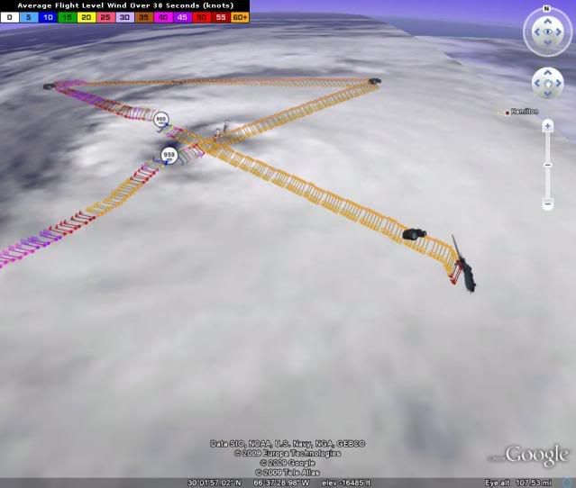
it finished an EWRC... and there is ANOTHER concentric band developing
http://www.nrlmry.navy.mil/tc-bin/tc_ho ... egreeticks
http://www.nrlmry.navy.mil/tc-bin/tc_ho ... egreeticks
0 likes

Re: Re:
Derek Ortt wrote:
thats because the graphics are INCORRECTLY connecting forecast points with a straight line. How many times does this have to be repeated? A very simple cubic spline of the NHC track has this coming into eastern Nova Scotia. I ran models last night and 4 of them showed a significant threat to Halifax (these same models showed the EWRC today). I'll see what tomorrow brings before making any final conclusions where this makes landfall. However, to say Halifax is not at risk of a direct landfall is beyond absurd! You must not quite grasp the concept of forecast uncertainty (and it is not just you... many people have trouble getting this concept and I don't believe the cone explains the real uncertainty)
I don't think this can be stated enough, Derek. Ike was a fine example. Galveston took a direct hit on a Saturday. The Tuesday before, I evacuated because of the info here and that very statement you just made. At that time, Tuesday, Ike was predicted to hit the TX/Mexico border. Call me silly, but I did not feel safe to quit watching Bill intensely until he cleared Florida. To tell anyone north of Bill's present location that they won't get hit is irresponsible, IMO.
0 likes
-
montrealboy
- Tropical Storm

- Posts: 172
- Joined: Mon Sep 15, 2003 6:39 pm
- Location: Montreal, Quebec, Canada
Re: ATL: HURRICANE BILL (Advisories)
http://www.weatheroffice.gc.ca/hurrican ... nts_e.html
Hurricane Information Statements
WOCN31 CWHX 220629 AAB
Hurricane Bill information statement issued by the Canadian
Hurricane centre of Environment Canada at 3.29 AM ADT Saturday
22 August 2009.
The next statement will be issued by 9.00 AM ADT
... Rainfall warnings to be issued for Nova Scotia and pei ...
.. Correct the initial position ..
1. Current position, strength, central pressure and motion
At 3.00 AM ADT... Hurricane Bill was located near latitude 32.2 N
And longitude 68.2 W... About 205 nautical miles or 330 km
West of Bermuda . Maximum sustained winds are
Estimated at 90 knots... 167 km/h... And central pressure at 959
MB. Bill is moving north at 18 knots... 33 km/h.
2. Forecast position, central pressure and strength
Date time lat lon MSLP Max wind
ADT MB kts kmh
Aug 22 3.00 AM 32.2N 68.2W 959 90 167
Aug 22 3.00 PM 35.4N 68.0W 960 95 176
Aug 23 3.00 AM 39.3N 66.8W 965 90 167
Aug 23 3.00 PM 43.2N 63.0W 970 75 139
Aug 24 3.00 AM 46.4N 55.0W 975 65 120 transitioning
Aug 24 3.00 PM 49.2N 45.0W 980 50 93 post-tropical
Aug 25 3.00 AM 51.8N 35.0W 990 45 83 post-tropical
Aug 25 3.00 PM 53.7N 25.0W 992 45 83 post-tropical
Aug 26 3.00 AM 56.2N 14.0W 995 40 74 post-tropical
3. Public weather impacts and warnings summary
Rainfall warnings will be issued with this mornings public forecast
for Nova Scotia and Eastern Prince Edward Island. All of the
available guidance are showing rainfall amounts of 100 mm or more
across most of Nova Scotia and over 50 mm for Eastern Prince Edward
Island and Extreme Northern Nova Scotia.
With our track adjustment a little further south.. Rainfall
Amounts should be lower across New Brunswick. However there will
Be interaction between the leading rainbands of Bill and a cold
Front approaching that province so rainfall totals could possibly
exceed 25 millimetres for some locales in New Brunswick.
The rain just moves into Newfoundland later in the day on Sunday
So rainfall amounts will not quite make warning criteria. The
rainfall warnings for Southern Newfoundland will be reassessed
This afternoon when day 2 night is included in the public forecast.
There will certainly be potential for 100 mm for southern protions
Of Newfoundland.
With our track adjustment a little to the south.. The area of
strongest winds associated with hurricane Bill will remain just
offshore of Eastern Nova Scotia and Cape Breton. Winds are
Forecast to gust to 80 km/h for the eastern coastline of nova
Scotia and Cape Breton and up to 70 km/h for the remainder of the
Nova Scotia coastline on Sunday. Inland wind gusts are forecast
To be near 60 km/h.
For the Newfoundland south coast the strongest winds will not
Arrive until after midnight Sunday. On its current track winds
potentially gusting to 110 km/h are possible for the Burin and
Avalon peninsulas overnight Sunday into early Monday. Winds in
The Wreckhouse area could possibly gust to 120 km/h Sunday
Evening.
Swell from hurricane Bill continues to spread northward and
Should reach the Nova Scotia coast later today. Swell heights are
forecast to reach 2 metres later today and this will generate
Rough surf and possible life-threatening rip currents along
Some of Nova Scotia beaches. As hurricane Bill moves by the
Nova Scotia coastline on Sunday breaking wave heights could
Possibly reach 5 metres putting coastal infrastructure and
Human life at risk.
Swell heights on the coast of Newfoundland will not start to
Build until Sunday and will possibly exceed 2 metres on the
South coast by midnight Sunday as Bill approaches. The larger
Waves will not arrive on the Newfoundland shores until overnight
Or early Monday.
Some of the highest spring tides of the year will occur this
Weekend in Atlantic Canada and these high tides combined with
The large waves and possible storm surge could cause some
Damage to coastal infrastructure. The exact timing of the high
Tides to the arrival of the hurricane will be crucial especially
For Southeastern Newfoundland and it is too early to pin those
numbers down.
Residents of and visitors to Nova Scotia are advised to exercise
extreme caution if venturing near the coastline today and Sunday
Due to the life threatening wave conditions. The same caution
Applies to residents of and visitors to Newfoundland on Sunday.
4. Marine weather impacts and warnings summary
Bill is expected to enter the waters of the Maritimes as a
Hurricane early Sunday morning. The core of hurricane force winds
Is expected to move along the western slope waters during the
Morning on Sunday then reach Sable Sunday afternoon. Bill will
continue to weaken as it moves into eastern waters and be a minimal
transitioning hurricane as it arrives on the Avalon Peninsula of
Newfoundland early Monday morning.
Hurricane force wind warnings and storm force wind warnings will
Be issued by the Atlantic storm prediction centre this morning
For most offshore waters of Nova Scotia for Sunday. Storm force
Wind warnings will be issued for the southern marine areas of
Newfoundland by the Newfoundland and Labrador weather office for
Sunday evening. Hurricane warnings are not required at this time.
Significant wave heights of up to 14 metres will move onto the
Scotian shelf on Sunday and waves of up to 10 metres will
Move onto the Southwestern Grand Banks on Monday. Waves of up to
8 metres will reach the Northern Grand Banks late on Monday.
For Atlantic coastal Nova Scotia strong surf and waves possibly
exceeding 5 to 7 m will impact certain areas. For coastal
Newfoundland waves also may exceed 6 to 8 m..Especially south
To southwest facing coastlines from the Burin Peninsula to cape
Race.
5. Technical discussion for meteorologists
A. Analysis
We continue to follow the national hurricane center lead on positions
and strength of hurricane Bill throughout the period.
Hurricane Bill is currently passing between the island of Bermuda
And buoy 41048. Bermuda has experienced sustained gale force winds
and gusts sometimes exceeding 50 knots for several hours during the
evening and overnight period. At 04Z buoy 41408 had peak winds of
50 knots and a significant wave height already up over 8 metres.
These two stations along with a quikscat pass were very useful in
determining the wind radii which we have high confidence in at the
moment.
The satellite presentation of Bill has become less impressive over
the past few hours. Microwave imagery shows both a weakening inner
eyewall and an outer eyewall. The opportunity for strenghtening
Still exists but that window is closing.
A hurricane hunter aircraft is enroute to the hurricane to give
A better determination on the current strength of Bill.
B. Prognostic
Bill has already began a mostly northerly turn and hence we have
followed the new lastest model guidance which shows a track
adjustment to the south and east. The track positions are about
30 to 60 miles further offshore of the Nova Scotia coast.
The 48 hour position in vicinity of the Avalon Peninsula is also
slightly further south.
We indicate some strengthening for the first 12 hours as Bill
continues to move over warm waters and in a relatively low shear
Environment.. However Bill needs to complete the eyewall
Replacement cycle in a relatively short period of time. Beyond
The initial 24 hours the sea surface temperatures begin to cool
Quite quickly and shear should begin to take its toll. Whether
Bill is still a hurricane when its reaches the Avalon Peninsula
Remains to be seen. Beyond that.. Bill should race ahead of the
Upper trough into the Atlantic with little extratropical
Development.
Cyclone phase space diagrams indicate Bill will begin to undergo
extratropical transition late on the 23rd and will be completed
On the 24th.
C. Public weather
As the storm begins transitioning on Sunday we should be seeing
The rain shield extending to the left and forward of track and
The wind field starting to expand away from the storm centre.
For Northern New Brunswick a predecessor rain band associated with
the hurricane will form Saturday and pulses of rain associated
With it may give rain amounts exceeding 25 mm.
Although the reggem rain field is displaced too far to the north and
west based on our storm positions its overall rainfall amount
guidance is quite good. Both the gfs and nam have small pockets
Of 5 inches or more of qpf. Rainfall amounts over coastal Nova Scotia
appear to be on the order of 100 mm for a significant portion and
local amounts of 150 mm are not unreasonable. Rainfall amounts
diminish proportionally inland.
Rainfall will not be an issue for the island of Newfoundland until
day 2 night and will be given further consideration with the 12Z
model runs.
D. Marine weather
As Bill winds down and undergoes extratropical transition in our
waters we maintain the gale force wind radii but shrink the
Storm force and hurricane force winds in the nw and sw quadrants
To show the switch to the right of track of the wind field.
Predicted wind radii (NM)
Time gales storms hurricane
Ne se sw nw ne se sw nw ne se sw nw
22/06Z 250 200 135 180 100 100 50 80 75 30 25 30
22/18Z 275 225 150 200 110 110 60 85 90 40 25 35
23/06Z 250 225 140 180 105 100 60 85 80 40 25 40
23/18Z 225 250 140 175 105 100 60 85 60 40 10 20
24/06Z 225 250 150 150 105 100 60 70 50 25 5 5
24/18Z 225 250 150 125 100 50 25 25 0 0 0 0
25/06Z 225 250 150 125 0 0 0 0 0 0 0 0
25/18Z 250 250 150 125 0 0 0 0 0 0 0 0
26/06Z 250 250 150 125 0 0 0 0 0 0 0 0
END/NICKERSON
0 likes


Bill still seems to be having a fairly hard time keeping itself together and cooler waters are ahead of it. Still I agree with Derek I think it'll keep the winds fairly high even if the structure does decline somewhat further.
Motion was 345 and its hard to tell with the rather ragged structure the direction its heading now but its still not quite at due north yet thats for sure.
Motion was 345 and its hard to tell with the rather ragged structure the direction its heading now but its still not quite at due north yet thats for sure.
0 likes
-
cycloneye

- Admin

- Posts: 149588
- Age: 69
- Joined: Thu Oct 10, 2002 10:54 am
- Location: San Juan, Puerto Rico
Re: ATL: HURRICANE BILL (Advisories)
263
WTNT33 KNHC 221132
TCPAT3
BULLETIN
HURRICANE BILL INTERMEDIATE ADVISORY NUMBER 28A
NWS TPC/NATIONAL HURRICANE CENTER MIAMI FL AL032009
800 AM AST SAT AUG 22 2009
...BILL MOVING NORTHWARD WITH LITTLE CHANGE IN STRENGTH...
A TROPICAL STORM WARNING REMAINS IN EFFECT FOR BERMUDA.
A TROPICAL STORM WARNING IS IN EFFECT FOR THE COAST OF MASSACHUSETTS
FROM WOODS HOLE TO SAGAMORE BEACH...INCLUDING THE ISLANDS OF
MARTHAS VINEYARD AND NANTUCKET. A TROPICAL STORM WARNING MEANS
THAT TROPICAL STORM CONDITIONS ARE EXPECTED SOMEWHERE WITHIN THE
WARNING AREA WITHIN 24 HOURS.
INTERESTS ELSEWHERE ALONG THE COAST OF NEW ENGLAND AND IN THE
CANADIAN MARITIMES SHOULD MONITOR THE PROGRESS OF BILL. ADDITIONAL
WATCHES OR WARNINGS MAY BE ISSUED LATER TODAY FOR OTHER PORTIONS OF
NOVA SCOTIA AND NEWFOUNDLAND.
FOR STORM INFORMATION SPECIFIC TO YOUR AREA IN THE UNITED STATES...
PLEASE MONITOR PRODUCTS ISSUED BY YOUR LOCAL NATIONAL WEATHER
SERVICE FORECAST OFFICE. FOR STORM INFORMATION SPECIFIC TO YOUR
AREA OUTSIDE OF THE UNITED STATES...PLEASE MONITOR PRODUCTS ISSUED
BY YOUR NATIONAL METEOROLOGICAL SERVICE.
AT 800 AM AST...1200 UTC...THE CENTER OF HURRICANE BILL WAS LOCATED
NEAR LATITUDE 34.0 NORTH...LONGITUDE 68.4 WEST OR ABOUT 235 MILES...
380 KM...WEST-NORTHWEST OF BERMUDA AND ABOUT 410 MILES...660 KM...
EAST OF CAPE HATTERAS NORTH CAROLINA. THIS POSITION IS ALSO ABOUT
510 MILES...820 KM...SOUTH OF NANTUCKET MASSACHUSETTS.
BILL IS MOVING TOWARD THE NORTH NEAR 22 MPH...35 KM/HR. A TURN
TOWARD THE NORTH-NORTHEAST AND AN INCREASE IN FORWARD SPEED IS
EXPECTED ON SUNDAY. ON THE FORECAST TRACK...THE CORE OF HURRICANE
BILL SHOULD PASS OFFSHORE THE COAST OF NEW ENGLAND LATE TODAY OR
TONIGHT AND APPROACH NOVA SCOTIA ON SUNDAY.
MAXIMUM SUSTAINED WINDS ARE NEAR 105 MPH...165 KM/HR...WITH HIGHER
GUSTS. BILL IS A CATEGORY TWO HURRICANE ON THE SAFFIR-SIMPSON
SCALE. SOME FLUCTUATIONS IN INTENSITY ARE POSSIBLE TODAY...FOLLOWED
BY WEAKENING TONIGHT AND SUNDAY AS THE CENTER OF BILL MOVES NORTH
OF THE GULF STREAM.
HURRICANE FORCE WINDS EXTEND OUTWARD UP TO 85 MILES...140 KM...FROM
THE CENTER...AND TROPICAL STORM FORCE WINDS EXTEND OUTWARD UP TO 275
MILES...445 KM. BERMUDA IS STILL REPORTING SUSTAINED WINDS OF
AROUND 40 MPH...64 KM/HR...AT THIS TIME.
THE ESTIMATED MINIMUM CENTRAL PRESSURE IS 960 MB...28.35 INCHES.
BILL IS EXPECTED TO PRODUCE TOTAL RAIN ACCUMULATIONS OF 1 TO
2 INCHES OVER BERMUDA.
THE BERMUDA WEATHER SERVICE HAS INDICATED THAT THE STORM TIDE WILL
RAISE WATER LEVELS BY AS MUCH AS 3 FEET ABOVE GROUND LEVEL ALONG
THE COAST...ALONG WITH LARGE AND DANGEROUS BATTERING WAVES.
LARGE SWELLS GENERATED BY HURRICANE BILL ARE AFFECTING THE BAHAMAS
AND BERMUDA...AND BEGINNING TO AFFECT THE SOUTHEAST COAST OF THE
UNITED STATES. LARGE SWELLS WILL BEGIN TO AFFECT MUCH OF THE
REMAINDER OF THE U.S. EAST COAST AND THE ATLANTIC MARITIMES OF
CANADA LATER TODAY AND SUNDAY. THESE SWELLS WILL LIKELY CAUSE
EXTREMELY DANGEROUS SURF AND LIFE-THREATENING RIP CURRENTS.
...SUMMARY OF 800 AM AST INFORMATION...
LOCATION...34.0N 68.4W
MAXIMUM SUSTAINED WINDS...105 MPH
PRESENT MOVEMENT...NORTH OR 360 DEGREES AT 22 MPH
MINIMUM CENTRAL PRESSURE...960 MB
THE NEXT ADVISORY WILL BE ISSUED BY THE NATIONAL HURRICANE CENTER AT
1100 AM AST.
$$
FORECASTER AVILA
0 likes
-
Derek Ortt
-
tolakram
- Admin
- Posts: 20186
- Age: 62
- Joined: Sun Aug 27, 2006 8:23 pm
- Location: Florence, KY (name is Mark)
Re: ATL: HURRICANE BILL (03L)
Water Vapor loop. Everything starting to back up waiting for Bill.
http://www.ssd.noaa.gov/goes/east/nwatl/flash-wv.html
http://www.ssd.noaa.gov/goes/east/nwatl/flash-wv.html
0 likes
Re: ATL: HURRICANE BILL (03L)
From the 11pm Friday advisory until the 5am Saturday advisory, there has been a large jump in the probability of ts conditions as determined by the NHC. Halifax now has an 80% chance (up from 58% chance at 11pm fri advisory), Eastport has a 31% chance, and Nantucket went from a 20% chance to a 40% chance in just one advisory!
Wind speed probabilities as of 5am advisory today.....probability of 34kt (39mph), 50kt, and 64 kt winds by location (change from prior advisory at 11pm friday in parentheses):
Halifax, NS
34kt = 80% (+22)
50kt = 46% (+21)
64kt = 18% (+10)
Eastport, ME
34kt = 31% (+13)
50kt = 4% (+1)
64kt = 0% (+0)
Nantucket, MA
34kt = 40% (+20)
50kt = 5% (+2)
64kt = 0% (+0)
0 likes
-
Derek Ortt
Re: ATL: HURRICANE BILL (03L)
One more shift like the one between the current and prior update, and ts warnings may need to be pushed west over more of new england...
current:

prior:

current:
prior:
0 likes
-
Derek Ortt
TS warning/Hurricane Watch soon for Nova Scotia. They need a Hurricane WARNING, however
WOCN31 CWHX 221200
Hurricane Bill information statement issued by the canadian
Hurricane centre of Environment Canada at 9.00 AM ADT Saturday
22 August 2009.
The next statement will be issued by 3.00 PM ADT
...On Sunday Bill will Nova Scotia and portions of pei...
1. Current position, strength, central pressure and motion
At 9.00 AM ADT... Hurricane Bill was located near latitude 33.9 N
And longitude 68.6 W... About 215 nautical miles or 400 km
West northwest of Bermuda . Maximum sustained winds are
Estimated at 90 knots... 167 km/h... And central pressure at 960
MB. Bill is moving north at 21 knots... 39 km/h.
2. Forecast position, central pressure and strength
Date time lat lon MSLP Max wind
ADT MB kts kmh
Aug 22 9.00 AM 33.9N 68.6W 960 90 167
Aug 22 9.00 PM 38.0N 68.0W 963 95 176
Aug 23 9.00 AM 42.1N 65.3W 968 85 157
Aug 23 9.00 PM 46.1N 59.5W 973 70 130 transitioning
Aug 24 9.00 AM 48.7N 50.0W 978 60 111 post-tropical
Aug 24 9.00 PM 50.3N 37.5W 988 45 83 post-tropical
Aug 25 9.00 AM 51.7N 27.5W 998 35 65 post-tropical
Aug 25 9.00 PM 53.3N 18.0W 999 30 56 post-tropical
3. Public weather impacts and warnings summary
Tropical storm warnings will be issued shortly for portions
Of Southwestern Nova Scotia. Hurricane watches will be issued
For portion of Northeastern Nova Scotia. Tropical storm watches
Will be issued for the remainder of Nova Scotia and eastern
Prince Edward Island and Southwestern Newfoundland.
Rainfall warnings are in effect for all of Nova Scotia and
Eastern Prince Edward Island for Sunday as the rainbands from
Bill make their way onshore and inland. Rainfall guidance shows
A wide swath of rainfall amounts in the 75 to 100 mm range for
coastal Nova Scotia with local areas nearing 150 mm. Rainfall
Amounts decrease away from the coast.
On our current track.. Rainfall amounts should be lower across New
Brunswick.The outermost rainbands of Bill are forecast to reach
Southeastern New Brunswick on Sunday and rainfall amounts could be
high but just below warning criteria. There will be
An interaction between the leading rainbands of Bill and a cold
Front approaching from the north so rainfall totals could possibly
exceed 25 millimetres for some localities in New Brunswick.
Any future northward movement of the forecast track of Bill will
require adjustments to the spatial coverage of the rainfall warnings.
Bill will affect Newfoundland Sunday night giving rain at times
Heavy and strong winds to most regions. The potential
For 100 mm of rain exists for portions of Newfoundland.
The strongest winds will reach the south coast after midnight
potentially gusting to 110 km/h on the Burin and
Avalon peninsulas overnight Sunday into early Monday. Winds in
The Wreckhouse area could possibly gust to 120 km/h Sunday
Evening.
Based on the current forecast track and intensity..
Tropical storm force winds of 65 km/h with gusts to 90 will
Affect most of Nova Scotia and portions of pei and tropical
Storm watch and warnings will be issued later today.
Later on Sunday hurricane force winds of 120 km/h with gusts to 140
are expected to affect the eastern shore and Southern Cape Breton
And hurricane watches will be issued for those regions later today.
Swell waves will continue to grow and move rapidly to the
Coast of Nova Scotia today and tonight. This will generate
Rough surf and possible life-threatening rip currents along
Some of Nova Scotia beaches. As hurricane Bill moves by the
Nova Scotia coastline on Sunday breaking wave heights could
Possibly reach 5 metres putting coastal infrastructure and
Human life at risk.
Swell heights on the coast of Newfoundland will not start to
Build until Sunday and will possibly exceed 2 metres on the
South coast by midnight Sunday as Bill approaches. The larger
Waves will arrive on the Newfoundland shores late Sunday night
Or early Monday.
Some of the highest spring tides of the year will occur this
Weekend in Atlantic Canada and these high tides combined with
The large waves and possible storm surge could cause some
Damage to coastal infrastructure. The exact timing of the high
Tides to the arrival of the hurricane will be crucial especially
For Southeastern Newfoundland and it is too early to pin those
numbers down.
Residents of and visitors to Nova Scotia are advised to exercise
extreme caution if venturing near the coastline today and Sunday
Due to the life threatening wave conditions. The same caution
Applies to residents of and visitors to Newfoundland on Sunday.
4. Marine weather impacts and warnings summary
Early today hurricane force to gale force wind warnings will be
issued for the southern maritime waters. Appropriate warnings
Will be issued for the Newfoundland waters as well. Storm force
Wind warnings will be issued for the southern marine areas of
Newfoundland by the Newfoundland and Labrador weather office for
Sunday evening.
Bill is expected to enter the waters of the Maritimes as a
Hurricane early Sunday morning. The core of hurricane force winds
Is expected to move along the western slope waters Sunday
Morning passing just south of Cape Breton Sunday evening. Bill will
pass over Southeastern Newfoundland Sunday night then move
Away from the Avalon Peninsula on Monday.
Significant wave heights of up to 14 metres will move onto the
Scotian shelf on Sunday and waves of up to 10 metres will
Move onto the Southwestern Grand Banks on Monday. Waves of up to
8 metres will reach the Northern Grand Banks late on Monday.
For Atlantic coastal Nova Scotia strong surf and waves possibly
exceeding 5 to 7 metres will impact certain areas. For coastal
Newfoundland waves also may exceed 6 to 8 metres especially south
To southwest facing coastlines from the Burin Peninsula to cape
Race.
5. Technical discussion for meteorologists
A. Analysis
We continue to follow the national hurricane center lead on positions
and strength of hurricane Bill throughout the period.
Hurricane Bill passed west of Bermuda today. A weather
Station on the island reported a wind gust to 156 km/h. Bill also
passed east of buoy 41048 during the night. Peak winds at the buoy
were 54 knots and the maximum significant wave height reported
Was 8.3 metres. These two observations along with a convenient
quikscat pass were very useful in determining the wind radii tables.
We have high confidence in the table at the moment.
The satellite presentation of Bill shows an outer eyewall trying to
contract toward the centre of the storm. The opportunity for
strenghtening still exists but that window is closing.
A hurricane hunter aircraft reported maximum flight wind of 121
Knots in the ne quadrant and 103 knots in the southeastern quadrant.
They also reported that the inner eyewall has dissipated.
B. Prognostic
The just west of a due north track of Bill has continued for the
Last 6 hours. This keeps the confidence in the further offshore
Track forecast reasonable high. The model tracks remain tightly
clustered off the coast of Nova Scotia and across the southern
portions of Newfoundland.
We maintain the current intensity of Bill for the first 12 to 18
hours as Bill continues to move over warm waters in a low shear
environment. Beyond thenext 18 hours the sea surface temperatures
begin to cool quite quickly and shear should begin to take its toll.
Whether Bill is still a hurricane when its reaches the Avalon
Peninsula remains to be seen. Beyond that.. Bill should race ahead
Of the upper trough into the Atlantic with little extratropical
development.
Cyclone phase space diagrams indicate Bill will begin to undergo
extratropical transition late on the 23rd and will be completed
On the 24th.
C. Public weather
As the storm begins transitioning on Sunday we should be seeing
The rain shield extending to the left and forward of track and
The wind field starting to expand away from the storm centre.
For New Brunswick a predecessor rain band associated with
The hurricane will form today and pulses of rain associated
With it may give rain amounts exceeding 25 mm.
Although the reg Gem rain field is displaced too far to the north and
west based on our storm positions its overall rainfall amount
guidance is quite good. Both the gfs and nam have small pockets
Of 5 inches or more of qpf. Rainfall amounts over coastal Nova Scotia
appear to be on the order of 100 mm for a significant portion and
local amounts of 150 mm are not unreasonable. Rainfall amounts
diminish proportionally inland.
Rainfall will not be an issue for the island of Newfoundland until
day 2 night and will be given further consideration with the 12Z
model runs.
D. Marine weather
As Bill undergoes extratropical transition and weakens in our
Waters we maintain the gale force wind radii but shrink the
Storm force and hurricane force winds in the nw and sw quadrants
To show the switch to the right of track of the wind field.
Predicted wind radii (NM)
Time gales storms hurricane
Ne se sw nw ne se sw nw ne se sw nw
22/12Z 275 210 140 190 105 105 55 80 90 40 25 30
23/00Z 260 225 145 190 105 105 60 85 85 40 25 30
23/12Z 235 235 140 160 100 105 75 75 70 50 30 40
24/00Z 210 240 180 160 90 115 75 60 45 60 45 30
24/12Z 210 240 180 160 100 75 40 45 0 0 0 0
25/00Z 210 250 180 160 0 0 0 0 0 0 0 0
25/12Z 210 250 180 160 0 0 0 0 0 0 0 0
26/00Z 0 0 0 0 0 0 0 0 0 0 0 0
End nickerson/roussel
0 likes
-
wxman57

- Moderator-Pro Met

- Posts: 23175
- Age: 68
- Joined: Sat Jun 21, 2003 8:06 pm
- Location: Houston, TX (southwest)
Re: Re:
The cone represents the 67% 5-year track error. It's a series of circles at 12, 24, 36, 48, 72, 96 and 120 hours. The circles are connected by tangent lines to form the cone. The center of the storm will track within this cone 67% of the time, but that in no way means that the cone will contain the effects of the storm. Ike's hurricane winds at landfall were bigger than the cone as projected on the coast 36 hours from landfall.
That said, at no time was Ike forecast to hit the Texas/Mexico border. There were a few forecasts on Monday of a landfall near Corpus Christi, but Houston remained inside the cone from 10AM CDT Sunday, Sept. 7th up until landfall, as seen here:
http://www.nhc.noaa.gov/archive/2008/gr ... p_5W.shtml
Good thing you evacuated early. Even if Ike had hit down by Matagorda Bay, Galveston would have gone underwater and the surge in Galveston Bay would have been just as high as it was, if not higher. Never feel comfortable with a track moving inland south of you.
Here's Ike's cone 36 hours from landfall with it's landfall wind radii and surge overlaid:

That said, at no time was Ike forecast to hit the Texas/Mexico border. There were a few forecasts on Monday of a landfall near Corpus Christi, but Houston remained inside the cone from 10AM CDT Sunday, Sept. 7th up until landfall, as seen here:
http://www.nhc.noaa.gov/archive/2008/gr ... p_5W.shtml
Good thing you evacuated early. Even if Ike had hit down by Matagorda Bay, Galveston would have gone underwater and the surge in Galveston Bay would have been just as high as it was, if not higher. Never feel comfortable with a track moving inland south of you.
mpic wrote:Derek Ortt wrote:
thats because the graphics are INCORRECTLY connecting forecast points with a straight line. How many times does this have to be repeated? A very simple cubic spline of the NHC track has this coming into eastern Nova Scotia. I ran models last night and 4 of them showed a significant threat to Halifax (these same models showed the EWRC today). I'll see what tomorrow brings before making any final conclusions where this makes landfall. However, to say Halifax is not at risk of a direct landfall is beyond absurd! You must not quite grasp the concept of forecast uncertainty (and it is not just you... many people have trouble getting this concept and I don't believe the cone explains the real uncertainty)
I don't think this can be stated enough, Derek. Ike was a fine example. Galveston took a direct hit on a Saturday. The Tuesday before, I evacuated because of the info here and that very statement you just made. At that time, Tuesday, Ike was predicted to hit the TX/Mexico border. Call me silly, but I did not feel safe to quit watching Bill intensely until he cleared Florida. To tell anyone north of Bill's present location that they won't get hit is irresponsible, IMO.
Here's Ike's cone 36 hours from landfall with it's landfall wind radii and surge overlaid:
Last edited by wxman57 on Sat Aug 22, 2009 9:01 am, edited 1 time in total.
0 likes
-
Stephanie

- S2K Supporter
- Posts: 23843
- Age: 63
- Joined: Thu Feb 06, 2003 9:53 am
- Location: Glassboro, NJ
Re: ATL: HURRICANE BILL (03L)
Bill looks like he's still going due north in the loops I just looked at. That front is stalled right over us and we're getting thunderstorm after thunderstorm. In the middle of the night we had a real light show and was raked with storms.
The radar is showing all of the rain moving south up through MD and not from the west from PA when a front is usually moving through.
The radar is showing all of the rain moving south up through MD and not from the west from PA when a front is usually moving through.
0 likes
Re: ATL: HURRICANE BILL (03L)
There were a few forecasts on Monday of a landfall near Corpus Christi, but Houston remained inside the cone from 10AM CDT Sunday, Sept. 7th up until landfall, as seen here:
That's what I was "remembering, Wxman...my 60 year old brain is a bit rusty at times. Thank you for the correction. The point being, though, that a great number of people (laymen) around here pretty quit watching because the line wasn't pointed here.
Give me a minute to find the one I was talking about...may have the wrong day.
0 likes
Who is online
Users browsing this forum: No registered users and 46 guests