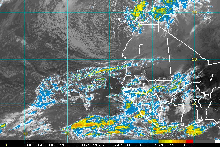
Strong tropical wave ssw of Cape Verde islands

This is the general tropical discussion area. Anyone can take their shot at predicting a storms path.

Moderator: S2k Moderators

Forum rules

The posts in this forum are NOT official forecasts and should not be used as such. They are just the opinion of the poster and may or may not be backed by sound meteorological data. They are NOT endorsed by any professional institution or STORM2K. For official information, please refer to products from the National Hurricane Center and National Weather Service.

Help Support Storm2K
Message
Author
User avatar
cycloneye
Admin
Admin
Posts: 145603
Age: 68
Joined: Thu Oct 10, 2002 10:54 am
Location: San Juan, Puerto Rico

Strong tropical wave ssw of Cape Verde islands

#1 Postby cycloneye » Sat Aug 22, 2009 11:34 am

The position right now inside Africa (In Central Africa) coincides with the timing that GFS starts to develop it in a strong way per 12z run.Lets see what happens late next week and see if other models coincide with GFS. Remember that GFS did fantastic in terms of announcing the development of Bill many days in advance.

Below image updates every 15 minutes and if you click at symbol,a good closeup will be seen.

Image

Image
0 likes   

User avatar
gatorcane
S2K Supporter
S2K Supporter
Posts: 23692
Age: 47
Joined: Sun Mar 13, 2005 3:54 pm
Location: Boca Raton, FL

#2 Postby gatorcane » Sat Aug 22, 2009 11:37 am

ah you beat me to it luis :) Looks like a good possibility for development. The 12Z develops this wave starting around 3-4 days from now and by this time next weekend, we could have a named (Danny?) system again in the MDR, another Cape Verde system heading west. Looks like it starts to show signs of moving more WNW, perhaps starting a recurve around day 8, however its far out and things will change on where it goes and how much it develops.

Image

and here is the H5 steering pattern, showing the Bermuda-Azores High in the Central Atlantic...its not too strong but stronger than previous runs I have seen of GFS. We'll watch future models runs to see how it handles this feature which would impact the future path this system would take.

Image
0 likes   

Sanibel
Category 5
Category 5
Posts: 10375
Joined: Mon Aug 30, 2004 11:06 pm
Location: Offshore SW Florida

Re: Strong Wave inside Africa (GFS develops)

#3 Postby Sanibel » Sat Aug 22, 2009 11:44 am

GFS tends to be accurate with Africa waves in this season's conditions.


Definitely a recurver from that synoptic.
0 likes   

User avatar
KWT
Category 5
Category 5
Posts: 31415
Joined: Tue Aug 17, 2004 11:02 am
Location: UK!!!

#4 Postby KWT » Sat Aug 22, 2009 11:45 am

Its certainly been a feature of previous runs as well though like this run most start to take it NW by 40W...still I have my doubts given the sort of weakness required for that sharp of a turn!

Still need to see other models other then the GFS come onboard, thus far its totally on its own.
0 likes   

User avatar
cycloneye
Admin
Admin
Posts: 145603
Age: 68
Joined: Thu Oct 10, 2002 10:54 am
Location: San Juan, Puerto Rico

Re: Strong Wave inside Africa (GFS develops)

#5 Postby cycloneye » Sat Aug 22, 2009 11:51 am

jimfti you posted this at the other wave thread but the timing coincides with the wave inside Africa.

Image
0 likes   

User avatar
cycloneye
Admin
Admin
Posts: 145603
Age: 68
Joined: Thu Oct 10, 2002 10:54 am
Location: San Juan, Puerto Rico

Re: Strong Wave inside Africa (GFS develops)

#6 Postby cycloneye » Sat Aug 22, 2009 11:53 am

It has a hurricane but well east of Bermuda as it recurves.More models please. :)

http://www.nco.ncep.noaa.gov/pmb/nwprod ... loop.shtml

Image
0 likes   

User avatar
KWT
Category 5
Category 5
Posts: 31415
Joined: Tue Aug 17, 2004 11:02 am
Location: UK!!!

#7 Postby KWT » Sat Aug 22, 2009 11:54 am

I wonder how the 12z compares, I'm pretty confident the 12z is further north, esp by 40W...pattern looks set for recurvers from Cape Verde systems for the rest of the season IMO looking at the overall set-up
0 likes   

User avatar
cycloneye
Admin
Admin
Posts: 145603
Age: 68
Joined: Thu Oct 10, 2002 10:54 am
Location: San Juan, Puerto Rico

Re: Strong Wave inside Africa (GFS develops)

#8 Postby cycloneye » Sat Aug 22, 2009 11:59 am

Agree that CV systems will the synoptic pattern setting up favors recurving.Systems have to form west of 50W and at low latitud to then not recurve.
0 likes   

jinftl
Category 5
Category 5
Posts: 4312
Joined: Tue Aug 31, 2004 4:47 pm
Location: fort lauderdale, fl

Re: Strong Wave inside Africa (GFS develops)

#9 Postby jinftl » Sat Aug 22, 2009 12:31 pm

Perhaps, but as we see with Bill, recurve at 40W vs. 65W may not mean avoiding all landmasses in the end (i.e., Bermuda, New England, Canada).

I will be curious to see future model runs...if we do in fact have a system taking shape around 10N or 11N....that is a very different scenario perhaps, in terms of being coaxed wnw then nw and finally n and ne....than a system taking shape off of africa at 14N or 15N. Just the 'geometry' alone of a wnw to nw curve at 10N40W doesn't necessarily mean all storms will steer clear of landmasses like the Islands or even U.S....it all comes down to angles and timing.

cycloneye wrote:Agree that CV systems will the synoptic pattern setting up favors recurving.Systems have to form west of 50W and at low latitud to then not recurve.
0 likes   

User avatar
KWT
Category 5
Category 5
Posts: 31415
Joined: Tue Aug 17, 2004 11:02 am
Location: UK!!!

#10 Postby KWT » Sat Aug 22, 2009 12:33 pm

True to some extent but the upper troughs seem to be digging down quite well this summer and the upper highs don't seem to be all the strong either, of course something could get through and thats something to always watch IMO just in case!
0 likes   

jinftl
Category 5
Category 5
Posts: 4312
Joined: Tue Aug 31, 2004 4:47 pm
Location: fort lauderdale, fl

Re:

#11 Postby jinftl » Sat Aug 22, 2009 12:37 pm

Of course a system that formed in the western carribean could use such a pattern against us here in florida....i.e. a wlma type track later in the season.....troughs can be friends or enemies depending on where system are in relation to them!

KWT wrote:True to some extent but the upper troughs seem to be digging down quite well this summer and the upper highs don't seem to be all the strong either, of course something could get through and thats something to always watch IMO just in case!
0 likes   

User avatar
gatorcane
S2K Supporter
S2K Supporter
Posts: 23692
Age: 47
Joined: Sun Mar 13, 2005 3:54 pm
Location: Boca Raton, FL

Re:

#12 Postby gatorcane » Sat Aug 22, 2009 1:39 pm

KWT wrote:I wonder how the 12z compares, I'm pretty confident the 12z is further north, esp by 40W...pattern looks set for recurvers from Cape Verde systems for the rest of the season IMO looking at the overall set-up


Perhaps but Cape Verde season usually lasts through about Sept. 20th or so. That is 4 weeks still and the long-wave patterns can change in that time. Also, we know the long-range GFS has not done well with troughs and ridges especially after 7 days out. It's definitely not written in stone that if this is Danny it recurves like the 12Z is showing. As Luis stated, lets see some more models (hint: ECMWF), also to see if they agree on development or not.
0 likes   

User avatar
KWT
Category 5
Category 5
Posts: 31415
Joined: Tue Aug 17, 2004 11:02 am
Location: UK!!!

#13 Postby KWT » Sat Aug 22, 2009 1:47 pm

Very true I do agree Gatorcane but if you've got troughs digging down far enough to lift out a system like Danny, then they are only going to get stronger and dig further south over the enxt few weeks as the Arctic starts to cool.

Still it only takes one to sneak under the radar and something becomes a problem!
0 likes   

User avatar
cycloneye
Admin
Admin
Posts: 145603
Age: 68
Joined: Thu Oct 10, 2002 10:54 am
Location: San Juan, Puerto Rico

Re: Strong Wave inside Africa (GFS develops into a Hurricane)

#14 Postby cycloneye » Sat Aug 22, 2009 2:07 pm

12z ECMWF shows hints of something in MDR but nothing more.

http://www.ecmwf.int/products/forecasts ... 12!!!step/

So GFS is basiclly alone on the 12z package.
0 likes   

User avatar
CourierPR
Category 5
Category 5
Posts: 1335
Age: 71
Joined: Tue Aug 31, 2004 7:53 pm
Location: Pompano Beach, Florida

Re: Strong Wave inside Africa (GFS develops into a Hurricane)

#15 Postby CourierPR » Sat Aug 22, 2009 2:19 pm

With the lingering synoptic setup, it would seem that we should look closer in for more homegrown systems. This year's CV season may be short lived.
0 likes   

Scorpion

#16 Postby Scorpion » Sat Aug 22, 2009 2:23 pm

Well, if it shows it recurving now then it's probably wrong. GFS had Bill going straight across for days before it formed.
0 likes   

User avatar
cycloneye
Admin
Admin
Posts: 145603
Age: 68
Joined: Thu Oct 10, 2002 10:54 am
Location: San Juan, Puerto Rico

Re: Strong wave inside Africa

#17 Postby cycloneye » Sat Aug 22, 2009 6:06 pm

The 18z GFS run has almost nothing compared with the 12z run that had a hurricane. I would discount this 18z run as it has less data so lets see what the 00z run has.

12z GFS

Image

18z GFS

Image
0 likes   

jinftl
Category 5
Category 5
Posts: 4312
Joined: Tue Aug 31, 2004 4:47 pm
Location: fort lauderdale, fl

Re: Strong wave inside Africa

#18 Postby jinftl » Sat Aug 22, 2009 6:21 pm

If this is the system, it certainly doesn't appear to want to recurve...this is the 2nd run today that shows a system forming late in the week and wanting to hug the area around 10N as it moves west.
(double post....not sure if this thread is in fact the same discussion as the other cape verde wave thread)

Image
0 likes   

User avatar
KWT
Category 5
Category 5
Posts: 31415
Joined: Tue Aug 17, 2004 11:02 am
Location: UK!!!

#19 Postby KWT » Sat Aug 22, 2009 6:21 pm

Well the 06z didn't show much but the 0z run did, so who knows cycloneye!

However until I see one other model suggest anything at all I'm not all that interested just yet, got something that will probablytry and form closer to your part of the world if the models are right.
0 likes   

User avatar
cycloneye
Admin
Admin
Posts: 145603
Age: 68
Joined: Thu Oct 10, 2002 10:54 am
Location: San Juan, Puerto Rico

Re: Strong wave inside Africa

#20 Postby cycloneye » Sat Aug 22, 2009 7:36 pm

Leaving the models aside,the wave that I am following is at this hour (8:35 EDT) located at the Greenwich line or 0. It has a MLC attached with it.Lets see when it emerges the coast in a couple of days how it does.

Image

Below image updates every 15 minutes.Click symbol to see closeup.

Image
0 likes   


Return to “Talkin' Tropics”

Who is online

Users browsing this forum: Brent, duilaslol and 102 guests