ATL: TROPICAL DEPRESSION DANNY (05L)

Moderator: S2k Moderators

Message
Author
User avatar
cycloneye
Admin
Admin
Posts: 145300
Age: 68
Joined: Thu Oct 10, 2002 10:54 am
Location: San Juan, Puerto Rico

Re: ATL: Invest 92L - Computer Models

#301 Postby cycloneye » Tue Aug 25, 2009 8:05 am

WHXX01 KWBC 251302
CHGHUR
TROPICAL CYCLONE GUIDANCE MESSAGE
NWS TPC/NATIONAL HURRICANE CENTER MIAMI FL
1302 UTC TUE AUG 25 2009

DISCLAIMER...NUMERICAL MODELS ARE SUBJECT TO LARGE ERRORS.
PLEASE REFER TO NHC OFFICIAL FORECASTS FOR TROPICAL CYCLONE
AND SUBTROPICAL CYCLONE INFORMATION.

ATLANTIC OBJECTIVE AIDS FOR

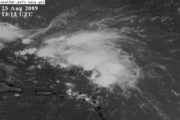
DISTURBANCE INVEST (AL922009) 20090825 1200 UTC

...00 HRS... ...12 HRS... ...24 HRS. .. ...36 HRS...
090825 1200 090826 0000 090826 1200 090827 0000

LAT LON LAT LON LAT LON LAT LON
BAMS 21.6N 63.0W 24.0N 66.5W 26.3N 69.5W 28.2N 71.6W
BAMD 21.6N 63.0W 23.8N 65.1W 25.7N 67.1W 27.4N 68.9W
BAMM 21.6N 63.0W 23.5N 65.7W 25.2N 68.0W 26.8N 69.9W
LBAR 21.6N 63.0W 23.9N 65.3W 25.9N 67.2W 27.4N 68.3W
SHIP 25KTS 32KTS 40KTS 49KTS
DSHP 25KTS 32KTS 40KTS 49KTS

...48 HRS... ...72 HRS... ...96 HRS. .. ..120 HRS...
090827 1200 090828 1200 090829 1200 090830 1200

LAT LON LAT LON LAT LON LAT LON
BAMS 29.8N 72.8W 31.7N 72.7W 33.0N 70.6W 35.9N 66.5W
BAMD 29.0N 69.9W 32.1N 69.6W 35.7N 67.2W 41.6N 63.1W
BAMM 28.2N 71.1W 30.5N 71.3W 33.0N 69.7W 37.1N 66.3W
LBAR 28.8N 68.8W 31.3N 67.7W 33.6N 66.9W 36.2N 66.6W
SHIP 56KTS 71KTS 77KTS 76KTS
DSHP 56KTS 71KTS 77KTS 76KTS

...INITIAL CONDITIONS...
LATCUR = 21.6N LONCUR = 63.0W DIRCUR = 305DEG SPDCUR = 20KT
LATM12 = 18.4N LONM12 = 59.9W DIRM12 = 313DEG SPDM12 = 22KT
LATM24 = 16.5N LONM24 = 56.0W
WNDCUR = 25KT RMAXWD = 50NM WNDM12 = 20KT
CENPRS = 1010MB OUTPRS = 1012MB OUTRAD = 120NM SDEPTH = M
RD34NE = 0NM RD34SE = 0NM RD34SW = 0NM RD34NW = 0NM

Image
0 likes   

User avatar
bvigal
S2K Supporter
S2K Supporter
Posts: 2276
Joined: Sun Jul 24, 2005 8:49 am
Location: British Virgin Islands
Contact:

Re: ATL: Invest 92L

#302 Postby bvigal » Tue Aug 25, 2009 8:08 am

I agree it's north of Puerto Rico . Our winds have been from the south for several hours, as I've been running radar loop since 5:30, watching showers move due north over Virgin Gorda/Anegada.
6am airports showed St. Thomas with lowest barometer of anywhere in EC except Trinidad, 1011.5mb wind S 6kt, although as of 8am, no reports since last night from either St. Croix or Beef Island; Salt River Bay St. Croix buoy (away from land influences, unlike many other observing stations) reported 5am wind S 8kt pressure 29.84in or 1010.5mb. Downtown Charlotte Amalie buoy readings are misleading, protected by harbour and big mountain, rarely show true winds, and to some extent also true for the airport re: direction when winds are light. Almost no ship reports today between 06z until 12z, only one in the area: SHIP 22.30 -60.30 70deg 22.9kt seas 8.2ft, and ship wind readings are highest measured. Airports are 2-min average. (for wind speeds, like comparing apples and oranges) Comparing all the readings on a day to day basis for years, I'd say today was definitely thin on data, but from the little there is, I believe the low is north or northwest of us.
0 likes   

otowntiger
Category 5
Category 5
Posts: 1921
Joined: Tue Aug 31, 2004 7:06 pm

Re:

#303 Postby otowntiger » Tue Aug 25, 2009 8:10 am

Derek Ortt wrote:Will say something else

the chances of a landfall may be just a little lower than this time yesterday. This looks to have move every so slightly slower than forecast. Yes, EC/CMC still indicate landfall. However, we need to watch for a center to form closer to the GFS (it sure is not there now, the greatest turning is not far from Puerto Rico). If we get formation or reformation to the north, this thing i likely a goner


I agree Derek. This system looked to me from the beginning to be destined to go north and soon. That is how this season is shaping up. A good pattern for Florida anyway, and perhaps the rest of the East Coast if it holds.
0 likes   

User avatar
vbhoutex
Storm2k Executive
Storm2k Executive
Posts: 29112
Age: 73
Joined: Wed Oct 09, 2002 11:31 pm
Location: Cypress, TX
Contact:

Re: ATL: Invest 92L

#304 Postby vbhoutex » Tue Aug 25, 2009 8:10 am

ronjon wrote:I see a broad center of CC turning north of PR near 21N-65.5W. If low pressure develops here, it is much closer to the Euro/CMC position than GFS. The 06Z GFS develops its low at 21N-61W under the heavy convection.

http://www.ssd.noaa.gov/goes/flt/t1/sloop-vis.html

It does appear that there could be some low level turning in that area or a little East of it. (21.0N-64.5W) Of course as wsman says surface obs do make it real in the final analysis.
0 likes   

User avatar
ronjon
Category 5
Category 5
Posts: 4822
Joined: Fri Aug 19, 2005 5:17 pm
Location: Hernando Beach, FL

Re: ATL: Invest 92L

#305 Postby ronjon » Tue Aug 25, 2009 8:13 am

vbhoutex wrote:
ronjon wrote:I see a broad center of CC turning north of PR near 21N-65.5W. If low pressure develops here, it is much closer to the Euro/CMC position than GFS. The 06Z GFS develops its low at 21N-61W under the heavy convection.

http://www.ssd.noaa.gov/goes/flt/t1/sloop-vis.html

It does appear that there could be some low level turning in that area or a little East of it. (21.0N-64.5W) Of course as wsman says surface obs do make it real in the final analysis.


Yeah VB, it looks broad an elongated kinda west-east. Hard to place an exact center until it tightens up and some convection builds near it.
0 likes   

otowntiger
Category 5
Category 5
Posts: 1921
Joined: Tue Aug 31, 2004 7:06 pm

Re: ATL: Invest 92L - Computer Models

#306 Postby otowntiger » Tue Aug 25, 2009 8:16 am

Steve H. wrote:Truely looks to be the year of the Trough. Good news for us, unless the Caribbean is cooking next month. But we in Florida should still watch it no doubt. :flag:
Yep. I think so far the synoptic pattern really favors us here in Florida.
0 likes   

User avatar
HURAKAN
Professional-Met
Professional-Met
Posts: 46086
Age: 38
Joined: Thu May 20, 2004 4:34 pm
Location: Key West, FL
Contact:

#307 Postby HURAKAN » Tue Aug 25, 2009 8:46 am

Image

30 minutes ago
0 likes   

User avatar
HURAKAN
Professional-Met
Professional-Met
Posts: 46086
Age: 38
Joined: Thu May 20, 2004 4:34 pm
Location: Key West, FL
Contact:

Re: ATL: Invest 92L - Computer Models

#308 Postby HURAKAN » Tue Aug 25, 2009 8:50 am

Code: Select all

                    *   ATLANTIC SHIPS INTENSITY FORECAST       *
                    *      GOES DATA AVAILABLE                  *
                    *      OHC  DATA AVAILABLE                  *
                    *  INVEST      AL922009  08/25/09  12 UTC   *

TIME (HR)          0     6    12    18    24    36    48    60    72    84    96   108   120
SHEAR (KT)        25    17    14    11     5     5    11     8    10     7    15    16    20
SHEAR DIR        239   229   229   247   340   358   329   289   255   235   219   211   218
SST (C)         28.5  28.6  28.7  28.8  28.9  29.0  28.9  28.9  28.8  28.6  28.3  28.0  27.8


Shear relatively favorable in the middle of the forecast period
0 likes   

User avatar
Bocadude85
Category 5
Category 5
Posts: 2991
Age: 38
Joined: Mon Apr 18, 2005 2:20 pm
Location: Honolulu,Hi

Re: ATL: Invest 92L - Computer Models

#309 Postby Bocadude85 » Tue Aug 25, 2009 8:52 am

otowntiger wrote:
Steve H. wrote:Truely looks to be the year of the Trough. Good news for us, unless the Caribbean is cooking next month. But we in Florida should still watch it no doubt. :flag:
Yep. I think so far the synoptic pattern really favors us here in Florida.


You guys are also forgetting that its only August and that a lot of times a big Bermuda High sets up in September. Thats why South Florida gets most of its landfalls in September. Remember 2004? Persistent east coast trough in August was pulling everything up toward the Carolinas and then a big ridge built in September pusing everything west towards Florida.
0 likes   

User avatar
Blown Away
S2K Supporter
S2K Supporter
Posts: 10145
Joined: Wed May 26, 2004 6:17 am

Re: ATL: Invest 92L

#310 Postby Blown Away » Tue Aug 25, 2009 8:53 am

The 12z has the broad center near 21.6N / 63W. Now some are saying the broad center is north of PR and I do see a broad rotation north of PR. North of PR is a 3-4 degree west adjustment, does that mean 92L will respond quicker to the trough and recurve sooner or does it mean 92L will go farther west before recurving?
0 likes   

Sanibel
Category 5
Category 5
Posts: 10375
Joined: Mon Aug 30, 2004 11:06 pm
Location: Offshore SW Florida

Re: ATL: Invest 92L

#311 Postby Sanibel » Tue Aug 25, 2009 8:55 am

The front over Florida is stationary and slightly regressing.


The GOM ULL is sliding slowly SW.


The Caribbean ULL is punching into the center of 92L and should keep it from gaining in intensity.
0 likes   

User avatar
HURAKAN
Professional-Met
Professional-Met
Posts: 46086
Age: 38
Joined: Thu May 20, 2004 4:34 pm
Location: Key West, FL
Contact:

#312 Postby HURAKAN » Tue Aug 25, 2009 8:57 am

25/1145 UTC 21.7N 63.3W T1.5/1.5 92L -- Atlantic

Latest
0 likes   

User avatar
Blown Away
S2K Supporter
S2K Supporter
Posts: 10145
Joined: Wed May 26, 2004 6:17 am

Re: ATL: Invest 92L - Computer Models

#313 Postby Blown Away » Tue Aug 25, 2009 8:58 am

Image

If 92L's broad center is relocated N of PR these models are way off with regards to the initial position.
0 likes   

otowntiger
Category 5
Category 5
Posts: 1921
Joined: Tue Aug 31, 2004 7:06 pm

Re: ATL: Invest 92L - Computer Models

#314 Postby otowntiger » Tue Aug 25, 2009 9:05 am

[quote

If 92L's broad center is relocated N of PR these models are way off with regards to the initial position.[/quote]

True. If it does form in that area, you would think that the models would need to shift west, somewhat. Not enough to threaten FL, but certainly enough to keep folks in the Carolinas, northward vigilant. But it also comes down to timing with all the steering factors down the road. By the time this thing forms the surrounding infuences may be pulling it more north than indicated or by the same token more west. Who knows? (certainly not me- I just like watching and weighing in with my uneducated opinion. :) )
0 likes   

User avatar
Typhoon_Willie
Category 5
Category 5
Posts: 1042
Joined: Mon Jun 09, 2003 3:19 pm
Location: Greenacres City, Florida

Re: ATL: Invest 92L - Computer Models

#315 Postby Typhoon_Willie » Tue Aug 25, 2009 9:06 am

In the latest TWO the Hurricane Center mentions that people in the Bahamas specifically the Turks and Caicos should monitor this system. Gives you an idea where they think the system may be headed.
0 likes   

User avatar
wxman57
Moderator-Pro Met
Moderator-Pro Met
Posts: 22978
Age: 67
Joined: Sat Jun 21, 2003 8:06 pm
Location: Houston, TX (southwest)

Re: Re:

#316 Postby wxman57 » Tue Aug 25, 2009 9:07 am

Blown_away wrote:
Hey Wxman how about posting one of those purdy maps w/ the crosshair for the center. :D


Ok. Still no evidence of an LLC in the obs, though the pressure is falling at that buoy south of the crosshairs. I think it's well on its way to "Danny", but it won't happen until tomorrow.

Image
0 likes   

User avatar
x-y-no
Category 5
Category 5
Posts: 8359
Age: 65
Joined: Wed Aug 11, 2004 12:14 pm
Location: Fort Lauderdale, FL

#317 Postby x-y-no » Tue Aug 25, 2009 9:13 am

Both the initial position and initial motion in the model graphic look completely wacky to me. If the shear relaxes, this thing will form well southwest of there and the motion is closer to WNW.

In my extremely preliminary amateur opinion, we're looking at a threat to the NE Bahamas and the Carolinas.
0 likes   

User avatar
x-y-no
Category 5
Category 5
Posts: 8359
Age: 65
Joined: Wed Aug 11, 2004 12:14 pm
Location: Fort Lauderdale, FL

Re: Re:

#318 Postby x-y-no » Tue Aug 25, 2009 9:20 am

wxman57 wrote:
Blown_away wrote:
Hey Wxman how about posting one of those purdy maps w/ the crosshair for the center. :D


Ok. Still no evidence of an LLC in the obs, though the pressure is falling at that buoy south of the crosshairs. I think it's well on its way to "Danny", but it won't happen until tomorrow.

Image


So, given that surface ob to the WSW of the cross-hairs and the obs in the vicinity of Puerto Rico, shouldn't any estimated center be not too far north of the eastern end of Puerto Rico?
0 likes   

User avatar
Blown Away
S2K Supporter
S2K Supporter
Posts: 10145
Joined: Wed May 26, 2004 6:17 am

Re: ATL: Invest 92L - Computer Models

#319 Postby Blown Away » Tue Aug 25, 2009 9:22 am

Image

Maybe I'm overthinking this but the 12z models don't even remotely come close to the Turks & caicos Islands, but yet the NHC specifically tells this are to pay attention. Maybe the NHC thinks the 12z models are to aggressive w/ the recurve.
0 likes   

User avatar
AtlanticWind
S2K Supporter
S2K Supporter
Posts: 1888
Age: 66
Joined: Sun Aug 08, 2004 9:57 pm
Location: Plantation,Fla

Re: ATL: Invest 92L

#320 Postby AtlanticWind » Tue Aug 25, 2009 9:24 am

Center appears to be near 22N and 64W movig wnw maybe even nw

http://www.ssd.noaa.gov/goes/flt/t1/flash-vis.html
0 likes   


Return to “2009”

Who is online

Users browsing this forum: No registered users and 5 guests