
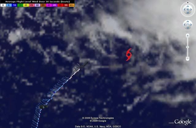
At 17:28:00Z (first observation), the observation was 357 miles (575 km) to the E (99°) from Nassau, Bahamas.
At 17:37:30Z (last observation), the observation was 378 miles (608 km) to the E (94°) from Nassau, Bahamas.
ATL: TROPICAL DEPRESSION DANNY (05L)
Moderator: S2k Moderators

Re: ATL: TROPICAL STORM DANNY
massweathernet wrote:FOX-25 BOSTON boldly announces their track forecast:

That's just NHC's forecast.
0 likes

-
Air Force Met
- Military Met

- Posts: 4372
- Age: 57
- Joined: Tue Jul 08, 2003 9:30 am
- Location: Roan Mountain, TN
Re: ATL: TROPICAL STORM DANNY
massweathernet wrote:FOX-25 BOSTON boldly announces their track forecast:
FOX-25 BOSTON boldly copies NHC track...
0 likes
-
storms NC

- Tropical Storm

- Posts: 247
- Age: 70
- Joined: Tue Sep 14, 2004 2:41 pm
- Location: Coast of NC & southwest coast of Fla
Re: ATL: TROPICAL STORM DANNY
Air Force Met wrote:canes04 wrote:Forward speed has slowed down, also convection firing north and east of center.
Still think he will be close to the coast of FLA.
Uh.....No.
No it is not a Fla storm. But it could come close to the Fla and Ga by250-300 mile out. I said could not it will. This is a NC storm a best here.It could come inland on the NC coast. For I think the NHC will move it more west with each run. How much more west it will go I don't know. But right now looking at this Loop it is moveing more to the west. I it should be south of the next check point. But over all WNW
http://www.ssd.noaa.gov/goes/flt/t1/loop-vis.html
0 likes
-
SEASON_CANCELED

- Category 3

- Posts: 887
- Joined: Mon Jul 06, 2009 5:17 am
- Location: 8 Bit Charlie Sheen
Re: ATL: TROPICAL STORM DANNY
This is going to affect someone on the CONUS or canadian maritimes. Lets start discussing strength. Whats the potential? NHC thinks a borderline cat 2 at some point
0 likes
-
cycloneye

- Admin

- Posts: 149414
- Age: 69
- Joined: Thu Oct 10, 2002 10:54 am
- Location: San Juan, Puerto Rico
Re: ATL: TROPICAL STORM DANNY
Very off topic=We have a code Yellow in the Eastern Atlantic.See details at Talking Tropics forum in Strong Wave thread.
0 likes
-
deltadog03

- Professional-Met

- Posts: 3580
- Joined: Tue Jul 05, 2005 6:16 pm
- Location: Macon, GA

-
Air Force Met
- Military Met
- Posts: 4372
- Age: 57
- Joined: Tue Jul 08, 2003 9:30 am
- Location: Roan Mountain, TN
Re: ATL: TROPICAL STORM DANNY
storms NC wrote:
No it is not a Fla storm. But it could come close to the Fla and Ga by250-300 mile out.
250-300 miles is about as close as the NHC track is now....
0 likes
000
URNT15 KNHC 261747
AF307 0205A DANNY HDOB 16 20090826
173800 2441N 07119W 9592 00434 0080 +224 +223 281004 005 008 000 03
173830 2443N 07118W 9595 00432 0082 +224 +222 241004 006 016 000 03
173900 2444N 07117W 9589 00436 0079 +225 +218 295001 002 014 000 03
173930 2445N 07116W 9592 00433 0079 +225 +217 357001 002 012 000 03
174000 2446N 07115W 9594 00431 0078 +225 +221 351001 003 012 000 00
174030 2447N 07114W 9594 00431 0078 +225 +221 325001 001 010 000 03
174100 2449N 07113W 9602 00455 0084 +226 +222 184002 003 010 000 03
174130 2449N 07111W 9590 00434 0077 +229 +215 192002 003 012 000 03
174200 2450N 07110W 9589 00435 0076 +230 +211 206002 002 011 000 03
174230 2451N 07108W 9592 00433 0076 +230 +211 220002 002 011 001 00
174300 2452N 07107W 9593 00432 0076 +228 +216 243001 002 008 000 03
174330 2453N 07105W 9592 00432 0076 +230 +215 243001 002 011 000 03
174400 2453N 07104W 9589 00435 0076 +228 +221 302001 002 013 000 03
174430 2454N 07102W 9592 00431 0075 +226 +224 311002 003 013 000 03
174500 2455N 07101W 9592 00432 0075 +225 +225 288003 004 013 000 03
174530 2456N 07059W 9594 00428 0076 +225 +225 257004 005 012 000 03
174600 2457N 07058W 9593 00430 0081 +224 +224 137001 003 009 000 03
174630 2458N 07057W 9591 00431 0080 +229 +219 081003 004 011 000 03
174700 2459N 07055W 9590 00431 0073 +228 +223 102003 003 014 000 03
174730 2500N 07054W 9592 00430 0074 +229 +224 127002 003 011 000 03
$$
;
0 likes
-
Air Force Met
- Military Met
- Posts: 4372
- Age: 57
- Joined: Tue Jul 08, 2003 9:30 am
- Location: Roan Mountain, TN
Re: ATL: TROPICAL STORM DANNY
SEASON_CANCELED wrote:Whats the potential? NHC thinks a borderline cat 2 at some point
Where did you see that? Discussion/Advisory states 65 KTS. That's a low end Cat 1. Then it becomes ET.
0 likes
-
SEASON_CANCELED
- Category 3
- Posts: 887
- Joined: Mon Jul 06, 2009 5:17 am
- Location: 8 Bit Charlie Sheen
Re: ATL: TROPICAL STORM DANNY
Air Force Met wrote:SEASON_CANCELED wrote:Whats the potential? NHC thinks a borderline cat 2 at some point
Where did you see that? Discussion/Advisory states 65 KTS. That's a low end Cat 1. Then it becomes ET.
thanks. Saw it on flhurricane
0 likes
-
DanKellFla

- Category 5

- Posts: 1291
- Joined: Fri Mar 17, 2006 12:02 pm
- Location: Lake Worth, Florida
Re: ATL: TROPICAL STORM DANNY
canes04 wrote:Forward speed has slowed down, also convection firing north and east of center.
Still think he will be close to the coast of FLA.
???? Scratching head ?????
Maybe, and that is a big maybe, Danny will come close enough to Florida to give us some nice weather.
0 likes
-
Derek Ortt
000
URNT15 KNHC 261757
AF307 0205A DANNY HDOB 17 20090826
174800 2501N 07053W 9590 00431 0073 +227 +225 105005 005 009 000 03
174830 2502N 07052W 9589 00431 0072 +225 +225 107006 007 009 000 00
174900 2504N 07051W 9593 00428 0088 +229 +227 101006 007 010 000 00
174930 2505N 07049W 9594 00456 0091 +227 +227 091007 009 013 000 03
175000 2506N 07048W 9589 00428 0078 +226 +226 093007 008 016 000 03
175030 2507N 07047W 9594 00454 0086 +224 +224 078012 014 011 001 03
175100 2508N 07048W 9592 00428 0078 +227 +225 067015 015 999 999 03
175130 2508N 07050W 9592 00428 0077 +224 +224 058013 015 008 001 03
175200 2506N 07050W 9592 00430 0086 +228 +227 061008 011 016 000 00
175230 2505N 07051W 9589 00432 0073 +229 +228 062005 006 014 001 03
175300 2503N 07051W 9596 00457 0086 +228 +228 060004 005 999 999 03
175330 2502N 07051W 9586 00433 0072 +225 +225 059003 004 999 999 03
175400 2500N 07050W 9594 00457 0093 +229 +226 000000 002 007 001 03
175430 2459N 07049W 9593 00457 0080 +230 +221 222002 003 999 999 03
175500 2500N 07048W 9593 00457 0089 +223 +223 178003 004 999 999 03
175530 2501N 07047W 9589 00430 0079 +229 +229 166003 005 007 000 00
175600 2503N 07046W 9593 00455 0094 +220 +220 133004 005 009 002 00
175630 2504N 07045W 9589 00429 0072 +228 +227 109004 004 007 000 03
175700 2505N 07044W 9591 00427 0089 +228 +227 101006 007 009 000 03
175730 2506N 07043W 9589 00429 0087 +226 +226 108007 008 011 000 03
$$
0 likes
-
massweathernet

- Tropical Low

- Posts: 48
- Joined: Mon May 18, 2009 1:52 pm
- Location: Boston, MA
- Contact:
Re: ATL: TROPICAL STORM DANNY
UW - CIMSS
ADVANCED DVORAK TECHNIQUE
ADT-Version 7.2.3
Tropical Cyclone Intensity Algorithm
----- Current Analysis -----
Date : 26 AUG 2009 Time : 164500 UTC
Lat : 25:04:29 N Lon : 70:32:11 W
CI# /Pressure/ Vmax
2.8 /1002.0mb/ 41.0kt
Final T# Adj T# Raw T#
2.8 2.8 2.8
Latitude bias adjustment to MSLP : +0.0mb
Center Temp : +17.3C Cloud Region Temp : -4.4C
0 likes
-
deltadog03
- Professional-Met
- Posts: 3580
- Joined: Tue Jul 05, 2005 6:16 pm
- Location: Macon, GA
http://www.atmos.washington.edu/~ovens/ ... nhanced+12
Still think models are doing a bad job with the ull over LA.......
Still think models are doing a bad job with the ull over LA.......
0 likes
-
vbhoutex

- Storm2k Executive
- Posts: 29147
- Age: 74
- Joined: Wed Oct 09, 2002 11:31 pm
- Location: Cypress, TX
- Contact:
Re:
DanKellFla wrote:3 out of 4 quadrents are nearly empty. But, Danny has a definite center of circulation. I am surprised it managed to get this far. I don't see how it is going to get too much stronger in the current conditions.
I have to agree with DanKellFla on this. What convection there is is off to the SE of the center and really seems to be not that heavy either. I would think the conditions would need to become almost perfect very soon in order for Danny to become an semblance of what is currently progged. Could a pro-met please chime in on this?
0 likes
Who is online
Users browsing this forum: No registered users and 2 guests