ATL: TROPICAL DEPRESSION DANNY (05L)
Moderator: S2k Moderators
-
Blown Away

- S2K Supporter

- Posts: 10253
- Joined: Wed May 26, 2004 6:17 am
Re: ATL: TROPICAL STORM DANNY
storms NC, even if Danny gets close to your area, most of the high wind/rain energy should be on the east side. So I think you dodged another one! 
0 likes

Re: ATL: TROPICAL STORM DANNY
Aric Dunn wrote:Steve H. wrote:Correct Aric. It is still heading on a wnw course and the ULL was retrograding west the last time I looked.
The biggest issue with that ull .. is that it does not appear at all to be opening up and if it does not open up and cuts off then the trough that is supposed to dig into the se will not be able to make it far enough .. and a ridge will likely build back in and something to watch is if that upper low starts to move westward again from is current stationary position. Because that will tell us that one the models are wrong and 2 the system maybe around quite a bit longer than previosly forecast. as of right now is see little motion with danny and nothing at the moment to move it .. so watch to see if that upper low opens up and starts to move NE
so what would essentially happen then? Woyld this bring it closer to the Carolinas?
0 likes
-
brunota2003

- S2K Supporter
- Posts: 9476
- Age: 35
- Joined: Sat Jul 30, 2005 9:56 pm
- Location: Stanton, KY...formerly Havelock, NC
- Contact:
Re: Re:
Thunder44 wrote:brunota2003 wrote:There is a 75 just below that 67 that is also flagged...however, there is a 59 that is NOT flagged.
But that came under a 21kt flight level report.
I've noticed (for instance in H Bill) before that sometimes the strongest surface winds are measured further away from the strongest flight level winds...for Bill, I think the peaks were 2 or 3 lines in separation.
0 likes
-
Aric Dunn
- Category 5

- Posts: 21238
- Age: 43
- Joined: Sun Sep 19, 2004 9:58 pm
- Location: Ready for the Chase.
- Contact:
Re: Re:
storms NC wrote:Aric Dunn wrote:storms NC wrote:Let me sum this up for some that are not so sure about the North turn.
Now you have a ULL over by La that is moveing east. Now as it get closer to danny it will turn Danny NW. then you have the jet stream. Now it is to slide down to the south and bend to the north. Right now it is to the north by the great lakes.
Now they are takeing that the jet stream will come down and the ULL to push Danny out to the NW to NNW to NNE.
So there you have why it will not hit the southeast coast.
actually thats not the case that upper low is still not moving .. and maybe cutting off .. if thats the case say good by to north motion..in the short term.
This is from out of Morehead City NWS
IMPACTS OF DANNY WILL BEGIN TO BE FELT LATE THU NIGHT INTO EARLY
FRIDAY AS PCPN CHANCES AND WINDS INCREASE ALONG THE COAST AHEAD OF
THE APPROACHING TROPICAL STORM. EXPECT BANDS OF TROPICAL SHOWERS
WILL BE ROTATING IN FROM THE COAST BY FRI AFTN BUT TEND TO WEAKEN
AS THEY ENCOUNTER THE DRIER AIR INLAND. UPPER LOW OVR GULF COASTAL
REGION WILL OPEN UP AND PUSH NORTHEAST ACROSS THE SE STATES ON
FRIDAY WHICH WILL EVENTUALLY TURN DANNY TO THE NORTH. THE MAINIMPACTS OF DANNY ARE EXPECTED TO BE FELT FRIDAY NIGHT WITH THE
POSSIBILITY OF TORRENTIAL RAIN AND HIGH WINDS PARTICULARLY FOR THE
OUTER BANKS AND AREAS SURROUNDING THE PAMLICO SOUND. CURRENT QPF
PROJECTIONS SUGGEST 1-2 INCHES OF RAIN BUT WILL LIKELY SEE
LOCALIZED HIGHER AMOUNTS MAINLY OVER COASTAL AREAS.
DANNY EXPECTED TO BE MOVING RAPIDLY NNE AND AWAY FROM THE AREA ON
SATURDAY WITH DECREASING CHANCES FOR PCPN EARLY AS WINDS SHIFT
WEST ALLOWING A DRIER FLOW AND SUBSIDENCE BEHIND THE DEPARTING
STORM.
lol ... i know what all the forecast are saying.. but they are all dependent on this ull opening up and moving NE.. the problem is its not opening up at all right now and thats the point ... wait and see what happens..
0 likes
-
brunota2003
- S2K Supporter
- Posts: 9476
- Age: 35
- Joined: Sat Jul 30, 2005 9:56 pm
- Location: Stanton, KY...formerly Havelock, NC
- Contact:
They'll probably discard it though, it may be valid, but maybe not representative of the circulations winds. A couple of passes through the area should prove or disprove the 59 knots.
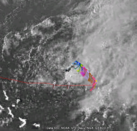
Another interesting fact, the T numbers last run on the SSD site are 2.0/2.0...or 35 mph (30 knots), yet this system (for being so disorganized) has winds of at least 50 mph (45 knots)...that is at least a 15 mph difference between truth and sat guess...makes you wonder what else they've been off on?
Another interesting fact, the T numbers last run on the SSD site are 2.0/2.0...or 35 mph (30 knots), yet this system (for being so disorganized) has winds of at least 50 mph (45 knots)...that is at least a 15 mph difference between truth and sat guess...makes you wonder what else they've been off on?
Last edited by brunota2003 on Wed Aug 26, 2009 7:13 pm, edited 1 time in total.
0 likes
-
TheEuropean

- Professional-Met

- Posts: 1797
- Age: 60
- Joined: Tue Sep 20, 2005 3:17 pm
- Location: Voerde, Germany
- Contact:
-
Dave

- Retired Staff

- Posts: 13442
- Age: 75
- Joined: Tue Aug 01, 2006 3:57 pm
- Location: Milan Indiana
- Contact:
URNT15 KWBC 270008
NOAA3 WXWXA DANNY1 HDOB 24 20090826
235830 2627N 07025W 6789 03414 0078 +097 +045 029005 005 999 999 03
235900 2626N 07027W 6648 03587 0080 +085 +041 014006 006 014 000 03
235930 2625N 07028W 6524 03744 0078 +077 +030 028005 006 014 000 03
000000 2623N 07030W 6439 03852 0084 +067 +027 042005 005 010 001 03
000030 2622N 07032W 6440 03851 0085 +066 +024 051005 005 005 000 03
000100 2621N 07034W 6439 03853 0085 +067 +023 054004 005 006 000 03
000130 2619N 07036W 6438 03854 0081 +069 +022 069003 004 004 000 03
000200 2618N 07038W 6438 03853 0080 +070 +022 086003 003 999 999 03
000230 2617N 07040W 6439 03853 0081 +070 +022 095004 004 999 999 03
000300 2615N 07042W 6439 03855 0091 +063 +029 109004 005 999 999 03
000330 2614N 07043W 6439 03853 0092 +062 +034 114005 005 999 999 03
000400 2613N 07045W 6439 03855 0095 +060 +036 149005 005 999 999 03
000430 2611N 07047W 6440 03853 0098 +058 +033 175004 004 999 999 03
000500 2610N 07049W 6440 03853 0099 +058 +033 183002 003 999 999 03
000530 2608N 07051W 6441 03852 0097 +059 +035 170002 002 999 999 03
000600 2607N 07053W 6440 03853 0093 +061 +035 123002 003 999 999 03
000630 2606N 07055W 6440 03852 0091 +063 +033 103003 004 999 999 03
000700 2604N 07057W 6441 03852 0091 +063 +032 091004 004 999 999 03
000730 2603N 07058W 6440 03853 0089 +064 +029 068004 005 999 999 03
000800 2602N 07100W 6439 03854 0084 +068 +024 056004 005 999 999 03
0 likes
-
brunota2003
- S2K Supporter
- Posts: 9476
- Age: 35
- Joined: Sat Jul 30, 2005 9:56 pm
- Location: Stanton, KY...formerly Havelock, NC
- Contact:
Like I said in the Recon thread:
They'll probably discard it though, it may be valid, but maybe not representative of the circulations winds. A couple of passes through the area should prove or disprove the 59 knots.
Another interesting fact, the T numbers last run on the SSD site are 2.0/2.0...or 35 mph (30 knots), yet this system (for being so disorganized) has winds of at least 50 mph (45 knots)...that is at least a 15 mph difference between truth and sat guess...makes you wonder what else they've been off on?
0 likes
-
Dave
- Retired Staff
- Posts: 13442
- Age: 75
- Joined: Tue Aug 01, 2006 3:57 pm
- Location: Milan Indiana
- Contact:
000
UZNT13 KWBC 270009
XXAA 77007 99268 70699 07969 99011 25810 09032 00098 24609 09542
92780 20200 09533 85509 17207 15520 70147 098// 15508 88999 77999
31313 09608 82350
61616 NOAA3 WXWXA DANNY1 OB 07
62626 REL 2680N06993W 235053 SPG 2681N06996W 235510 WL150 09540 0
86 DLM WND 12023 010697 MBL WND 09544 LST WND 011=
XXBB 77008 99268 70699 07969 00011 25810 11998 24410 22942 21608
33922 20200 44728 10620 55696 09614
21212 00011 09032 11994 09546 22970 09550 33958 10541 44941 10039
55893 11520 66858 15520 77791 14018 88761 16019 99721 13014 11696
15009
31313 09608 82350
61616 NOAA3 WXWXA DANNY1 OB 07
62626 REL 2680N06993W 235053 SPG 2681N06996W 235510 WL150 09540 0
86 DLM WND 12023 010697 MBL WND 09544 LST WND 011=
0 likes
-
Aric Dunn
- Category 5
- Posts: 21238
- Age: 43
- Joined: Sun Sep 19, 2004 9:58 pm
- Location: Ready for the Chase.
- Contact:
Re: ATL: TROPICAL STORM DANNY
artist wrote:Aric Dunn wrote:Steve H. wrote:Correct Aric. It is still heading on a wnw course and the ULL was retrograding west the last time I looked.
The biggest issue with that ull .. is that it does not appear at all to be opening up and if it does not open up and cuts off then the trough that is supposed to dig into the se will not be able to make it far enough .. and a ridge will likely build back in and something to watch is if that upper low starts to move westward again from is current stationary position. Because that will tell us that one the models are wrong and 2 the system maybe around quite a bit longer than previosly forecast. as of right now is see little motion with danny and nothing at the moment to move it .. so watch to see if that upper low opens up and starts to move NE
so what would essentially happen then? Woyld this bring it closer to the Carolinas?
exactly .. if that trough cannot dig far enough south than it would not be able to turn northerly very much as a ridge would eventually build back in .. but we have to wait and see what this upper low is going to do ..
0 likes
-
BensonTCwatcher

- Category 5
- Posts: 1050
- Joined: Sat Aug 28, 2004 10:11 pm
- Location: Southport NC
-
Dave
- Retired Staff
- Posts: 13442
- Age: 75
- Joined: Tue Aug 01, 2006 3:57 pm
- Location: Milan Indiana
- Contact:
URNT15 KWBC 270018
NOAA3 WXWXA DANNY1 HDOB 25 20090827
000830 2600N 07102W 6440 03853 0084 +069 +028 044005 005 999 999 03
000900 2559N 07104W 6440 03854 0084 +069 +030 065004 005 999 999 03
000930 2558N 07106W 6439 03855 0087 +067 +029 070004 004 999 999 03
001000 2556N 07108W 6441 03853 0088 +066 +028 075004 004 999 999 03
001030 2555N 07110W 6441 03853 0082 +071 +020 068005 006 999 999 03
001100 2553N 07112W 6441 03853 0078 +074 +019 055006 006 999 999 03
001130 2552N 07113W 6441 03853 0070 +079 +013 044007 007 999 999 03
001200 2551N 07115W 6441 03852 0078 +074 +017 047006 006 999 999 03
001230 2549N 07117W 6441 03852 0075 +075 +016 042007 007 999 999 03
001300 2548N 07119W 6440 03854 0076 +074 +016 046007 007 999 999 03
001330 2546N 07121W 6441 03851 0072 +078 +012 045008 009 999 999 03
001400 2545N 07123W 6442 03852 0069 +080 +013 040008 008 004 000 03
001430 2543N 07125W 6441 03852 0067 +081 +016 033008 008 999 999 03
001500 2542N 07127W 6441 03854 0070 +080 +016 029008 009 999 999 03
001530 2541N 07128W 6441 03853 0070 +079 +016 035008 009 999 999 03
001600 2539N 07130W 6442 03853 0070 +080 +011 026009 009 999 999 03
001630 2538N 07132W 6441 03854 0072 +079 +009 022009 009 999 999 03
001700 2536N 07134W 6441 03854 0075 +078 +008 019010 011 999 999 03
001730 2535N 07136W 6441 03855 0075 +077 +008 028010 011 999 999 03
001800 2533N 07138W 6441 03855 0075 +078 +008 035010 011 999 999 03
0 likes
-
Aric Dunn
- Category 5
- Posts: 21238
- Age: 43
- Joined: Sun Sep 19, 2004 9:58 pm
- Location: Ready for the Chase.
- Contact:
Re:
BensonTCwatcher wrote:Have to agree on the ULL Aric, RAMSDIS 14Km WV loop shows it clearly not sure if it will move,but it has to affect the timing of everything the longer it stays put.
exactly most models have it opened up in the next 12 to 24 hours.. but right now it is not weakening and actually looks to be cutting off ... again just have to wait ..
0 likes
-
storms NC

- Tropical Storm

- Posts: 247
- Age: 70
- Joined: Tue Sep 14, 2004 2:41 pm
- Location: Coast of NC & southwest coast of Fla
Re: ATL: TROPICAL STORM DANNY
Blown_away wrote:storms NC, even if Danny gets close to your area, most of the high wind/rain energy should be on the east side. So I think you dodged another one!
Well that all depends on where it would come in at. If into Wilm by 50 miles. And by this I am talking about the eye. I would be on the east side of the storm. If it come in at the outer banks a little wind and rain like you said.
0 likes
-
BensonTCwatcher
- Category 5
- Posts: 1050
- Joined: Sat Aug 28, 2004 10:11 pm
- Location: Southport NC
Who is online
Users browsing this forum: No registered users and 10 guests