Latest
Moderator: S2k Moderators


Stormcenter wrote:Way too much energy is being spent on 94.

Derek Ortt wrote:a little bit. However, I am watching closer to 15N for development, not 10N


cycloneye wrote:I think it will be code orange at 8 PM.Anyone agree with me?


caribsue wrote:cycloneye wrote:I think it will be code orange at 8 PM.Anyone agree with me?
LOL ... Meeee..... better bring back those bears cycloneye


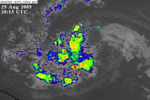
Derek Ortt wrote:I see the northern feature is the most likely as there appears to be some banding setting up there. Also, based upon the sat, that looks to me where the vorticity is the greatest.
it is also the only area that has model support

cycloneye wrote:caribsue wrote:cycloneye wrote:I think it will be code orange at 8 PM.Anyone agree with me?
LOL ... Meeee..... better bring back those bears cycloneye
Here they are.
funster wrote:It was smart of 94L to hide down there away from all those ULLs. It is starting to tilt at an angle now so maybe it will develop soon. If it gets into the warm untapped Caribbean waters it will definitely develop, i think. Then a strong cold front could come by and pull it into the gulf and send it racing up the east coast, which does not need any more rain and has lots of trees rooted in damp ground that could easily fall in strong winds.
Users browsing this forum: No registered users and 5 guests