ATL : TROPICAL DEPRESSION ERIKA (06L)

Moderator: S2k Moderators

Message
Author
User avatar
'CaneFreak
Category 5
Category 5
Posts: 1486
Joined: Mon Jun 05, 2006 10:50 am
Location: New Bern, NC

Re: ATL : TROPICAL STORM ERIKA (06L)

#3121 Postby 'CaneFreak » Wed Sep 02, 2009 10:04 am

Air Force Met wrote:From the discussion:

"THERE ARE MULTIPLE SWIRLS APPARENT ON THE SATELLITE IMAGERY ROTATING IN THE LARGER CIRCULATION ENVELOPE WITH A MEAN CENTER TO THE WEST OF THE DEEP CONVECTION.......SHEAR IS PRIMARILY COMING FROM SOUTHWESTERLY WINDS BETWEEN 300 MB-250 MB...AND THIS IS APPARENTLY UNDERCUTTING "

There's my undercutting shear and multiple centers...


Yep...and you forgot one thing...dry air...
0 likes   

User avatar
Maritimer71
S2K Supporter
S2K Supporter
Posts: 41
Joined: Sun Aug 23, 2009 6:07 am
Location: Nova Scotia - Canada

#3122 Postby Maritimer71 » Wed Sep 02, 2009 10:04 am

The one thing I have learned about storms... it doesn't matter if its organized, disorganized, downgraded or what...

If its coming your way - be prepared..

Danny packed more of a punch for us here in Nova Scotia than Bill and Bill was a classified hurricane while Danny was downgraded and we didn't even get wind warnings for, and we got higher gusts than we did with Bill, which we had warnings for...

If Erika or parts of Erika will be heading your way - take the necessary precautions... Just because the Met freaks are unimpressed by the storm, doesn't mean she won't knock you on your butt if you don't take her seriously.
0 likes   

Aric Dunn
Category 5
Category 5
Posts: 21238
Age: 42
Joined: Sun Sep 19, 2004 9:58 pm
Location: Ready for the Chase.
Contact:

Re: ATL : TROPICAL STORM ERIKA (06L)

#3123 Postby Aric Dunn » Wed Sep 02, 2009 10:04 am

Air Force Met wrote:From the discussion:

"THERE ARE MULTIPLE SWIRLS APPARENT ON THE SATELLITE IMAGERY ROTATING IN THE LARGER CIRCULATION ENVELOPE WITH A MEAN CENTER TO THE WEST OF THE DEEP CONVECTION.......SHEAR IS PRIMARILY COMING FROM SOUTHWESTERLY WINDS BETWEEN 300 MB-250 MB...AND THIS IS APPARENTLY UNDERCUTTING "

There's my undercutting shear and multiple centers...


lol .. well ask for it back if its yours.. lol :P
0 likes   

User avatar
artist
Category 5
Category 5
Posts: 9792
Joined: Mon Jun 06, 2005 3:26 pm
Location: West Palm

Re: ATL : TROPICAL STORM ERIKA - Computer Models

#3124 Postby artist » Wed Sep 02, 2009 10:04 am

knotimpaired wrote:
otowntiger wrote:
Blown_away wrote:Image

For now, the "All Clear For Florida" has been discontinued.

While that may be true it appears that the storm will not develop into anything to get too worked up over. Certainly right now she's not feeling too good and no one really knows what she could do intensity wise.


I cannot read who the blue line is that has it coming right over us. Can anyone read it and are they reliable?

It is the GFDL. Here is a summary of it. Sorry I don't know its accuracy though, but found this on its website - (I don't know how accurate this info is though)
Since it became operational in 1995, the Geophysical Fluid Dynamics Laboratory’s (GFDL) hurricane forecast model has consistently been among the leading models used by the National Hurricane Center (NHC) for accuracy in predicting hurricane track and intensity. GFDL’s hurricane forecast model performed extremely well again in the 2008 hurricane season. In both the East Pacific and Atlantic basins, the GFDL model had the lowest track forecast errors when compared to the other standard numerical guidance. In the critical 48-hour and 72-hour time period, the model errors in the Atlantic basin were about 13 and 8 percent (respectively) better than the next best standard model guidance.
http://www.gfdl.gov/index/news-app/stor ... 008-season
0 likes   

User avatar
BatzVI
Tropical Storm
Tropical Storm
Posts: 199
Joined: Sat Jun 10, 2006 8:27 am
Location: St. Thomas, Virgin Islands

Re: ATL : TROPICAL STORM ERIKA (06L)

#3125 Postby BatzVI » Wed Sep 02, 2009 10:04 am

With the latest 3-day cone showing the track (which I know is uncertain) going between St. Croix and St. Thomas, I still don't understand why there isn't even a "watch" up for us...Granted it will not be the strongest system, but people still need time to prepare boats, etc.....
0 likes   

User avatar
Bocadude85
Category 5
Category 5
Posts: 2991
Age: 38
Joined: Mon Apr 18, 2005 2:20 pm
Location: Honolulu,Hi

Re: ATL : TROPICAL STORM ERIKA - Computer Models

#3126 Postby Bocadude85 » Wed Sep 02, 2009 10:08 am

[quote="HardCard"]
otowntiger wrote:Give me a break! I said it [b]appears that the storm will not be anything to get worked up about. The NHC has reasons for not predicting a major, but of course anything can happen. If you want to go ahead and work yourself into a frenzy over a very weak T.S, over 1000 miles away, feel free. :P
[/b]


I dont think I am worked into a frenzy here.. perhaps you need to learn a little about tropical meteorology before you make posts, because clearly half the time you have no idea what you are talking about.
Last edited by Bocadude85 on Wed Sep 02, 2009 10:21 am, edited 1 time in total.
0 likes   

Sanibel
Category 5
Category 5
Posts: 10375
Joined: Mon Aug 30, 2004 11:06 pm
Location: Offshore SW Florida

Re: ATL : TROPICAL STORM ERIKA (06L)

#3127 Postby Sanibel » Wed Sep 02, 2009 10:09 am

I'll get clobbered :spam: 
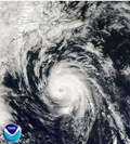
BUT, I think the visible center over Guadeloupe is the center only it has been made weak by shear displacement. The surface bands to the north obviously spiral into it in my opinion.
This puts the track low and near the islands.

This is cool. Masters says there's low level northeasterly shear scooting the surface swirl out from under the main convection that is being sheared from the south and southwest.
0 likes   

User avatar
southerngale
Retired Staff
Retired Staff
Posts: 27418
Joined: Thu Oct 10, 2002 1:27 am
Location: Southeast Texas (Beaumont area)

Re: Re:

#3128 Postby southerngale » Wed Sep 02, 2009 10:13 am

Stormcenter wrote:I agree with Frank2 at this moment Erika "does not" look good.
What looks like the center is completely exposed.


'CaneFreak wrote:
Frank2 wrote:You must be speaking of someone else - this has never looked that impressive, other than a few days ago when the MLC was showing decent banding, but other than that, it's similar to Danny when it comes to disorganization, so don't be surprised if they do downgrade it, since it's very poorly organized (even for a TD) at this time...

Frank


This is a joke right? You aren't serious...you can't be...

You don't have to agree with just Frank2... I think we ALL can agree that Erika doesn't look very good at the moment.

But you don't have to reply to agree with Frank2 anyway... I think it's pretty much just understood, a given. :wink:
0 likes   

Jimsot
Tropical Storm
Tropical Storm
Posts: 157
Age: 77
Joined: Sat Sep 09, 2006 1:31 pm
Location: Upstate SC

Re: ATL : TROPICAL STORM ERIKA (06L)

#3129 Postby Jimsot » Wed Sep 02, 2009 10:16 am

BatzVI wrote:With the latest 3-day cone showing the track (which I know is uncertain) going between St. Croix and St. Thomas, I still don't understand why there isn't even a "watch" up for us...Granted it will not be the strongest system, but people still need time to prepare boats, etc.....


Well we have warnings here on Anguilla. When I checked this morning Erika was going to pass to our NorthEast by 20 miles. Now at 11:00AM it is going to pass to our SouthWest by 40 miles. I gotta know which windows to close tonight! :?:

If it stays like this we should get some decent rain (we need it) and a good show, but we are ever vigilant.
0 likes   

User avatar
jasons2k
Storm2k Executive
Storm2k Executive
Posts: 8245
Age: 51
Joined: Wed Jul 06, 2005 12:32 pm
Location: The Woodlands, TX

Re: Re:

#3130 Postby jasons2k » Wed Sep 02, 2009 10:19 am

Stormcenter wrote:We can't even get this thing past the islands and you have it the GOM already.
If it made it in there (GOM) it would be short lived if it survived.
Aric Dunn wrote:Not withstanding the potential for this entering the gulf if it hold together is increasing quickly and of course the bahamas and florida before that.


1) "We can't even get this thing past the islands and you have it the GOM already." He doesn't have it in the GOM already. He just said the longer this stays a disporganized mess and keeps moving west, the chances of this going into the GOM do increase.

I think that's a fair assessment at this point in time. Those chances are still slim...but they increase over time if this keeps up.

2) "If it made it in there (GOM) it would be short lived if it survived." How can you possibly make that assertion at this time? We're talking at least 5-7 days away. Where in the Gulf would it be? How strong would the cyclone be (if it still even exists)? What would the shear be like in that location at that time, and why? Can you show us why Erika would be short-lived in the GOM if that happened?

I don't think anyone can answer those questions yet with any confidence at all. Until such a scenario draws closer (if it does??), I think it's best to neither overhype nor underhype the possibilities.

We just don't know yet what things will look like a week from now, or even if this thread will be open still a week from now.
0 likes   

User avatar
Evil Jeremy
S2K Supporter
S2K Supporter
Posts: 5463
Age: 32
Joined: Mon Apr 10, 2006 2:10 pm
Location: Los Angeles, CA

Re: ATL : TROPICAL STORM ERIKA - Computer Models

#3131 Postby Evil Jeremy » Wed Sep 02, 2009 10:19 am

Even a weak TS can cause damage and ruin lives.
0 likes   

User avatar
wxman57
Moderator-Pro Met
Moderator-Pro Met
Posts: 22980
Age: 67
Joined: Sat Jun 21, 2003 8:06 pm
Location: Houston, TX (southwest)

Re: ATL : TROPICAL STORM ERIKA (06L)

#3132 Postby wxman57 » Wed Sep 02, 2009 10:19 am

Well, my initial estimate of 15Z position was only off by 0.1 latitude from NHC's. My track takes the center (one of them) directly over PR Friday morning. Though with the current and projected state of disorganization, I expect that the main threat will be heavy rainfall across the NE Caribbean and not wind. My 5 day point is about 100 miles SSW of NHC's. But that may be a moot point as Erika may well have opened up into a wave by then (or dissipated completely).
0 likes   

User avatar
BatzVI
Tropical Storm
Tropical Storm
Posts: 199
Joined: Sat Jun 10, 2006 8:27 am
Location: St. Thomas, Virgin Islands

Re: ATL : TROPICAL STORM ERIKA (06L)

#3133 Postby BatzVI » Wed Sep 02, 2009 10:20 am

That's kind of my point, there is a lot of uncertainty, so we need to be prepared for anything....unfortunately, until a watch or warning is put up, some people don't take it seriously. Even if it's not going to blow us off the face of the earth, there are still problems associated with smaller systems.
0 likes   

Sanibel
Category 5
Category 5
Posts: 10375
Joined: Mon Aug 30, 2004 11:06 pm
Location: Offshore SW Florida

Re: ATL : TROPICAL STORM ERIKA (06L)

#3134 Postby Sanibel » Wed Sep 02, 2009 10:20 am

Now that SSD finally got its act together and updated the Floater the Guadeloupe center could be quitting and a new center could be forming closer to the convection.
0 likes   

User avatar
HurricaneQueen
S2K Supporter
S2K Supporter
Posts: 1011
Age: 79
Joined: Sat Oct 12, 2002 7:36 pm
Location: No. Naples, Fl (Vanderbilt Beach area)

Re:

#3135 Postby HurricaneQueen » Wed Sep 02, 2009 10:21 am

Maritimer71 wrote:The one thing I have learned about storms... it doesn't matter if its organized, disorganized, downgraded or what...

If its coming your way - be prepared..

Danny packed more of a punch for us here in Nova Scotia than Bill and Bill was a classified hurricane while Danny was downgraded and we didn't even get wind warnings for, and we got higher gusts than we did with Bill, which we had warnings for...

If Erika or parts of Erika will be heading your way - take the necessary precautions... Just because the Met freaks are unimpressed by the storm, doesn't mean she won't knock you on your butt if you don't take her seriously.


Excellent points made in this post. While most of us are concerned with the appearance, etc. of Ericka, we have to remember that here are some people that will be impacted in some way over the next couple of days be it flooding rains, mudslides, rough surf or just squally weather. After all our years here, we should know that anything can happen in the tropics. Just my 2 cents.

Hi to Aquawind and some others that I haven't seen yet this season.

Lynn
0 likes   

User avatar
HURAKAN
Professional-Met
Professional-Met
Posts: 46086
Age: 38
Joined: Thu May 20, 2004 4:34 pm
Location: Key West, FL
Contact:

#3136 Postby HURAKAN » Wed Sep 02, 2009 10:22 am

Image

RECON should depart to investigate Erika in one hour.
0 likes   

User avatar
PTrackerLA
Category 5
Category 5
Posts: 5277
Age: 41
Joined: Thu Oct 10, 2002 8:40 pm
Location: Lafayette, LA

Re: ATL : TROPICAL STORM ERIKA (06L)

#3137 Postby PTrackerLA » Wed Sep 02, 2009 10:23 am

Sure is bursting now. What will happen if this passes under PR and Hispanola if there is another center relocation further south?
0 likes   

User avatar
x-y-no
Category 5
Category 5
Posts: 8359
Age: 65
Joined: Wed Aug 11, 2004 12:14 pm
Location: Fort Lauderdale, FL

Re: ATL : TROPICAL STORM ERIKA - Computer Models

#3138 Postby x-y-no » Wed Sep 02, 2009 10:23 am

otowntiger wrote: Give me a break! I said it appears that the storm will not be anything to get worked up about. The NHC has reasons for not predicting a major, but of course anything can happen. If you want to go ahead and work yourself into a frenzy over a very weak T.S, over 1000 miles away, feel free. :P


I don't see anyone in a frenzy. This board is about discussing the weather and in particular this forum is about discussing tropical weather. That includes messy, weak systems like Erika.

Also, appearances can be very deceptive. Recall, if you can, what a pathetic mess Katrina-to-be was up until less than 24 hours before landfall in Dade County. That's not to say that Erika will do anything like that, but only to say that even messy, pathetically weak systems bear watching in this neighborhood.
0 likes   

Sanibel
Category 5
Category 5
Posts: 10375
Joined: Mon Aug 30, 2004 11:06 pm
Location: Offshore SW Florida

Re: ATL : TROPICAL STORM ERIKA (06L)

#3139 Postby Sanibel » Wed Sep 02, 2009 10:24 am

The Bamm Bamms proved accurate with a sheared storm.
0 likes   

User avatar
southerngale
Retired Staff
Retired Staff
Posts: 27418
Joined: Thu Oct 10, 2002 1:27 am
Location: Southeast Texas (Beaumont area)

Re: Re:

#3140 Postby southerngale » Wed Sep 02, 2009 10:25 am

Actually, he said "not withstanding the potential for this entering the gulf..." not that it WAS going into the GOM. But who the heck knows where it's going, anyway? Nobody knows for sure. A few days ago, you said it wouldn't get anywhere near the Caribbean. It looks pretty close to it right now.

Stormcenter wrote:We can't even get this thing past the islands and you have it the GOM already.
If it made it in there (GOM) it would be short lived if it survived.


Aric Dunn wrote:
HURAKAN wrote:The center found by RECON is under the convection or very close to it, not the one over the Lesser Antilles. Strong convection is developing over the estimated position of the center, therefore, the NHC won't downgrade the system to TD without RECON information.


yeah even though there is clearly a vortex rotating sw the ball of convection that is firing is the main center or at least more dominate.

the models are just not going to have a easy time at all for the 12z run this is farther south than any model except the bam models from 3 days ago when they had it entering the NE carrib.

expect yet another shift west and south .. possibly across DR which does not bode well for strengthening...

not withstanding the potential for this entering the gulf if it hold together is increasing quickly and of course the bahamas and florida before that.
0 likes   


Return to “2009”

Who is online

Users browsing this forum: No registered users and 2 guests