This is the system in front of the Antilles
Moderator: S2k Moderators


HURAKAN wrote:TROPICAL WEATHER DISCUSSION
NWS TPC/NATIONAL HURRICANE CENTER MIAMI FL
805 AM EDT FRI SEP 04 2009
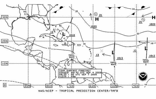
TROPICAL WAVE IS ALONG 34W/35W S OF 18N WITH A 1011 MB LOW ALONG
THE WAVE NEAR 14N MOVING W NEAR 10 KT. THE WAVE COINCIDES WITH A
DEEP LAYER MOISTURE MAXIMUM OBSERVED IN TOTAL PRECIPITABLE WATER
IMAGERY. HOWEVER...SATELLITE IMAGERY AND THE TPW IMAGERY
INDICATE DRY SAHARAN AIR LAYER HAS BEING INJECTED INTO THE WAVE
JUST S OF THE LOW LEVEL CENTER. SCATTERED MODERATE/ISOLATED
STRONG CONVECTION IS FROM 15N-17N BETWEEN 34W-36W.


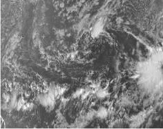
HURAKAN wrote:http://i21.photobucket.com/albums/b300/HURAKAN5/RECON/427-1.jpg
Another look


wxman57 wrote:HURAKAN, I believe this is the correct disturbance being discussed on this thread. It's the one west of the disturbance near the Cape Verde Islands.
HURAKAN wrote:wxman57 wrote:HURAKAN, I believe this is the correct disturbance being discussed on this thread. It's the one west of the disturbance near the Cape Verde Islands.
In the image, I'm talking about the system to th west. I know things are tough but there are not a lot of things to see out there!!!

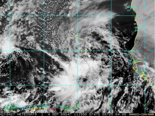
wxman57 wrote:HURAKAN wrote:http://i21.photobucket.com/albums/b300/HURAKAN5/RECON/427-1.jpg
Another look
HURAKAN, I believe this is the correct disturbance being discussed on this thread. It's the one west of the disturbance near the Cape Verde Islands. Surrounded by dry air and relatively cool water, it has little chance of developing.

Aric Dunn wrote:
wrong motion there ...
its been heading wsw to west .. and the ridge is buildingin all levels ..
west motion for the next 2 to 3 days.. development likely..
invest in the morning TD likely after that ..
Frank2 wrote:Let's face it folks, aside from Bill which came along during the positive MJO and was a very impressive system from the start, per the long range forecasts, this will be a season similar to other El Nino seasons - perhaps one or two hurricanes but not much else...
That's the way it is, and considering how fragile (or damaged) the economy is, that's a good thing, for sure...
Can you image the terrible impact in human terms if the US endured another Andrew or Katrina at this point - talk about economic collapse...
Frank

Users browsing this forum: No registered users and 77 guests


