caribepr wrote:I applaud you who are not pro mets following this one! Many say they have the interest but it often is about what concerns them personally and I will admit I am more than half way among that group. But I'm totally enjoying you all watching for the next development of what looks by all signs to be a fish but a very interesting BIG fish!
Good on ya! You may be few but you back up the talk (and of course a pro met can and should wait til morning!!! A life job like this has to be paced or insanity takes over).
That's my story, comfortable with the consensus of the models, and I'm stickin' to it (though I'll admit, deep somewhere in my rock brain I'm waiting until the north turn to let Fred stop being a potential Flint stone)
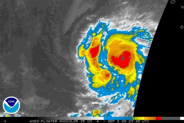
This is my first full and intense track of what is now a certain cane. I am loving it and i am totally hooked so glad to have a fish lol.
Seriously though finding this site has made me feel better about my obsession with reading the charts and tracking sat pictures. I am not strange like my friends think :p