I'll be sure to keep that in mind, thanks for the info.Air Force Met wrote:bayoubebe wrote:attallaman wrote:Two of NOLA's TV METs were saying this morning there is a good possibility that SE LA and coastal MS could receive heavy rains from the system currently in the BOC later this week. Could the METs in NOLA be right or is the system in the BOC primarily heading for SC TX, SE TX, or SW LA?
TWC is only indicating a 30 to 40% chance of "Isolated Thunderstorms" at this point in our area(SE LA).
Please remember that TWC isn't really doing much "independent" forecasting. They are using the NWS forecast.
Possible NW Gulf Development Late This Week?
Moderator: S2k Moderators
Forum rules

The posts in this forum are NOT official forecasts and should not be used as such. They are just the opinion of the poster and may or may not be backed by sound meteorological data. They are NOT endorsed by any professional institution or STORM2K. For official information, please refer to products from the National Hurricane Center and National Weather Service.
-
attallaman
Re: Possible NW Gulf Development Late This Week?
0 likes
-
gboudx

- S2K Supporter

- Posts: 4090
- Joined: Thu Sep 04, 2003 1:39 pm
- Location: Rockwall, Tx but from Harvey, La
Re: Re:
attallaman wrote:OK latest what? Explain please.HURAKAN wrote:
Latest
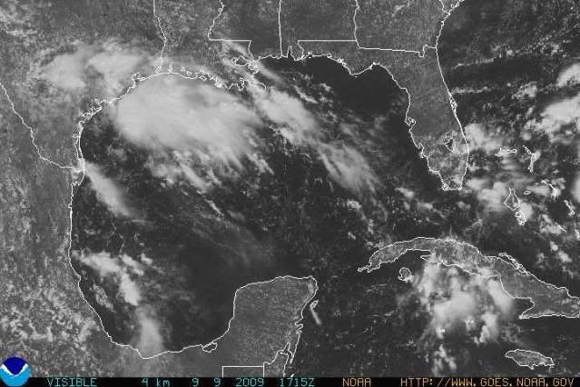
It was the latest satellite photo of the Gulf. Found here. http://www.goes.noaa.gov/GIFS/GULFVS.JPG
0 likes
-
attallaman
Re: Re:
That's strange, all I saw was the word "Latest" and the logo for Photobucket, no sat image. Thanks for clarifying that.gboudx wrote:attallaman wrote:OK latest what? Explain please.HURAKAN wrote:
Latest
It was the latest satellite photo of the Gulf. Found here. http://www.goes.noaa.gov/GIFS/GULFVS.JPG
0 likes
-
gboudx
- S2K Supporter
- Posts: 4090
- Joined: Thu Sep 04, 2003 1:39 pm
- Location: Rockwall, Tx but from Harvey, La
Re: Re:
attallaman wrote:That's strange, all I saw was the word "Latest" and the logo for Photobucket, no sat image. Thanks for clarifying that.
The sat image was being displayed at first. But yes, now all we see is the logo for Photobucket. I guess Hurakan exceeded storage limits or something.
0 likes


Re: Possible NW Gulf Development Late This Week?
OK latest what? Explain please. OT: What exactly is that you seem to be holding in your hands in your avatar? Is that the bottom of a Magnalite gumbo pot? Just curious.
Stop it your making me hungry! I also was curious that was?
Stop it your making me hungry! I also was curious that was?
0 likes
-
gboudx
- S2K Supporter
- Posts: 4090
- Joined: Thu Sep 04, 2003 1:39 pm
- Location: Rockwall, Tx but from Harvey, La
Re: Possible NW Gulf Development Late This Week?
tailgater wrote:Stop it your making me hungry! I also was curious that was?
I have a pot for boiling crawfish and that looks like the lid for it. Except that one looks smaller.
0 likes
-
attallaman
Re: Possible NW Gulf Development Late This Week?
Well if you find out inquiring minds want to know.gboudx wrote:tailgater wrote:Stop it your making me hungry! I also was curious that was?
I have a pot for boiling crawfish and that looks like the lid for it. Except that one looks smaller.
0 likes
-
attallaman
Re: Possible NW Gulf Development Late This Week?
My aunt who lives in Cypress, TX just called to tell me it's raining pretty good there this afternoon.
0 likes
Re: Possible NW Gulf Development Late This Week?
Back on topic, latest NAM.
http://www.nco.ncep.noaa.gov/pmb/nwprod ... loop.shtml
still bringing a low into SW La.
http://www.nco.ncep.noaa.gov/pmb/nwprod ... loop.shtml
still bringing a low into SW La.
0 likes

Re: Possible NW Gulf Development Late This Week?
looks like most of the weather will be in southeast texas. what is the time frame of the weather starting?
0 likes


Re: Possible NW Gulf Development Late This Week?
i am not knowledgeable enough to know what i am looking at, but does anyone think this has the signs of starting to develop into anything?
0 likes
-
chzzdekr81

- S2K Supporter
- Posts: 189
- Joined: Sun Aug 30, 2009 7:54 pm
- Location: Orange, Texas (SETX)
- Contact:
Re: Possible NW Gulf Development Late This Week?
My favorite metoerologist (Greg Bostwick) said that in the next few days, upper level winds will diminish, and we could see formation later on. Definately something to keep an eye on.
0 likes

Re: Possible NW Gulf Development Late This Week?
This area has had a few bursts of convection but the shear has been blowing the tops off leaving little naked swirls at the surface. Don't know if the shear has eased some this afternoon or not?
0 likes
-
CajunMama
- Retired Staff

- Posts: 10791
- Joined: Thu Feb 06, 2003 9:57 pm
- Location: 30.22N, 92.05W Lafayette, LA
Re: Re:
attallaman wrote:OK latest what? Explain please. OT: What exactly is that you seem to be holding in your hands in your avatar? Is that the bottom of a Magnalite gumbo pot? Just curious.HURAKAN wrote:
Latest
I must say it's one of his better graphics
0 likes


Re: Re:
That's strange, all I saw was the word "Latest" and the logo for Photobucket, no sat image. Thanks for clarifying that.[/quote][/quote]attallaman wrote:[img]
That's all I saw too. I thought it has something to do with the "Pro" in the picture which had something to do with my Pro comment.
We had quite a bit of rain in this area today.
I hope the Texans can get some much needed rain.
0 likes

Re: Possible NW Gulf Development Late This Week?
12Z NAM looks impressive but is likely way overdone. So far nothing more than just a bunch of tropical moisture. For those that read my points last night did anyone notice the excessive rainfall over C TX this morning SW of Austin. Small slow moving MCS in a tropical air mass produced 3-5 inches in a couple of hours. Look out for the nocturnal stuff the next few nights as this may end up getting someone more than any Gulf surface low.
0 likes
-
Portastorm

- Storm2k Moderator

- Posts: 9955
- Age: 63
- Joined: Fri Jul 11, 2003 9:16 am
- Location: Round Rock, TX
- Contact:
Re: Possible NW Gulf Development Late This Week?
Jeff, parts of Hays County (Wimberley) and south of there indeed received significant amounts of rain this morning. It looked like the heavier precip would edge into the AUS metro area ... but alas, it didn't happen.
0 likes
Who is online
Users browsing this forum: No registered users and 352 guests