Is EL NINO showing us a sign of things to come this winter

Winter Weather Discussion

Moderator: S2k Moderators

Forum rules

The posts in this forum are NOT official forecast and should not be used as such. They are just the opinion of the poster and may or may not be backed by sound meteorological data. They are NOT endorsed by any professional institution or STORM2K.

Help Support Storm2K
Message
Author
User avatar
CaptinCrunch
S2K Supporter
S2K Supporter
Posts: 8728
Age: 57
Joined: Mon Nov 03, 2003 4:33 pm
Location: Kennedale, TX (Tarrant Co.)

Is EL NINO showing us a sign of things to come this winter

#1 Postby CaptinCrunch » Sat Sep 12, 2009 10:26 am

NWS FT WORTH TX

.PREV DISCUSSION... /ISSUED 528 AM CDT SAT SEP 12 2009/

PRIMARY FORECAST CONCERN IS FLASH FLOODING POTENTIAL THIS
AFTERNOON THROUGH THIS EVENING. 00Z MODELS PICK UP ON SOME
INTERESTING FEATURES THIS AFTERNOON THAT COULD COME TOGETHER TO
PROVIDE INGREDIENTS FAVORABLE FOR FLASH FLOODING. IT IS DIFFICULT
TO DISCERN HOW MUCH OF THIS IS DUE TO CONVECTIVE FEEDBACK DUE TO
ALL 00Z GUIDANCE SHOWING WIDESPREAD CONVECTION OVER NORTH TX.
NAM/GFS/ECMWF ALL AGREE ON LOW PRESSURE SYSTEM BECOMING STRONGER
ALONG THE GULF COAST THIS AFTERNOON. THIS SEEMS LIKELY TO OCCUR AS
08Z WATER VAPOR IMAGERY AND 08Z RUC TROPOPAUSE ANALYSIS INDICATE A
STRONG SHORTWAVE TROUGH DIVING SOUTHEAST ALONG THE TX/MEXICO
BORDER.

AS THIS LOW PRESSURE SYSTEM DEEPENS ALL MODELS PICK UP ON TWO
INTERESTING FEATURES...THE FIRST IS AN AREA OF WARM AIR ADVECTION
IN THE H800 TO H600 LAYER OVER EASTERN PORTIONS OF THE CWA. THIS
CAUSES THE MID LVL THERMAL GRADIENT TO TIGHTEN UP OVER THE
FORECAST AREA...AND BY THIS AFTERNOON MODELS ARE INDICATING A
FAIRLY STRONG ZONE OF MID LVL FRONTOGENESIS SETTING UP FROM NEAR
PARIS SOUTHWEST TOWARDS COMANCHE. FORECAST SOUNDINGS INDICATE A
NEARLY SATURATED TROPOSPHERE OVER NORTH TX...SO UNDER THE
INFLUENCE OF FRONTOGENETIC FORCING...WOULD EXPECT SOME ENHANCED
PRECIPITATION TO DEVELOP ALONG AND SOUTHEAST OF THIS FORCING AXIS
WITH UPWARD VERTICAL MOTION TO THE WARM SIDE OF THE AXIS. THE
SECOND FEATURE OF INTEREST IS THE MODELS INDICATING A FAIRLY
STRONG EASTERLY LOW LVL JET AROUND THE H800 LVL THIS AFTERNOON.
09Z WIND PROFILERS AND RADAR DERIVED VAD WIND PROFILES INDICATE
EASTERLY FLOW OF 15 TO 20 KTS OVER THE FORECAST AREA. MODELS
INDICATE THIS WILL INCREASE TO 35 TO 40 KTS BY LATE THIS
AFTERNOON. 12/00Z SHV SOUNDING WAS NEARLY SATURATED THROUGH THE
TROPOSPHERE...AND IF STRONG EASTERLY LLJ PANS OUT...LOW LVL
TRAJECTORIES WOULD KEEP AN AMPLE SUPPLY OF RICH MOISTURE FLOWING
INTO NORTH TX THIS AFTERNOON AND THIS EVENING. WITH A COUPLE OF
ENHANCEMENTS LOOKING LIKELY FOR MESOSCALE FORCING THIS AFTERNOON A
LOOK AT TYPICAL PARAMETERS USED TO DIAGNOSE POTENTIAL FOR HEAVY
RAINFALL BECOME IMPORTANT. FIRST...PRECIPITABLE WATER VALUES LOOK
TO REMAIN ABOVE 2 INCHES FOR THE NEXT 24 HRS OVER NORTH TX.
SECOND...MID LEVEL RH VALUES ARE FORECAST TO REMAIN AT OR ABOVE 90
PERCENT OVER THE SAME TIME PERIOD. LASTLY IS THE THERMODYNAMIC
PROFILE OVER THE CWA...FORECAST SOUNDINGS ARE NEARLY MOIST
ADIABATIC THROUGH THE ENTIRE TROPOSPHERE. THIS MEANS TALL AND
SKINNY TYPE CAPE WHICH HAS BEEN ASSOCIATED WITH SOUNDINGS
FAVORABLE FOR GOOD PRECIPITATION EFFICIENCY. THIS ALSO MEANS THE
THETA E DIFFERENCE WITH HEIGHT IS MINIMAL...MEANING THAT PERIODS
OF INTENSE CONVECTION WILL NOT QUICKLY STABILIZE THE ENVIRONMENT
ALLOWING FOR PROLONGED PERIODS OF CONVECTION.

ALL IN ALL THERE SEEMS TO BE A HIGH RISK FOR HEAVY RAINFALL WHICH
COULD LEAD TO FLASH FLOODING WHEREVER THE MOST INTENSE CONVECTION
SETS UP THIS AFTERNOON. BASED ON THE GENERAL AGREEMENT OF THE
PLACEMENT OF THE MID LVL BAROCLINIC ZONE IN THE NAM/GFS/ECMWF THIS
ZONE APPEARS TO MAINLY AFFECT AREAS IN THE FORT WORTH CWA ALONG
AND NORTH OF AN EMORY TO FORT WORTH TO COMANCHE LINE. A FLASH
FLOOD WATCH REMAINS IN EFFECT FOR THE ENTIRE CWA AS RAINFALL OVER
THE PAST 24 HRS HAS LED TO MOIST SOIL CONDITIONS ACROSS MUCH OF
NORTH TX. HEAVY RAINFALL OVER ANY PORTION OF THE AREA COULD LEAD
TO FLASH FLOODING. IN GENERAL...MOST LOCATIONS ARE EXPECTED TO
RECEIVE ANYWHERE FROM 1 TO 3 INCHES OF RAINFALL OVER THE NEXT 24
HRS...WITH ISOLATED AREAS RECEIVING TOTALS IN EXCESS OF 5 INCHES.
THE AREAS MOST LIKELY TO SEE ISOLATED HIGHER AMOUNTS WOULD BE
NORTHERN AND WESTERN PORTIONS OF THE FORECAST AREA.

SUNDAY AND SUNDAY NIGHT...AXIS OF HEAVIEST RAINFALL MAY SHIFT
NORTH AS MODELS INDICATE A DRY SLOT INTRUSION AT H500 SUNDAY
MORNING WHICH SHOULD TEMPORARILY INTERRUPT DEEP CONVECTION. WITH
EXPECTED RAINFALL OVER MUCH OF NORTH TX IN THE 1 TO 3 INCH RANGE
TODAY AND TONIGHT...ANY ADDITIONAL TSTM ACTIVITY COULD CAUSE FLASH
FLOODING...SO LEFT FLASH FLOOD WATCH CONTINUE THROUGH SUNDAY
AFTERNOON AT THIS TIME. IF DRY SLOT SHUTS THINGS DOWN...LATER
SHIFTS CAN REEVALUATE THE NEED FOR THE WATCH CONTINUING THRU 7 PM
SUNDAY.

REMAINDER OF THE FORECAST...THE GFS AND ECMWF DIVERGE ON HOW TO
HANDLE THIS UPPER LVL DISTURBANCE IN THE EXTENDED FORECAST. THE
GFS HAS THE UPPER LOW VACATING THE AREA BY TUESDAY NIGHT...WHILE
THE ECMWF HOLDS THE UPPER LOW OVER NORTHEASTERN TX THRU THURSDAY.
AT THIS TIME ONLY REAL CHANGES TO MEDIUM RANGE FORECAST WAS TO
BUMP UP POPS A BIT OVER THE NORTHEASTERN COUNTIES OF THE FORECAST
AREA. NO REAL CONFIDENCE WHETHER THE GFS OR ECMWF HAS THE RIGHT
SOLUTION...SO LEFT LOW CHC POPS IN THE FORECAST THRU THURSDAY
UNTIL A LARGE SCALE SOLUTION COMES INTO BETTER AGREEMENT.


I have already recieved over 3 inches or rain since yesterday morning here and looks as another 3 to 5 inches is on the way. This not the norm around here for this time of the year, it's more of a mid October pattern. Hope this can only be a sign of a awesome El NINO winter with lots of Snow.
0 likes   

User avatar
mpic
S2K Supporter
S2K Supporter
Posts: 622
Joined: Thu Oct 20, 2005 11:24 am
Location: Splendora, TX

Re: Is EL NINO showing us a sign of things to come this winter

#2 Postby mpic » Sat Sep 12, 2009 11:24 am

I hope not...too far south for snow for me which equates to a lot of rain. I have a side business that operates strictly outdoors during the next 3-4 months and don't need rain during that time at all. :eek:
0 likes   

User avatar
ntxweatherwatcher
Tropical Depression
Tropical Depression
Posts: 71
Joined: Thu Oct 23, 2008 3:55 pm
Location: Bedford, TX DFW

Re: Is EL NINO showing us a sign of things to come this winter

#3 Postby ntxweatherwatcher » Sat Sep 12, 2009 9:49 pm

Bring on the snow!!! :froze:
0 likes   

User avatar
somethingfunny
ChatStaff
ChatStaff
Posts: 3926
Age: 37
Joined: Thu May 31, 2007 10:30 pm
Location: McKinney, Texas

Re: Is EL NINO showing us a sign of things to come this winter

#4 Postby somethingfunny » Sun Sep 13, 2009 1:14 am

I was just thinking, this would've been one heck of an ice storm if it had happened in December.
0 likes   

User avatar
CaptinCrunch
S2K Supporter
S2K Supporter
Posts: 8728
Age: 57
Joined: Mon Nov 03, 2003 4:33 pm
Location: Kennedale, TX (Tarrant Co.)

#5 Postby CaptinCrunch » Sun Sep 13, 2009 4:51 pm

Sunday afternoon at 4:46pm and rain gage is slightly over 5.75 inches. Thats the total since Friday morning and I expect another 1.5 inches thru Tuesday afternoon when rain chances start to wind down.

http://forecast.weather.gov/MapClick.ph ... 2=-97.2191

http://radar.weather.gov/Conus/southplains_loop.php
0 likes   

User avatar
cheezyWXguy
Category 5
Category 5
Posts: 6108
Joined: Mon Feb 13, 2006 12:29 am
Location: Dallas, TX

Re:

#6 Postby cheezyWXguy » Sun Sep 13, 2009 5:26 pm

CaptinCrunch wrote:Sunday afternoon at 4:46pm and rain gage is slightly over 5.75 inches. Thats the total since Friday morning and I expect another 1.5 inches thru Tuesday afternoon when rain chances start to wind down.

http://forecast.weather.gov/MapClick.ph ... 2=-97.2191

http://radar.weather.gov/Conus/southplains_loop.php

Yeah the rain has been coming down all weekend and has only just in the past hour or two started to dry out. According to the precip map on radar, my area had around 5 inches yesterday and the night before, and over the last 24 hours an additional 1.5. More coming tonight apparently...
0 likes   

User avatar
CaptinCrunch
S2K Supporter
S2K Supporter
Posts: 8728
Age: 57
Joined: Mon Nov 03, 2003 4:33 pm
Location: Kennedale, TX (Tarrant Co.)

Re: Is EL NINO showing us a sign of things to come this winter

#7 Postby CaptinCrunch » Tue Sep 15, 2009 2:13 pm

I dumped the rain gauge this morning with a total of slightly above 7.25 inches for the four day total (Fri-Mon). Thats the most rain I have seen in a 4 day period since spring of 2003.
0 likes   

User avatar
Portastorm
Storm2k Moderator
Storm2k Moderator
Posts: 9914
Age: 63
Joined: Fri Jul 11, 2003 9:16 am
Location: Round Rock, TX
Contact:

Re: Is EL NINO showing us a sign of things to come this winter

#8 Postby Portastorm » Wed Sep 16, 2009 8:15 am

It is interesting to note, especially if one has been reading forecast discussions out of NWSFOs in Texas this week, that the Pacific is playing a much more significant role in our weather and that areas of low pressure (upper level mainly) are already impacting us. While the ENSO signals are still in the "weak" category, it is clear to me that El Nino is already flexing its muscle. Makes me wonder what lies ahead?! :wink:
0 likes   

User avatar
srainhoutx
S2K Supporter
S2K Supporter
Posts: 6919
Age: 67
Joined: Sun Jan 14, 2007 11:34 am
Location: Haywood County, NC
Contact:

Re: Is EL NINO showing us a sign of things to come this winter

#9 Postby srainhoutx » Wed Sep 16, 2009 9:14 am

Portastorm wrote:It is interesting to note, especially if one has been reading forecast discussions out of NWSFOs in Texas this week, that the Pacific is playing a much more significant role in our weather and that areas of low pressure (upper level mainly) are already impacting us. While the ENSO signals are still in the "weak" category, it is clear to me that El Nino is already flexing its muscle. Makes me wonder what lies ahead?! :wink:


Certainly interesting as we witnessed last weekend across TX. It is very unusaul to see such a setup this early in the fall season. We can already begin to see the inpacts of El Nino setting up as wind flow (W and SW in the EPAC) is beginning to change. I suspect as we move further into fall and winter, we will see some interesting days as a weak/moderate El Nino pattern begins to show it's hand.
0 likes   

User avatar
CaptinCrunch
S2K Supporter
S2K Supporter
Posts: 8728
Age: 57
Joined: Mon Nov 03, 2003 4:33 pm
Location: Kennedale, TX (Tarrant Co.)

Re: Is EL NINO showing us a sign of things to come this winter

#10 Postby CaptinCrunch » Thu Sep 17, 2009 8:17 am

AREA FORECAST DISCUSSION
NATIONAL WEATHER SERVICE FORT WORTH TX
403 AM CDT THU SEP 17 2009


.DISCUSSION...
THE STACKED LOW PRESSURE SYSTEM IS NOW MOVING SOUTH THROUGH EAST
TEXAS. SCATTERED DRIZZLE AND LIGHT RAIN HAS BEEN ONGOING
OVERNIGHT...SLOWLY ADVANCING SOUTH...AND THE WINDS HAVE CONTINUED
TO REMAIN GUSTY UP TO 30 MPH AT TIMES. THE MODELS ARE INDICATING
THE LOW PRESSURE SYSTEM WILL REMAIN STACKED TODAY WITH
PRECIPITATION CONTINUING/REDEVELOPING. DESPITE THE WIDELY SCATTERED
NATURE OF THE SHOWERS THIS MORNING...WILL CONTINUE TO CARRY HIGH
POPS ACROSS MUCH OF NORTH TEXAS TODAY. THE PRECIPITATION SHOULD
TAPER OFF TONIGHT AS THE LOW PRESSURE SYSTEM MOVES TO THE EAST.

HOWEVER...MODELS ARE SHOWING THE SURFACE LOW AND 925-700 MB LOWS
WILL REMAIN OVER LOUISIANA FOR MUCH OF THE WEEKEND.
ALOFT...ANOTHER WEAK LOW PRESSURE SYSTEM WILL DEVELOP OVER
OKLAHOMA KEEPING A WEAKNESS OVER THE AREA. WILL CONTINUE WITH
SMALL CHANCE POPS FRIDAY AND SATURDAY...MAINLY OVER THE EASTERN
HALF OF NORTH TEXAS.

A POTENT UPPER LEVEL SYSTEM IS STILL FORECAST TO DIVE DOWN THE
PLAINS EARLY NEXT WEEK. THE TIMING OF THE COLD FRONT HAS SLOWED
DOWN A LITTLE BUT AM STILL SIDING WITH THE FASTER TIMING OF THE
GFS AND CANADIAN. THIS BRINGS THE FRONT INTO NORTH TEXAS MONDAY
AFTERNOON/EVENING. THE BEST CHANCE FOR RAIN ASSOCIATED WITH THE
FRONT WILL BE MONDAY NIGHT. SEVERE WEATHER IS POSSIBLE AHEAD OF
AND ALONG THE COLD FRONT AND THE MODELS ARE SUGGESTING A SQUALL
LINE IS POSSIBLE.

CONFIDENCE IN THE FORECAST BEYOND MONDAY NIGHT IS LOW AS THE
MODELS DIVERGE SIGNIFICANTLY. BOTH THE GFS AND ECMWF ARE NOW
DEVELOPING A CUT-OFF LOW FROM THE SYSTEM THAT DIVES DOWN THE
PLAINS. THE GFS WANDERS THIS LOW OVER THE TEXAS PANHANDLE WHILE
THE ECMWF RETROGRADES THE LOW TO THE WEST AND BUILDS A RIDGE IN
OVER TEXAS. FOR NOW HAVE KEPT A COOLER FORECAST CLOSER TO THE GFS
SOLUTION AS THE ECMWF IS SHOWING DIFFERENCES BEGINNING AS EARLY AS
MONDAY WITH THE FRONT. HAVE ALSO KEPT THE EXTENDED FORECAST DRY
BEHIND THE FRONT.

CLOUD COVER AND RAIN ACTIVITY TODAY WILL HELP KEEP TEMPERATURES
COOL AGAIN TODAY. THEN TEMPERATURES WILL WARM THIS WEEKEND AS THE
LOW PRESSURE SYSTEM KICKS OUT AND UPPER LEVEL HEIGHTS RISE
SLIGHTLY. MUCH DRIER AIR WILL FILTER INTO NORTH TEXAS BEHIND THE
COLD FRONT ALLOWING FOR COOLER NIGHTS BUT DAYTIME HIGHS WILL STILL
REMAIN IN THE UPPER 70S AND 80S.


Rain, Rain, and more Rain!!!

The cut off low that has soaked TX just will not leave, it seems to just wonder around with out direction or purpose, at this rate we will never dry out.
Sure wish it was late December and 25 degrees, and we would be up to our armpits in snow for sure.
0 likes   

Flyinman
S2K Supporter
S2K Supporter
Posts: 265
Joined: Thu Aug 16, 2007 3:03 pm
Location: The Woodlands, Texas

Re: Is EL NINO showing us a sign of things to come this winter

#11 Postby Flyinman » Thu Sep 17, 2009 8:35 am

Well, I wish it would wonder this way as we were one of the few areas not to receive a lot of rainfall out of the system originally. Again it looks like we will be just on the edge. Rain deficit now almost 11.00".
0 likes   

User avatar
CaptinCrunch
S2K Supporter
S2K Supporter
Posts: 8728
Age: 57
Joined: Mon Nov 03, 2003 4:33 pm
Location: Kennedale, TX (Tarrant Co.)

#12 Postby CaptinCrunch » Thu Sep 17, 2009 2:00 pm

Here's the rain total thru September 16th. This is from the Arlington Airport about 7 miles to the E-NE from me. They had about 1.5 inches more than what I got at the house.


TOTAL FOR MONTH:..... 9.98 inches
DPTR FM NORMAL:....... 8.52 inches
GRTST 24HR:.... 5.45" ON 12-13
0 likes   

User avatar
gboudx
S2K Supporter
S2K Supporter
Posts: 4080
Joined: Thu Sep 04, 2003 1:39 pm
Location: Rockwall, Tx but from Harvey, La

#13 Postby gboudx » Thu Sep 17, 2009 2:31 pm

From last Thursday, to this morning, I've had about 7.5" in Rockwall. And we've probably picked up at least another 0.5 so far today. Mushrooms are in bloom. :)
0 likes   

User avatar
CaptinCrunch
S2K Supporter
S2K Supporter
Posts: 8728
Age: 57
Joined: Mon Nov 03, 2003 4:33 pm
Location: Kennedale, TX (Tarrant Co.)

Re: Is EL NINO showing us a sign of things to come this winter

#14 Postby CaptinCrunch » Tue Sep 22, 2009 1:20 pm

CLIMATE PREDICTION CENTER/NCEP/NWS
10 September 2009

ENSO Alert System Status: El Niño Advisory

Synopsis: El Niño is expected to strengthen and last through the Northern Hemisphere winter 2009-2010.
A weak El Niño continued during August 2009, as sea surface temperature (SST) remained above-average across the equatorial Pacific Ocean (Fig. 1). Consistent with this warmth, the latest weekly values of the Niño-region SST indices were between +0.7°C to +1.0°C (Fig. 2). Subsurface oceanic heat content (average temperatures in the upper 300m of the ocean, Fig. 3) anomalies continued to reflect a deep layer of anomalous warmth between the ocean surface and the thermocline, particularly in the central Pacific (Fig. 4). Enhanced convection over the western and central Pacific abated during the month, but the pattern of suppressed convection strengthened over Indonesia. Low-level westerly wind anomalies continued to become better established over parts of the equatorial Pacific Ocean. These oceanic and atmospheric anomalies reflect an ongoing weak El Niño.
A majority of the model forecasts for the Niño-3.4 SST index (Fig. 5) suggest El Niño will reach at least moderate strength during the Northern Hemisphere fall (3-month Niño-3.4 SST index of +1.0°C or greater). Many model forecasts even suggest a strong El Niño (3-month Niño-3.4 SST index in excess of +1.5°C) during the fall and winter, but current observations and trends indicate that El Niño will most likely peak at moderate strength. Therefore, current conditions, trends, and model forecasts favor the continued development of a weak-to-moderate strength El Niño into the Northern Hemisphere fall 2009, with the likelihood of at least a moderate strength El Niño during the winter 2009-10.
0 likes   

jinftl
Category 5
Category 5
Posts: 4312
Joined: Tue Aug 31, 2004 4:47 pm
Location: fort lauderdale, fl

Re: Is EL NINO showing us a sign of things to come this winter

#15 Postby jinftl » Sun Sep 27, 2009 5:42 pm

What can be expected with an el nino winter in florida? More cloudiness and rain....along with more severe storms...than normal. The cloudiness can keep daytime temps cooler than normal. The likelihood of killing frosts and freezes goes down in el nino winters, however.

From NWS Melbourne:

With moderate El Nino conditions increasing likely for the upcoming dry season (November 1 through April 30, 2010) below normal average temperatures are expected in Florida. At this long range there is uncertainty in the strength of the developing El Nino. Statistical guidance favors cooler than normal mean temperatures during El Nino conditions in Florida, but with lesser chances of devastating freezes like we experienced this past winter during weak La Nina conditions. The below normal temperatures are typically the result of stormier and rainier conditions with attendant cloud cover rather
than intrusions of very cold air from the north.
http://www.srh.noaa.gov/mlb/enso/Florid ... ust_09.pdf
0 likes   

User avatar
CaptinCrunch
S2K Supporter
S2K Supporter
Posts: 8728
Age: 57
Joined: Mon Nov 03, 2003 4:33 pm
Location: Kennedale, TX (Tarrant Co.)

Re: Is EL NINO showing us a sign of things to come this winter

#16 Postby CaptinCrunch » Mon Oct 05, 2009 8:20 am

For the second time in a month NTX is looking at some major flooding with rain forecasted everyday this week to add to the several inches we got Saturday night and Sunday morning. This is the work of EL Nino and it once again proves that we are looking at a much wetter and colder winter patteren across much of the state of Texas as well as the Southeren U.S.

A stronger Fall patteren will setup by mid month with much cooler temps and we will start seeing the trees and landscape look more like a late fall, or earlier winter.

AREA FORECAST DISCUSSION...UPDATED
NATIONAL WEATHER SERVICE FORT WORTH TX
609 AM CDT MON OCT 5 2009


PRIMARY FORECAST CONCERNS ARE RAINFALL/TSTM CHANCES ASSOCIATED
WITH A FRONTAL BOUNDARY THAT LOOKS TO OSCILLATE NORTH AND SOUTH
THRU NORTH TX THROUGHOUT THIS WORK WEEK.

00Z UPPER AIR ANALYSIS INDICATED AN UPPER LOW OVER THE
NORTHWESTERN CONUS WITH A COUPLE OF EMBEDDED STRONG SHORTWAVE
TROUGHS. H700 ANALYSIS INDICATED THE PRESENCE OF A BAROCLINIC
ZONE ALONG THE RED RIVER VALLEY AND H850 ANALYSIS INDICATED A
STATION BOUNDARY IN PLACE EXTENDING THRU NORTH TX EAST INTO
NORTHERN LA. H250 ANALYSIS INDICATED A 100 KT PLUS UPPER JET OVER
THE SOUTHERN ROCKIES CAUSING FAIRLY STRONG LEE SIDE CYCLOGENESIS
TO SET UP OVER EASTERN CO WHERE 1 MB/HR SFC PRESSURE FALLS HAVE
BEEN OBSERVED OVERNIGHT.

WITH THE NEXT SHORTWAVE TROUGH ROUNDING THE BASE OF THE UPPER LOW
PER 07Z WATER VAPOR IMAGERY...EXPECT THE LEE SIDE CYCLOGENESIS
REGIME TO REMAIN ACTIVE FOR MUCH OF THE DAY TODAY. THE EFFECT THIS
WILL HAVE ON NORTH TX WX WILL BE TO BRING A FAIRLY STRONG
SOUTHERLY LOW LVL JET THRU CENTRAL TX DURING THE DAYTIME HRS
TODAY...OVER THE COLD FRONT THAT MOVED THRU THE FORECAST AREA ON
SATURDAY NIGHT. THE LOW LVL JET WILL BRING GOOD MOISTURE TRANSPORT
AND WAA OVER THE SLOPING COLD FRONT...KEEPING CLOUDS IN PLACE AND
A CHANCE FOR SOME RAIN SHOWER ACTIVITY FOR MUCH OF THE DAY TODAY.
THE PERSISTENCE OF THE LOW LVL JET WILL EVENTUALLY CAUSE THE COLD
FRONT TO RETREAT NORTH AS A WARM FRONT BY LATE THIS
AFTERNOON...MAKING FOR A TOUGH HIGH/LOW TEMPERATURE FORECAST OVER
THE NEXT 24 HRS. WITH THE FRONT RETREATING NORTH...TEMPERATURES
WILL BEGIN INCREASING THIS AFTERNOON DESPITE THICK CLOUD
COVER...AND CONTINUE TO DO SO THROUGHOUT THE OVERNIGHT HRS.
THEREFORE...TODAY`S HIGH TEMPERATURE FORECAST AND TONIGHT`S LOW
TEMPERATURE FORECAST ARE GOING TO BE NEARLY IDENTICAL. TSTM
CHANCES TODAY LOOK MOST LIKELY FOR AREAS WEST OF INTERSTATE 35 AS
THE CORE OF THE LLJ AND THUS BEST MOISTURE RETURN AND LOW LVL
ISENTROPIC LIFT WILL HOLD ACRS MUCH OF CENTRAL TX. IN TERMS OF
LARGE SCALE FORCING FOR ASCENT...SHORTWAVE TROUGH ENERGY LOOKS TO
HOLD NORTH OF THE FORECAST AREA...SO IN THE ABSENCE OF STRONG
FORCING FOR ASCENT...HAVE KEPT CHANCE OF PRECIP SOMEWHAT LOW
DESPITE STRONG MOISTURE RETURN THIS AFTERNOON.

THE STRONG SHORTWAVE TROUGH LOOKS TO MOVE NORTHEAST INTO THE
CENTRAL PLAINS TONIGHT...SENDING THE FRONTAL BOUNDARY BACK SOUTH
INTO THE SOUTHERN PLAINS ONCE AGAIN. WITH MUCH OF THE UPPER LVL
FORCING MOVING OUT OF THE PLAINS FEELING IS THAT BEST PRECIP
CHANCES WILL BE RELEGATED TO THE VICINITY OF THE FRONTAL BOUNDARY
AS IT MOVES INTO NORTH TX. LOOKING AT H850 LIFTED INDICES...THE
BEST LOW LVL INSTABILITY LOOKS TO REMAIN SOUTHEAST OF THE H850
DEPICTION OF THE SLOPING COLD FRONT...SO HAVE HELD BEST TSTM
CHANCES TO THE CORRIDOR OF LOWEST LI`S AT THE H850 LVL DURING THE
OVERNIGHT HRS. WITH THE UPPER LVL ENERGY CONTINUING OFF TO THE
NORTHEAST ON TUESDAY...EXPECT THAT THE FRONTAL BOUNDARY WILL ONCE
AGAIN STALL OUT SOMEWHERE IN NORTH TX. WHEREVER THIS FRONT ENDS UP
WOULD EXPECT TSTMS TO BE POSSIBLE THROUGHOUT THE DAY ON TUESDAY IN
THE GENERAL VICINITY OF THE BOUNDARY. VEERING LOW LVL FLOW AND A
STALLING OUT BOUNDARY DOES RAISE THE POTENTIAL FOR HEAVY RAINFALL
WHICH MAY LEAD TO FLOODING...HOWEVER ONCE AGAIN LACK OF STRONG
LARGE SCALE FORCING FOR ASCENT PRECLUDES HIGH CONFIDENCE IN A
FLOODING EVENT.

TUESDAY NIGHT THROUGH FRIDAY...THE PATTERN MORE OR LESS REPEATS
ITSELF DURING THIS PERIOD. TSTM CHANCES LINGER ALONG THE STALLED
OUT FRONTAL BOUNDARY TUESDAY NIGHT. TSTMS WILL LIKELY GRADUALLY
PUSH THE FRONTAL BOUNDARY SOUTH DURING THE DAY ON WEDNESDAY BEFORE
ANOTHER STRONG SHORTWAVE TROUGH DIGS INTO THE SOUTHEASTERN CONUS
PROMPTING LEE SIDE CYCLOGENESIS AND A RETREATING FRONT FOR LATE IN
THE DAY ON WEDNESDAY INTO WEDNESDAY NIGHT. WEDNESDAY NIGHT IS
ANOTHER TIME PERIOD WHERE WEDNESDAY`S HIGH AND WEDNESDAY NIGHT`S
LOW WILL BE NEARLY EQUAL WITH TEMPERATURES INCREASING THROUGHOUT
THE OVERNIGHT HRS. THE SHORTWAVE TROUGH WILL MOVE EAST DURING THE
DAY ON THURSDAY PROMPTING THE FRONT TO MOVE SOUTH ONCE AGAIN FOR
THURSDAY AFTERNOON AND THURSDAY NIGHT. THE BIG DIFFERENCE HERE IS
THAT THE SHORTWAVE TROUGH LOOKS TO MOVE MORE EAST THAN NORTH AS IT
MOVES THROUGH THE PLAINS THIS TIME AROUND...LIKELY PROVIDING THE
LARGE SCALE FORCING FOR ASCENT NEEDED TO SUPPORT WIDESPREAD TSTM
ACTIVITY ALONG THE COLD FRONT THURSDAY NIGHT. FOR NOW...MODELS ARE
KEEPING THE HEAVIEST PRECIPITATION/BEST UPPER LVL DYNAMICS JUST
NORTH OF THE CWA...SO BEST FLOODING POTENTIAL MAY REMAIN IN
EASTERN OK OR INTO AR. HOWEVER THIS TIME PERIOD IS SOMETHING TO
PAY ATTENTION TO AS IT NEARS THE SHORT TERM FORECAST RANGE AS
BETTER UPPER LVL SUPPORT MAKES WIDESPREAD HEAVY PRECIPITATION MORE
LIKELY.

THIS WEEKEND...AS LONG AS THE SHORTWAVE TROUGH STAYS SOUTH AS
GFS/ECMWF DEPICT...THIS SHOULD SEND THE COLD FRONT WELL SOUTH OUT OF
TX FOR THE WEEKEND...MAKING A DRY FORECAST LIKELY.
0 likes   

User avatar
Ntxw
Storm2k Moderator
Storm2k Moderator
Posts: 22783
Joined: Wed Oct 21, 2009 6:34 pm
Location: DFW, Texas

#17 Postby Ntxw » Mon Nov 30, 2009 9:28 pm

Can anyone post the current pacific temperatures\nino regions?
0 likes   
The above post and any post by Ntxw is NOT an official forecast and should not be used as such. It is just the opinion of the poster and may or may not be backed by sound meteorological data. It is NOT endorsed by any professional institution including Storm2k. For official information, please refer to NWS products.

  Help support Storm2K!
Help Support Storm2K

User avatar
cycloneye
Admin
Admin
Posts: 145247
Age: 68
Joined: Thu Oct 10, 2002 10:54 am
Location: San Juan, Puerto Rico

Re: Is EL NINO showing us a sign of things to come this winter

#18 Postby cycloneye » Mon Nov 30, 2009 9:52 pm

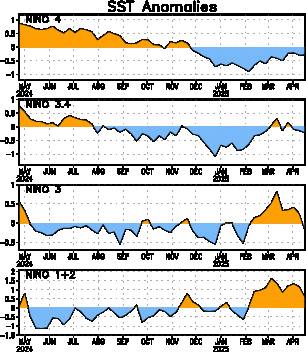
This is from Climate Prediction Center weekly updates.Moderate El Nino continues this week.

Niño 4= +1.6ºC
Niño 3.4= +1.7ºC
Niño 3= +1.3ºC
Niño1+2= +0.2ºC


Image

http://www.cpc.ncep.noaa.gov/products/a ... ts-web.pdf
0 likes   
Visit the Caribbean-Central America Weather Thread where you can find at first post web cams,radars
and observations from Caribbean basin members Click Here

User avatar
Ntxw
Storm2k Moderator
Storm2k Moderator
Posts: 22783
Joined: Wed Oct 21, 2009 6:34 pm
Location: DFW, Texas

#19 Postby Ntxw » Mon Nov 30, 2009 10:06 pm

Thanks :D
0 likes   
The above post and any post by Ntxw is NOT an official forecast and should not be used as such. It is just the opinion of the poster and may or may not be backed by sound meteorological data. It is NOT endorsed by any professional institution including Storm2k. For official information, please refer to NWS products.


  Help support Storm2K!

Help Support Storm2K


User avatar
cycloneye
Admin
Admin
Posts: 145247
Age: 68
Joined: Thu Oct 10, 2002 10:54 am
Location: San Juan, Puerto Rico

Re:

#20 Postby cycloneye » Mon Nov 30, 2009 10:23 pm

Ntxw wrote:Thanks :D


If you want to know more about what is going on with ENSO,you can go to the thread dedicated to that at Talking Tropics forum.

viewtopic.php?f=31&t=92137&hilit=&p=1948002#p1948002
0 likes   
Visit the Caribbean-Central America Weather Thread where you can find at first post web cams,radars
and observations from Caribbean basin members Click Here


Return to “Winter Weather”

Who is online

Users browsing this forum: No registered users and 14 guests