ATL: TROPICAL LOW ex-FRED (ex-07L)

Moderator: S2k Moderators

Message
Author
Aric Dunn
Category 5
Category 5
Posts: 21238
Age: 42
Joined: Sun Sep 19, 2004 9:58 pm
Location: Ready for the Chase.
Contact:

Re: Re:

#1601 Postby Aric Dunn » Sun Sep 20, 2009 11:05 pm

LarryWx wrote:
Aric Dunn wrote:well eclipse time again.. which means sleep .:)


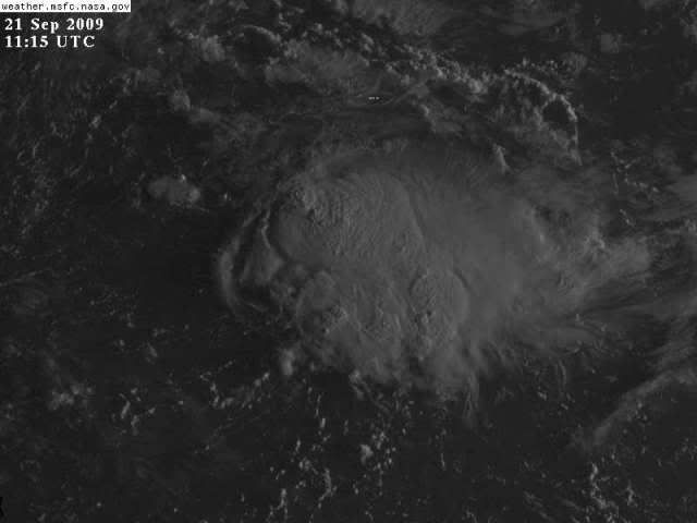
The 11:30 PM sat. photo suggests warming of the coldest cloud tops. However, the overall area of convection seems to be spreading out/growing in size all around the area of lowest pressure. So, I can't tell that this is necessarily a sign that the convection is pretty much going to go poof. Any other opinions? Aric, before you hit the sack, any comments? Otherwise, good night.


I pretty sure what we see with the convection recently is not much weakening of the shear rather just becoming more divergent which is helping convection. if you look at the upper flow on WV the trough over the US is pulling NNE and we have a ull over the southern gulf that has been in part the problem with the shear. but the trough lifting out has shifted the flow or split it a little making it more divergent. GFS weakens the shear down to 10kts tomorrow evening and is more divergent as well. Not saying it will develop but it is probably going to be its last chance..
0 likes   

Aric Dunn
Category 5
Category 5
Posts: 21238
Age: 42
Joined: Sun Sep 19, 2004 9:58 pm
Location: Ready for the Chase.
Contact:

Re:

#1602 Postby Aric Dunn » Sun Sep 20, 2009 11:06 pm

IvanSurvivor wrote:Before u go Aric, what's that in the GOM?

looks like a old boundary left over.. would not worry too much about it..
0 likes   

User avatar
deltadog03
Professional-Met
Professional-Met
Posts: 3580
Joined: Tue Jul 05, 2005 6:16 pm
Location: Macon, GA

Re: ATL: TROPICAL LOW ex-FRED (ex-07L)

#1603 Postby deltadog03 » Sun Sep 20, 2009 11:14 pm

To elab on what Aric said

Image
0 likes   

IvanSurvivor
Tropical Storm
Tropical Storm
Posts: 152
Joined: Wed Aug 20, 2008 12:12 am
Location: Pensacola Florida (Warrington)

#1604 Postby IvanSurvivor » Sun Sep 20, 2009 11:18 pm

Thanks...Good Night!
0 likes   

LarryWx
S2K Supporter
S2K Supporter
Posts: 6305
Joined: Sun Sep 07, 2003 2:04 pm
Location: GA

Re: ATL: TROPICAL LOW ex-FRED (ex-07L)

#1605 Postby LarryWx » Sun Sep 20, 2009 11:19 pm

Is shear best estimated by looking at 300 mb or is it better to look at 200 mb maps? Anyone? Thanks.
0 likes   

Aric Dunn
Category 5
Category 5
Posts: 21238
Age: 42
Joined: Sun Sep 19, 2004 9:58 pm
Location: Ready for the Chase.
Contact:

Re: ATL: TROPICAL LOW ex-FRED (ex-07L)

#1606 Postby Aric Dunn » Sun Sep 20, 2009 11:22 pm

LarryWx wrote:Is shear best estimated by looking at 300 mb or 200 mb maps? Anyone? Thanks.


well really from all layers.. its calculated through all layers but typically the 200 to 300 mb layer is a good area to look for trouble areas. Mid level shear is typically worse as it disrupts the convection well before it can mature.
Last edited by Aric Dunn on Sun Sep 20, 2009 11:23 pm, edited 1 time in total.
0 likes   

User avatar
deltadog03
Professional-Met
Professional-Met
Posts: 3580
Joined: Tue Jul 05, 2005 6:16 pm
Location: Macon, GA

#1607 Postby deltadog03 » Sun Sep 20, 2009 11:23 pm

Larry, I usually go by the time of year. Usually in summer I will look at 200mb. However you can look at either one. 200,250 and 300 on the gfs show very light winds over next 36 hours over that area.
0 likes   

LarryWx
S2K Supporter
S2K Supporter
Posts: 6305
Joined: Sun Sep 07, 2003 2:04 pm
Location: GA

Re: ATL: TROPICAL LOW ex-FRED (ex-07L)

#1608 Postby LarryWx » Sun Sep 20, 2009 11:37 pm

Thanks Aric and Delta. Time to call it a night. Nobody knows what tomorrow will hold for sure, but it does seem to have suddenly gotten a bit more interesting these last couple of hours not too far away from the SE. What a fascinating system.

IF this were to later affect the SE in a bodily way, I'd lean toward a weak hit on the Carolina's as of now. However, that (strength and track) is far from set in stone. The key is the door is pretty wide open for a potential hit in the SE within a few days if something were to actually get more organized. Also, it appears to me that this system will be moving pretty slowly and may even come close to stalling at times later in the week. So, it may be awhile before we know its ultimate fate.
Good night!
0 likes   

User avatar
carolina_73
Tropical Storm
Tropical Storm
Posts: 148
Joined: Wed Jul 23, 2008 1:30 am

Re: ATL: TROPICAL LOW ex-FRED (ex-07L)

#1609 Postby carolina_73 » Mon Sep 21, 2009 2:42 am

Fred sure is a fighter.
Image Image
0 likes   

User avatar
Nimbus
Category 5
Category 5
Posts: 5300
Joined: Mon Jul 19, 2004 10:54 am

#1610 Postby Nimbus » Mon Sep 21, 2009 5:32 am

The convection that is blossoming is quite far east of the LLC. There does still seem to be a closed surface circulation moving west under the new upper level high. The reports we have been getting claim surface pressures have risen and the low pressure at the surface has become very broad and shallow. That would be consistent with a system that spun itself down over a long time.

The exiting trough could be just fanning up convection one last time, and if so ex Fred would dissipate once he gets under the upper level high. Did any of you die hard Fred patrons find any surface pressure readings below 1012? If the LLC had a small area of relatively lower pressure at the surface Fred might have a chance to spin back up. The pro mets are probably correct and the pressure gradient is flat as a pie pan though.
0 likes   

Aric Dunn
Category 5
Category 5
Posts: 21238
Age: 42
Joined: Sun Sep 19, 2004 9:58 pm
Location: Ready for the Chase.
Contact:

#1611 Postby Aric Dunn » Mon Sep 21, 2009 5:54 am

its never looked this good.. this thing is ridiculous .. lol
0 likes   

Aric Dunn
Category 5
Category 5
Posts: 21238
Age: 42
Joined: Sun Sep 19, 2004 9:58 pm
Location: Ready for the Chase.
Contact:

Re: ATL: TROPICAL LOW ex-FRED (ex-07L)

#1612 Postby Aric Dunn » Mon Sep 21, 2009 5:57 am

CHeck out the Shear falling like a rock .. right in its path ..lol

Image
0 likes   

xironman
S2K Supporter
S2K Supporter
Posts: 2522
Joined: Sun Jun 10, 2007 4:53 pm
Location: NoVA

Re: ATL: TROPICAL LOW ex-FRED (ex-07L)

#1613 Postby xironman » Mon Sep 21, 2009 6:07 am

Aric Dunn wrote:CHeck out the Shear falling like a rock .. right in its path ..lol


You can see that just by watching the cirrus. The first set of visibles should be interesting to see where the swirl is compared to the convection.
0 likes   

User avatar
deltadog03
Professional-Met
Professional-Met
Posts: 3580
Joined: Tue Jul 05, 2005 6:16 pm
Location: Macon, GA

#1614 Postby deltadog03 » Mon Sep 21, 2009 6:07 am

hmmm...just opened the eyeballs for a quick few and what the heck fred. ha the llc still looks pretty solid and its under some nice convection. and if that shear map is correct Aric, this thing could try to spin up today. wxman, I think you need more raid.
0 likes   

Aric Dunn
Category 5
Category 5
Posts: 21238
Age: 42
Joined: Sun Sep 19, 2004 9:58 pm
Location: Ready for the Chase.
Contact:

Re: ATL: TROPICAL LOW ex-FRED (ex-07L)

#1615 Postby Aric Dunn » Mon Sep 21, 2009 6:11 am

xironman wrote:
Aric Dunn wrote:CHeck out the Shear falling like a rock .. right in its path ..lol


You can see that just by watching the cirrus. The first set of visibles should be interesting to see where the swirl is compared to the convection.


its at pretty much 30.3 N 74W heading nearly Due west..
0 likes   

xironman
S2K Supporter
S2K Supporter
Posts: 2522
Joined: Sun Jun 10, 2007 4:53 pm
Location: NoVA

Re: ATL: TROPICAL LOW ex-FRED (ex-07L)

#1616 Postby xironman » Mon Sep 21, 2009 6:18 am

Aric Dunn wrote:
xironman wrote:
Aric Dunn wrote:CHeck out the Shear falling like a rock .. right in its path ..lol


You can see that just by watching the cirrus. The first set of visibles should be interesting to see where the swirl is compared to the convection.


its at pretty much 30.3 N 74W heading nearly Due west..

So the convection is displaced east There almost looked like there was a spin a bit south of that earlier on the IR2. Say around 29N, but my eyes hurt from watching this for weeks.
0 likes   

User avatar
HURAKAN
Professional-Met
Professional-Met
Posts: 46086
Age: 38
Joined: Thu May 20, 2004 4:34 pm
Location: Key West, FL
Contact:

#1617 Postby HURAKAN » Mon Sep 21, 2009 6:36 am

Image

Latest
0 likes   

User avatar
cycloneye
Admin
Admin
Posts: 145300
Age: 68
Joined: Thu Oct 10, 2002 10:54 am
Location: San Juan, Puerto Rico

Re: ATL: TROPICAL LOW ex-FRED (ex-07L)

#1618 Postby cycloneye » Mon Sep 21, 2009 6:36 am

TROPICAL WEATHER OUTLOOK
NWS TPC/NATIONAL HURRICANE CENTER MIAMI FL
800 AM EDT MON SEP 21 2009

FOR THE NORTH ATLANTIC...CARIBBEAN SEA AND THE GULF OF MEXICO...

TROPICAL CYCLONE FORMATION IS NOT EXPECTED DURING THE NEXT 48 HOURS.

$$
FORECASTER PASCH
0 likes   

User avatar
ronjon
Category 5
Category 5
Posts: 4822
Joined: Fri Aug 19, 2005 5:17 pm
Location: Hernando Beach, FL

Re: ATL: TROPICAL LOW ex-FRED (ex-07L)

#1619 Postby ronjon » Mon Sep 21, 2009 6:41 am

Looks like the LLC has tucked under the western convection near 29.5N-73.5W accoding to shortwave IR SAT - need VIS to confirm. Wow, ole freddie has more lives than a cat. Shear has dropped way down - does it develop or pulse down again. Gonna run smack into a DLM ridge near SC or possibly get pushed SW back toward FL.

http://www.ssd.noaa.gov/goes/east/watl/loop-ir2.html
0 likes   

User avatar
alan1961
Category 2
Category 2
Posts: 771
Joined: Mon Mar 20, 2006 11:58 am
Location: Derby, Derbyshire, England
Contact:

Re: ATL: TROPICAL LOW ex-FRED (ex-07L)

#1620 Postby alan1961 » Mon Sep 21, 2009 6:45 am

http://miami.justweather.com/hurricane/#lightbox=p50

30 minute delay radar on wlpg, loop the GOM.
0 likes   


Return to “2009”

Who is online

Users browsing this forum: No registered users and 4 guests