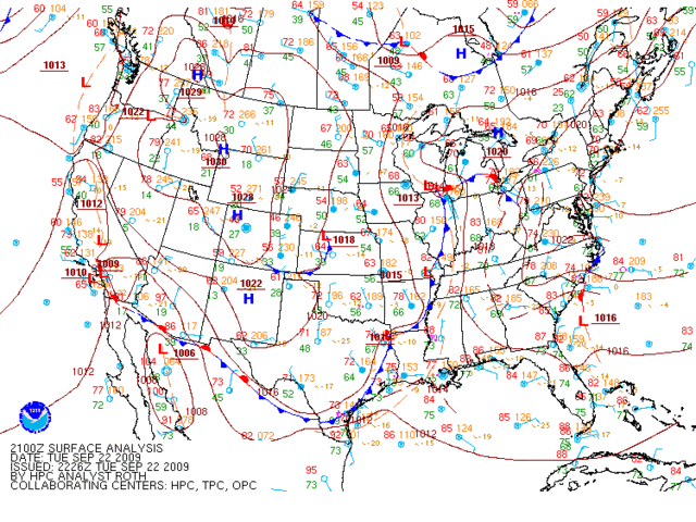
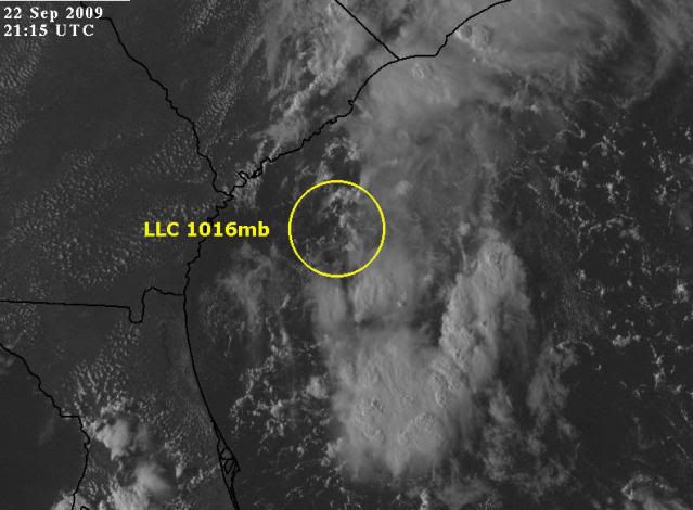
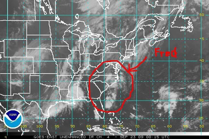
Well tomorrow we can put Fred to rest, although wxman57 once said in this thread that it would probably come onshore and then continue to the west coast! lol. The HPC now has it as a 1016mb low approaching the GA/SC border. It should bring a pretty good amount of rain into the SE coast from northern Fl to NC, especially SC it looks like. BTW, wxman57, I saw what you posted earlier about the HPC putting an L on the map sometimes to represent a little low level vorticity at times. The way I learned to forecast at Penn State is that if I see an L and have doubts, go look at the HPC and local AFD discussions and you can get a pretty good idea. If you go look at JAX or CHS or others on the SE coast, AND the NHC discussion from this afternoon, they all say there's a closed low out there still (embedded in a tropical wave/inverted trough), they all say it's moving WNW, and they all say it's the remnants of Fred. That's why I think the little L on the HPC surface analysis is Fred. When it's gone, and they don't show it, and don't mention Fred, Fred's gone.
Here's an excerpt from the 2:05PM NHC Tropical Weather Discussion:
000
AXNT20 KNHC 221720
TWDAT
TROPICAL WEATHER DISCUSSION
NWS TPC/NATIONAL HURRICANE CENTER MIAMI FL
205 PM EDT TUE SEP 22 2009
THE ATLANTIC OCEAN...
AN UPPER LEVEL TROUGH IS ALONG 78W/79W FROM 31N TO GRAND BAHAMA ISLAND TO THE COAST OF CUBA NEAR 21N77W. THE 1017 MB LOW PRESSURE CENTER NEAR 31N THAT IS ALONG THE TROUGH IS THE REMNANT LOW OF HURRICANE FRED.