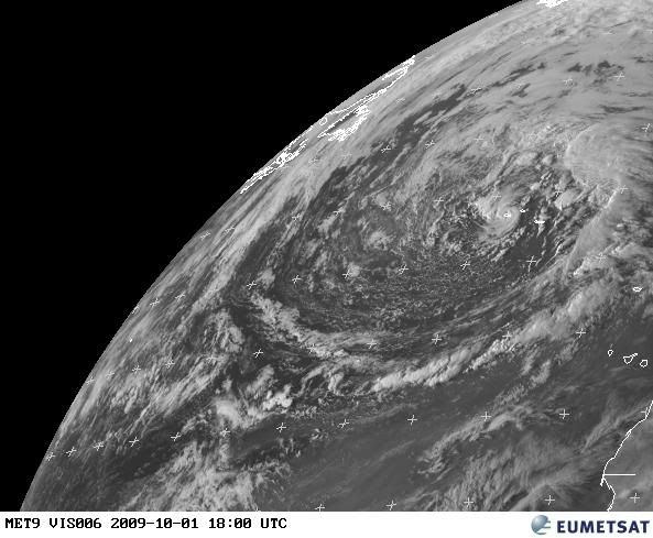
We've seen TCs develop in the core of large extratropical lows in the past. The Halloween hurricane of 1991 would be an example. SSTs near the Azores are about 22C. A bit chilly, but not too cold for a hybrid type storm. This low is no longer frontal, as it's well-separated from the occluded front. That feature which looks like an eye probably isn't indicative of it being a hurricane. I don't think it's a true eye. Surface obs in the area are only in the 20-25 kt range across the Azores, with higher winds 300-400 miles to the north and east. This morning's QS had a gap right through the Azores, but did show a number of 30kt winds around the perimeter of the low.
Should it be named? First we'd need some evidence that it is producing TS winds. No data to support that now, nor is there data to confirm it doesn't have TS winds. It doesn't have any deep convection around the center, so that's an argument against classifying it as tropical. Maybe an STS if winds of 39 mph are indicated.
It'll probably hang around the Azores for a few days before accelerating off to the NE over much colder water.
Here's a surface plot:


