TROPICAL WEATHER OUTLOOK
NWS TPC/NATIONAL HURRICANE CENTER MIAMI FL
800 AM EDT THU OCT 8 2009
FOR THE NORTH ATLANTIC...CARIBBEAN SEA AND THE GULF OF MEXICO...
THE NATIONAL HURRICANE CENTER IS ISSUING ADVISORIES ON TROPICAL
DEPRESSION HENRI...LOCATED ABOUT 165 MILES NORTHEAST OF THE
NORTHERN LEEWARD ISLANDS.
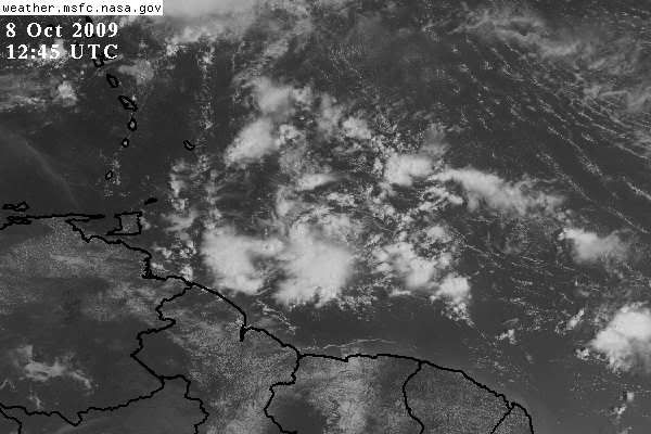
SHOWERS AND THUNDERSTORMS ASSOCIATED WITH A TROPICAL WAVE LOCATED
ABOUT 350 MILES EAST OF THE SOUTHERN WINDWARD ISLANDS REMAIN POORLY
ORGANIZED. DEVELOPMENT...IF ANY...OF THIS SYSTEM SHOULD BE SLOW TO
OCCUR AS IT MOVES TO THE WEST-NORTHWEST AT ABOUT 15 TO 20 MPH.
THERE IS A LOW CHANCE...LESS THAN 30 PERCENT...OF THIS SYSTEM
BECOMING A TROPICAL CYCLONE DURING THE NEXT 48 HOURS.
ELSEWHERE...TROPICAL CYCLONE FORMATION IS NOT EXPECTED DURING THE
NEXT 48 HOURS.
$$
FORECASTER BLAKE
Wave behind Henri
Moderator: S2k Moderators
Forum rules

The posts in this forum are NOT official forecasts and should not be used as such. They are just the opinion of the poster and may or may not be backed by sound meteorological data. They are NOT endorsed by any professional institution or STORM2K. For official information, please refer to products from the National Hurricane Center and National Weather Service.
-
cycloneye

- Admin

- Posts: 149520
- Age: 69
- Joined: Thu Oct 10, 2002 10:54 am
- Location: San Juan, Puerto Rico
Re: Wave behind Henri
0 likes
Visit the Caribbean-Central America Weather Thread where you can find at first post web cams,radars
and observations from Caribbean basin members Click Here
and observations from Caribbean basin members Click Here


-
somethingfunny

- ChatStaff

- Posts: 3926
- Age: 37
- Joined: Thu May 31, 2007 10:30 pm
- Location: McKinney, Texas
Re: Wave behind Henri
This is the new 92L, right?
It's too close to Henri to allow them both to develop properly IMO. I think this will become the dominant system.
It's too close to Henri to allow them both to develop properly IMO. I think this will become the dominant system.
0 likes
-
cycloneye
- Admin
- Posts: 149520
- Age: 69
- Joined: Thu Oct 10, 2002 10:54 am
- Location: San Juan, Puerto Rico
Re: Wave behind Henri
Thread locked because is invest 92L.Go to the 92L thread at active storms forum to continue the discussions.
viewtopic.php?f=62&p=1931459#p1931459
viewtopic.php?f=62&p=1931459#p1931459
0 likes
Visit the Caribbean-Central America Weather Thread where you can find at first post web cams,radars
and observations from Caribbean basin members Click Here
and observations from Caribbean basin members Click Here
Who is online
Users browsing this forum: HurricaneRyan, Ulf and 57 guests