WPAC : TROPICAL DEPRESSION MIRINAE (23W)
Moderator: S2k Moderators
-
Derek Ortt
-
cycloneye

- Admin

- Posts: 149751
- Age: 69
- Joined: Thu Oct 10, 2002 10:54 am
- Location: San Juan, Puerto Rico
Re: WPAC : TYPHOON MIRINAE (23W) PAGASA=TYPHOON SANTI
I agree that Baler is the area that Jim may go the most north.South from there Jim. 
0 likes
Visit the Caribbean-Central America Weather Thread where you can find at first post web cams,radars
and observations from Caribbean basin members Click Here
and observations from Caribbean basin members Click Here
-
ozonepete
- Professional-Met

- Posts: 4743
- Joined: Mon Sep 07, 2009 3:23 pm
- Location: From Ozone Park, NYC / Now in Brooklyn, NY
Re: WPAC : TYPHOON MIRINAE (23W) PAGASA=TYPHOON SANTI
Aslkahuna wrote:Based on the track at about 16.1N best location for an intercept would be around Dingalan Bay or between there and Baler. That track lies along the base of the northern mountains and comes out between Dagupan and San Fernando La Union. Intensity will be the main key here. DMIA (Old Clark Field) will be protected by the mountains to the West so may not bring much more than 40-50 kt gusts (STY Rita took the same track which passes 48 miles north of DMIA in 1978 and brought 58kt gusts but it was a much stronger storm at landfall). Manila and Subic open to the South China Sea will see stronger gusts and heavier rains. If rapid motion continues, the storm effects will be relatively short in duration.
Steve
Boy is it great to have you around! Thanks for posting that Steve.
0 likes
-
metenthusiast

- Category 1

- Posts: 271
- Age: 48
- Joined: Sun Oct 18, 2009 1:09 am
- Location: Manila, Phllippines
- Contact:
Re: WPAC : TYPHOON MIRINAE (23W) PAGASA=TYPHOON SANTI
I see that JTWc and JMA is starting to be in agreement with the tracks... bringing it further south and nearer to Metro Manila...


0 likes
-
oaba09
- S2K Supporter

- Posts: 1496
- Age: 39
- Joined: Thu Oct 01, 2009 10:02 am
- Location: Valenzuela, Philippines
- Contact:
Re: WPAC : TYPHOON MIRINAE (23W) PAGASA=TYPHOON SANTI
metenthusiast wrote:I see that JTWc and JMA is starting to be in agreement with the tracks... bringing it further south and nearer to Metro Manila...
I hope you're prepared for this saturday
0 likes
-
metenthusiast
- Category 1
- Posts: 271
- Age: 48
- Joined: Sun Oct 18, 2009 1:09 am
- Location: Manila, Phllippines
- Contact:
Re: Re:
ozonepete wrote:oaba09 wrote:ozonepete wrote:
I know too! I wish I was there.
In the Philippines, if you're a storm chaser, you don't need to travel a lot....The typhoons come right at ya........
Sure looks like you won't have to go anywhere to see most of this one, my friend. Just promise you won't worry so much. And I promise we will all be here to provide information as we can, and remember, the mountains to your east DO offer a lot of protection. As far as the rains go, you know this is very serious so I hope you have your evacuation plans ready. You do, right? And do you have plans on how to get in communication with your loved ones and maybe even us if you get separated? I hope so.
Jim, just NEVER put your guard down whenever you're chasing storms here in the Philippines, and always think ahead of time to ascertain your options and contingencies. Right here, it's no just the storm itslef you're gonna have to watch but the terrain conditions as well. The mountains DO offer a lot of protection, as far as wind deflection is concerned. But let me remind you that they also POSE a threat by means of landslides if things get rough and out of hand. The mountain regions in Luzon are quite notorious on this aspects, as might already knew from past occurrence and in the news.
Just be careful and stay safe.
0 likes
-
ozonepete
- Professional-Met
- Posts: 4743
- Joined: Mon Sep 07, 2009 3:23 pm
- Location: From Ozone Park, NYC / Now in Brooklyn, NY
Re:
Derek Ortt wrote:I don't quite agree with 90KT. I still favor closer to a 75KT intensity for the time being, though based upon the latest microwave, it may quickly reach 90-100KT over the next 12-24 hours
Gotta agree. Very rare to see a 90 knot tropical cyclone that has never had an eye unobscured by clouds. The eye has only partially and briefly shown up in conventional satellite images in the last 24 hours. Pretty odd.
0 likes
-
metenthusiast
- Category 1
- Posts: 271
- Age: 48
- Joined: Sun Oct 18, 2009 1:09 am
- Location: Manila, Phllippines
- Contact:
Re: WPAC : TYPHOON MIRINAE (23W) PAGASA=TYPHOON SANTI
oaba09 wrote:metenthusiast wrote:I see that JTWc and JMA is starting to be in agreement with the tracks... bringing it further south and nearer to Metro Manila...
I hope you're prepared for this saturday
Thanks! Don't worry, I have been expecting the worse (i.e. a much southern track for Mirinae) from the start, so I'm already prepared ever since this started. I'm also having my dialysis schedule tomorrow, Friday, instead of my usual treatment on Saturday.
0 likes
-
ozonepete
- Professional-Met
- Posts: 4743
- Joined: Mon Sep 07, 2009 3:23 pm
- Location: From Ozone Park, NYC / Now in Brooklyn, NY
Re: WPAC : TYPHOON MIRINAE (23W) PAGASA=TYPHOON SANTI
Definitely going west-southwest. Metro Manila could easily get a direct hit.
0 likes
-
metenthusiast
- Category 1
- Posts: 271
- Age: 48
- Joined: Sun Oct 18, 2009 1:09 am
- Location: Manila, Phllippines
- Contact:
Re: WPAC : TYPHOON MIRINAE (23W) PAGASA=TYPHOON SANTI
ozonepete wrote:Definitely going west-southwest. Metro Manila could easily get a direct hit.
That's bad. I hope this baby levels out on a westward track sooner. But if it doesn't, I'm sure those words of yours would be prophetic and we might get a direct hit....
0 likes
-
oaba09
- S2K Supporter
- Posts: 1496
- Age: 39
- Joined: Thu Oct 01, 2009 10:02 am
- Location: Valenzuela, Philippines
- Contact:
Re: WPAC : TYPHOON MIRINAE (23W) PAGASA=TYPHOON SANTI
ozonepete wrote:Definitely going west-southwest. Metro Manila could easily get a direct hit.
I'm expecting for the electricity to go out on saturday because of this so you guys will probably not hear from us come mirinae's landfall......
0 likes
-
ozonepete
- Professional-Met
- Posts: 4743
- Joined: Mon Sep 07, 2009 3:23 pm
- Location: From Ozone Park, NYC / Now in Brooklyn, NY
Re: WPAC : TYPHOON MIRINAE (23W) PAGASA=TYPHOON SANTI
Very fascinating tropical cyclone. I assume that the easterly shear has been more in the upper levels and thus has had more of a limited effect than deeper shear would. It would certainly help to explain the constantly overcast eye. But I'm also wondering if, in the end, there has been some consistent but small-scale ingestion of dry air that has been preventing the thunderstorms in the central region to grow as high as they mght have. Hopefully a thorough post-mortem will tell.
0 likes
-
cycloneye
- Admin
- Posts: 149751
- Age: 69
- Joined: Thu Oct 10, 2002 10:54 am
- Location: San Juan, Puerto Rico
Re: WPAC : TYPHOON MIRINAE (23W) PAGASA=TYPHOON SANTI
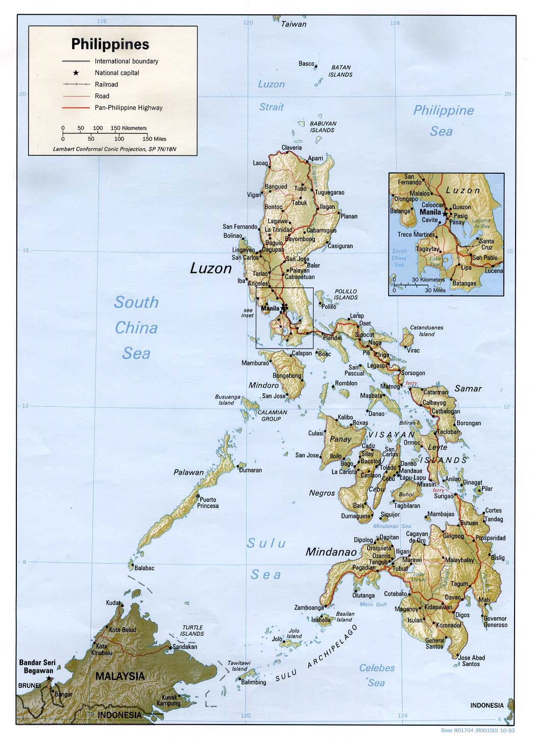
Pagasa 11 AM Warning

Location of Center:
(as of 10:00 a.m.) 890 km East of Casiguran, Aurora
Coordinates: 16.0°N, 131.7°E
Strength: Maximum sustained winds of 150 kph near the center
and gustiness of up to 185 kph
Movement: West at 24 kph
Forecast Positions/Outlook: Friday morning:
440 km East of Casiguran, Aurora
Saturday morning:
Vicinity of Casiguran, Aurora or
210 km Northeast of Manila
Sunday morning:
170 km West of Dagupan City or
280 km Northwest of Manila
0 likes
Visit the Caribbean-Central America Weather Thread where you can find at first post web cams,radars
and observations from Caribbean basin members Click Here
and observations from Caribbean basin members Click Here


Re: WPAC : TYPHOON MIRINAE (23W) PAGASA=TYPHOON SANTI
ozonepete wrote:Very fascinating tropical cyclone. I assume that the easterly shear has been more in the upper levels and thus has had more of a limited effect than deeper shear would. It would certainly help to explain the constantly overcast eye. But I'm also wondering if, in the end, there has been some consistent but small-scale ingestion of dry air has been preventing the thunderstorms in the central region to grow as high as they mght have. Hopefully a thorough post-mortem will tell.
I agree with you, I think that dry air could be a possibility. Dry air has been present to the west of the storm since the beginning and although it has been able to moisten its path, if there is some wind shear dry air incursion it's not out of question.
0 likes

Re: Re:
I know too! I wish I was there. [/quote]
In the Philippines, if you're a storm chaser, you don't need to travel a lot....The typhoons come right at ya........[/quote]
Sure looks like you won't have to go anywhere to see most of this one, my friend. Just promise you won't worry so much. And I promise we will all be here to provide information as we can, and remember, the mountains to your east DO offer a lot of protection. As far as the rains go, you know this is very serious so I hope you have your evacuation plans ready. You do, right? And do you have plans on how to get in communication with your loved ones and maybe even us if you get separated? I hope so.[/quote]
Jim, just NEVER put your guard down whenever you're chasing storms here in the Philippines, and always think ahead of time to ascertain your options and contingencies. Right here, it's no just the storm itslef you're gonna have to watch but the terrain conditions as well. The mountains DO offer a lot of protection, as far as wind deflection is concerned. But let me remind you that they also POSE a threat by means of landslides if things get rough and out of hand. The mountain regions in Luzon are quite notorious on this aspects, as might already knew from past occurrence and in the news.
Just be careful and stay safe. [/quote]
Will do. Once I get on the ground with my compass and check out the topography I'll find a good place to hole up. If you folks would kindly post anything new on this site then I'll get it much faster. I'll be using a Globe tatoo USB wireless card on the road and it's pretty slow as it is. Anything to cut the download time is much appreciated. Also, commentary, analysis, etc is much appreciated as it helps me dial in to what is going on quickly. I'll post when I can here or on twitter at "extremestorms". Time to catch a plane . . .
In the Philippines, if you're a storm chaser, you don't need to travel a lot....The typhoons come right at ya........[/quote]
Sure looks like you won't have to go anywhere to see most of this one, my friend. Just promise you won't worry so much. And I promise we will all be here to provide information as we can, and remember, the mountains to your east DO offer a lot of protection. As far as the rains go, you know this is very serious so I hope you have your evacuation plans ready. You do, right? And do you have plans on how to get in communication with your loved ones and maybe even us if you get separated? I hope so.[/quote]
Jim, just NEVER put your guard down whenever you're chasing storms here in the Philippines, and always think ahead of time to ascertain your options and contingencies. Right here, it's no just the storm itslef you're gonna have to watch but the terrain conditions as well. The mountains DO offer a lot of protection, as far as wind deflection is concerned. But let me remind you that they also POSE a threat by means of landslides if things get rough and out of hand. The mountain regions in Luzon are quite notorious on this aspects, as might already knew from past occurrence and in the news.
Just be careful and stay safe.
Will do. Once I get on the ground with my compass and check out the topography I'll find a good place to hole up. If you folks would kindly post anything new on this site then I'll get it much faster. I'll be using a Globe tatoo USB wireless card on the road and it's pretty slow as it is. Anything to cut the download time is much appreciated. Also, commentary, analysis, etc is much appreciated as it helps me dial in to what is going on quickly. I'll post when I can here or on twitter at "extremestorms". Time to catch a plane . . .
0 likes
-
drdavisjr

- Category 1
- Posts: 428
- Age: 58
- Joined: Mon Oct 12, 2009 7:07 am
- Location: Marilao, Bulacan, Philippines
- Contact:
Re: Re:
JTE50 wrote:Will do. Once I get on the ground with my compass and check out the topography I'll find a good place to hole up. If you folks would kindly post anything new on this site then I'll get it much faster. I'll be using a Globe tatoo USB wireless card on the road and it's pretty slow as it is. Anything to cut the download time is much appreciated. Also, commentary, analysis, etc is much appreciated as it helps me dial in to what is going on quickly. I'll post when I can here or on twitter at "extremestorms". Time to catch a plane . . .
We'll be online as long as we can be
0 likes
Who is online
Users browsing this forum: No registered users and 47 guests