Moderator: S2k Moderators


jinftl wrote:A Cat 3 in the next 24 hours or a Cat 3 when approaching the Florida panhandle? For my education,which models are saying this?
Clearly the NHC isn't factoring those models in their forecast, particularly beyond 36 hours...Hurricanewatcher2007 wrote:jinftl wrote:Just so no one gets confused by the discussion here....the discussion is a general one....there is no forecast that is calling for Ida to have 115 mph winds...either as a hurricane or extratropical system...as she approaches the Gulf Coast and Florida. The current forecast calls for a 50 mph tropical storm transitioning into an equally squally extratropical low pressure late Tuesday. The biggest threats could be from coastal flooding and beach erosion in susceptible areas like the Florida Big Bend.
Its not a general discussion. Yes the official forecast doesn't have Ida getting to cat 3 but this isn't the thread for official forecasts. This is the model discussion which some of the models do show Ida getting to be a cat 3.


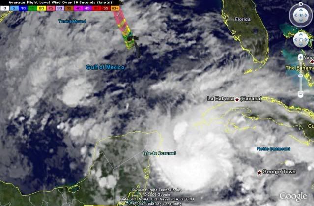
Evil Jeremy wrote:Not even a hurricane watch for Cuba. There needs to be a hurricane watch up for that area yesterday.
Ivanhater wrote:00z GFS...Nasty weather for the North Central Gulfcoast
robbielyn wrote:Ivanhater wrote:00z GFS...Nasty weather for the North Central Gulfcoast
See if this verifies jinftl, then west coast wont get diddly from the actual storm just gradient winds and peripheral rain it
never fails this is all we ever get.

Hurricanewatcher2007 wrote:
GFDL shows it.
18z GFDL=Cat 3 Landfall at Panhandle


Derek Ortt wrote:any warning would be needed for about 30 miles of Cuban coastline
Users browsing this forum: No registered users and 27 guests