


ATL : TROPICAL DEPRESSION IDA
Moderator: S2k Moderators
-
cycloneye

- Admin

- Posts: 149746
- Age: 69
- Joined: Thu Oct 10, 2002 10:54 am
- Location: San Juan, Puerto Rico
Re: ATL : HURRICANE IDA - Models
I think following the models at this point with 24 hours of a landfall is not too useful as we can follow Ida on satelite and see how is the intensity and track as it nears land.I dont know about you but the best performers for Ida were GFDL and HWRF on intensity and track.Maybe GFDL went a tad too agressive at one point making Ida a cat 5 and having landfall in the gulf coast as a cat 3 but overall it did fine.Same with HWRF.
0 likes
Visit the Caribbean-Central America Weather Thread where you can find at first post web cams,radars
and observations from Caribbean basin members Click Here
and observations from Caribbean basin members Click Here
-
Dave

- Retired Staff

- Posts: 13442
- Age: 75
- Joined: Tue Aug 01, 2006 3:57 pm
- Location: Milan Indiana
- Contact:
URNT15 KNHC 090333
AF304 0611A IDA HDOB 02 20091109
032530 3024N 08855W 0188 00000 0170 +211 +122 360000 000 999 999 23
032600 3024N 08855W 0188 00000 0170 +203 +124 360000 000 999 999 23
032630 3024N 08855W 0188 00000 0170 +203 +126 360000 000 999 999 23
032700 3024N 08856W 0188 00000 0170 +201 +127 360000 000 999 999 23
032730 3024N 08856W 0188 00000 0169 +200 +128 360000 000 999 999 23
032800 3024N 08856W 0187 00000 0168 +200 +129 360000 000 999 999 23
032830 3024N 08856W 0184 00000 0167 +200 +130 360000 000 999 999 23
032900 3024N 08856W 0186 00000 0168 +200 +130 360000 000 999 999 23
032930 3024N 08856W 0187 00000 0168 +200 +130 360000 000 999 999 23
033000 3024N 08856W 0187 00000 0169 +200 +130 360000 000 999 999 23
033030 3024N 08856W 0187 00000 0168 +200 +129 360000 000 999 999 23
033100 3024N 08856W 0186 00000 0168 +200 +129 360000 000 999 999 23
033130 3024N 08856W 0186 00000 0168 +200 +128 360000 000 999 999 23
033200 3024N 08856W 0181 00000 0165 +198 +128 360000 000 999 999 23
033230 3024N 08856W 0183 00000 0165 +205 +128 360000 000 999 999 23
033300 3024N 08856W 0184 00000 0166 +205 +128 360000 000 999 999 23
033330 3024N 08856W 0184 00000 0165 +200 +129 360000 000 999 999 23
033400 3024N 08856W 0179 00000 0163 +196 +137 053004 008 999 999 23
033430 3025N 08855W 0115 00039 0167 +194 +148 065013 020 999 999 03
033500 3026N 08854W 9868 00262 0175 +195 +134 081030 031 999 999 03
$$
;
Takeoff
0 likes
-
deltadog03

- Professional-Met

- Posts: 3580
- Joined: Tue Jul 05, 2005 6:16 pm
- Location: Macon, GA


-
gone2beach

- S2K Supporter

- Posts: 70
- Joined: Wed Aug 27, 2008 1:20 pm
- Location: Long Beach, MS
I guess the Weather Service in New Orleans/Baton Rouge, LA hasn't caught up with the latest yet....
http://forecast.weather.gov/MapClick.php?CityName=Long+Beach&state=MS&site=LIX&textField1=30.362&textField2=-89.1673&e=0
http://forecast.weather.gov/MapClick.php?CityName=Long+Beach&state=MS&site=LIX&textField1=30.362&textField2=-89.1673&e=0
Last edited by gone2beach on Sun Nov 08, 2009 10:44 pm, edited 1 time in total.
0 likes
-
IvanSurvivor
- Tropical Storm

- Posts: 152
- Joined: Wed Aug 20, 2008 12:12 am
- Location: Pensacola Florida (Warrington)
Re: ATL : HURRICANE IDA
JTE50 wrote:The Weather Channel's Jim Cantore is in Pensacola Beach now.
Confirmed?
0 likes

-
cycloneye
- Admin
- Posts: 149746
- Age: 69
- Joined: Thu Oct 10, 2002 10:54 am
- Location: San Juan, Puerto Rico
Re: ATL : HURRICANE IDA
JTE50 wrote:The Weather Channel's Jim Cantore is in Pensacola Beach now.
A perfect spot for him to report as he knows the area.
0 likes
Visit the Caribbean-Central America Weather Thread where you can find at first post web cams,radars
and observations from Caribbean basin members Click Here
and observations from Caribbean basin members Click Here
-
ozonepete
- Professional-Met
- Posts: 4743
- Joined: Mon Sep 07, 2009 3:23 pm
- Location: From Ozone Park, NYC / Now in Brooklyn, NY
Re: ATL : HURRICANE IDA
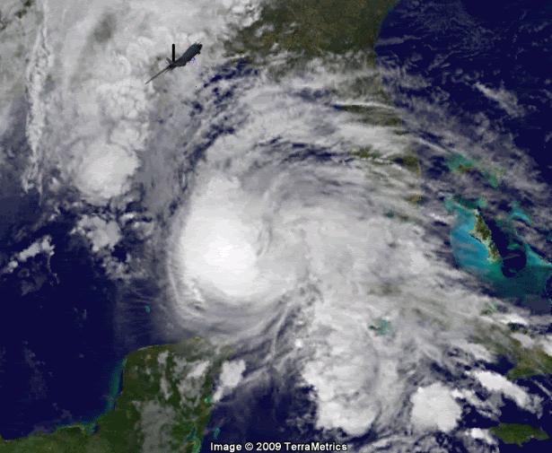
Aric Dunn wrote:Aric Dunn wrote:ozonepete wrote:Aric, you are the undisputed master of satellite interpretation. What the heck is going on on the eastern side?
some dry air maybe around, or its a dynamical issue... not sure really.. let me think about it.. lol
The center is pretty much dead center in the convection.. slight to the right side though, so as before the the eye probably closed or open on the east. would have to say maybe something to do with the old surface boundary to its east maybe inhibiting some in-flow. its hard to says really I dont have the answer right now. I will look around I guess .. lol
the dynamical possibility is that its forward motion is creating some greater convergence on the front left and the east side is left to catch up, that seems unlikely though cause lots of system have moved faster than this but maintained convection all around.
convection is maintaining quite well though everywhere else. .
I like your thoughts. It could very well be that it's a combination of two of the things you said. That the old surface boundary is inhibiting some inflow AND the better convergence on the left front is leaving the right side to periodically catch up. It's done it twice now in the last 24 hours, which is pretty impressive in itself. Thanks for taking the time to mull it over. I really just have to say that you keep calling future movements and strengths that a lot of people disagree with but you get proved right almost every time. Notice I said "almost". hehe
0 likes
-
attallaman
Re: ATL : HURRICANE IDA
Jim Cantore posted this on Twitter about an hour ago for those who want to take him some hot glazed KK's tomorrow morning.
In Pensacola Beach for Ida. This storm will have a long legacy through the week including abuse to some mid Atlantic beaches. Night all.
about 1 hour ago from web
0 likes
-
MGC

- S2K Supporter
- Posts: 5941
- Joined: Sun Mar 23, 2003 9:05 pm
- Location: Pass Christian MS, or what is left.
Re: ATL : HURRICANE IDA
Ida's looks to have peaked. Cloud tops are starting to warm and outflow looks to be becoming restricted. Ida also looks to be increasing in forward speed.....MGC
0 likes
-
IvanSurvivor
- Tropical Storm
- Posts: 152
- Joined: Wed Aug 20, 2008 12:12 am
- Location: Pensacola Florida (Warrington)
Re: ATL : HURRICANE IDA
IvanSurvivor wrote:JTE50 wrote:The Weather Channel's Jim Cantore is in Pensacola Beach now.
Confirmed?
We might know for sure if TWC actually reported weather instead of Storm Stories or March of the Penguins, etc.
0 likes
Re: ATL : HURRICANE IDA
IvanSurvivor wrote:JTE50 wrote:The Weather Channel's Jim Cantore is in Pensacola Beach now.
Confirmed?
Yes, it's on his twitter page
0 likes
-
Dave
- Retired Staff
- Posts: 13442
- Age: 75
- Joined: Tue Aug 01, 2006 3:57 pm
- Location: Milan Indiana
- Contact:
URNT15 KNHC 090343
AF304 0611A IDA HDOB 03 20091109
033530 3027N 08853W 9577 00500 0160 +181 +124 090030 031 999 999 03
033600 3029N 08854W 9221 00842 0181 +158 +114 105034 036 999 999 03
033630 3029N 08856W 8956 01123 0197 +140 +106 118036 036 999 999 03
033700 3029N 08858W 8585 01455 0182 +114 +098 128038 038 999 999 03
033730 3029N 08900W 8260 01792 0186 +106 +042 132033 037 999 999 03
033800 3028N 08902W 7957 02088 0164 +125 -061 134031 031 999 999 03
033830 3027N 08903W 7661 02402 0139 +118 -082 137028 029 999 999 03
033900 3026N 08905W 7428 02660 0138 +104 -093 131026 027 999 999 03
033930 3025N 08906W 7225 02907 0149 +093 -103 125024 024 999 999 03
034000 3024N 08908W 7030 03132 0153 +077 -116 125023 023 999 999 03
034030 3022N 08910W 6787 03413 0153 +054 -128 131024 024 999 999 03
034100 3021N 08911W 6570 03714 0163 +036 -142 134026 027 999 999 03
034130 3020N 08912W 6398 03915 0169 +019 -155 132029 029 999 999 03
034200 3018N 08912W 6214 04144 0184 +000 -166 125028 028 999 999 03
034230 3017N 08912W 6037 04381 0179 -016 -177 124029 030 999 999 03
034300 3015N 08912W 5874 04559 0149 -030 -187 127028 029 999 999 03
034330 3014N 08912W 5758 04717 0151 -040 -201 132029 030 999 999 03
034400 3012N 08912W 5612 04936 0165 -054 -217 141029 030 999 999 03
034430 3010N 08912W 5482 05117 0233 -066 -227 139026 027 999 999 03
034500 3009N 08912W 5350 05310 0239 -087 -195 144028 029 999 999 03
$$
;
0 likes
-
attallaman
Re: ATL : HURRICANE IDA
LOL.IvanSurvivor wrote:IvanSurvivor wrote:JTE50 wrote:The Weather Channel's Jim Cantore is in Pensacola Beach now.
Confirmed?
We might know for sure if TWC actually reported weather instead of Storm Stories or March of the Penguins, etc.
0 likes
Re: ATL : HURRICANE IDA
JTE50 wrote:The Weather Channel's Jim Cantore is in Pensacola Beach now.
Then Pensacola should be quite assured that Ida is not going to hit Pensacola...lol (j/k)
0 likes


Re:
Dean4Storms wrote:Try driving a high profile vehicle or truck and stay in a narrow lane on a bridge with winds above 45mph hitting you broadside and you'll understand why. It would look like a Bristol Nascar race out there!
The Florida Highway Patrol has closed bridges here in NE Florida in 40mph winds.
Dames Point and the Buckman Bridge are two that actively get closed.
Buckman is 3.5 miles long over the St Johns, fun to drive in high winds.
Dames Point is 175 feet high, that makes for fun as well.
Here in NE Florida, you can be stuck, considering there is only 7 bridges that connect the two sides of Duval County over the St Johns River.
0 likes
Who is online
Users browsing this forum: No registered users and 89 guests