Texas winter wx thread (2009-2010)
Moderator: S2k Moderators
Forum rules
 The posts in this forum are NOT official forecast and should not be used as such. They are just the opinion of the poster and may or may not be backed by sound meteorological data. They are NOT endorsed by any professional institution or STORM2K.

The posts in this forum are NOT official forecast and should not be used as such. They are just the opinion of the poster and may or may not be backed by sound meteorological data. They are NOT endorsed by any professional institution or STORM2K.
-
cheezyWXguy

- Category 5

- Posts: 6282
- Joined: Mon Feb 13, 2006 12:29 am
- Location: Dallas, TX
Re: Texas winter wx thread (2009-2010)
Complete changeover to snow here in plano. 33.4 degrees (wow, a lot lower than 40, huh) and snowing pretty heavily. Sticking to the grass, cars, rooves, everything except the roads.
0 likes

Re: Texas winter wx thread (2009-2010)
Snowing here in Dallas it's still mixed with rain a little, but mostly snow.
0 likes

-
zaqxsw75050

- Tropical Storm

- Posts: 178
- Joined: Thu Mar 06, 2008 4:21 pm
- Location: Hong Kong
Re: Texas winter wx thread (2009-2010)
Snowing here in Grand Prairie
Not very good pic but give you the idea what it is like outside

Not very good pic but give you the idea what it is like outside
0 likes
-
PTrackerLA

- Category 5
- Posts: 5281
- Age: 42
- Joined: Thu Oct 10, 2002 8:40 pm
- Location: Lafayette, LA
Re: Texas winter wx thread (2009-2010)
Let's see some pictures Dallas area! I hope to see some flakes Friday night but I'm afraid it will be too warm. I think this is just the start of our snow chances this winter in the south though.
0 likes
-
Extremeweatherguy

- Category 5
- Posts: 11095
- Joined: Mon Oct 10, 2005 8:13 pm
- Location: Florida
Re: Texas winter wx thread (2009-2010)
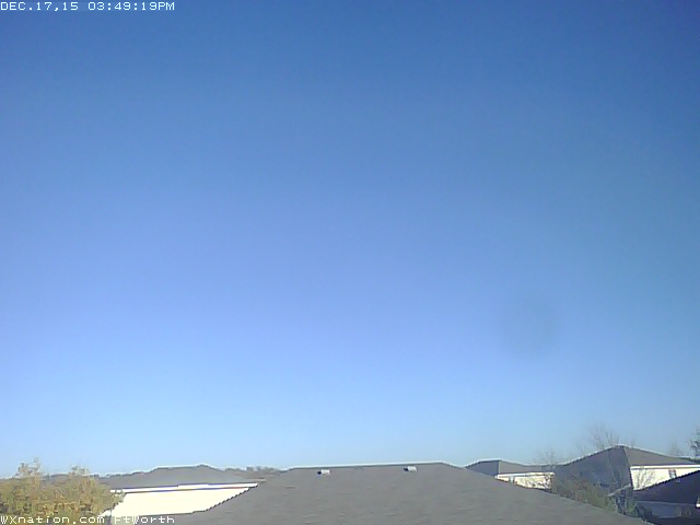
Webcam in Fort Worth is clearly showing the accumulating snow...
You guys down in the Dallas area are lucky! It's still just mainly a cold rain here in OKC.
You guys down in the Dallas area are lucky! It's still just mainly a cold rain here in OKC.
0 likes
-
srainhoutx

- S2K Supporter

- Posts: 6919
- Age: 68
- Joined: Sun Jan 14, 2007 11:34 am
- Location: Haywood County, NC
- Contact:
Re: Texas winter wx thread (2009-2010)
Congrats N TX folks.  Morning e-mail from Jeff...
Winter precipitation possible Friday
Large storm system that resulted in widespread moderate to heavy rains Tuesday evening is progressing eastward this morning while cold arctic air surges down the front range of the Rockies. Widespread 1-2 inches of rain fell yesterday evening over much of the area.
Cold arctic air mass with current temperatures in the teens over E CO and 20’s over W KS and NE NM will be surging southward into Texas tonight and into coastal Texas late Thursday. Short wave noted over the NW Rockies will track slowly ESE today and then gets kicked SE Thursday into eastern New Mexico as upstream speed max rotates into the system. Active sub-tropical jet is already pulling moisture toward central and NE Mexico this morning….El Nino??
Thursday night-Friday night:
Critical period comes Friday as cold arctic air mass settles over coastal Texas while W TX short wave then moves ESE and E across central into E TX during the day. 00Z GFS forecast soundings for 600am Friday morning for IAH are above freezing with the surface to near 800mb level (around 3,000 ft) above freezing. KCLL soundings for the same time shows a freezing level at 961mb (roughly 800 ft above the ground). By 600pm Friday, IAH, CLL, VCT, and HOU all show a profile with both air temperature and dewpoint at or below freezing. This suggest at NW to SE change over from rain to snow during the afternoon on Friday as cold air advection within the lower atmosphere brings the lower levels to below freezing.
So what about the moisture? GFS and NAM have trended drier when compared to yesterday and do not produce as much QPF across the region. GFS has also shifted the axis of heavier precipitation NW along a line from near Austin to Huntsville. Models also support the idea of another coastal low developing off the south Texas coast with the best moisture remaining offshore. I am tempted to go a little more wet than the models given the active look to the upstream sub-tropical jet and the overall wet fall pattern we have seen with these coastal low systems over the past few weeks.
Feel a large part of the area stands a decent shot of seeing snow by Friday evening…but the intensity and duration of the snow along with surface temperatures will greatly dictate any accumulations. Best chances of accumulations are currently along and NW of a line from Conroe to Wallis to Columbus and HPC is indicating 4” or greater possible into the Austin metro area and then into our extreme NW counties. For metro Houston and areas along US 59 expect to see the rain mix with and then change to snow Friday afternoon/evening. Will not go with accumulation just yet as ground temperatures will be warm and intensity of snowfall will have to overcome melting on impact. Will even see a mix and possible change over along the coast and into Victoria, northern Calhoun, and northern Jackson counties by Friday afternoon. If models trend wetter or offshore moisture moves a tad northward some significant accumulations would be possible all areas under meso scale snow bands.
Will continue to apply the degree of the forecast uncertainty in regards to how much moisture, timing of the short wave, and cooling of the air column. All ingredients must come together within about a 12 hour window Friday afternoon/evening for this event to produce snow. Best chances for this to happen is over our N and NW counties, but we are still over 48 hours from the start of the event and much can/will change in that amount of time.
Other item of concern will be very cold air by Saturday morning as short wave departs by midnight allowing skies to clear. Will likely see a widespread freeze over all areas with lows falling into the upper 20’s. This would be the first freeze of this winter and will require widespread freezing warnings. If snow cover is on the ground, temperatures could bottom out in the mid 20’s as ground warmth will be trapped under the snow cover.
Very cold Saturday under clear skies early as sun will go into melting any snow…especially N of I-10. Expect highs only in the mid to upper 40’s with a rapid increase in clouds during the afternoon. Another short wave in this very fast flow aloft approaches on Sunday with a coastal trough developing in the NW Gulf resulting in Gulf moisture upgliding over the cold arctic dome. Doubt this entrenched air mass will modify quickly and expect cloudy, cold, and periods of rain by Sunday.
0 likes
Carla/Alicia/Jerry(In The Eye)/Michelle/Charley/Ivan/Dennis/Katrina/Rita/Wilma/Ike/Harvey
Member: National Weather Association
Wx Infinity Forums
http://wxinfinity.com/index.php
Facebook.com/WeatherInfinity
Twitter @WeatherInfinity
Member: National Weather Association
Wx Infinity Forums
http://wxinfinity.com/index.php
Facebook.com/WeatherInfinity
Twitter @WeatherInfinity
-
HarlequinBoy

- Category 5
- Posts: 1400
- Age: 35
- Joined: Wed Nov 29, 2006 1:57 am
- Location: Memphis
Re: Texas winter wx thread (2009-2010)
Yay Dallas! I'm jealous. Maybe the Abilene/Dallas surprise will continue my way. Definitely doesn't look good for Memphis for the next storm. Best moisture is definitely over southeast Texas and what precip is expected to fall across the Deep South looks to fall across central Mississippi. Still not too far out for that to change though. It would blow if we just got the cold and no snow. Just like OKC. 
0 likes
-
HarlequinBoy
- Category 5
- Posts: 1400
- Age: 35
- Joined: Wed Nov 29, 2006 1:57 am
- Location: Memphis

Letting up here north of Dallas
0 likes
The above post and any post by Ntxw is NOT an official forecast and should not be used as such. It is just the opinion of the poster and may or may not be backed by sound meteorological data. It is NOT endorsed by any professional institution including Storm2k. For official information, please refer to NWS products.
Help support Storm2K!
-
Portastorm

- Storm2k Moderator

- Posts: 9954
- Age: 63
- Joined: Fri Jul 11, 2003 9:16 am
- Location: Round Rock, TX
- Contact:
Re:
iorange55 wrote:Uploading some quick video, and a few pictures. This is pretty awesome! It's been all snow for 45 minutes now, and it's sticking really nicely. Temp has dropped to 32, and there is still moderate snow coming down.
Hey iorange55, I'm happy for you! You've been coaxing this event on all week and your hard work pays off!!
0 likes
Hopefully the snow machine will get cranking on Friday and the rest of Texas (southern half) can enjoy some too!
0 likes
The above post and any post by Ntxw is NOT an official forecast and should not be used as such. It is just the opinion of the poster and may or may not be backed by sound meteorological data. It is NOT endorsed by any professional institution including Storm2k. For official information, please refer to NWS products.
Help support Storm2K!
Help support Storm2K!
-
HarlequinBoy
- Category 5
- Posts: 1400
- Age: 35
- Joined: Wed Nov 29, 2006 1:57 am
- Location: Memphis
Do weather offices in Texas not update snow amounts via LSRs? I kept trying to find snowfalls from both the El Paso and Midland/Odessa office and couldn't, and now I'm trying to find amounts from north Texas. It looks like southern Tarrant County should be getting pretty heavy snow. They have really high reflectivity.
0 likes
-
AggieSpirit
- Tropical Storm
- Posts: 223
- Joined: Sat Nov 29, 2003 5:18 am
- Location: Midlothian, TX
Re: Texas winter wx thread (2009-2010)
Snowing in Midlothian for about 45 minutes -- nice flakes - but just a dusting on the tops of roofs, cars, and grass.
Still, and early season treat. Wife and I been watching it and enjoying breakfast at Whataburger here. All the peeps in here pretty much in agreement that it is a pleasant surprise.
Still, and early season treat. Wife and I been watching it and enjoying breakfast at Whataburger here. All the peeps in here pretty much in agreement that it is a pleasant surprise.
0 likes
Re: Texas winter wx thread (2009-2010)
Thanks portastorm! Hopefully Austin gets some later this week :]
I'll try to get some video up a little showing more of the actual snow falling, but here are a few "silly" pictures

And then silly evolution came along, and he grew hair, arms, and legs.

Semi-bad picture of the snow falling

I'll try to get some video up a little showing more of the actual snow falling, but here are a few "silly" pictures
And then silly evolution came along, and he grew hair, arms, and legs.
Semi-bad picture of the snow falling
0 likes
-
CaptinCrunch

- S2K Supporter
- Posts: 8777
- Age: 58
- Joined: Mon Nov 03, 2003 4:33 pm
- Location: Kennedale, TX (Tarrant Co.)
-
cctxhurricanewatcher

- Category 5
- Posts: 1206
- Joined: Sun Sep 12, 2004 8:53 pm
- Location: Corpus Christi, Texas
Re: Texas winter wx thread (2009-2010)
KLEBERG-NUECES-
INCLUDING THE CITIES OF...KINGSVILLE...CORPUS CHRISTI
404 AM CST WED DEC 2 2009
FRIDAY...LIGHT RAIN LIKELY. BREEZY...COOLER. NEAR STEADY
TEMPERATURE IN THE MID 40S. NORTH WINDS 15 TO 25 MPH. CHANCE OF
RAIN 70 PERCENT.
.FRIDAY NIGHT...PARTLY CLOUDY WITH A 20 PERCENT CHANCE OF LIGHT
RAIN AND LIGHT SNOW IN THE EVENING...THEN MOSTLY CLEAR AFTER
MIDNIGHT. COLDER. LOWS AROUND 30 INLAND...IN THE MID 30S COAST.

0 likes
-
somethingfunny

- ChatStaff

- Posts: 3926
- Age: 37
- Joined: Thu May 31, 2007 10:30 pm
- Location: McKinney, Texas
Re: Texas winter wx thread (2009-2010)
AHHHHHHHHH OH MY GOD BEST MORNING EVER!!!!!!!!!!!!!!!!!!!!!!!!!!!
0 likes
Re:
CaptinCrunch wrote:snow over for most, changed back to rain, looks as if it nevered happened. but it was nice to see it fall.
Still snowing here. It's lighter, but it's still all snow. The roofs look mighty pretty
0 likes
Who is online
Users browsing this forum: No registered users and 29 guests