Texas winter wx thread (2009-2010)

Winter Weather Discussion

Moderator: S2k Moderators

Forum rules

The posts in this forum are NOT official forecast and should not be used as such. They are just the opinion of the poster and may or may not be backed by sound meteorological data. They are NOT endorsed by any professional institution or STORM2K.

Help Support Storm2K
Message
Author
User avatar
iorange55
Category 5
Category 5
Posts: 2388
Joined: Thu Nov 13, 2008 9:47 pm
Location: Big D

Re:

#1241 Postby iorange55 » Tue Dec 15, 2009 11:52 pm

Ntxw wrote:That's amazing though yet again I think the big storm is being pushed back some.


Well it never did really show a lot of moisture for Christmas, and it's still showing a strong push of cold air for Christmas. It hasn't really changed too much, I'm sure it'll go back and forth.
0 likes   

User avatar
srainhoutx
S2K Supporter
S2K Supporter
Posts: 6919
Age: 67
Joined: Sun Jan 14, 2007 11:34 am
Location: Haywood County, NC
Contact:

Re: Texas winter wx thread (2009-2010)

#1242 Postby srainhoutx » Tue Dec 15, 2009 11:54 pm

0 likes   
Carla/Alicia/Jerry(In The Eye)/Michelle/Charley/Ivan/Dennis/Katrina/Rita/Wilma/Ike/Harvey

Member: National Weather Association
Wx Infinity Forums
http://wxinfinity.com/index.php

Facebook.com/WeatherInfinity
Twitter @WeatherInfinity

User avatar
severe
Tropical Low
Tropical Low
Posts: 46
Joined: Fri Dec 19, 2008 9:14 pm
Location: N/W Galveston County

Re: Texas winter wx thread (2009-2010)

#1243 Postby severe » Tue Dec 15, 2009 11:56 pm

iorange55 wrote:lol this is ridiculous. The new GFS is basically predicting the end of the world

Looks like the Great southern blizzard of 2009. :eek:
0 likes   

User avatar
Ntxw
Storm2k Moderator
Storm2k Moderator
Posts: 22787
Joined: Wed Oct 21, 2009 6:34 pm
Location: DFW, Texas

#1244 Postby Ntxw » Tue Dec 15, 2009 11:57 pm

And I thought 18z was a eye candy...

Edit: At least this will be during the time frame that everyone's at home for the holidays IF it is to be believed
0 likes   
The above post and any post by Ntxw is NOT an official forecast and should not be used as such. It is just the opinion of the poster and may or may not be backed by sound meteorological data. It is NOT endorsed by any professional institution including Storm2k. For official information, please refer to NWS products.

  Help support Storm2K!
Help Support Storm2K

User avatar
cctxhurricanewatcher
Category 5
Category 5
Posts: 1206
Joined: Sun Sep 12, 2004 8:53 pm
Location: Corpus Christi, Texas

Re: Texas winter wx thread (2009-2010)

#1245 Postby cctxhurricanewatcher » Wed Dec 16, 2009 12:03 am

I think it might getting safe to say the period from Christmas Eve to New Years Day "might" be some of the wildest winter weather we've had in Texas for awhile. It might not be record cold. But it does look like it could be a prolonged cold snap with much of the state in the ice box. It will be interesting to see what the EURO has to say.
0 likes   

HockeyTx82
S2K Supporter
S2K Supporter
Posts: 2540
Joined: Tue Oct 27, 2009 11:17 am
Location: Ponder, TX

Re:

#1246 Postby HockeyTx82 » Wed Dec 16, 2009 12:04 am

Ntxw wrote:And I thought 18z was a eye candy...

Edit: At least this will be during the time frame that everyone's at home for the holidays IF it is to be believed


Well I work in IT and I am on call the whole break if something happens with the servers I have to go in..........
0 likes   
Don't hold me accountable for anything I post on this forum. Leave the real forecasting up to the professionals.

Location: Ponder, TX (all observation posts are this location unless otherwise noted)

User avatar
LaBreeze
Category 5
Category 5
Posts: 1497
Joined: Thu Sep 04, 2003 1:57 pm
Location: SW Louisiana

Re: Texas winter wx thread (2009-2010)

#1247 Postby LaBreeze » Wed Dec 16, 2009 12:28 am

Pushed back to????
0 likes   

attallaman

Re:

#1248 Postby attallaman » Wed Dec 16, 2009 5:11 am

southerngale wrote:Btw, I've seen a lot of new members joining and posting recently, particularly quite a few new Texas posters. Welcome to all of you! :)
OT: Hey is dem' Saints gonna beat dem' Cowboys in the dome on Saturday night? As they say in NOLA "GEAUX SAINTS, BLESS YOU BOYS".
0 likes   

User avatar
iorange55
Category 5
Category 5
Posts: 2388
Joined: Thu Nov 13, 2008 9:47 pm
Location: Big D

Re: Texas winter wx thread (2009-2010)

#1249 Postby iorange55 » Wed Dec 16, 2009 5:38 am

I'm dreaming of a white Christmas....just like the ones I...used well never knew.


180hrs


Image


192hrs


Image


204hrs
Image
0 likes   

User avatar
Ntxw
Storm2k Moderator
Storm2k Moderator
Posts: 22787
Joined: Wed Oct 21, 2009 6:34 pm
Location: DFW, Texas

Re: Texas winter wx thread (2009-2010)

#1250 Postby Ntxw » Wed Dec 16, 2009 5:45 am

Should the 12z run continue to verify (I don't trust 18z and 6z runs very much) I'll be a happy camper :D any news from the EC?
0 likes   
The above post and any post by Ntxw is NOT an official forecast and should not be used as such. It is just the opinion of the poster and may or may not be backed by sound meteorological data. It is NOT endorsed by any professional institution including Storm2k. For official information, please refer to NWS products.


  Help support Storm2K!

Help Support Storm2K


User avatar
Portastorm
Storm2k Moderator
Storm2k Moderator
Posts: 9914
Age: 63
Joined: Fri Jul 11, 2003 9:16 am
Location: Round Rock, TX
Contact:

Re: Texas winter wx thread (2009-2010)

#1251 Postby Portastorm » Wed Dec 16, 2009 7:11 am

Ntxw wrote:Should the 12z run continue to verify (I don't trust 18z and 6z runs very much) I'll be a happy camper :D any news from the EC?


The 0z Euro actually looks a little bit warmer over the next five days than some previous runs. However, it still has the major dump of Arctic air around Christmas.
0 likes   

User avatar
Portastorm
Storm2k Moderator
Storm2k Moderator
Posts: 9914
Age: 63
Joined: Fri Jul 11, 2003 9:16 am
Location: Round Rock, TX
Contact:

Re: Texas winter wx thread (2009-2010)

#1252 Postby Portastorm » Wed Dec 16, 2009 7:31 am

Oh, and I think it is now time to post this ... ALL ABOARD!!!!! The Polar Express is about the leave the station.

Image
0 likes   

User avatar
srainhoutx
S2K Supporter
S2K Supporter
Posts: 6919
Age: 67
Joined: Sun Jan 14, 2007 11:34 am
Location: Haywood County, NC
Contact:

Re: Texas winter wx thread (2009-2010)

#1253 Postby srainhoutx » Wed Dec 16, 2009 7:43 am

Portastorm wrote:Oh, and I think it is now time to post this ... ALL ABOARD!!!!! The Polar Express is about the leave the station.

Image


Yep Portastorm. Just keep Lucy under control, OK. :cheesy:

HPC in very early morning Prelim Extended throws the ECMWF under the bus, FOR NOW...

PRELIMINARY EXTENDED FORECAST DISCUSSION
NWS HYDROMETEOROLOGICAL PREDICTION CENTER CAMP SPRINGS MD
311 AM EST WED DEC 16 2009

VALID 12Z SUN DEC 20 2009 - 12Z WED DEC 23 2009

A FAIRLY COMPLEX LONGWAVE PATTERN IS EXPECTED TO PREVAIL DURING
THE MEDIUM RANGE PERIOD WITH A REX-BLOCK RETROGRADING FROM THE
NORTHERN ATLANTIC TO EASTERN CANADA...A SPLIT-FLOW REGIME
PREVAILING OVER CENTRAL CANADA...AND AN AMPLIFYING TROUGH OVER THE
NORTHERN PACIFIC WHICH MAINTAINS SPLIT-FLOW ALONG THE WEST COAST
AS WELL UNTIL AT LEAST DAY 5. WHILE LONGWAVE FLOW AGREEMENT IS
REASONABLY GOOD THIS CYCLE...DETAIL DIFFERENCES ARE INHERENTLY
LARGE AND GROW WITH TIME...WITH MUCH OF THE UNCERTAINTY
ORIGINATING FROM THE NORMALLY MORE COMPLEX HIGHER LATITUDES WHERE
MODEL INITIALIZATION IS TYPICALLY WORSE. THUS...THE APPROACH
DURING THE MEDIUM RANGE PERIOD IS TO USE DETERMINISTIC SOLUTIONS
AS MUCH AS IS REASONABLY POSSIBLE EARLY TO MAINTAIN DETAIL BUT
THEN SWITCH TO ENSEMBLES LATER IN THE PERIOD. THERE EXISTS SEVERAL
DAY-T0-DAY MODEL DIFFERENCES TO CONTEND WITH...THE EARLIEST OF
WHICH WILL EXIST ALONG THE EAST COAST...WITH ALL MODELS TRENDING
FARTHER OFFSHORE AND FASTER WITH A DEEPENING CYCLONE...WITH THE
ECMWF TAKING AN UNUSUAL TURN TOWARD THE WEST AS THE LOW REACHES
THE CANADIAN MARITIMES BY DAY 6. THUS...WILL STAY CLOSER TO THE
CONSENSUS BY THIS TIME WHICH CONTINUES TO EJECT THE LOW INTO THE
NORTHERN ATLANTIC. BEFORE THEN HOWEVER...
MODEL SOLUTIONS ARE QUITE CLOSE WITH THE TRACK OF THE LOW.
MEANWHILE...IN THE NORTHWEST THE ECMWF IS NEARLY A FAST OUTLIER
WITH A SMALL UPPER LOW DRIFTING INTO THE REGION BY DAY 5...WITH
THE GFS ABOUT 1-2 DAYS SLOWER. THE CANADIAN AND GEFS MEAN OFFER A
REASONABLE COMPROMISE HERE GIVEN THE SPREAD...WITH THE ECMWF
CONSIDERED UNLIKELY GIVEN THAT ITS SOLUTION IS OUT OF PHASE WITH
OTHER GUIDANCE OVER THE NORTHEAST PACIFIC. FINALLY...THE
SPLIT-FLOW REGIME OVER CENTRAL CANADA SHOULD FAVOR A REGULAR BUT
UNCERTAIN FLOW OF SHORTWAVE TROUGHS FROM WESTERN CANADA THROUGH
THE DAKOTAS AND EAST WHICH WILL BE DIFFICULT TO TIME. THUS...WILL
USE A 50/50 BLEND OF THE GFS/ECMWF THROUGH DAY 5 BEFORE COMPLETELY
ABANDONING DETERMINISTIC GUIDANCE IN FAVOR OF 100 PERCENT GEFS
MEAN BY DAY 7.


JAMES


Although Amarillo offers a little "nugget" at the very end of the morning AFD...

BOTH THE GFS AND ECMWF ATTEMPT TO BRING A STRONG LOW PRESSURE SYSTEM
BY THE MIDDLE OF NEXT WEEK. THOUGH LOW CONFIDENCE PREVENTS US FROM
ADDING POPS AT THIS TIME...THIS SYSTEM COULD AFFECT HOLIDAY TRAVELERS
WEDNESDAY THROUGH FRIDAY OF NEXT WEEK AND SOMEWHERE FROM THE CENTRAL
TO EASTERN U.S.


NUNEZ
0 likes   
Carla/Alicia/Jerry(In The Eye)/Michelle/Charley/Ivan/Dennis/Katrina/Rita/Wilma/Ike/Harvey

Member: National Weather Association
Wx Infinity Forums
http://wxinfinity.com/index.php

Facebook.com/WeatherInfinity
Twitter @WeatherInfinity

weatherguy425
Tropical Storm
Tropical Storm
Posts: 180
Joined: Sun Aug 16, 2009 1:06 pm
Location: Houston, TX > Lubbock, TX > Savannah, GA
Contact:

Re: Texas winter wx thread (2009-2010)

#1254 Postby weatherguy425 » Wed Dec 16, 2009 7:45 am

So as far as not following the ECMWF does that mean they're thinking a warmer solution or just drier?
0 likes   

User avatar
srainhoutx
S2K Supporter
S2K Supporter
Posts: 6919
Age: 67
Joined: Sun Jan 14, 2007 11:34 am
Location: Haywood County, NC
Contact:

Re: Texas winter wx thread (2009-2010)

#1255 Postby srainhoutx » Wed Dec 16, 2009 7:58 am

weatherguy425 wrote:So as far as not following the ECMWF does that mean they're thinking a warmer solution or just drier?


Perhaps at the moment they are not buying the BIG STORM shown by the ECMWF for Christmas Eve just yet... :wink:

Image

Image
0 likes   
Carla/Alicia/Jerry(In The Eye)/Michelle/Charley/Ivan/Dennis/Katrina/Rita/Wilma/Ike/Harvey

Member: National Weather Association
Wx Infinity Forums
http://wxinfinity.com/index.php

Facebook.com/WeatherInfinity
Twitter @WeatherInfinity

User avatar
iorange55
Category 5
Category 5
Posts: 2388
Joined: Thu Nov 13, 2008 9:47 pm
Location: Big D

Re: Texas winter wx thread (2009-2010)

#1256 Postby iorange55 » Wed Dec 16, 2009 8:01 am

Perhaps at the moment they are not buying the BIG STORM shown by the ECMWF for Christmas Eve just yet... :wink:


but they're buying into the GFS big storm? They're both showing big storms, so are they going with another model?
0 likes   

User avatar
srainhoutx
S2K Supporter
S2K Supporter
Posts: 6919
Age: 67
Joined: Sun Jan 14, 2007 11:34 am
Location: Haywood County, NC
Contact:

Re: Texas winter wx thread (2009-2010)

#1257 Postby srainhoutx » Wed Dec 16, 2009 8:08 am

iorange55 wrote:
Perhaps at the moment they are not buying the BIG STORM shown by the ECMWF for Christmas Eve just yet... :wink:


but they're buying into the GFS big storm? They're both showing big storms, so are they going with another model?


Hmmm, I don't see such a big storm on the GFS in the same time frame. We shall see. Remember that there remains a lot of volatility in guidance at this range.

Image

Image
0 likes   
Carla/Alicia/Jerry(In The Eye)/Michelle/Charley/Ivan/Dennis/Katrina/Rita/Wilma/Ike/Harvey

Member: National Weather Association
Wx Infinity Forums
http://wxinfinity.com/index.php

Facebook.com/WeatherInfinity
Twitter @WeatherInfinity

User avatar
iorange55
Category 5
Category 5
Posts: 2388
Joined: Thu Nov 13, 2008 9:47 pm
Location: Big D

Re: Texas winter wx thread (2009-2010)

#1258 Postby iorange55 » Wed Dec 16, 2009 8:15 am

srainhoutx wrote:
iorange55 wrote:
Perhaps at the moment they are not buying the BIG STORM shown by the ECMWF for Christmas Eve just yet... :wink:


but they're buying into the GFS big storm? They're both showing big storms, so are they going with another model?


Hmmm, I don't see such a big storm on the GFS in the same time frame. We shall see...


Yeah I meant the one the day before I just figured they were picking up on the same storm just a day or two difference in timing.
0 likes   

User avatar
srainhoutx
S2K Supporter
S2K Supporter
Posts: 6919
Age: 67
Joined: Sun Jan 14, 2007 11:34 am
Location: Haywood County, NC
Contact:

Re: Texas winter wx thread (2009-2010)

#1259 Postby srainhoutx » Wed Dec 16, 2009 8:30 am

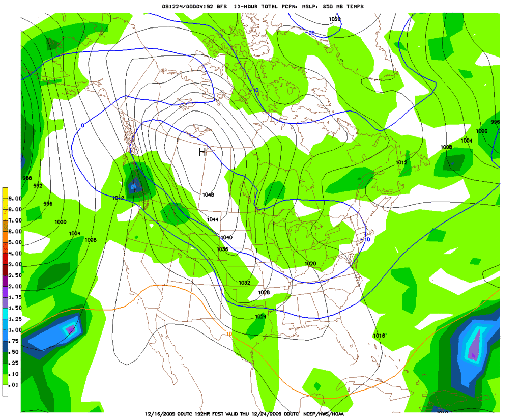
Here is the HPC Model Diagnostic Discussion this morning. I suspect there is a lot of attention being given to the current forecasting challange of a possible Nor'easter for the weekend and just beyond. Let's see how things unfold as the day moves along. There will likely be many twists and turns as we move ahead toward Christmas. It is becoming clearer that there will be some mighty 'chilly air" heading S around and after Christmas IMHO.

MODEL DIAGNOSTIC DISCUSSION
NWS HYDROMETEOROLOGICAL PREDICTION CENTER CAMP SPRINGS MD
152 AM EST WED DEC 16 2009

VALID DEC 16/0000 UTC THRU DEC 19/1200 UTC


...SEE NOUS42 KWNO ADMNFD FOR THE STATUS OF THE UPPER AIR
INGEST...

00Z MODEL EVALUATION INCLUDING THE NEW ECMWF AND FINAL PREFERENCES

MODEL INITIALIZATION ERRORS DO NOT APPEAR TO HAVE A SIGNIFICANT
IMPACT ON THE FORECAST.

...COLD FRONT MOVING THROUGH THE NORTHWEST TODAY/TONIGHT...

THE NAM/GFS SHOW GOOD AGREEMENT WITH OTHER GUIDANCE WITH THE
TIMING/INTENSITY OF THE COLD FRONTAL PASSAGE...WITH THE FRONT
RETREATING NORTHWARD AS A WARM FRONT BY TNGT/THU AFTER PASSAGE OF
A SECONDARY SHORTWAVE TROUGH WHICH MODELS SHOW GOOD AGREEMENT WITH
AS WELL.

...SHORTWAVE TROUGH NEAR THE WESTERN GREAT LAKES...

GOOD MODEL AGREEMENT EXISTS ON THE RAPID PROGRESSION OF THIS LOW
AMPLITUDE SHORTWAVE TROUGH THROUGH THE REGION BY TONIGHT.

...COLD FRONT REACHING THE PACIFIC NORTHWEST THU NGT/FRI...

PREFERENCE: GFS OR ECMWF

THE NAM AVERAGES ABOUT 6 HRS SLOWER WITH THE ARRIVAL AND PASSAGE
OF THE FRONT COMPARED TO THE MAJORITY OF OTHER GUIDANCE...WHILE
THE NEW CANADIAN IS ABOUT 6-9 HRS FASTER THAN THE MEAN. GIVEN A
CLUSTERING NEAR THE DETERMINISTIC CONSENSUS...RECOMMEND A SOLUTION
CLOSEST TO THE GFS OR NEW ECMWF.

...LOW PRESSURE FORMING OVER THE GULF OF MEXICO/SOUTHEAST COAST
THU/FRI...

PREFERENCE: BEFORE 00Z FRI...EXCLUDE THE ECMWF
AFTER 00Z FRI...1/3 EACH GFS/CANADIAN/UKMET

THE NEW ECMWF HAS TRENDED SOUTH OF PRIOR ECMWF RUNS WITH INITIAL
LOW DEVELOPMENT IN THE WESTERN GULF BY 00Z FRI...BUT STILL APPEARS
TO FAR NORTH WITH RESPECTS TO THE SOLUTION ENVELOPE. THUS...ITS
SOLUTION THROUGH THIS TIME IS CONSIDERED A LOW PROBABILITY
SCENARIO. THE NEW ECMWF HAS ALSO TRENDED SOUTHWARD WITH THE LOW
OFF THE SOUTHEAST COAST LATE IN THE PERIOD...BUT STILL LIES NEAR
THE NORTHWESTERN EDGE OF THE GUIDANCE ENVELOPE BY 12Z SAT.
UPSTREAM CONDITIONS...
PARTICULARLY THE EVOLUTION OF A SHORTWAVE TROUGH OVER THE OHIO
VALLEY...WILL LARGELY DETERMINE THE EVOLUTION OF THE SOUTHEAST
LOW...AND WITH THE NEW ECMWF TRENDING MORE PROGRESSIVE AND TOWARD
THE GFS/CANADIAN/UKMET WITH A TROUGH OVER THE OHIO VALLEY LATE IN
THE PERIOD...BUT STILL PERHAPS TOO FAR NORTH...OUR PREFERENCE
CONTINUES TO CENTER AROUND A 3 MODEL BLEND INCLUDING THE
GFS/CANADIAN/UKMET...WHICH COINCIDENTALLY IS NEAR THE GEFS
MEAN...FOR BOTH THE SOUTHEAST LOW AND THE SHORTWAVE TROUGH
EVOLUTION OVER THE OHIO VALLEY LATE IN THE PERIOD.

...LOW PRESSURE RETROGRADING INTO THE CANADIAN MARITIMES FRI...

PREFERENCE: 1/3 EACH GFS/CANADIAN/UKMET

THE NEW ECMWF HAS TRENDED TOWARD GFS/CANADIAN/UKMET WITH A SURFACE
LOW RETROGRADING THROUGH THE CANADIAN MARITIMES BY 12Z SAT...WITH
THE NAM CONSIDERED A SLOW OR EAST OUTLIER. WHILE THE NEW ECMWF HAS
TRENDED TOWARD THE PREFERRED DIRECTION...ITS SOLUTION IS STILL
CONSIDERED TOO FAR EAST BY 12Z SAT TO BE INCLUDED IN THE
PREFERENCE. THIS PREFERENCE IS ALSO CONSISTENT WITH PREFERENCES
OVER THE OHIO VALLEY AND THE SOUTHEAST.

...MODEL TREND GRAPHICS AT
http://WWW.HPC.NCEP.NOAA.GOV/HTML/MODEL2.SHTML...

...500MB FORECASTS AT http://WWW.HPC.NCEP.NOAA.GOV/H5PREF/H5PREF.SHTML...

JAMES
0 likes   
Carla/Alicia/Jerry(In The Eye)/Michelle/Charley/Ivan/Dennis/Katrina/Rita/Wilma/Ike/Harvey

Member: National Weather Association
Wx Infinity Forums
http://wxinfinity.com/index.php

Facebook.com/WeatherInfinity
Twitter @WeatherInfinity

User avatar
srainhoutx
S2K Supporter
S2K Supporter
Posts: 6919
Age: 67
Joined: Sun Jan 14, 2007 11:34 am
Location: Haywood County, NC
Contact:

Re: Texas winter wx thread (2009-2010)

#1260 Postby srainhoutx » Wed Dec 16, 2009 8:47 am

As I suspected, the HPC in the detailed Morning Prelim Extended offers some "nuggets" in their thinking. Folks, this is a very tricky forecasting challenge with the Holidays fast approaching and with a very difficult Upper Air Pattern.

PRELIMINARY EXTENDED FORECAST DISCUSSION
NWS HYDROMETEOROLOGICAL PREDICTION CENTER CAMP SPRINGS MD
821 AM EST WED DEC 16 2009

VALID 12Z SUN DEC 20 2009 - 12Z WED DEC 23 2009

A FAIRLY COMPLEX LONGWAVE PATTERN IS EXPECTED TO PREVAIL DURING
THE MEDIUM RANGE PERIOD WITH A REX-BLOCK RETROGRADING FROM THE
NORTHERN ATLANTIC TO EASTERN CANADA...A SPLIT-FLOW REGIME
PREVAILING OVER CENTRAL CANADA...AND AN AMPLIFYING TROUGH OVER THE
NORTHERN PACIFIC WHICH MAINTAINS SPLIT-FLOW ALONG THE WEST COAST
AS WELL UNTIL AT LEAST DAY 5. WHILE LONGWAVE FLOW AGREEMENT IS
REASONABLY GOOD THIS CYCLE...DETAIL DIFFERENCES ARE INHERENTLY
LARGE AND GROW WITH TIME...WITH MUCH OF THE UNCERTAINTY
ORIGINATING FROM THE NORMALLY MORE COMPLEX HIGHER LATITUDES WHERE
MODEL INITIALIZATION IS TYPICALLY WORSE. THUS...THE APPROACH
DURING THE MEDIUM RANGE PERIOD IS TO USE DETERMINISTIC SOLUTIONS
AS MUCH AS IS REASONABLY POSSIBLE EARLY TO MAINTAIN DETAIL BUT
THEN SWITCH TO ENSEMBLES LATER IN THE PERIOD. THERE EXISTS SEVERAL
DAY-T0-DAY MODEL DIFFERENCES TO CONTEND WITH...THE EARLIEST OF
WHICH WILL EXIST ALONG THE EAST COAST...WITH ALL MODELS TRENDING
FARTHER OFFSHORE AND FASTER WITH A DEEPENING CYCLONE...WITH THE
ECMWF TAKING AN UNUSUAL TURN TOWARD THE WEST AS THE LOW REACHES
THE CANADIAN MARITIMES BY DAY 6. THUS...WILL STAY CLOSER TO THE
CONSENSUS BY THIS TIME WHICH CONTINUES TO EJECT THE LOW INTO THE
NORTHERN ATLANTIC. BEFORE THEN HOWEVER...
MODEL SOLUTIONS ARE QUITE CLOSE WITH THE TRACK OF THE LOW.
MEANWHILE...IN THE NORTHWEST THE ECMWF IS NEARLY A FAST OUTLIER
WITH A SMALL UPPER LOW DRIFTING INTO THE REGION BY DAY 5...WITH
THE GFS ABOUT 1-2 DAYS SLOWER. THE CANADIAN AND GEFS MEAN OFFER A
REASONABLE COMPROMISE HERE GIVEN THE SPREAD...WITH THE ECMWF
CONSIDERED UNLIKELY GIVEN THAT ITS SOLUTION IS OUT OF PHASE WITH
OTHER GUIDANCE OVER THE NORTHEAST PACIFIC. FINALLY...THE
SPLIT-FLOW REGIME OVER CENTRAL CANADA SHOULD FAVOR A REGULAR BUT
UNCERTAIN FLOW OF SHORTWAVE TROUGHS FROM WESTERN CANADA THROUGH
THE DAKOTAS AND EAST WHICH WILL BE DIFFICULT TO TIME. THUS...WILL
USE A 50/50 BLEND OF THE GFS/ECMWF THROUGH DAY 5 BEFORE COMPLETELY
ABANDONING DETERMINISTIC GUIDANCE IN FAVOR OF 100 PERCENT GEFS
MEAN BY DAY 7 FOR EARLY PRELIMS.

UPDATED MORNING PRELIMS FAVOR ECMWF AND THE 00Z ECMWF ENS MEANS
THRU THE PERIOD WITH AN INCREASING AMOUNT OF THE MEANS THRU THE
PERIOD. THIS PRODUCES MINIMAL SFC CHANGES BUT 00Z ECMWF ENS MEANS
LOOKS CLOSE TO THE OP 0Z ECMWF AND 00Z GFS ENS MEANS LATE PERIOD
DEVELOPING A HIGH AMPLITUDE TROF OVER THE INTERMTN REGION INSTEAD
OF THE RIDGING BY THE OP 0Z GFS. THIS ALSO ELIMINATES THE DEEP
GREAT LAKES VORTEX OF GFS BY DAY 7.


MODERATELY STRONG LOW PRESSURE COMING OFF THE SOUTHEAST SEABOARD
SATURDAY WILL BRING SOME HVY COASTAL RAINS AND BRISK NE WINDS TO
THE LOWER MID ATLC COAST BEFORE MOVING NEWD. RECENT
OP MODELS HAVE SHIFTED THE SFC TRACK EWD LOWERING THE INLAND AND
MORE NWD SNOW THREAT OVER THE INTERIOR MID ATLC REGION NAD
NORTHEAST. SUBTLE CHANGES IN THE DIGGING MID LEVEL TROF AND
DOWNSTREAM RIDGING ALLOWED FOR PREVIOUS SOLUTIONS ESPECIALLY ECMWF
AND CMC HAVING A MORE WWD SFC TRACK. STRONG NEG AO/NAO IN PLACE
AND TRANSITION TO A POSITIVE PNA WITH ENOUGH AMBIENT COLD AIR
OFTEN A SET FOR ERN CONUS SNOW EVENTS HOWEVER IT ALWAYS REMAINS
QUITE CRITICAL AND DEPENDENT UPON SFC AND MID LEVEL FEATURES
LOCATIONS. TODAYS OP MODEL RUNS SHUNT THIS EWD ENOUGH FOR A STAND
DOWN ON A SNOW THREAT. HOWEVER LAGGED AVERAGE FORECAST OF OF ECMWF
AND GFS STILL INDICATE A POSSIBILITY OF A MORE INTENSE AND WEST
SFC TRACK CLOSER TO PRIOR ECMWF/CMC RUNS AND THE MAJORITY OF BOTH
CMC AND ECMWF ENSEMBLE MEMBER SFC LOWS ARE CONSIDERABLY WESTWARD
OF THE OP MODEL RUNS WITH HALF OF TEH GFS MEMBERS ALSO WEST. THEIR
RESPECTIVE ENS MEAN PCPN OUTPUT IS CONSIDERABLY WETTER WESTWARD
AND WELL INLAND OVER THE MID ATLC AND SOUTHEAST NEW ENGLAND THAN
THE OP MODELS. THIS HAS BEEN TAKEN INTO CONSIDERATION WITH HPC
POPS. A RECURRENT ANALOG OVER THE PAST SEVERAL DAYS HAS BEEN THE
EVENT OF 23-24 DEC 1966.

JAMES/ROSENSTEIN

0 likes   
Carla/Alicia/Jerry(In The Eye)/Michelle/Charley/Ivan/Dennis/Katrina/Rita/Wilma/Ike/Harvey

Member: National Weather Association
Wx Infinity Forums
http://wxinfinity.com/index.php

Facebook.com/WeatherInfinity
Twitter @WeatherInfinity


Return to “Winter Weather”

Who is online

Users browsing this forum: No registered users and 11 guests