Southern Plains winter wx thread (2009-2010)
Moderator: S2k Moderators
Forum rules
 The posts in this forum are NOT official forecast and should not be used as such. They are just the opinion of the poster and may or may not be backed by sound meteorological data. They are NOT endorsed by any professional institution or STORM2K.

The posts in this forum are NOT official forecast and should not be used as such. They are just the opinion of the poster and may or may not be backed by sound meteorological data. They are NOT endorsed by any professional institution or STORM2K.
-
wx247

- S2K Supporter

- Posts: 14279
- Age: 42
- Joined: Wed Feb 05, 2003 10:35 pm
- Location: Monett, Missouri
- Contact:
Winter Weather Advisories up from SE KS and NE OK through SW MO and NW AR. Calling for 1-3" of snow. I think there will be some isolated higher amounts.
0 likes
Personal Forecast Disclaimer:
The posts in this forum are NOT official forecast and should not be used as such. They are just the opinion of the poster and may or may not be backed by sound meteorological data. They are NOT endorsed by any professional institution or storm2k.org. For official information, please refer to the NHC and NWS products.
The posts in this forum are NOT official forecast and should not be used as such. They are just the opinion of the poster and may or may not be backed by sound meteorological data. They are NOT endorsed by any professional institution or storm2k.org. For official information, please refer to the NHC and NWS products.
-
wx247
- S2K Supporter
- Posts: 14279
- Age: 42
- Joined: Wed Feb 05, 2003 10:35 pm
- Location: Monett, Missouri
- Contact:
Wound up with 2.5" of snow here out of this clipper system.
0 likes
Personal Forecast Disclaimer:
The posts in this forum are NOT official forecast and should not be used as such. They are just the opinion of the poster and may or may not be backed by sound meteorological data. They are NOT endorsed by any professional institution or storm2k.org. For official information, please refer to the NHC and NWS products.
The posts in this forum are NOT official forecast and should not be used as such. They are just the opinion of the poster and may or may not be backed by sound meteorological data. They are NOT endorsed by any professional institution or storm2k.org. For official information, please refer to the NHC and NWS products.
-
Extremeweatherguy

- Category 5

- Posts: 11095
- Joined: Mon Oct 10, 2005 8:13 pm
- Location: Florida
Wow, it is going to be getting COLD in Oklahoma this week. The forecast for south OKC is calling for two days with highs in the teens and lows in the single digits! That is quite impressive! I will not be in town during the cold snap, but it should still be pretty chilly where i'm going too (western NC)...though hopefully not that chilly.

0 likes
-
wx247
- S2K Supporter
- Posts: 14279
- Age: 42
- Joined: Wed Feb 05, 2003 10:35 pm
- Location: Monett, Missouri
- Contact:
I think these weather events are timed for when you are not around. LOL 
0 likes
Personal Forecast Disclaimer:
The posts in this forum are NOT official forecast and should not be used as such. They are just the opinion of the poster and may or may not be backed by sound meteorological data. They are NOT endorsed by any professional institution or storm2k.org. For official information, please refer to the NHC and NWS products.
The posts in this forum are NOT official forecast and should not be used as such. They are just the opinion of the poster and may or may not be backed by sound meteorological data. They are NOT endorsed by any professional institution or storm2k.org. For official information, please refer to the NHC and NWS products.
-
Texas Snowman

- Storm2k Moderator

- Posts: 6197
- Joined: Fri Jan 25, 2008 11:29 am
- Location: Denison, Texas
Re: Southern Plains winter wx thread (2009-2010)
LOL! I was thinking the same thing!!! 
EWG, when are you traveling this winter? I'd like to plan for more cold and or snow events in the southern great plains!!!
EWG, when are you traveling this winter? I'd like to plan for more cold and or snow events in the southern great plains!!!
0 likes
The above post and any post by Texas Snowman is NOT an official forecast and should not be used as such. It is just the opinion of the poster and may or may not be backed by sound meteorological data. It is NOT endorsed by any professional institution including storm2k.org. For official information, please refer to NWS products.
-
Extremeweatherguy
- Category 5
- Posts: 11095
- Joined: Mon Oct 10, 2005 8:13 pm
- Location: Florida
Re: Southern Plains winter wx thread (2009-2010)
After this trip to North Carolina I should be done traveling for a while. This probably means an end to the cold weather and winter precipitation across the southern plains for the rest of the month and through February. Sorry guys! lolTexas Snowman wrote:LOL! I was thinking the same thing!!!
EWG, when are you traveling this winter? I'd like to plan for more cold and or snow events in the southern great plains!!!
0 likes
-
arizona_sooner
- Tropical Depression

- Posts: 64
- Joined: Sat Jan 09, 2010 10:09 am
- Location: Peoria, AZ
-
Extremeweatherguy
- Category 5
- Posts: 11095
- Joined: Mon Oct 10, 2005 8:13 pm
- Location: Florida
Re: Southern Plains winter wx thread (2009-2010)
Interesting statement from this morning's Norman AFD...
IT SHOULD BE NOTED THAT CURRENT TEMPERATURES IN INTERIOR ALASKA
ARE COLDER THAN HAS BEEN SEEN ALL WINTER... AND PROBABLY COLDER
THAN ANYTHING IN THE LAST SEVERAL YEARS. QUITE A FEW -40S AND
-50S... AND EVEN A -60F AT 06Z. FORTUNATELY... FOR US ANYWAY...
THERE ARE NO GIANT ANTICYCLONES ON THIS SIDE OF THE NORTH POLE
AND THE ARCTIC OSCILLATION INDEX HAS RETURNED TO NEAR NEUTRAL. IT
WAS DECIDEDLY NEGATIVE WHEN THE COLD AIR WAS FLOWING FREELY OUT OF
CANADA. DATA FROM THE GFS/ENSEMBLES INDICATE A POSSIBLE RETURN TO
A STRONGLY-NEGATIVE A.O. INDEX BY THE END OF THE MONTH... SO WE
MAY NOT BE THROUGH WITH THE ARCTIC AIR THIS SEASON.
0 likes
-
Extremeweatherguy
- Category 5
- Posts: 11095
- Joined: Mon Oct 10, 2005 8:13 pm
- Location: Florida
Re: Southern Plains winter wx thread (2009-2010)
The weather for next weekend is looking really interesting! The GFS has continuously been showing a major storm system impacting the plains. The way it stands now, this appears as if it could become a possible blizzard in the central/northern plains and may be a heavy rain or strong/severe weather event in the southern plains.
Take a look at the 00z GFS run:
156 hrs = http://www.nco.ncep.noaa.gov/pmb/nwprod ... n_156l.gif
162 hrs = http://www.nco.ncep.noaa.gov/pmb/nwprod ... n_162l.gif
168 hrs = http://www.nco.ncep.noaa.gov/pmb/nwprod ... n_168l.gif
174 hrs = http://www.nco.ncep.noaa.gov/pmb/nwprod ... n_174l.gif
This scenario reminds me more of something I would expect to see in March, not January.
0 likes
-
Extremeweatherguy
- Category 5
- Posts: 11095
- Joined: Mon Oct 10, 2005 8:13 pm
- Location: Florida
An interesting little temperature gradient has set up over Oklahoma tonight along a weak and nearly stationary frontal boundary...
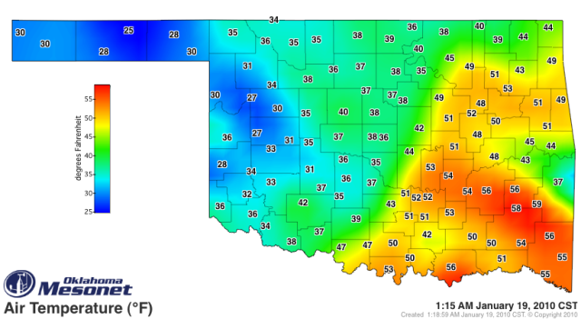
There is a nearly 20 degree temperature swing from one side of the boundary to the other, with temperatures generally in the 20s and 30s behind the boundary and in the 40s and 50s ahead of the boundary.
There is a nearly 20 degree temperature swing from one side of the boundary to the other, with temperatures generally in the 20s and 30s behind the boundary and in the 40s and 50s ahead of the boundary.
0 likes
-
Extremeweatherguy
- Category 5
- Posts: 11095
- Joined: Mon Oct 10, 2005 8:13 pm
- Location: Florida
-
Extremeweatherguy
- Category 5
- Posts: 11095
- Joined: Mon Oct 10, 2005 8:13 pm
- Location: Florida
From storms to...snow? The 00z GFS seems to think so. It is showing a decent looking winter weather event setting up for the southern plains a week from today with the potential for some snow/sleet to fall across Oklahoma and even north Texas if things play out right. Could get interesting..
162 hrs (surface) = http://www.nco.ncep.noaa.gov/pmb/nwprod ... n_162l.gif
168 hrs (surface) = http://www.nco.ncep.noaa.gov/pmb/nwprod ... n_168l.gif
174 hrs (surface) = http://www.nco.ncep.noaa.gov/pmb/nwprod ... n_174l.gif
180 hrs (surface) = http://www.nco.ncep.noaa.gov/pmb/nwprod ... n_180l.gif
192 hrs (surface) = http://www.nco.ncep.noaa.gov/pmb/nwprod ... n_192l.gif
0 likes

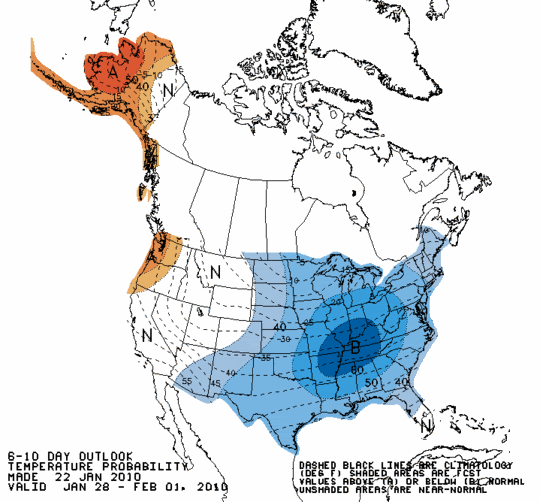
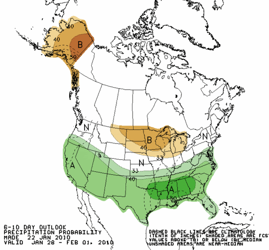
The pattern change should happen after this weekend. Looks like January is about to go out the way it's supposed to, chilly! The EC has shown similar 
0 likes
The above post and any post by Ntxw is NOT an official forecast and should not be used as such. It is just the opinion of the poster and may or may not be backed by sound meteorological data. It is NOT endorsed by any professional institution including Storm2k. For official information, please refer to NWS products.
Help support Storm2K!
-
Extremeweatherguy
- Category 5
- Posts: 11095
- Joined: Mon Oct 10, 2005 8:13 pm
- Location: Florida
Re: Southern Plains winter wx thread (2009-2010)
Local news meteorologists are starting to get bullish on the possible winter threat next week...
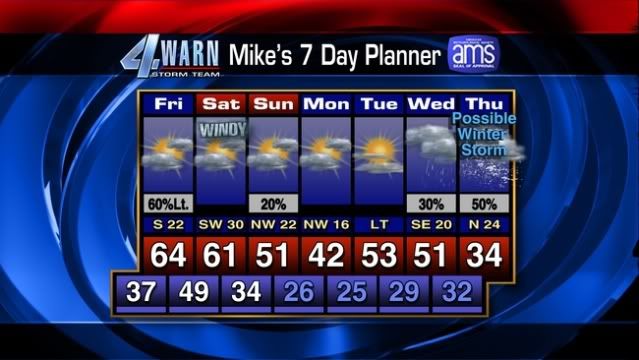
could get interesting!
could get interesting!
0 likes
Re: Southern Plains winter wx thread (2009-2010)
AS THIS WEATHER SYSTEM WRAPS UP TO OUR NORTH...IT WILL SEND A
CONTINENTAL FRONT THROUGH THE REGION BY SATURDAY NIGHT...WITH COOLER
WEATHER SETTLING IN THROUGH MONDAY. MODELS ARE FAIRLY CONSISTENT
WITH THE NEXT SOUTHERN STREAM WAVE APPROACHING BY MID NEXT
WEEK...BRINGING A CHANCE OF RAIN BY WEDNESDAY.
0 likes
The above post and any post by Ntxw is NOT an official forecast and should not be used as such. It is just the opinion of the poster and may or may not be backed by sound meteorological data. It is NOT endorsed by any professional institution including Storm2k. For official information, please refer to NWS products.
Help support Storm2K!
Help support Storm2K!
-
srainhoutx

- S2K Supporter
- Posts: 6919
- Age: 68
- Joined: Sun Jan 14, 2007 11:34 am
- Location: Haywood County, NC
- Contact:
Re: Southern Plains winter wx thread (2009-2010)
0 likes
Carla/Alicia/Jerry(In The Eye)/Michelle/Charley/Ivan/Dennis/Katrina/Rita/Wilma/Ike/Harvey
Member: National Weather Association
Wx Infinity Forums
http://wxinfinity.com/index.php
Facebook.com/WeatherInfinity
Twitter @WeatherInfinity
Member: National Weather Association
Wx Infinity Forums
http://wxinfinity.com/index.php
Facebook.com/WeatherInfinity
Twitter @WeatherInfinity
-
Extremeweatherguy
- Category 5
- Posts: 11095
- Joined: Mon Oct 10, 2005 8:13 pm
- Location: Florida
-
Extremeweatherguy
- Category 5
- Posts: 11095
- Joined: Mon Oct 10, 2005 8:13 pm
- Location: Florida
12z GFS MOS output for Oklahoma City...
WEDNESDAY
Daytime High: 45F
Overnight Low: 28F
-41% chance of precip-
THURSDAY
Daytime High: 40F
Overnight Low: 21F
-49% chance of precip-
FRIDAY
Daytime High: 40F
Overnight Low: 21F
-15% chance of precip-
Compared to the mild weather of late, temperatures like these will feel quite cold!
WEDNESDAY
Daytime High: 45F
Overnight Low: 28F
-41% chance of precip-
THURSDAY
Daytime High: 40F
Overnight Low: 21F
-49% chance of precip-
FRIDAY
Daytime High: 40F
Overnight Low: 21F
-15% chance of precip-
Compared to the mild weather of late, temperatures like these will feel quite cold!
0 likes
-
Extremeweatherguy
- Category 5
- Posts: 11095
- Joined: Mon Oct 10, 2005 8:13 pm
- Location: Florida

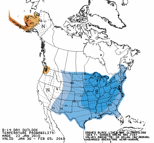
I would place a bet that at some point the next 2-3 weeks, the southern plains will get active with winter storms. I can see a cross polar flow setting up with baja\California lows marching in. The best maybe yet to come to our surprise. 03' looks to be a good analog year and February was the cream of the crop that winter.
0 likes
The above post and any post by Ntxw is NOT an official forecast and should not be used as such. It is just the opinion of the poster and may or may not be backed by sound meteorological data. It is NOT endorsed by any professional institution including Storm2k. For official information, please refer to NWS products.
Help support Storm2K!
Help support Storm2K!
Who is online
Users browsing this forum: No registered users and 85 guests