
Out in west texas the forecast has went from ..
The snowfall moving into the area will evaporate before hitting the ground..
to
Some very light snowfall and flurries my reach the ground
to
Now 1-3 inches of snowfall expected..
That gives places east and se of midland a better chance to get snowfall..
Let's just hope that trend continues right across Texas..
SE TX/SW LA Winter WX - 2011-2012
Moderator: S2k Moderators
Forum rules
 The posts in this forum are NOT official forecast and should not be used as such. They are just the opinion of the poster and may or may not be backed by sound meteorological data. They are NOT endorsed by any professional institution or STORM2K.

The posts in this forum are NOT official forecast and should not be used as such. They are just the opinion of the poster and may or may not be backed by sound meteorological data. They are NOT endorsed by any professional institution or STORM2K.
-
srainhoutx

- S2K Supporter

- Posts: 6919
- Age: 68
- Joined: Sun Jan 14, 2007 11:34 am
- Location: Haywood County, NC
- Contact:
Re: SE TX/SW LA winter wx: Arctic Blast here-coldest since 1996
Good Morning on this Very chilly Friday. Temp 25 Wind Chill 15 and DP 8 in NW Harris County. David Paul on KHOU says flurries are possible later today in the Houston Area. Midland/Odessa reporting light snow at this hour with Winter Weather Advisories out W. HGX thoughts this morning...
AREA FORECAST DISCUSSION
NATIONAL WEATHER SERVICE HOUSTON/GALVESTON TX
416 AM CST FRI JAN 8 2010
.DISCUSSION...
ARCTIC AIRMASS STRETCHES SOUTH FROM THE HIGH PLAINS TO GULF...THE
1045MB CENTER OF NEBRASKA WILL CONTINUE TO SLOWLY MOVE SOUTHEAST
SLOWLY INCREASING PRESSURE ACROSS SETX. S/W MOVING INTO WEST TEXAS
WILL TRACK EAST-SOUTHEAST AND SHOULD BRING A MID LEVEL DECK INTO
THE AREA AND PACIFIC MOISTURE WILL STREAM OVERHEAD TO BOOT. THIS
INCREASING CLOUD COVER AND CONTINUED CAA WILL MAKE FOR A COLD DAY.
MORNING LOWS IN THE 20S WILL CONTINUE UNTIL EARLY AFTERNOON AS
TEMPERATURES CREEP INTO THE LOW 30S INLAND...WARMER ON THE COAST.
THE DURATION OF ABOVE FREEZING TEMPS WILL ONLY BE 1 TO 3 HOURS FOR
SOME OF THE SOUTHERN INLAND AREAS...THEN BACK INTO THE FREEZER.
THE UPPER DISTURBANCE WAS ALREADY PRODUCING RADAR RETURNS FROM
WACO TO MIDLAND...MOST LIKELY VIRGA SUBLIMATING IN THE VERY DRY
AIR IT WOULD BE FALLING INTO. SHOULD BE A MOSTLY CLOUDY TO CLOUDY
DAY ACROSS THE REGION. THE S/W DEPARTS EAST TONIGHT AND SKIES
SHOULD CLEAR OUT LEADING TO OPTIMAL RADIATIONAL COOLING THE
COLDEST TEMPS OF THE WINTER AND MANY OF RECENT WINTERS. OVERNIGHT
LOWS PLUNGING INTO THE TEENS AND EVEN UPPER 20S ON THE ISLAND.
OTHER THAN A SHOT OF CIRRUS SATURDAY RACING SOUTH INTO THE AREA
THE WARMING ON SATURDAY LOOKING GOOD WITH HIGHS MAKING IN INTO THE
40S. THE OVERNIGHT LOWS SUNDAY MORNING WILL BE COLD AS WELL WITH
THE SURFACE HIGH OVERHEAD AND IN ARKANSAS. THE HIGH EVENTUALLY
MOVES EAST MONDAY SETTING UP A LIGHT ONSHORE FLOW WITH DEWPOINTS
RECOVERING AND WARMER TEMPS. TWO UPPER LOWS TRACKING ACROSS NW
MEXICO AND INTO THE AREA WILL BRING BACK INCREASING MOISTURE
TUESDAY THEN THE SECOND AND MORE VIGOROUS LOW THURSDAY-FRIDAY
SHOULD GIVE THE AREA RAINFALL AND MORE SEASONAL TEMPS. HAVE
TRENDED THE FORECAST STRONGLY IN FAVOR OF THE ECMWF SOLUTION FOR
TUESDAY THROUGH FRIDAY.
IMPRESSIVE WINDS ALONG THE COAST THIS MORNING SHOULD DROP OFF LATE
THIS MORNING SO HAVE EXTENDED THE WIND ADVISORY FOR THE COASTAL
AREAS OF THE COASTAL COUNTIES.
http://radar.weather.gov/Conus/southplains_loop.php
0 likes
Carla/Alicia/Jerry(In The Eye)/Michelle/Charley/Ivan/Dennis/Katrina/Rita/Wilma/Ike/Harvey
Member: National Weather Association
Wx Infinity Forums
http://wxinfinity.com/index.php
Facebook.com/WeatherInfinity
Twitter @WeatherInfinity
Member: National Weather Association
Wx Infinity Forums
http://wxinfinity.com/index.php
Facebook.com/WeatherInfinity
Twitter @WeatherInfinity

-
srainhoutx
- S2K Supporter
- Posts: 6919
- Age: 68
- Joined: Sun Jan 14, 2007 11:34 am
- Location: Haywood County, NC
- Contact:
Re:
jasons wrote:This is a bad one guys. 24F here with wind still gusting close to 20mph.
And looking at Galveston - 29F with winds at 28 mph gusts to 35mph - ouch!
A lot of dead plants from this one - even the protected ones unfortunately.
And to think it will be worse tonight. Goodness. Temp 24 DP 9 Wind chill 15 in NW Harris County. Please be carefull folks. Several fires last night with 2 fatalities that I know of.
0 likes
Carla/Alicia/Jerry(In The Eye)/Michelle/Charley/Ivan/Dennis/Katrina/Rita/Wilma/Ike/Harvey
Member: National Weather Association
Wx Infinity Forums
http://wxinfinity.com/index.php
Facebook.com/WeatherInfinity
Twitter @WeatherInfinity
Member: National Weather Association
Wx Infinity Forums
http://wxinfinity.com/index.php
Facebook.com/WeatherInfinity
Twitter @WeatherInfinity
-
srainhoutx
- S2K Supporter
- Posts: 6919
- Age: 68
- Joined: Sun Jan 14, 2007 11:34 am
- Location: Haywood County, NC
- Contact:
Re: SE TX/SW LA winter wx: Arctic Blast here-coldest since 1996
Morning e-mail from Jeff...
Massive arctic high pressure cells continues to build southward into TX.
Wind chills currently in the low to mid teens with air temperatures below freezing
Hard Freeze Warning remains in effect and being met at several locations.
Discussion:
Fairly uncomfortable outside this morning with strong N winds of 15-25mph continuing and temperatures in the mid to upper 20’s. Wind chills range from 11 at Sugar Land to 14 at Galveston, to 15 at Victoria. 600am temperatures ranged from 23 at Conroe to 29 at Galveston, 25 at Sugar Land, and 27 at Victoria. The entire area is at or below freezing at this time and the temperatures will continue to fall of the next 2-3 hours given strong cold air advection in place and very cold upstream air mass.
Up top the base of the long wave trough will combine with an active sub-tropical jet to thicken a layer of high and mid level clouds today. Radar returns over W and C TX this morning are not reaching the ground given an extremely dry sub-cloud layer with dewpoints from 0-15 over much of the area…do not see much if any chance of snow today with this disturbance as everything will evaporate before reaching the surface. Thickening clouds will help reduce the already low January sun angle and heating ability. Will see temperatures bottom out in the next 2-3 hours and then begin a very slow rise. Area in the mid 20’s or those along and N of US 59 will not likely get above freezing today. Most of this location fell below freezing at 900pm last night…and would not expect most of these areas to get above freezing until some point Saturday afternoon.
Coldest night will be tonight as arctic high builds into TX and skies clear allowing decent radiational cooling conditions. With extremely low dewpoints and afternoon highs at or below freezing over much of the area…the upper teens look likely along and N of US 59. Arctic high will begin to shift eastward Saturday, so Sunday morning will average a few degrees warmer than Saturday morning…but it will still be in the upper teens to low 20’s over much of the region…see forecasted lows below.
Arctic high moves eastward early next week and SE winds return. Gulf is getting a good work over at the moment with howling N winds all the way to the Yucatan, so it will take some time to bring moisture back to the area…first weather system Tues/Wed looks moisture starved with a much more potent event shaping up for late next week. At this time temperatures should moderate back into the 30-50’s for lows and highs so will go with everything liquid at this time for both events.
Mornings lows as of 600am:
College Station: 24
Huntsville: 22
Brenham: 25
Conroe: 23
IAH: 26
Hobby: 26
Sugar Land: 25
Wharton: 29
Galveston: 29 (First time below 30 since 1996)
Angleton: 27
Bay City: 29
Palacios: 28
Victoria: 27
Port Lavaca: 30
Giddings: 24
Austin: 24
Waco: 20
DFW: 17
Forecast Lows this weekend:
North of a line from Columbus to Spring to Liberty
Saturday: 17-19
Sunday: 17-20
Monday: 26-29
North of a line from Victoria to Sugar Land
Saturday: 19-21
Sunday: 19-23
Monday: 27-30
Galveston Bay region and coastline:
Saturday: 25-27
Sunday: 26-30
Monday: 32-34
Matagorda Bay region and coastline:
Saturday: 25-27
Sunday: 26-29
Monday: 33-36
Houston Urban Heat Core (roughly inside the 610 Loop):
Saturday: 22-24
Sunday: 22-25
Monday: 29-32
0 likes
Carla/Alicia/Jerry(In The Eye)/Michelle/Charley/Ivan/Dennis/Katrina/Rita/Wilma/Ike/Harvey
Member: National Weather Association
Wx Infinity Forums
http://wxinfinity.com/index.php
Facebook.com/WeatherInfinity
Twitter @WeatherInfinity
Member: National Weather Association
Wx Infinity Forums
http://wxinfinity.com/index.php
Facebook.com/WeatherInfinity
Twitter @WeatherInfinity
-
vbhoutex

- Storm2k Executive

- Posts: 29150
- Age: 74
- Joined: Wed Oct 09, 2002 11:31 pm
- Location: Cypress, TX
- Contact:
Re:
jasons wrote:This is a bad one guys. 24F here with wind still gusting close to 20mph.
And looking at Galveston - 29F with winds at 28 mph gusts to 35mph - ouch!
A lot of dead plants from this one - even the protected ones unfortunately.
Made it down to 23f at the weatherbug nearest to the house. Here at the house we hit 24f and are now up to a whopping 26f. Had to go out and re-cover one of the Hibiscus since the wind had once again pulled one of the edges from its moorings(heavy bricks). Definitely not looking good for the plants.
0 likes
Skywarn, C.E.R.T.
Please click below to donate to STORM2K to help with the expenses of keeping the site going:

Please click below to donate to STORM2K to help with the expenses of keeping the site going:
-
srainhoutx
- S2K Supporter
- Posts: 6919
- Age: 68
- Joined: Sun Jan 14, 2007 11:34 am
- Location: Haywood County, NC
- Contact:
Re: SE TX/SW LA winter wx: Arctic Blast here-coldest since 1996
HGX Update...just goes to show how cold it's been...
AREA FORECAST DISCUSSION
NATIONAL WEATHER SERVICE HOUSTON/GALVESTON TX
942 AM CST FRI JAN 8 2010
.DISCUSSION...
A THICK CANOPY OF CIRRUS HAS AND WILL CONTINUE TO OVERSPREAD MUCH
OF SOUTHEAST TEXAS. THE CLOUDS LOOK SUFFICIENTLY THICK TO BLOCK
OUT THE SUN AND RETARD HEATING. NUMERICAL GUIDANCE HAS BEEN TOO WARM
AND AM NOT SURE MAX TEMPS WILL HIT THE FREEZING NORTH OF I-10.
WILL TRIM MAX TEMPS A FEW DEGREES. 12Z NAM12 SUGGESTS THAT THE
CLOUDS WILL CLEAR AROUND 06Z. WITH DRY AIR IN PLACE...TEMPS WILL
PLUNGE QUICKLY ONCE THE SKIES CLEAR. WILL LET THE WIND ADVISORY
ALONG THE COAST EXPIRE AT 18Z AS THE PRESSURE GRADIENT CONTINUES
TO SLOWLY WEAKEN. WILL ISSUE NEW ZONES AND UPDATE THE NPW ONCE THE WIND
ADVISORY EXPIRES. HARD FREEZE WARNING WILL REMAIN IN PLACE THROUGH
SUNDAY MORNING. 43
&&
.CLIMATE...
THE FIRST SEVEN DAYS OF 2010 HAVE BEEN UNSEASONABLY COLD.
CURRENTLY...THE AVERAGE TEMPERATURE HAS BEEN 42.3 DEGREES WHICH IS
THE NINTH COLDEST START TO THE YEAR. HOBBY AIRPORT IS AVERAGING
43.8 DEGREES FOR THE FIRST WEEK OF THE NEW YEAR...WHICH IS THE
SIXTH COLDEST START TO THE YEAR.
0 likes
Carla/Alicia/Jerry(In The Eye)/Michelle/Charley/Ivan/Dennis/Katrina/Rita/Wilma/Ike/Harvey
Member: National Weather Association
Wx Infinity Forums
http://wxinfinity.com/index.php
Facebook.com/WeatherInfinity
Twitter @WeatherInfinity
Member: National Weather Association
Wx Infinity Forums
http://wxinfinity.com/index.php
Facebook.com/WeatherInfinity
Twitter @WeatherInfinity
-
southerngale

- Retired Staff

- Posts: 27418
- Joined: Thu Oct 10, 2002 1:27 am
- Location: Southeast Texas (Beaumont area)
Good chilly morning! It's warmed up to 26° this morning. Had a low of 22° per 2 Live WeatherNET KFDM stations on each side of me. (a little colder than Jan.5th and one degree colder than Dec.5th)
Tonight is expected to be much colder. I'm making a pot of homemade chili today. Yum!
NWS LCH posted some record low maximums this morning:
Tonight is expected to be much colder. I'm making a pot of homemade chili today. Yum!
NWS LCH posted some record low maximums this morning:
AREA FORECAST DISCUSSION
NATIONAL WEATHER SERVICE LAKE CHARLES LA
1034 AM CST FRI JAN 8 2010
.UPDATE...
WILL BE QUITE A BRISK AND COLD DAY ACROSS THE FORECAST AREA. HIGH
LEVEL CLOUDS MOVING ACROSS THE REGION TODAY AND COLD AIR ADVECTION
WILL HELP KEEP TEMPERATURES DOWN TODAY. HIGH TEMPERATURES WILL
BARELY GET ABOVE FREEZING WITH READINGS IN THE LOWER TO MID 30S.
SOME DAILY LOW MAXES FOR JANUARY 8TH WILL BE CLOSE TO FALLING AND
ARE AS FOLLOWS:
LCH...35F...1968.
BPT...35F...1988.
ARA...33F...1988.
LFT...31F...1988.
AEX...29F...1971.
WILL ONLY MAKE COSMETIC CHANGES TO ZONES AND GRIDS AT THIS TIME.
ZFP WAS UPDATED AS WIND CHILL ADVISORY FOR THIS MORNING HAS
EXPIRED. WIND CHILLS ARE NOW ABOVE CRITERIA LEVEL...BUT WILL STILL
REMAIN QUITE COLD WITH READINGS THIS AFTERNOON IN THE 20S. LOOKING
BACK AT THE OFFICIAL OBSERVATIONS HERE ARE SOME OF THE LOWEST WIND
CHILL READINGS FROM LATE LAST NIGHT AND EARLY THIS MORNING:
POE...10F.
AEX...10F.
DRI...12F.
BPT...12F.
LCH...13F.
ARA...13F.
LFT...14F.
ALSO OF NOTE WAS THE LOW WATER READINGS THIS MORNING DURING LOW
TIDE ALONG THE COAST. ACTUAL TIDE READINGS WERE BETWEEN (-2.0) AND
(-3.0) FEET MLLW. LOOKS LIKE WITH THE CONTINUATION OF THE OFFSHORE
FLOW OVER THE NEXT COUPLE OF DAYS...THAT TIDE LEVELS AROUND LOW
TIDE WILL BE AT LOW WATER ADVISORY CRITERIA.
RUA
0 likes
Please support Storm2k by making a donation today. It is greatly appreciated! Click here:
 my Cowboys my Rockets my Astros
my Cowboys my Rockets my Astros-
southerngale
- Retired Staff
- Posts: 27418
- Joined: Thu Oct 10, 2002 1:27 am
- Location: Southeast Texas (Beaumont area)
Re: SE TX/SW LA winter wx: Arctic Blast here-coldest since 1996
Current temps across Southeast and East Texas as of 11:15 a.m.
Brrrr!!
27.5 °F Oil Rig : 30 mi SE High Island, TX
26.3 °F Anahuac ES : Anahuac, TX
27.9 °F Central HS : Beaumont, TX
26.4 °F Curtis ES : Beaumont, TX
24.7 °F Field ES : Beaumont, TX
27.9 °F Homer Drive ES : Beaumont, TX
26.7 °F KFDM-TV : Beaumont, TX
26.0 °F Monsignor Kelly High School : Beaumont, TX
26.5 °F Odom Academy : Beaumont, TX
26.5 °F Richard Milburn Academy : Beaumont, TX
26.9 °F Roy Guess ES : Beaumont, TX
28.3 °F St. Anne Catholic School : Beaumont, TX
26.0 °F St. Anthony Cathedral School : Beaumont, TX
26.0 °F Bridge City MS : Bridge City, TX
26.6 °F Buna ES : Buna, TX
22.5 °F Colmesneil ISD : Colmesneil, TX
29.5 °F Hamshire-Fannett MS : Fannett, TX
24.7 °F Fred ES : Fred, TX
24.6 °F High Island ISD : High Island, TX
22.6 °F Rowe Intermediate : Jasper, TX
26.6 °F Kirbyville ES : Kirbyville, TX
26.2 °F Kountze ES : Kountze, TX
25.5 °F Sam Houston HS : Lake Charles, LA
24.8 °F Helena Park ES : Nederland, TX
26.3 °F Hillcrest ES : Nederland, TX
24.6 °F Newton ES : Newton, TX
25.2 °F Anderson ES : Orange, TX
25.8 °F Deweyville HS : Orange, TX
25.2 °F St. Mary Catholic School : Orange, TX
26.9 °F West Orange-Stark MS : Orange, TX
26.5 °F Lamar State College : Port Arthur, TX
26.2 °F Sabine Pass School : Sabine Pass, TX
25.6 °F West Hardin CCISD : Saratoga, TX
27.3 °F Laura Reeves ES : Silsbee, TX
26.1 °F Sour Lake ES : Sour Lake, TX
24.9 °F Spurger ISD : Spurger, TX
27.9 °F Pine Forest ES : Vidor, TX
27.2 °F Vidor JHS : Vidor, TX
26.1 °F Warren ES : Warren, TX
26.3 °F East Chambers Media Center : Winnie, TX
25.5 °F Woodville MS : Woodville, TX
37.4 °F High Island 264C - Block A264 : 90 mi SE Galveston, TX
27.3 °F Sea Rim State Park - NDBC : Sabine Pass, TX
0 likes
Please support Storm2k by making a donation today. It is greatly appreciated! Click here:
my Cowboys my Rockets my Astros
my Cowboys my Rockets my Astros

Re: SE TX/SW LA winter wx: Arctic Blast here-coldest since 1996
Analysis: Likely Houston's fourth-worst cold snap in four decades
10 Coldest 3 Day Period
1/30/1951 - 2/1/1951 28 degrees
2/4/1989 - 2/6/1989 30 degrees
12/24/1983 - 12/26/1983 31 degrees
1/31/1951 - 2/2/1951 31 degrees
2/5/1989 - 2/7/1989 32 degrees
12/23/1983 - 12/25/1983 32 degrees
12/22/1983 - 12/24/1983 33 degrees
1/19/1978 - 1/21/1978 33 degrees
1/9/1973 - 1/11/1973 34 degrees
12/19/1929 - 12/21/1929 34 degrees
http://blogs.chron.com/sciguy/archives/ ... _four.html
0 likes
-
southerngale
- Retired Staff
- Posts: 27418
- Joined: Thu Oct 10, 2002 1:27 am
- Location: Southeast Texas (Beaumont area)
It's still in the 20's across most of Southeast and East Texas. Currently 29° here.
KFDM WeatherNET Live temps as of 12:30 p.m.
28.8 °F Oil Rig : 30 mi SE High Island, TX
28.3 °F Anahuac ES : Anahuac, TX
30.3 °F Central HS : Beaumont, TX
29.2 °F Curtis ES : Beaumont, TX
28.0 °F Field ES : Beaumont, TX
29.9 °F Homer Drive ES : Beaumont, TX
30.1 °F KFDM-TV : Beaumont, TX
29.0 °F Monsignor Kelly High School : Beaumont, TX
30.1 °F Odom Academy : Beaumont, TX
28.7 °F Richard Milburn Academy : Beaumont, TX
29.9 °F Roy Guess ES : Beaumont, TX
31.3 °F St. Anne Catholic School : Beaumont, TX
26.9 °F St. Anthony Cathedral School : Beaumont, TX
29.4 °F Bridge City MS : Bridge City, TX
28.3 °F Buna ES : Buna, TX
22.1 °F Colmesneil ISD : Colmesneil, TX
34.0 °F Hamshire-Fannett MS : Fannett, TX
26.0 °F Fred ES : Fred, TX
28.0 °F High Island ISD : High Island, TX
23.1 °F Rowe Intermediate : Jasper, TX
28.1 °F Kirbyville ES : Kirbyville, TX
28.0 °F Kountze ES : Kountze, TX
27.8 °F Sam Houston HS : Lake Charles, LA
28.4 °F Helena Park ES : Nederland, TX
30.3 °F Hillcrest ES : Nederland, TX
26.5 °F Newton ES : Newton, TX
27.8 °F Anderson ES : Orange, TX
27.9 °F Deweyville HS : Orange, TX
28.3 °F St. Mary Catholic School : Orange, TX
29.9 °F West Orange-Stark MS : Orange, TX
30.2 °F Lamar State College : Port Arthur, TX
28.5 °F Sabine Pass School : Sabine Pass, TX
27.1 °F West Hardin CCISD : Saratoga, TX
28.6 °F Laura Reeves ES : Silsbee, TX
29.0 °F Sour Lake ES : Sour Lake, TX
26.1 °F Spurger ISD : Spurger, TX
30.2 °F Pine Forest ES : Vidor, TX
30.5 °F Vidor JHS : Vidor, TX
26.6 °F Warren ES : Warren, TX
29.2 °F East Chambers Media Center : Winnie, TX
25.1 °F Woodville MS : Woodville, TX
37.4 °F High Island 264C - Block A264 : 90 mi SE Galveston, TX
29.5 °F Sea Rim State Park - NDBC : Sabine Pass, TX
0 likes
Please support Storm2k by making a donation today. It is greatly appreciated! Click here:
my Cowboys my Rockets my Astros
my Cowboys my Rockets my Astros-
southerngale
- Retired Staff
- Posts: 27418
- Joined: Thu Oct 10, 2002 1:27 am
- Location: Southeast Texas (Beaumont area)
It doesn't look like we'll get above freezing today. After sitting at 29° for several hours, it's now dropped back to 28°. NWS had a forecast high for my location of 35°. No clue why they forecast it that high when they also forecast Nederland (down by the airport) at 36° (they haven't reached that either). It's always colder up here. Anyway, unless the temps head back up, it appears that BPT may have set a record for low maximum. The record is 35° set in 1988. The temp was 32° one hour, then went to 34° the next hour and now back to 33° for the past few hours.
My bird bath is frozen solid. I hit it with a bat, then dropped a brick on it, no real effect. It just scraped the ice a little. Winter weather fun!
KFDM WeatherNET Live temps as of 3:30 p.m.
31.7 °F Oil Rig : 30 mi SE High Island, TX
29.0 °F Anahuac ES : Anahuac, TX
30.0 °F Central HS : Beaumont, TX
28.7 °F Curtis ES : Beaumont, TX
27.1 °F Field ES : Beaumont, TX
28.4 °F Homer Drive ES : Beaumont, TX
28.9 °F KFDM-TV : Beaumont, TX
28.4 °F Monsignor Kelly High School : Beaumont, TX
29.4 °F Odom Academy : Beaumont, TX
28.6 °F Richard Milburn Academy : Beaumont, TX
29.4 °F Roy Guess ES : Beaumont, TX
31.0 °F St. Anne Catholic School : Beaumont, TX
27.2 °F St. Anthony Cathedral School : Beaumont, TX
28.8 °F Bridge City MS : Bridge City, TX
27.1 °F Buna ES : Buna, TX
24.5 °F Colmesneil ISD : Colmesneil, TX
32.3 °F Hamshire-Fannett MS : Fannett, TX
25.1 °F Fred ES : Fred, TX
29.0 °F High Island ISD : High Island, TX
24.9 °F Rowe Intermediate : Jasper, TX
28.3 °F Kirbyville ES : Kirbyville, TX
27.2 °F Kountze ES : Kountze, TX
27.9 °F Sam Houston HS : Lake Charles, LA
28.5 °F Helena Park ES : Nederland, TX
30.4 °F Hillcrest ES : Nederland, TX
26.9 °F Newton ES : Newton, TX
28.2 °F Anderson ES : Orange, TX
27.6 °F Deweyville HS : Orange, TX
27.9 °F St. Mary Catholic School : Orange, TX
30.1 °F West Orange-Stark MS : Orange, TX
30.8 °F Lamar State College : Port Arthur, TX
30.7 °F Sabine Pass School : Sabine Pass, TX
26.8 °F West Hardin CCISD : Saratoga, TX
28.1 °F Laura Reeves ES : Silsbee, TX
28.2 °F Sour Lake ES : Sour Lake, TX
26.6 °F Spurger ISD : Spurger, TX
29.0 °F Pine Forest ES : Vidor, TX
30.1 °F Vidor JHS : Vidor, TX
26.7 °F Warren ES : Warren, TX
30.3 °F East Chambers Media Center : Winnie, TX
26.2 °F Woodville MS : Woodville, TX
32.2 °F Sea Rim State Park - NDBC : Sabine Pass, TX
0 likes
Please support Storm2k by making a donation today. It is greatly appreciated! Click here:
my Cowboys my Rockets my Astros
my Cowboys my Rockets my Astros-
srainhoutx
- S2K Supporter
- Posts: 6919
- Age: 68
- Joined: Sun Jan 14, 2007 11:34 am
- Location: Haywood County, NC
- Contact:
Re: SE TX/SW LA winter wx: Arctic Blast here-coldest since 1996
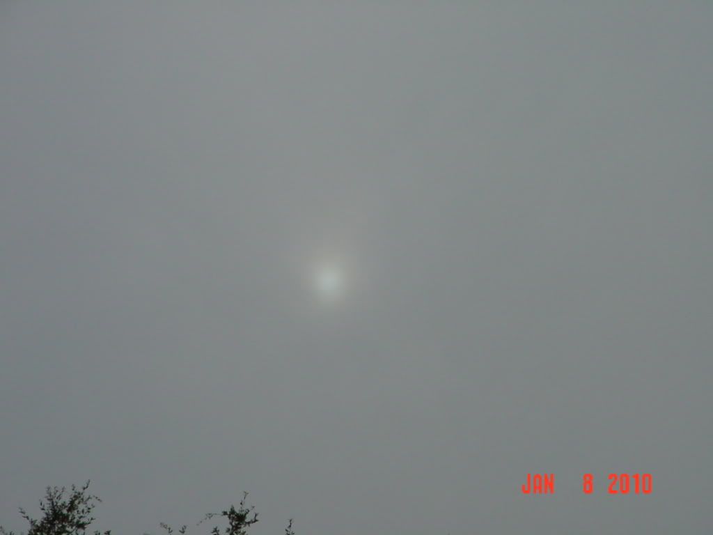
Just an FYI: We're right under a nice virga snow shower in NW Harris County right now. 
0 likes
Carla/Alicia/Jerry(In The Eye)/Michelle/Charley/Ivan/Dennis/Katrina/Rita/Wilma/Ike/Harvey
Member: National Weather Association
Wx Infinity Forums
http://wxinfinity.com/index.php
Facebook.com/WeatherInfinity
Twitter @WeatherInfinity
Member: National Weather Association
Wx Infinity Forums
http://wxinfinity.com/index.php
Facebook.com/WeatherInfinity
Twitter @WeatherInfinity
-
southerngale
- Retired Staff
- Posts: 27418
- Joined: Thu Oct 10, 2002 1:27 am
- Location: Southeast Texas (Beaumont area)
-
srainhoutx
- S2K Supporter
- Posts: 6919
- Age: 68
- Joined: Sun Jan 14, 2007 11:34 am
- Location: Haywood County, NC
- Contact:
Re:
southerngale wrote:Don't forget to post pics of your virgaman.
Btw, down to 27° here now. It's gonna be a coooooooooold night!
Here ya go SG...
0 likes
Carla/Alicia/Jerry(In The Eye)/Michelle/Charley/Ivan/Dennis/Katrina/Rita/Wilma/Ike/Harvey
Member: National Weather Association
Wx Infinity Forums
http://wxinfinity.com/index.php
Facebook.com/WeatherInfinity
Twitter @WeatherInfinity
Member: National Weather Association
Wx Infinity Forums
http://wxinfinity.com/index.php
Facebook.com/WeatherInfinity
Twitter @WeatherInfinity

-
southerngale
- Retired Staff
- Posts: 27418
- Joined: Thu Oct 10, 2002 1:27 am
- Location: Southeast Texas (Beaumont area)
LOL - Awesome! 
Oh, and it looks like that record was set. It's already 31° down at the airport.
And I checked every KFDM WeatherNET station in Beaumont... none of them went above freezing... some never got out of the 20s! Wow!
Oh, and it looks like that record was set. It's already 31° down at the airport.
And I checked every KFDM WeatherNET station in Beaumont... none of them went above freezing... some never got out of the 20s! Wow!
0 likes
Please support Storm2k by making a donation today. It is greatly appreciated! Click here:
my Cowboys my Rockets my Astros
my Cowboys my Rockets my Astros-
vbhoutex
- Storm2k Executive
- Posts: 29150
- Age: 74
- Joined: Wed Oct 09, 2002 11:31 pm
- Location: Cypress, TX
- Contact:
Re: SE TX/SW LA winter wx: Arctic Blast here-coldest since 1996
I haven't been at home since noon since I am babysitting my granddaughter at her home since my wife is sick. The temp here in Copperfield has never made it above 32ºf based pm both my hand held and my kids outdoor thermometer. They have a pan with some ice in it out on the back patio that has stayed frozen solid all day. I've been peeking out ever so often to catch a peek at a flake. No such luck yet. Sure does look like it is snowing up there though and srain says we just had a virga shower so I believe!!LOL!
I'll be interested to see what my home thermometer shows when I get there. My car thermometer was reading "ice" then 31º when I left to come out here.
I'll be interested to see what my home thermometer shows when I get there. My car thermometer was reading "ice" then 31º when I left to come out here.
0 likes
Skywarn, C.E.R.T.
Please click below to donate to STORM2K to help with the expenses of keeping the site going:
Please click below to donate to STORM2K to help with the expenses of keeping the site going:
Who is online
Users browsing this forum: No registered users and 70 guests