Portastorm wrote:Now, THIS is more like it ... the 0z GFS@ 360 hours.
The rain is long gone before the 850mb temperatures go negative. During the rains, those temperatures are 11-13 C.
Moderator: S2k Moderators
 The posts in this forum are NOT official forecast and should not be used as such. They are just the opinion of the poster and may or may not be backed by sound meteorological data. They are NOT endorsed by any professional institution or STORM2K.
Portastorm wrote:Now, THIS is more like it ... the 0z GFS@ 360 hours.
Portastorm wrote:Ntxw wrote:If I remember correctly, didn't it snow on easter (around april 7th or so) in parts of central Texas back in 2007? Not sure if it did in Austin but I know it did in Waco.
Yes, that did occur in April 2007 although not as far south as Austin. I believe the snow started around the Copperas Cove-Killeen area northward. Talk about a rare event!


HURAKAN wrote:
Quite impressive

 my Cowboys my Rockets my Astros

austinrunner wrote:Portastorm wrote:Now, THIS is more like it ... the 0z GFS@ 360 hours.
The rain is long gone before the 850mb temperatures go negative. During the rains, those temperatures are 11-13 C.
Portastorm wrote:austinrunner wrote:Portastorm wrote:Now, THIS is more like it ... the 0z GFS@ 360 hours.
The rain is long gone before the 850mb temperatures go negative. During the rains, those temperatures are 11-13 C.
Trends, austinrunner, it's about the trends. More and more signs pointing to a vigorous return to colder conditions late this month.


Ntxw wrote::uarrow: If that were to happen in Texas either we'd be in some sort of an ice age or the north pole shifted a few hundred miles south
southerngale wrote:
Yet, with all the rain that was forecast, so far, just a little light rain here and there. Very little.
It's falling in my neighborhood tonight but there's not much gale force wind action here tonight as was forecasted by several TV Mets last night.Nederlander wrote:southerngale wrote:
Yet, with all the rain that was forecast, so far, just a little light rain here and there. Very little.
Yea what happened gale? Im kind of dumbfounded.. I havent seen ANY rain today..
srainhoutx wrote::uarrow: Just remember that the GFS at this range can be fairly good at sniffing out a pattern change. With AO/EPO aspects showing up in ensembles, there are strong indications that a colder regime is coming. Where, when, and what may fall concerning precip at this range we do not know. What can be taken from the OP GFS is there may very well be a significant Winter Storm somewhere in the S Plains region. Things can change rather quickly after a warm up as we saw this past November. Just my $0.02 cents worth. Enjoy the thaw while it lasts and let's hope that the El Nino Pattern ahead over the next couple of weeks does not bring more than we can handle in the liquid precip department.


txagwxman wrote:Looks like it will be mid 70s in Houston by Wednesday...Enjoy the warm weather this week. Most of the cold in the back of the forecast is across Canada into the Great Lakes, still no real mechanism to bring it into Texas yet. But will watch the models closely.
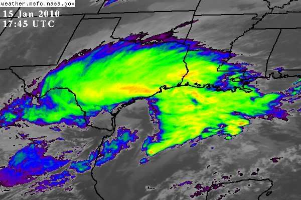
.PREV DISCUSSION... /ISSUED 422 AM CST SAT JAN 16 2010/
00Z UPPER AIR ANALYSIS DEPICTED A WEAKENING UPPER LEVEL LOW OVER
SOUTH TEXAS AND AN INTENSIFYING UPPER LOW OVER WESTERN KANSAS
NESTED WITHIN A BROAD TROUGH ACROSS THE PLAINS. WATER VAPOR LOOP
SHOWS THE UPPER LOW TO OUR NW DROPPING SOUTH INTO THE TEXAS
PANHANDLE...WHILE THE SOUTH TEXAS LOW IS LIFTING NORTH AND
SHEARING APART. THE PLACEMENT OF THE TWO LOWS PUT NORTH TEXAS IN A
DEFORMATION AXIS...WITH WIDESPREAD LIGHT RAIN CONTINUING.
FRONTOGENETIC LIFT ASSOCIATED WITH THE DEFORMATION AXIS WILL
WEAKEN DURING THE MORNING HOURS AS THE SOUTHERN UPPER LOW FILLS.
HOWEVER...THE UPPER LOW TO OUR NORTHWEST WILL SWING THROUGH THE
REGION DURING THE DAY AND RESULT IN CONTINUED DYNAMIC LIFT AND
CHANCES OF RAIN OVER THE NORTHERN HALF OF THE CWA.
PREVIOUS MODEL RUNS APPEAR TO HAVE SIGNIFICANTLY UNDERESTIMATED
THE STRENGTH OF THE UPPER LOW/POTENTIAL VORTICITY THAT WILL MOVE
ACROSS THE REGION TODAY. WATER VAPOR LOOP SUGGESTS A TROPOSPHERIC
FOLDING EVENT IS RESPONSIBLE FOR THE INCREASE IN PV...AND ONE
WONDERS IF THE MODELS ARE STILL PLAYING CATCH-UP. THEREFORE WILL
SIDE WITH THE WETTER SOLUTION FROM THE RUC AND SEEMINGLY REALISTIC
4KM WRF...AND KEEP THE POPS GOING OVER THE NORTHERN CWA THROUGH THE
AFTERNOON HOURS. WILL HOLD POPS INTO THE EVENING HOURS OVER THE
NORTHEAST ZONES. ALSO OF NOTE IS THAT NAM/RUC FORECASTS BRING THE
FREEZING LEVEL DOWN TO ABOUT 4K FT OVER THE NORTHERN ZONES. DEGREE
OF DYNAMIC LIFT/COOLING WILL BE IMPRESSIVE...BUT SURFACE TEMPS IN
THE MID 40S WITH NO LOW LEVEL COLD ADVECTION SHOULD PROVIDE AN
ADEQUATE BUFFER AND KEEP PRECIP ALL LIQUID.
Weatherdude20 wrote:System still developing but watch for Friday and Saturday the 22nd and 23rd.
Users browsing this forum: No registered users and 46 guests