Southern Plains winter wx thread (2009-2010)

Winter Weather Discussion

Moderator: S2k Moderators

Forum rules

The posts in this forum are NOT official forecast and should not be used as such. They are just the opinion of the poster and may or may not be backed by sound meteorological data. They are NOT endorsed by any professional institution or STORM2K.

Help Support Storm2K
Message
Author
User avatar
Extremeweatherguy
Category 5
Category 5
Posts: 11095
Joined: Mon Oct 10, 2005 8:13 pm
Location: Florida

#481 Postby Extremeweatherguy » Thu Jan 28, 2010 1:58 pm

We have accumulations of ice south of Oklahoma City up to as much as 0.20" right now. Everything is icing up nicely and icicles can be seen on the roofs, cars, etc. The grass is crunchy and the trees make the sound of cracking ice as the wind blows. Still not enough ice out there to cause too many tree branch breaking problems yet though, but within the next few hours there probably will be as totals start to approach/top 0.25".

It is worth noting that we are also getting a few periods of sleet pellets mixing in from time to time. The highest ratio of mixing though has only be about 50/50, so not really showing any signs of trying to "change over". More of just an occasional mix, and then back over to freezing rain.

Here are a few pictures I recently took around the area:

Image

Image

Image

Update: Might actually have close to 0.25" now. I just took a ruler outside and measured about that much on top of a railing.
Last edited by Extremeweatherguy on Thu Jan 28, 2010 2:07 pm, edited 1 time in total.
0 likes   

BlueIce
S2K Supporter
S2K Supporter
Posts: 194
Age: 37
Joined: Mon Sep 01, 2008 10:05 pm
Location: Oklahoma City, Oklahoma

Re: Southern Plains winter wx thread (2009-2010)

#482 Postby BlueIce » Thu Jan 28, 2010 1:59 pm

Widespread power outages are now being reported from Marlow to Duncan Oklahoma.
0 likes   

msstateguy83

Re: Southern Plains winter wx thread (2009-2010)

#483 Postby msstateguy83 » Thu Jan 28, 2010 2:15 pm

gary england just said with the winds out of the ne strong like they are in most areas including here in the falls that could be a sign of the upper level low getting stronger over w .tx...
0 likes   

BlueIce
S2K Supporter
S2K Supporter
Posts: 194
Age: 37
Joined: Mon Sep 01, 2008 10:05 pm
Location: Oklahoma City, Oklahoma

Re: Southern Plains winter wx thread (2009-2010)

#484 Postby BlueIce » Thu Jan 28, 2010 2:29 pm

msstateguy83 wrote:gary england just said with the winds out of the ne strong like they are in most areas including here in the falls that could be a sign of the upper level low getting stronger over w .tx...


Check it out, A tornado warning in central Texas
Image
0 likes   

User avatar
Extremeweatherguy
Category 5
Category 5
Posts: 11095
Joined: Mon Oct 10, 2005 8:13 pm
Location: Florida

Re: Southern Plains winter wx thread (2009-2010)

#485 Postby Extremeweatherguy » Thu Jan 28, 2010 3:20 pm

We have at least 0.25-0.30" of ice now with several limbs starting to sag noticeably outside. What's scary is that it looks like the heaviest bands of precipitation are moving in now. It could get dangerous here soon.
0 likes   

User avatar
wx247
S2K Supporter
S2K Supporter
Posts: 14279
Age: 41
Joined: Wed Feb 05, 2003 10:35 pm
Location: Monett, Missouri
Contact:

Re: Southern Plains winter wx thread (2009-2010)

#486 Postby wx247 » Thu Jan 28, 2010 3:22 pm

Extremeweatherguy wrote:We have at least 0.25-0.30" of ice now with several limbs starting to sag noticeably outside. What's scary is that it looks like the heaviest bands of precipitation are moving in now. It could get dangerous here soon.


I guess winter weather can occur in your neighborhood when you are present. ;)
0 likes   
Personal Forecast Disclaimer:
The posts in this forum are NOT official forecast and should not be used as such. They are just the opinion of the poster and may or may not be backed by sound meteorological data. They are NOT endorsed by any professional institution or storm2k.org. For official information, please refer to the NHC and NWS products.

User avatar
Extremeweatherguy
Category 5
Category 5
Posts: 11095
Joined: Mon Oct 10, 2005 8:13 pm
Location: Florida

Re: Southern Plains winter wx thread (2009-2010)

#487 Postby Extremeweatherguy » Thu Jan 28, 2010 3:46 pm

wx247 wrote:
Extremeweatherguy wrote:We have at least 0.25-0.30" of ice now with several limbs starting to sag noticeably outside. What's scary is that it looks like the heaviest bands of precipitation are moving in now. It could get dangerous here soon.


I guess winter weather can occur in your neighborhood when you are present. ;)
lol yeah, I guess so.
0 likes   

User avatar
Extremeweatherguy
Category 5
Category 5
Posts: 11095
Joined: Mon Oct 10, 2005 8:13 pm
Location: Florida

#488 Postby Extremeweatherguy » Thu Jan 28, 2010 3:47 pm

Precipitation has recently turned to an 80% sleet/20% frz rain mix here south of OKC. This is a good sign for sure (in terms of avoiding the worst case scenario ice storm), but who knows if it will last. Hopefully it does.
0 likes   

User avatar
vbhoutex
Storm2k Executive
Storm2k Executive
Posts: 29112
Age: 73
Joined: Wed Oct 09, 2002 11:31 pm
Location: Cypress, TX
Contact:

Re:

#489 Postby vbhoutex » Thu Jan 28, 2010 3:53 pm

Extremeweatherguy wrote:Precipitation has recently turned to an 80% sleet/20% frz rain mix here south of OKC. This is a good sign for sure (in terms of avoiding the worst case scenario ice storm), but who knows if it will last. Hopefully it does.

Radar seems to show the changeover moving into the OKC area within the next couple of hours. It is steadily advancing SWD and there were a couple of "snow pockets" around OKC too.
0 likes   
Skywarn, C.E.R.T.
Please click below to donate to STORM2K to help with the expenses of keeping the site going:
Image

User avatar
Extremeweatherguy
Category 5
Category 5
Posts: 11095
Joined: Mon Oct 10, 2005 8:13 pm
Location: Florida

Re: Southern Plains winter wx thread (2009-2010)

#490 Postby Extremeweatherguy » Thu Jan 28, 2010 4:19 pm

Seeing a few tree limbs fall around the area, but luckily the sleet is continuing and actually starting to accumulate fairly fast. The whole landscape is getting noticeably whiter and the moderate/heavy sleet falls.
0 likes   

User avatar
Extremeweatherguy
Category 5
Category 5
Posts: 11095
Joined: Mon Oct 10, 2005 8:13 pm
Location: Florida

Re: Southern Plains winter wx thread (2009-2010)

#491 Postby Extremeweatherguy » Thu Jan 28, 2010 6:27 pm

As the back edge of today's precipitation shield approaches, it looks like my precipitation totals so far are as follows..

Freezing rain = About 0.50"
Sleet = About 0.50-1.50"

Overall a pretty nasty storm, but so far nothing like it could have been. Further south and west though it sounds like things were much worse with severe ice damage being reported due to 0.75"+ freezing rain totals.

Now the question arises as to whether or not we will see a significant "round 2" out of this storm. The news media thinks we will, in the form of decent snow tomorrow, but as of now I am in a wait and see mode and will not be surprised if it goes one way or the other.

BTW: As I finish typing this, a large branch just snapped off a tree across the street. Impressive.
0 likes   

User avatar
Stephanie
S2K Supporter
S2K Supporter
Posts: 23843
Age: 63
Joined: Thu Feb 06, 2003 9:53 am
Location: Glassboro, NJ

Re: Southern Plains winter wx thread (2009-2010)

#492 Postby Stephanie » Thu Jan 28, 2010 8:34 pm

Just be careful - OK is under a state of emergency, right?
0 likes   

User avatar
Extremeweatherguy
Category 5
Category 5
Posts: 11095
Joined: Mon Oct 10, 2005 8:13 pm
Location: Florida

#493 Postby Extremeweatherguy » Thu Jan 28, 2010 9:23 pm

A few more pictures...

Sleet accumulating this afternoon
Image

Small downed limbs like this are a common sight, with a few larger ones down here and there
Image

Ice buildup is pretty significant on some trees
Image

The artificial nighttime light makes the ice shine
Image

Ground is completely sleet covered tonight
Image
0 likes   

User avatar
Extremeweatherguy
Category 5
Category 5
Posts: 11095
Joined: Mon Oct 10, 2005 8:13 pm
Location: Florida

#494 Postby Extremeweatherguy » Thu Jan 28, 2010 10:45 pm

Tomorrow's round of snow for central Oklahoma is starting to look more and more likely. Both the 00z GFS and NAM skew-t output depict the air column going completely sub-0C in OKC during the morning hours of Friday, with chances of snowfall developing around the same time and lasting well into the afternoon.
0 likes   

BlueIce
S2K Supporter
S2K Supporter
Posts: 194
Age: 37
Joined: Mon Sep 01, 2008 10:05 pm
Location: Oklahoma City, Oklahoma

Re: Southern Plains winter wx thread (2009-2010)

#495 Postby BlueIce » Thu Jan 28, 2010 10:59 pm

I am currently in MWC right now frezzing rain has started again here I would imagine we may see another .02 out of this shower.
0 likes   

User avatar
Extremeweatherguy
Category 5
Category 5
Posts: 11095
Joined: Mon Oct 10, 2005 8:13 pm
Location: Florida

#496 Postby Extremeweatherguy » Thu Jan 28, 2010 11:33 pm

Yeah we're getting more freezing rain here too, no sleet. This is definitely not good news. This additional light freezing rain might be just enough to send some of the currently sagging branches to their breaking point overnight.
0 likes   

BlueIce
S2K Supporter
S2K Supporter
Posts: 194
Age: 37
Joined: Mon Sep 01, 2008 10:05 pm
Location: Oklahoma City, Oklahoma

Re:

#497 Postby BlueIce » Thu Jan 28, 2010 11:44 pm

Extremeweatherguy wrote:Yeah we're getting more freezing rain here too, no sleet. This is definitely not good news. This additional light freezing rain might be just enough to send some of the currently sagging branches to their breaking point overnight.


EWG I think you are right, we seem to be on the breakover point on the ice, everytime I have gone outside tonight I have heard the trees moanig and groaning. We will see what transpires afer midnight tonight OKC may not be out of the woods quite yet.
0 likes   

User avatar
Extremeweatherguy
Category 5
Category 5
Posts: 11095
Joined: Mon Oct 10, 2005 8:13 pm
Location: Florida

Re: Southern Plains winter wx thread (2009-2010)

#498 Postby Extremeweatherguy » Fri Jan 29, 2010 10:20 am

Thankfully the ice looks to be over for good now, with the main p-type now becoming snow.
0 likes   

Weatherdude20

Re: Southern Plains winter wx thread (2009-2010)

#499 Postby Weatherdude20 » Fri Jan 29, 2010 12:13 pm

Its all sleet here now!
0 likes   

User avatar
srainhoutx
S2K Supporter
S2K Supporter
Posts: 6919
Age: 67
Joined: Sun Jan 14, 2007 11:34 am
Location: Haywood County, NC
Contact:

Re: Southern Plains winter wx thread (2009-2010)

#500 Postby srainhoutx » Fri Jan 29, 2010 1:20 pm

ZCZC NFDSPENES ALL
SPENES
MOZ000-ARZ000-OKZ000-KSZ000-
.
SATELLITE PRECIPITATION ESTIMATES..DATE/TIME 01/29/10 1735Z
SATELLITE ANALYSIS BRANCH/NESDIS---NPPU---TEL.301-763-8678
LATEST DATA USED: GOES-12 1715Z CW
.
LOCATION...MISSOURI...ARKANSAS...OKLAHOMA...KANSAS...
.
ATTN WFOS...LZK...SGF...TSA...ICT...OUN...
ATTN RFCS...LMRFC...MBRFC...ABRFC...
.
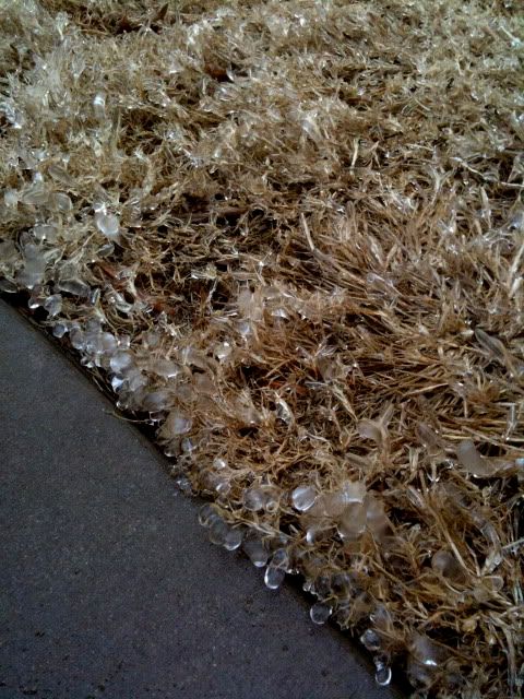
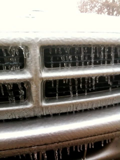
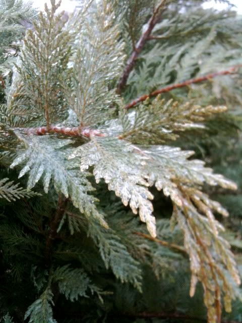
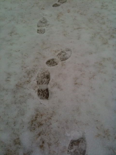
EVENT...MOD/HVY SNOW DEVELOPING
.
SATELLITE ANALYSIS AND TRENDS...WV IMAGERY IS SHOWING STRONG S/WV
SWINGING ENEWD ACROSS N-CENTRAL TX WITH INCREASING DIFFLUENT FLOW ALOFT.
EXPERIMENTAL MESO WINDS PRODUCT IS ADDITIONALLY SHOWING VERY STRONG
DIVERGENCE ALOFT ACROSS CENTRAL AND ERN OK AHEAD OF THIS S/WV AND WITHIN
LEFT-EXIT REGION OF 100 KT UL JET.
.
ALREADY PRECIPITATION...MAINLY IN THE FROZEN FORM IS FILLING IN NICELY
ACROSS CENTRAL/ERN OK...NW AR...SE KS...SW MO BASED ON RADAR AND STLT
IR LOOPS ARE SHOWING CLOUD TOPS EXPANDING IN COVERAGE ACROSS THE AREA IN
THE LAST 1-2 HRS. RATES ARE EXPECTED TO PICKUP AS MID-UL DYNAMICS FROM
THIS S/WV AND JET HELP IN INCREASING THE UVVS. MOD/HVY SNOW IS EXPECTED
TO DEVELOP OVER THE NEXT 1-3 HRS WITH RATES IN EXCESS OF 1.0"/HR POSSIBLE.
.
SEE NCEP HPC DISCUSSION AND QPF/S FOR FORECAST.
....NESDIS IS A MEMBER OF 12 PLANET....
.
SSD/SAB WEB ADDRESS FOR PRECIP ESTIMATES:
HTTP://WWW.SSD.NOAA.GOV/PS/PCPN/
...ALL LOWER CASE EXCEPT /PS/PCPN/
.
LAT...LON 3755 9435 3461 9415 3448 9761 3683 9787
0 likes   
Carla/Alicia/Jerry(In The Eye)/Michelle/Charley/Ivan/Dennis/Katrina/Rita/Wilma/Ike/Harvey

Member: National Weather Association
Wx Infinity Forums
http://wxinfinity.com/index.php

Facebook.com/WeatherInfinity
Twitter @WeatherInfinity


Return to “Winter Weather”

Who is online

Users browsing this forum: No registered users and 6 guests