But to totally write off the event is not right... Least I can say.
Texas winter wx thread (2009-2010)
Moderator: S2k Moderators
Forum rules
 The posts in this forum are NOT official forecast and should not be used as such. They are just the opinion of the poster and may or may not be backed by sound meteorological data. They are NOT endorsed by any professional institution or STORM2K.

The posts in this forum are NOT official forecast and should not be used as such. They are just the opinion of the poster and may or may not be backed by sound meteorological data. They are NOT endorsed by any professional institution or STORM2K.
-
Weatherdude20
Re: Texas winter wx thread (2009-2010)
Yeah, I think the NWS should atleast issue a special weather statement for the possibility of a winter weather disturbance to warn public that as far as models have depicted so far, a Winter Storm that could potentially cause widespread impacts across the region may occur.
But to totally write off the event is not right... Least I can say.
But to totally write off the event is not right... Least I can say.
0 likes
-
orangeblood
- S2K Supporter

- Posts: 3895
- Joined: Tue Dec 15, 2009 6:14 pm
- Location: Fort Worth, TX
Re:
msstateguy83 wrote:thats a good point of putting out graphics but when was that made?? to my knowledge i thought the ull was tracking further south then that not up ne if iam reading the graphic right
Yeah, that low is forecasted to move SE on most weather models. Wonder which one they are looking at ?
0 likes


-
wxman57

- Moderator-Pro Met

- Posts: 23175
- Age: 68
- Joined: Sat Jun 21, 2003 8:06 pm
- Location: Houston, TX (southwest)
Re: Texas winter wx thread (2009-2010)
mrgolf wrote:TXAGWXMAN,i got a question to ask you.I live up in memphis,tn.I know a little bit about weather,but not as much as you obviously.I know the ridge in eastern canada has been really strong and it has suppressed the barclinic zone well down in the gulf as of late.IF the ridge weakens enough before monday and the ridge retrogrades into west-central canada,as advertised by the HPC,could that allow the storm for next week to shift further north? Just wanted to know your take on that scenario.Thanks kevin
The storm track will eventually retreat to the north, putting the Memphis area back into the more exciting weather. The GFS suggests such a pattern change by the 8th of March.
0 likes
-
Storm Tracker SA-CS
- Tropical Depression

- Posts: 97
- Joined: Fri Feb 19, 2010 2:01 pm
- Location: College Station, TX
Re: Texas winter wx thread (2009-2010)
so do you guys think that winter is not over yet in san antonio and college station?
should i warn my family and friends of one or possibly 2 more winter storms?
should i warn my family and friends of one or possibly 2 more winter storms?
0 likes
-
Storm Tracker SA-CS
- Tropical Depression
- Posts: 97
- Joined: Fri Feb 19, 2010 2:01 pm
- Location: College Station, TX
Re: Texas winter wx thread (2009-2010)
hgx afd
HAVE IGNORED THE 12Z GFS
SOLUTION FOR TIME PERIOD BEYOND SUNDAY 18Z AS IT QUICKLY BECOMES
AN OUTLIER. WARM FRONT SETS UP NEAR COAST 00Z MONDAY AND POTENT
UPPER LOW MOVES VERY SLOWLY OUT OF NEW MEXICO 18Z SUN INTO WEST
CENTRAL TEXAS BY 18Z MONDAY. DIFFLUENT FLOW ALOFT AND STRONG WARM
FRONTOGENESIS DEVELOPS OVER SETX/SETX UTCW. SURFACE LOW FORMS
INLAND OF BROWNSVILLE AND THEN MOVES NORTHEAST TUCKED IN CLOSE TO
THE COAST YIELDING A STRONG EASTERLY FLOW THAT WILL LIKELY BRING A
ROUND OF ELEVATED TIDE ISSUES. WET SCENARIO FOR SETX 00Z MON-06Z
TUE WITH THE LOWS PASSAGE THROUGH THE UTCW BUT AS OF NOW NOT
GETTING SETX INTO THE WARM SECTOR. WILL HAVE TO WATCH THIS SYSTEM
CLOSELY AS THE ECMWF HAS BEEN SLOWING IT DOWN AND WIND PROFILES
ARE VERY STRONG.
does this mean watch for the possibility of another snow event in SE texas?
0 likes

Re: Texas winter wx thread (2009-2010)
Storm Tracker SA-CS wrote:so do you guys think that winter is not over yet in san antonio and college station?
should i warn my family and friends of one or possibly 2 more winter storms?
That's really optimistic as those areas really have only seen one real storm all winter (yesterday) it will take quite a bit of things coming together for those areas to see snow again. But the region (southern plains) as a whole there's a possibility of another one before season is out in the wacky winter that is.
0 likes
The above post and any post by Ntxw is NOT an official forecast and should not be used as such. It is just the opinion of the poster and may or may not be backed by sound meteorological data. It is NOT endorsed by any professional institution including Storm2k. For official information, please refer to NWS products.
Help support Storm2K!

Re: Texas winter wx thread (2009-2010)
Wxman57, ive heard the barclinic zone will shift further north,but once the ridge over canada shifts into west-central canada,wont that allow most of us to start warming up with ridge over central plains?I personally think our winterstorm chances are over if we dont get anything from this storm next week.just wondering 
0 likes
-
Portastorm

- Storm2k Moderator

- Posts: 9955
- Age: 63
- Joined: Fri Jul 11, 2003 9:16 am
- Location: Round Rock, TX
- Contact:
Re: Texas winter wx thread (2009-2010)
Storm Tracker SA-CS wrote:hgx afd
HAVE IGNORED THE 12Z GFS
SOLUTION FOR TIME PERIOD BEYOND SUNDAY 18Z AS IT QUICKLY BECOMES
AN OUTLIER. WARM FRONT SETS UP NEAR COAST 00Z MONDAY AND POTENT
UPPER LOW MOVES VERY SLOWLY OUT OF NEW MEXICO 18Z SUN INTO WEST
CENTRAL TEXAS BY 18Z MONDAY. DIFFLUENT FLOW ALOFT AND STRONG WARM
FRONTOGENESIS DEVELOPS OVER SETX/SETX UTCW. SURFACE LOW FORMS
INLAND OF BROWNSVILLE AND THEN MOVES NORTHEAST TUCKED IN CLOSE TO
THE COAST YIELDING A STRONG EASTERLY FLOW THAT WILL LIKELY BRING A
ROUND OF ELEVATED TIDE ISSUES. WET SCENARIO FOR SETX 00Z MON-06Z
TUE WITH THE LOWS PASSAGE THROUGH THE UTCW BUT AS OF NOW NOT
GETTING SETX INTO THE WARM SECTOR. WILL HAVE TO WATCH THIS SYSTEM
CLOSELY AS THE ECMWF HAS BEEN SLOWING IT DOWN AND WIND PROFILES
ARE VERY STRONG.
does this mean watch for the possibility of another snow event in SE texas?
No. It means that there could be some serious tidal issues along the coast and that there could be a very wet/stormy period for the HGX area as a result of the Euro slowing it down.
0 likes
-
Storm Tracker SA-CS
- Tropical Depression
- Posts: 97
- Joined: Fri Feb 19, 2010 2:01 pm
- Location: College Station, TX
Re: Texas winter wx thread (2009-2010)
oh so there isnt another chance of snow here with this system next week?
0 likes
-
msstateguy83
-
wxman57
- Moderator-Pro Met
- Posts: 23175
- Age: 68
- Joined: Sat Jun 21, 2003 8:06 pm
- Location: Houston, TX (southwest)
Re: Texas winter wx thread (2009-2010)
Storm Tracker SA-CS wrote:hgx afd
HAVE IGNORED THE 12Z GFS
SOLUTION FOR TIME PERIOD BEYOND SUNDAY 18Z AS IT QUICKLY BECOMES
AN OUTLIER. WARM FRONT SETS UP NEAR COAST 00Z MONDAY AND POTENT
UPPER LOW MOVES VERY SLOWLY OUT OF NEW MEXICO 18Z SUN INTO WEST
CENTRAL TEXAS BY 18Z MONDAY. DIFFLUENT FLOW ALOFT AND STRONG WARM
FRONTOGENESIS DEVELOPS OVER SETX/SETX UTCW. SURFACE LOW FORMS
INLAND OF BROWNSVILLE AND THEN MOVES NORTHEAST TUCKED IN CLOSE TO
THE COAST YIELDING A STRONG EASTERLY FLOW THAT WILL LIKELY BRING A
ROUND OF ELEVATED TIDE ISSUES. WET SCENARIO FOR SETX 00Z MON-06Z
TUE WITH THE LOWS PASSAGE THROUGH THE UTCW BUT AS OF NOW NOT
GETTING SETX INTO THE WARM SECTOR. WILL HAVE TO WATCH THIS SYSTEM
CLOSELY AS THE ECMWF HAS BEEN SLOWING IT DOWN AND WIND PROFILES
ARE VERY STRONG.
does this mean watch for the possibility of another snow event in SE texas?
I believe the concern may be for severe weather not snow.
0 likes
Re: Texas winter wx thread (2009-2010)


0 likes
The above post and any post by Ntxw is NOT an official forecast and should not be used as such. It is just the opinion of the poster and may or may not be backed by sound meteorological data. It is NOT endorsed by any professional institution including Storm2k. For official information, please refer to NWS products.
Help support Storm2K!
Help support Storm2K!


Re: Texas winter wx thread (2009-2010)
Ntxw wrote:
What's it saying Ntxw?
0 likes
Mom to 8 really is enough!
Stormy and more chilly weather for wxman's enjoyment!
0 likes
The above post and any post by Ntxw is NOT an official forecast and should not be used as such. It is just the opinion of the poster and may or may not be backed by sound meteorological data. It is NOT endorsed by any professional institution including Storm2k. For official information, please refer to NWS products.
Help support Storm2K!
Help support Storm2K!
-
Portastorm
- Storm2k Moderator
- Posts: 9955
- Age: 63
- Joined: Fri Jul 11, 2003 9:16 am
- Location: Round Rock, TX
- Contact:
Re: Texas winter wx thread (2009-2010)
CPC is on board with a heavy snow threat for the Panhandle and NE Texas early next week:
http://www.cpc.ncep.noaa.gov/products/predictions/threats/p_threats.gif
http://www.cpc.ncep.noaa.gov/products/predictions/threats/p_threats.gif
0 likes
Re: Texas winter wx thread (2009-2010)
IMHO, this storm will likely take the southern route due to the blocking of the upcoming nor'easter hanging around for a prolonged period up in the northeast.

As for the next month from the CPC


0 likes
The above post and any post by Ntxw is NOT an official forecast and should not be used as such. It is just the opinion of the poster and may or may not be backed by sound meteorological data. It is NOT endorsed by any professional institution including Storm2k. For official information, please refer to NWS products.
Help support Storm2K!
Help support Storm2K!
-
msstateguy83
000
FXUS64 KFWD 242203
AFDFWD
AREA FORECAST DISCUSSION
NATIONAL WEATHER SERVICE FORT WORTH TX
403 PM CST WED FEB 24 2010
.DISCUSSION...
SUNSHINE EFFECTIVELY MELTED SNOW TODAY. VISIBLE SATELLITE SHOWS
SOME SNOWCOVER REMAINING FROM GROESBECK AND TEAGUE...TO SOUTHERN
ANDERSON COUNTY...WHERE AS MUCH AS 6 INCHES OF SNOW FELL.
THE 10F ISODROSOTHERM HAS INVADED NORTHEAST TEXAS...WITH DEW
POINTS IN THE TEENS NOW INTO NORTH CENTRAL TEXAS. WINDS ARE
DIMINISHING AS SURFACE RIDGE BEGINS TRANSITING THE CWA FROM WEST
TO EAST. RETURN FLOW EVIDENT IN WESTERN ZONES...BWD-BKD-RPH-SPS.
ALTHOUGH SOUTHERLY WINDS WILL RETURN OVERNIGHT...SPEEDS WILL BE
LIGHT WITH MINIMAL ADVECTION. DRY AIR...CLEAR SKIES...AND LIGHT
WINDS WILL BE A RECIPE FOR EFFECTIVE RADIATIONAL COOLING TONIGHT.
MOISTURE WILL TRY TO MAKE A RAPID RETURN BEFORE NEXT FRONT ARRIVES
ON FRIDAY. MID-LEVEL TROUGH NEARLY COINCIDENT WITH THE SURFACE
FRONT WILL MEAN THE BULK OF THE LIFT WILL BE IN ADVANCE AND NEAR
SURFACE FROPA. TEMPERATURES ALONG THE RED RIVER WILL BE IN THE 30S
AS PRECIP IS ENDING. BUT WITH DOWNGLIDE AND DRYING ENSUING
THEREAFTER...SEE LITTLE IMPETUS FOR PRECIPITATION ONCE COLUMN
APPROACHES PROFILE FAVORABLE FOR SNOW REACHING THE SURFACE. WILL
MAINTAIN ALL RAIN FOR NOW...BUT WILL BEAR WATCHING FOR RAIN/SNOW
MIX FAR NORTH. OUN SNOW ACCUMULATION IS NEAR ZERO IMMEDIATELY
ADJACENT TO THE RED RIVER...SO INTEROFFICE BOUNDARY IS WITHIN
TOLERANCE FOR NOW.
GFS IS RAPIDLY BECOMING AN OUTLIER FOR SYSTEM EARLY NEXT WEEK.
HAVE FAVORED ECMWF/CANADIAN FOR MANY ELEMENTS...BUT HAVE NOT
ALTERED POPS TO ENTIRELY REFLECT COASTAL LOW CONSENSUS DEVELOPS.
SOME CONCERN IT WILL SIPHON OFF MOISTURE AND LIMIT PRECIP ON
MONDAY. MUCH TOO EARLY TO PERFECT-PROG THE EVENT...BUT HAVE
INCREASED POPS A BIT AS CONFIDENCE RISES IN COVERAGE WITH FROPA
SUNDAY NIGHT. STILL REMAINS POTENTIAL FOR RAIN/SNOW MIX MONDAY...
BUT CONCERNS ABOUT MODEL INCONSISTENCIES WILL KEEP AN ALL-RAIN
FORECAST FOR DAY 5.
25
&&
.PRELIMINARY POINT TEMPS/POPS...
DALLAS-FT. WORTH, TX 33 58 40 46 34 / 0 10 40 30 10
WACO, TX 32 61 41 53 36 / 0 5 30 20 5
PARIS, TX 31 51 37 41 32 / 0 10 60 60 20
DENTON, TX 31 57 40 46 32 / 0 10 40 30 10
MCKINNEY, TX 30 54 39 44 32 / 0 10 40 30 10
DALLAS, TX 36 57 40 46 35 / 0 10 40 30 10
TERRELL, TX 33 58 40 45 34 / 0 10 40 30 10
CORSICANA, TX 33 57 43 49 35 / 0 5 40 30 10
TEMPLE, TX 33 59 41 55 35 / 0 5 20 20 5
&&
.FWD WATCHES/WARNINGS/ADVISORIES...
NONE.
&&
$$
91/25
0 likes
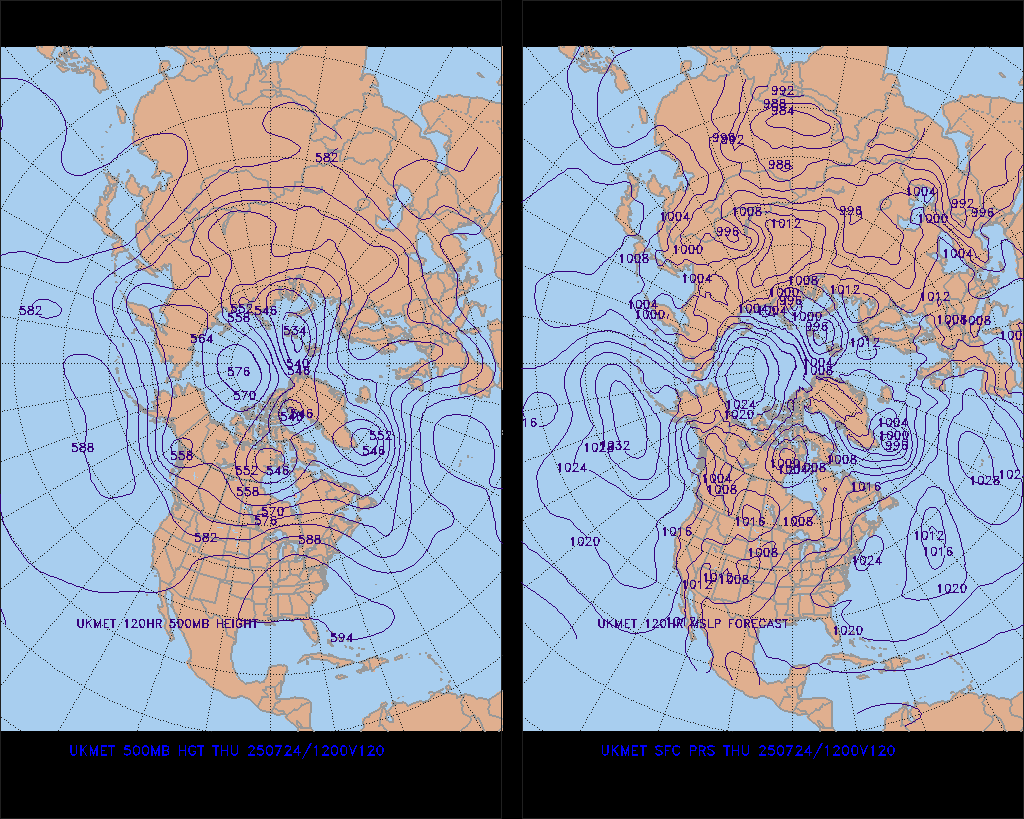
18z GFS never really cuts off the low pressure system. This is under a week from the event so between now and then either the other global models have to give way or the GFS. Lets see what tonight's 0z runs portray.
0 likes
The above post and any post by Ntxw is NOT an official forecast and should not be used as such. It is just the opinion of the poster and may or may not be backed by sound meteorological data. It is NOT endorsed by any professional institution including Storm2k. For official information, please refer to NWS products.
Help support Storm2K!
Help support Storm2K!
-
msstateguy83
Who is online
Users browsing this forum: No registered users and 97 guests