ENSO Updates (2007 thru 2023)
Moderator: S2k Moderators
Forum rules
The posts in this forum are NOT official forecasts and should not be used as such. They are just the opinion of the poster and may or may not be backed by sound meteorological data. They are NOT endorsed by any professional institution or STORM2K. For official information, please refer to products from the National Hurricane Center and National Weather Service.
The slow comedown continues with the El Nino, will be heading into the weak category soon enough if it carries on weakening like it is.
0 likes
Personal Forecast Disclaimer:
The posts in this forum are NOT official forecast and should not be used as such. They are just the opinion of the poster and may or may not be backed by sound meteorological data. They are NOT endorsed by any professional institution or storm2k.org. For official information, please refer to the NHC and NWS products
The posts in this forum are NOT official forecast and should not be used as such. They are just the opinion of the poster and may or may not be backed by sound meteorological data. They are NOT endorsed by any professional institution or storm2k.org. For official information, please refer to the NHC and NWS products
- cycloneye
- Admin

- Posts: 149154
- Age: 69
- Joined: Thu Oct 10, 2002 10:54 am
- Location: San Juan, Puerto Rico
Re: ENSO Updates=30 day SOI Index rises rapidly
Daily SOI Index
http://www.longpaddock.qld.gov.au/Seaso ... SOIValues/
1-Apr-2010 +15.21
2-Apr-2010 +23.07
3-Apr-2010 +22.78
4-Apr-2010 +25.88
5-Apr-2010 +27.18
6-Apr-2010 +28.55
Look how the daily SOI index is going up since this month started now in positive territory and the 30 day index will follow.The SOI being positive is another indicator that El Nino is in it's last stage.
30 day SOI Index

0 likes
Visit the Caribbean-Central America Weather Thread where you can find at first post web cams,radars
and observations from Caribbean basin members Click Here
and observations from Caribbean basin members Click Here
- cycloneye
- Admin

- Posts: 149154
- Age: 69
- Joined: Thu Oct 10, 2002 10:54 am
- Location: San Juan, Puerto Rico
Re: ENSO Updates=30 day SOI Index rises rapidly
El Nino is below moderate status at +0.9C according to the latest BoM data.


0 likes
Visit the Caribbean-Central America Weather Thread where you can find at first post web cams,radars
and observations from Caribbean basin members Click Here
and observations from Caribbean basin members Click Here
Yeah, 0.9C would make it down to an weak event at least in the weeklies. Now down to aobut the same levels we saw in summer 2009 which shut the season down really.
I think its only a matter of time before we see some quicker weakening, esp if the models are to be believed over the next 45-60 days.
I think its only a matter of time before we see some quicker weakening, esp if the models are to be believed over the next 45-60 days.
0 likes
Personal Forecast Disclaimer:
The posts in this forum are NOT official forecast and should not be used as such. They are just the opinion of the poster and may or may not be backed by sound meteorological data. They are NOT endorsed by any professional institution or storm2k.org. For official information, please refer to the NHC and NWS products
The posts in this forum are NOT official forecast and should not be used as such. They are just the opinion of the poster and may or may not be backed by sound meteorological data. They are NOT endorsed by any professional institution or storm2k.org. For official information, please refer to the NHC and NWS products
- cycloneye
- Admin

- Posts: 149154
- Age: 69
- Joined: Thu Oct 10, 2002 10:54 am
- Location: San Juan, Puerto Rico
Re: ENSO Updates=30 day SOI Index rises rapidly
The updated 30 day SOI index continues to show the rapid rise and now is at -2.2 from -4.8 that was yesterday.See the graphic three posts up from this one.
0 likes
Visit the Caribbean-Central America Weather Thread where you can find at first post web cams,radars
and observations from Caribbean basin members Click Here
and observations from Caribbean basin members Click Here
- brunota2003
- S2K Supporter

- Posts: 9476
- Age: 35
- Joined: Sat Jul 30, 2005 9:56 pm
- Location: Stanton, KY...formerly Havelock, NC
- Contact:
Re: ENSO Updates=30 day SOI Index rises rapidly
With yesterday's data in, the 30 day SOI index is above 0 for the first time since October.
http://www.longpaddock.qld.gov.au/Seaso ... SOIValues/
http://www.longpaddock.qld.gov.au/Seaso ... SOIValues/
0 likes
- cycloneye
- Admin

- Posts: 149154
- Age: 69
- Joined: Thu Oct 10, 2002 10:54 am
- Location: San Juan, Puerto Rico
Re: ENSO Updates=30 day SOI Index rises rapidly
The NASA model is in line with the other dynamic models that forecast Neutral conditions by May or June.
http://gmao.gsfc.nasa.gov/cgi-bin/produ ... /index.cgi

http://gmao.gsfc.nasa.gov/cgi-bin/produ ... /index.cgi

0 likes
Visit the Caribbean-Central America Weather Thread where you can find at first post web cams,radars
and observations from Caribbean basin members Click Here
and observations from Caribbean basin members Click Here
Wow thats really agressive cycloneye, it looks like that model is going for something very similar to 1998!
0 likes
Personal Forecast Disclaimer:
The posts in this forum are NOT official forecast and should not be used as such. They are just the opinion of the poster and may or may not be backed by sound meteorological data. They are NOT endorsed by any professional institution or storm2k.org. For official information, please refer to the NHC and NWS products
The posts in this forum are NOT official forecast and should not be used as such. They are just the opinion of the poster and may or may not be backed by sound meteorological data. They are NOT endorsed by any professional institution or storm2k.org. For official information, please refer to the NHC and NWS products
- cycloneye
- Admin

- Posts: 149154
- Age: 69
- Joined: Thu Oct 10, 2002 10:54 am
- Location: San Juan, Puerto Rico
Re: ENSO Updates
The daily data has gone to positive this morning.This will reflect in the 30 day index in the next day or two.
http://www.longpaddock.qld.gov.au/Seaso ... SOIValues/
8-Apr-2010 +1.07
http://www.longpaddock.qld.gov.au/Seaso ... SOIValues/
8-Apr-2010 +1.07
0 likes
Visit the Caribbean-Central America Weather Thread where you can find at first post web cams,radars
and observations from Caribbean basin members Click Here
and observations from Caribbean basin members Click Here
- cycloneye
- Admin

- Posts: 149154
- Age: 69
- Joined: Thu Oct 10, 2002 10:54 am
- Location: San Juan, Puerto Rico
Re: ENSO Updates
Climate Prediction Center Monthly update
No surprises here as they continue to forecast Neutral ENSO by the summer.
http://www.cpc.ncep.noaa.gov/products/a ... odisc.html
Synopsis: El Niño is expected to continue through the Northern Hemisphere spring 2010 and transition to ENSO-neutral conditions by Northern Hemisphere summer 2010.
El Niño weakened to moderate strength during March 2010, with sea surface temperature (SST) anomalies decreasing slightly, but still exceeding +1oC across much of the central and eastern equatorial Pacific Ocean at the end of the month (Fig. 1 and Fig. 2). Subsurface heat content anomalies (average temperatures in the upper 300m of the ocean, Fig. 3) decreased during March in response to the eastward expansion of below-average temperature anomalies at depth (100-200m) into the east-central Pacific (Fig. 4). Anomalous tropical convection remained consistent with El Niño, with enhanced convection over the central and eastern Pacific and suppressed convection over Indonesia (Fig. 5). The equatorial low-level easterly trade winds strengthened near the Date Line, while upper-level easterly wind anomalies became confined to the eastern Pacific. Collectively, these oceanic and atmospheric anomalies reflect an ongoing, but weakening El Niño.
Nearly all models predict decreasing SST anomalies in the Niño-3.4 region through 2010, with the model spread increasing at longer lead times (Fig. 6). The majority of models predict the 3-month Niño-3.4 SST anomaly will drop below +0.5oC by May-June-July 2010, indicating a transition to ENSO-neutral conditions that will likely persist through Northern Hemisphere summer. Over the last couple months, an increasing number of models, including the latest runs from the NCEP Climate Forecast System (CFS), are predicting below-average temperatures in the Niño-3.4 region by Northern Hemisphere fall, with some forecasts meeting thresholds for La Niña. However, it should be noted that model skill is at a minimum during this time of year, and also that the majority of models continue to indicate the persistence of ENSO-neutral conditions through 2010.
Expected El Niño impacts during April-June 2010 include drier-than-average conditions over Indonesia and enhanced convection over the central and eastern equatorial Pacific Ocean. For the contiguous United States, potential El Niño impacts include above-average precipitation for the southeastern states, while above-average temperatures are most likely for the Pacific Northwest.
0 likes
Visit the Caribbean-Central America Weather Thread where you can find at first post web cams,radars
and observations from Caribbean basin members Click Here
and observations from Caribbean basin members Click Here
- cycloneye
- Admin

- Posts: 149154
- Age: 69
- Joined: Thu Oct 10, 2002 10:54 am
- Location: San Juan, Puerto Rico
Re: ENSO Updates=30 day SOI goes positive since early October
Is the first time since early October that the 30 day SOI index goes to positive territory.


0 likes
Visit the Caribbean-Central America Weather Thread where you can find at first post web cams,radars
and observations from Caribbean basin members Click Here
and observations from Caribbean basin members Click Here
- cycloneye
- Admin

- Posts: 149154
- Age: 69
- Joined: Thu Oct 10, 2002 10:54 am
- Location: San Juan, Puerto Rico
Re: ENSO Updates
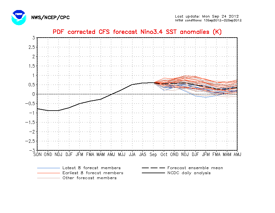
No change in the CFS model forecast of Neutral ENSO by June.


0 likes
Visit the Caribbean-Central America Weather Thread where you can find at first post web cams,radars
and observations from Caribbean basin members Click Here
and observations from Caribbean basin members Click Here
- brunota2003
- S2K Supporter

- Posts: 9476
- Age: 35
- Joined: Sat Jul 30, 2005 9:56 pm
- Location: Stanton, KY...formerly Havelock, NC
- Contact:
- cycloneye
- Admin

- Posts: 149154
- Age: 69
- Joined: Thu Oct 10, 2002 10:54 am
- Location: San Juan, Puerto Rico
Re:
brunota2003 wrote:+2.9 for the 30 day SOI
Yup,and it will keep climbing as the daily numbers continue to go up.It means that El Nino is toasted.
http://www.longpaddock.qld.gov.au/Seaso ... SOIValues/
0 likes
Visit the Caribbean-Central America Weather Thread where you can find at first post web cams,radars
and observations from Caribbean basin members Click Here
and observations from Caribbean basin members Click Here
-
Plant grower
- Tropical Depression

- Posts: 73
- Joined: Sat Feb 07, 2009 4:20 pm
Re: Re:
cycloneye wrote:brunota2003 wrote:+2.9 for the 30 day SOI
Yup,and it will keep climbing as the daily numbers continue to go up.It means that El Nino is toasted.
http://www.longpaddock.qld.gov.au/Seaso ... SOIValues/
By by nino hello no sleep this summer for me.
0 likes
- brunota2003
- S2K Supporter

- Posts: 9476
- Age: 35
- Joined: Sat Jul 30, 2005 9:56 pm
- Location: Stanton, KY...formerly Havelock, NC
- Contact:
- cycloneye
- Admin

- Posts: 149154
- Age: 69
- Joined: Thu Oct 10, 2002 10:54 am
- Location: San Juan, Puerto Rico
Re: ENSO Updates=CPC 4/12/10 update=El Nino 3.4 below +1.0C
Climate Prediction Center 4/12/10 update
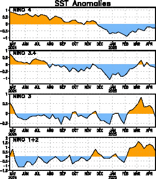
Data from the Climate Prediction Center's 4/12/10 update indicate that El Nino 3.4 area has falled to +0.8C,from the +1.0C number it was last week meaning that El Nino days are numbered.
Last Week Numbers
Niño 4= +0.9ºC
Nino 3.4=+1.0C
Niño 3= +0.9ºC
Niño1+2= +0.1ºC
This Week Numbers
Niño 4= +1.0ºC
Nino 3.4=+0.8C
Niño 3= +0.8ºC
Niño1+2= +0.4ºC
http://www.cpc.ncep.noaa.gov/products/a ... ts-web.pdf

0 likes
Visit the Caribbean-Central America Weather Thread where you can find at first post web cams,radars
and observations from Caribbean basin members Click Here
and observations from Caribbean basin members Click Here
- cycloneye
- Admin

- Posts: 149154
- Age: 69
- Joined: Thu Oct 10, 2002 10:54 am
- Location: San Juan, Puerto Rico
Re: ENSO Updates=CPC 4/12/10 update=El Nino 3.4 falls to +0.8C
The 30 day SOI index continues to go up,now at +5.2.See the graphic seven posts above this one.
0 likes
Visit the Caribbean-Central America Weather Thread where you can find at first post web cams,radars
and observations from Caribbean basin members Click Here
and observations from Caribbean basin members Click Here


