APR 24 1050 EDT
TORNADO
9 MI W MERIDIAN
LAUDERDALE CTY
MS
TRAINED SPOTTER
MULTIPLE TREES DOWN ACROSS HWY 80
IN TOWN OF MEEHAM
Severe Weather Threat. April 21st-25th, 2010 High Risk!
Moderator: S2k Moderators
Forum rules

The posts in this forum are NOT official forecast and should not be used as such. They are just the opinion of the poster and may or may not be backed by sound meteorological data. They are NOT endorsed by any professional institution or STORM2K.
-
Stephanie

- S2K Supporter

- Posts: 23843
- Age: 63
- Joined: Thu Feb 06, 2003 9:53 am
- Location: Glassboro, NJ
Re: Severe Weather Threat. April 21st-25th, 2010 High Risk!
The stream link above has no audio and is just showing the dopplar radar. 
0 likes
-
Dave

- Retired Staff

- Posts: 13442
- Age: 75
- Joined: Tue Aug 01, 2006 3:57 pm
- Location: Milan Indiana
- Contact:
LAUDERDALE MS-
1015 AM CDT SAT APR 24 2010
...A TORNADO WARNING REMAINS IN EFFECT UNTIL 1045 AM CDT FOR
NORTHEASTERN LAUDERDALE COUNTY...
AT 1015 AM CDT...NATIONAL WEATHER SERVICE METEOROLOGISTS CONTINUE TO
TRACK A SEVERE THUNDERSTORM CAPABLE OF PRODUCING A TORNADO. THIS
TORNADO WAS LOCATED NEAR TOOMSUBA MOVING NORTHEAST AT 50 MPH.
0 likes
-
Texas Snowman

- Storm2k Moderator

- Posts: 6197
- Joined: Fri Jan 25, 2008 11:29 am
- Location: Denison, Texas
Re: Severe Weather Threat. April 21st-25th, 2010 High Risk!
I've noticed something the past couple of days. Feel totally stupid for not figuring it out before now.
What I've noticed: last couple of days out west, tornado warnings often indicate a radar indicated twister and spotters confirming it.
I.E. "radar continues to indicate and spotters are tracking a large and dangerous tornado".
But you get over towards the Mississippi River and it's almost always worded "radar indicates a possible tornado."
I'm guessing trees...or the lack thereof...is the reason for that difference.
0 likes
The above post and any post by Texas Snowman is NOT an official forecast and should not be used as such. It is just the opinion of the poster and may or may not be backed by sound meteorological data. It is NOT endorsed by any professional institution including storm2k.org. For official information, please refer to NWS products.
-
CrazyC83
- Professional-Met

- Posts: 34315
- Joined: Tue Mar 07, 2006 11:57 pm
- Location: Deep South, for the first time!
Re: Severe Weather Threat. April 21st-25th, 2010 High Risk!
Texas Snowman wrote:I've noticed something the past couple of days. Feel totally stupid for not figuring it out before now.
What I've noticed: last couple of days out west, tornado warnings often indicate a radar indicated twister and spotters confirming it.
I.E. "radar continues to indicate and spotters are tracking a large and dangerous tornado".
But you get over towards the Mississippi River and it's almost always worded "radar indicates a possible tornado."
I'm guessing trees...or the lack thereof...is the reason for that difference.
That is correct - it has to do with trees, hills and HP supercells. Many tornadoes likely will not be initially reported.
0 likes
-
Texas Snowman
- Storm2k Moderator
- Posts: 6197
- Joined: Fri Jan 25, 2008 11:29 am
- Location: Denison, Texas
Re:
Dave wrote:APR 24 1100 EDT
TORNADO
MERIDIAN
LAUDERDALE
MS
TRAINED SPOTTER
TREES BLOCKING I-20 WITHIN MERIDIAN CITY LIMITS
That doesn't sound good...
0 likes
The above post and any post by Texas Snowman is NOT an official forecast and should not be used as such. It is just the opinion of the poster and may or may not be backed by sound meteorological data. It is NOT endorsed by any professional institution including storm2k.org. For official information, please refer to NWS products.
-
Dave
- Retired Staff
- Posts: 13442
- Age: 75
- Joined: Tue Aug 01, 2006 3:57 pm
- Location: Milan Indiana
- Contact:
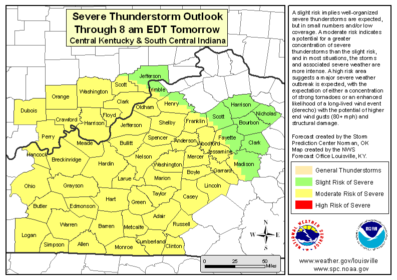
National Weather Service Weather Forecast Office
Louisville, KY
It now appears increasingly likely that severe storms will take place over the Ohio Valley today. Low and mid-level winds will increase in response to a deepening surface low which will increase wind shear as well. As a result, this afternoon and evening...conditions will
become favorable for one or more intense lines of storms and rotating supercells especially
over south central Kentucky. The main hazard from these storms will be wind
damage...potentially significant. Tornadoes are also possible, espcially after the first line of storms moves through the area. Some of these tornadoes may be strong and have long tracks. Hail, heavy rain, and cloud-to-ground lightning are likely as well.
Residents need to monitor later forecasts and statements from the National Weather
Service and local media for updates on this developing hazardous weather situation.
0 likes
-
CrazyC83
- Professional-Met
- Posts: 34315
- Joined: Tue Mar 07, 2006 11:57 pm
- Location: Deep South, for the first time!
Re: Severe Weather Threat. April 21st-25th, 2010 High Risk!
MESOSCALE DISCUSSION 0373
NWS STORM PREDICTION CENTER NORMAN OK
1028 AM CDT SAT APR 24 2010
AREAS AFFECTED...ERN LA...CNTRL/SRN MS...CNTRL/SRN AL
CONCERNING...TORNADO WATCH 91...92...93...
VALID 241528Z - 241700Z
THE SEVERE WEATHER THREAT FOR TORNADO WATCH
91...92...93...CONTINUES.
TORNADO THREAT WILL CONTINUE THROUGH THE AFTN WITH POTENTIALLY
STRONG AND LONG-TRACKED TORNADOES/SUPERCELLS LIKELY. VERY LARGE
HAIL AND DMGG WIND GUSTS CAN ALSO BE EXPECTED.
A COUPLE OF LARGE TSTMS...EXHIBITING SUPERCELL CHARACTERISTICS...
CONTINUE TO THRIVE WITHIN STRONG WAA REGIME ACROSS SERN MS AT 15Z.
THESE STORMS WILL CONTINUE ENE INTO CNTRL/SRN AL THROUGH LATE
MORNING ALONG NRN EDGE OF UPR 60S DEW POINTS. LOW-LCLS AND 400+
M2/S2 0-1KM SRH WILL ENHANCE THE TORNADO RISKS. NEARLY 8 DEG C/KM
MID-LVL LAPSE RATES WILL MAINTAIN THREAT OF VERY LARGE HAIL.
ACTIVITY...PER LATEST 4KM WRF-NMM...MAY REACH INTO ERN AL/WRN GA BY
22Z.
IN WAKE OF THESE STORMS...LARGE SCALE ASCENT WILL CONTINUE TO
INCREASE DOWNSTREAM OF THE NEGATIVE-TILT UPR SYSTEM OVER THE
ARKLATEX. WHILE ITS NOT ENTIRELY CLEAR...MORE STORMS WILL PROBABLY
DEVELOP IN THE DESTABILIZING/EXPANDING WARM SECTOR OVER THE LWR MS
VLY AND SPREAD ENE ACROSS CNTRL/SRN MS...ERN LA AND SRN AL THROUGH
THE AFTN. BEST INGREDIENTS FOR STRONG TORNADOES WILL EXIST OVER
CNTRL/NRN MS NWD...BUT IMPRESSIVE LLVL SHEAR PROFILES AND
MOIST/UNSTABLE BOUNDARY LAYER WILL MAINTAIN POSSIBILITIES OF
SIGNIFICANT TORNADOES ACROSS SRN PORTIONS OF MS/AL AND ERN LA
THROUGH THE AFTN AS WELL. THIS WILL BE PARTICULARLY THE CASE WITH
DISCRETE STORMS THAT MAY DEVELOP AHEAD OF THE DEVELOPING QLCS INVOF
THE WIND SHIFT PROGRESSING W-E THROUGH THE MID-SOUTH/LWR MS VLY THIS
AFTN.
..RACY.. 04/24/2010
ATTN...WFO...FFC...BMX...HUN...MOB...JAN...LIX...LCH...SHV...
LAT...LON 32279193 34208628 34378513 33448506 32148605 30528769
30369251 32279193
0 likes
-
Dave
- Retired Staff
- Posts: 13442
- Age: 75
- Joined: Tue Aug 01, 2006 3:57 pm
- Location: Milan Indiana
- Contact:
Pulling local information for a minute...
HAZARDOUS WEATHER OUTLOOK...CORRECTED
NATIONAL WEATHER SERVICE INDIANAPOLIS IN
934 AM EDT SAT APR 24 2010
INZ060-061-067>071-251345-
SULLIVAN-GREENE-KNOX-DAVIESS-MARTIN-LAWRENCE-JACKSON-
934 AM EDT SAT APR 24 2010
THIS HAZARDOUS WEATHER OUTLOOK IS FOR FAR SOUTHERN SECTIONS OF CENTRAL
INDIANA.
.DAY ONE...TODAY AND TONIGHT.
THUNDERSTORMS ARE LIKELY THIS AFTERNOON AND EVENING...AND SOME OF
THESE STORMS MAY BECOME SEVERE. THE PRIMARY THREAT FROM THESE
STORMS WILL BE DAMAGING WINDS...BUT TORNADOES ARE POSSIBLE AS
WELL. THE MOST LIKELY TIME FOR SEVERE STORMS LOOKS TO BE FROM 300
PM TO 1100 PM.
LIGHTNING IS A THREAT FROM ANY THUNDERSTORM THAT FORMS.
.DAYS TWO THROUGH SEVEN...SUNDAY THROUGH FRIDAY.
NO HAZARDOUS WEATHER IS EXPECTED AT THIS TIME.
.SPOTTER INFORMATION STATEMENT...
SPOTTER ACTIVATION MAY BE NEEDED THIS AFTERNOON AND EVENING.
Last edited by Dave on Sat Apr 24, 2010 10:32 am, edited 1 time in total.
0 likes


-
MGC

- S2K Supporter
- Posts: 5940
- Joined: Sun Mar 23, 2003 9:05 pm
- Location: Pass Christian MS, or what is left.
Re: Severe Weather Threat. April 21st-25th, 2010 High Risk!
Impressive hook echo with cell in NE Pearl River County MS tracking NE. Would not be surprised if it produces a twister......MGC
0 likes
Re: Severe Weather Threat. April 21st-25th, 2010 High Risk!
Live stream ABC 33/40 out of Birmingham reporting storm shelters opening up at Talledega.
0 likes
-
Texas Snowman
- Storm2k Moderator
- Posts: 6197
- Joined: Fri Jan 25, 2008 11:29 am
- Location: Denison, Texas
Re:
Bunkertor wrote:As to MD´s I have never read such like that...
...working on 373 ...
Going to be a LONG day I'm afraid.
This may be one of those super outbreaks talked about for years to come.
0 likes
The above post and any post by Texas Snowman is NOT an official forecast and should not be used as such. It is just the opinion of the poster and may or may not be backed by sound meteorological data. It is NOT endorsed by any professional institution including storm2k.org. For official information, please refer to NWS products.
-
Texas Snowman
- Storm2k Moderator
- Posts: 6197
- Joined: Fri Jan 25, 2008 11:29 am
- Location: Denison, Texas
Re: Severe Weather Threat. April 21st-25th, 2010 High Risk!
badger70 wrote:Live stream ABC 33/40 out of Birmingham reporting storm shelters opening up at Talledega.
If you've ever been to a NASCAR race...or driven by a track while a race weekend is going on...then you know how dangerous this situation is.
They have closed the track and the stands will be empty.
But there are tens of thousands camping around the track in motorhomes, RV trailers, truck campers, and tents. And that many people can't be evacuated quickly. (My wife and I sat in a parking lot at Texas Motor Speedway for four hours one time without the wheels ever moving.)
If a storm were to threaten the track, there would be countless people there that would literally be "sitting ducks".
0 likes
The above post and any post by Texas Snowman is NOT an official forecast and should not be used as such. It is just the opinion of the poster and may or may not be backed by sound meteorological data. It is NOT endorsed by any professional institution including storm2k.org. For official information, please refer to NWS products.
-
Dave
- Retired Staff
- Posts: 13442
- Age: 75
- Joined: Tue Aug 01, 2006 3:57 pm
- Location: Milan Indiana
- Contact:
MESOSCALE DISCUSSION 0373
NWS STORM PREDICTION CENTER NORMAN OK
1028 AM CDT SAT APR 24 2010
AREAS AFFECTED...ERN LA...CNTRL/SRN MS...CNTRL/SRN AL
CONCERNING...TORNADO WATCH 91...92...93...
VALID 241528Z - 241700Z
THE SEVERE WEATHER THREAT FOR TORNADO WATCH
91...92...93...CONTINUES.
TORNADO THREAT WILL CONTINUE THROUGH THE AFTN WITH POTENTIALLY
STRONG AND LONG-TRACKED TORNADOES/SUPERCELLS LIKELY. VERY LARGE
HAIL AND DMGG WIND GUSTS CAN ALSO BE EXPECTED.
A COUPLE OF LARGE TSTMS...EXHIBITING SUPERCELL CHARACTERISTICS...
CONTINUE TO THRIVE WITHIN STRONG WAA REGIME ACROSS SERN MS AT 15Z.
THESE STORMS WILL CONTINUE ENE INTO CNTRL/SRN AL THROUGH LATE
MORNING ALONG NRN EDGE OF UPR 60S DEW POINTS. LOW-LCLS AND 400+
M2/S2 0-1KM SRH WILL ENHANCE THE TORNADO RISKS. NEARLY 8 DEG C/KM
MID-LVL LAPSE RATES WILL MAINTAIN THREAT OF VERY LARGE HAIL.
ACTIVITY...PER LATEST 4KM WRF-NMM...MAY REACH INTO ERN AL/WRN GA BY
22Z.
IN WAKE OF THESE STORMS...LARGE SCALE ASCENT WILL CONTINUE TO
INCREASE DOWNSTREAM OF THE NEGATIVE-TILT UPR SYSTEM OVER THE
ARKLATEX. WHILE ITS NOT ENTIRELY CLEAR...MORE STORMS WILL PROBABLY
DEVELOP IN THE DESTABILIZING/EXPANDING WARM SECTOR OVER THE LWR MS
VLY AND SPREAD ENE ACROSS CNTRL/SRN MS...ERN LA AND SRN AL THROUGH
THE AFTN. BEST INGREDIENTS FOR STRONG TORNADOES WILL EXIST OVER
CNTRL/NRN MS NWD...BUT IMPRESSIVE LLVL SHEAR PROFILES AND
MOIST/UNSTABLE BOUNDARY LAYER WILL MAINTAIN POSSIBILITIES OF
SIGNIFICANT TORNADOES ACROSS SRN PORTIONS OF MS/AL AND ERN LA
THROUGH THE AFTN AS WELL. THIS WILL BE PARTICULARLY THE CASE WITH
DISCRETE STORMS THAT MAY DEVELOP AHEAD OF THE DEVELOPING QLCS INVOF
THE WIND SHIFT PROGRESSING W-E THROUGH THE MID-SOUTH/LWR MS VLY THIS
AFTN.
..RACY.. 04/24/2010
ATTN...WFO...FFC...BMX...HUN...MOB...JAN...LIX...LCH...SHV...
0 likes
Return to “USA & Caribbean Weather”
Who is online
Users browsing this forum: Cpv17 and 138 guests