2010 ACE: Atlantic=159.8625 / EPAC=48.44 / WPAC=118.6700

This is the general tropical discussion area. Anyone can take their shot at predicting a storms path.

Moderator: S2k Moderators

Forum rules

The posts in this forum are NOT official forecasts and should not be used as such. They are just the opinion of the poster and may or may not be backed by sound meteorological data. They are NOT endorsed by any professional institution or STORM2K. For official information, please refer to products from the National Hurricane Center and National Weather Service.

Help Support Storm2K
Message
Author
User avatar
RattleMan
Category 5
Category 5
Posts: 1218
Joined: Wed Aug 24, 2005 7:14 pm
Location: Phoenix, AZ

2010 ACE: Atlantic=159.8625 / EPAC=48.44 / WPAC=118.6700

#1 Postby RattleMan » Thu Jan 07, 2010 6:53 pm

This topic is a place to show all ACE that occurs in 2010. Remember that this is only for storms occuring in 2010, including SHEM storms that have a season that crosses years, but follows the Zeta protocol in that the ACE of storms that cross years count in the year they formed.

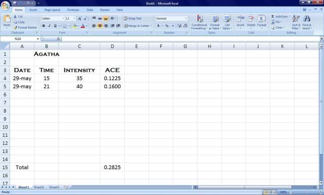
You can calculate ACE on your own if you want by downloading this Excel spreadsheet:
http://rattleman.fortunecity.com/ACE_Template.zip
Just modify the numbers in the "Knots" column on the left and the formulas within the spreadsheet will calculate everything else.

View 2009 ACE here:
viewtopic.php?f=31&t=105626

Data as of 7/1800z:

Code: Select all

   07S.Edzani   
Adv #   Knots   ACE
1   35   0.1225
2   40   0.16
3   40   0.16
4   45   0.2025
5   55   0.3025
6   75   0.5625
7   105   1.1025
8   120   1.44

Code: Select all

   Southwest Indian      
   Yearly ACE      
   Edzani   4.0525   100.00%
                  
   TOTAL   4.0525   
Last edited by cycloneye on Wed Nov 24, 2010 7:39 pm, edited 207 times in total.
Reason: Edited title to include totals from each basin
0 likes   

User avatar
cycloneye
Admin
Admin
Posts: 143865
Age: 68
Joined: Thu Oct 10, 2002 10:54 am
Location: San Juan, Puerto Rico

Re: 2010 ACE

#2 Postby cycloneye » Thu Jan 07, 2010 7:05 pm

Things started early with small but powerful TC Edzani.I am interested to see how will be the ACE numbers in the Atlantic after last years around 51 number.
0 likes   
Visit the Caribbean-Central America Weather Thread where you can find at first post web cams,radars
and observations from Caribbean basin members Click Here

User avatar
RattleMan
Category 5
Category 5
Posts: 1218
Joined: Wed Aug 24, 2005 7:14 pm
Location: Phoenix, AZ

Re: 2010 ACE

#3 Postby RattleMan » Sat Jan 09, 2010 3:16 pm

As of 09/1800z:

Code: Select all

   07S.Edzani   
Adv #   Knots   ACE
1   35   0.1225
2   40   0.16
3   40   0.16
4   45   0.2025
5   55   0.3025
6   75   0.5625
7   105   1.1025
8   120   1.44
9   125   1.5625
10   125   1.5625
11   140   1.96
12   135   1.8225
13   125   1.5625
14   120   1.44
15   115   1.3225
16   105   1.1025

Code: Select all

   Southwest Indian      
   Yearly ACE      
   Edzani   16.3875   100.00%
         
   TOTAL   16.3875   
0 likes   

User avatar
RattleMan
Category 5
Category 5
Posts: 1218
Joined: Wed Aug 24, 2005 7:14 pm
Location: Phoenix, AZ

Re: 2010 ACE

#4 Postby RattleMan » Thu Jan 14, 2010 10:26 pm

A little late, here's the final data on Edzani:

Code: Select all

   07S.Edzani   
Adv #   Knots   ACE
1   35   0.1225
2   40   0.16
3   40   0.16
4   45   0.2025
5   55   0.3025
6   75   0.5625
7   105   1.1025
8   120   1.44
9   125   1.5625
10   125   1.5625
11   140   1.96
12   135   1.8225
13   125   1.5625
14   120   1.44
15   115   1.3225
16   105   1.1025
17   100   1
18   100   1
19   90   0.81
20   75   0.5625
21   65   0.4225
22   55   0.3025
23   45   0.2025
24   45   0.2025
25   45   0.2025
26   45   0.2025
27   45   0.2025
28   45   0.2025
29   45   0.2025
30   45   0.2025
31   40   0.16
32   40   0.16
33   40   0.16
34   40   0.16
35   35   0.1225
36   35   0.1225

Code: Select all

   Southwest Indian      
   Yearly ACE      
   Edzani   22.99   100.00%
         
   TOTAL   22.99   
0 likes   

User avatar
cycloneye
Admin
Admin
Posts: 143865
Age: 68
Joined: Thu Oct 10, 2002 10:54 am
Location: San Juan, Puerto Rico

Re: 2010 ACE

#5 Postby cycloneye » Sun May 09, 2010 8:34 am

I am going to play the guessing game about the ACE numbers for the Atlantic and EPAC in 2010.

Atlantic=155
EPAC=105
0 likes   
Visit the Caribbean-Central America Weather Thread where you can find at first post web cams,radars
and observations from Caribbean basin members Click Here

User avatar
brunota2003
S2K Supporter
S2K Supporter
Posts: 9476
Age: 34
Joined: Sat Jul 30, 2005 9:56 pm
Location: Stanton, KY...formerly Havelock, NC
Contact:

#6 Postby brunota2003 » Sun May 09, 2010 2:12 pm

I think we might actually break 200 for the ACE in the Atlantic this year. What did 2005 end up with?
0 likes   

jinftl
Category 5
Category 5
Posts: 4312
Joined: Tue Aug 31, 2004 4:47 pm
Location: fort lauderdale, fl

Re:

#7 Postby jinftl » Sun May 09, 2010 2:29 pm

I added a post on another thread with the prediction that one private weather agency came out with that the analog years for 2010 will be 1958, 1964, 1966, 1969, 1995, 1998, and 2005.

The ACE for each of those seasons:

1958 - 121
1964 - 170
1966 - 145
1969 - 158
1995 - 228
1998 - 182
2005 - 248

The average of these seasons is 178. Anything higher than a season total ACE of 153 is considered a "hyperactive season". Anything above an ACE of 103 for the season is "above normal". If these anaolog years prove to be correct, we are not going to see anything like the total 2009 ACE of 51 this year!

http://en.wikipedia.org/wiki/Accumulated_cyclone_energy

brunota2003 wrote:I think we might actually break 200 for the ACE in the Atlantic this year. What did 2005 end up with?
0 likes   

User avatar
TreasureIslandFLGal
S2K Supporter
S2K Supporter
Posts: 1581
Age: 57
Joined: Sun Aug 15, 2004 6:16 pm
Location: Clearwater, Florida ~3 miles from the coast now. We finally moved safely off the barrier island!

Re: 2010 ACE

#8 Postby TreasureIslandFLGal » Thu May 13, 2010 12:32 pm

ACE for this year will be above 180 I predict. It will be a long year too...start early and end late. We will be watching the wet/dry cycles intently too, as it will be obvious that as they pass through an area, storms develop.
0 likes   
Chrissy & Ligeia
:flag:

User avatar
HURAKAN
Professional-Met
Professional-Met
Posts: 46086
Age: 38
Joined: Thu May 20, 2004 4:34 pm
Location: Key West, FL
Contact:

#9 Postby HURAKAN » Sat May 29, 2010 7:40 pm

Image
0 likes   

User avatar
cycloneye
Admin
Admin
Posts: 143865
Age: 68
Joined: Thu Oct 10, 2002 10:54 am
Location: San Juan, Puerto Rico

Re: 2010 ACE

#10 Postby cycloneye » Sat Jun 19, 2010 1:47 pm

Who wants to continue to post the ACE numbers as the EPAC continues roaring in front of the Atlantic in this early stage with Blas and Celia?
0 likes   
Visit the Caribbean-Central America Weather Thread where you can find at first post web cams,radars
and observations from Caribbean basin members Click Here

User avatar
hurricanetrack
HurricaneTrack.com
HurricaneTrack.com
Posts: 1781
Joined: Tue Dec 02, 2003 10:46 pm
Location: Wilmington, NC
Contact:

#11 Postby hurricanetrack » Sat Jun 19, 2010 2:05 pm

Anyone have that Excel formula template? If so, could you email it to me or post a link to it here? Thanks! mailroom at hurricanetrack dot com
0 likes   

User avatar
RattleMan
Category 5
Category 5
Posts: 1218
Joined: Wed Aug 24, 2005 7:14 pm
Location: Phoenix, AZ

Re: 2010 ACE

#12 Postby RattleMan » Sun Jun 20, 2010 1:56 am

Pardon my lack of postings thus far. Here we go!

20/0300z:

Code: Select all

   01E.Agatha   
Adv #   Knots   ACE
1   30-S   0
2   35   0.1225
3   40   0.16
4   30   0
5   25   0

Code: Select all

   03E.Blas   
Adv #   Knots   ACE
1   30   0
2   40   0.16
3   40   0.16
4   35   0.1225
5   40   0.16
6   40   0.16
7   45   0.2025
8   45   0.2025
9   55   0.3025
10   55   0.3025
11   50   0.25

Code: Select all

   04E.Celia   
Adv #   Knots   ACE
1   30-S   0
2   35   0.1225
3   40   0.16
4   55   0.3025

Code: Select all

   Eastern Pacific
Agatha   0.2825   9.78%
Blas   2.0225   69.98%
Celia   0.585   20.24%
   
TOTAL   2.89


hurricanetrack wrote:Anyone have that Excel formula template? If so, could you email it to me or post a link to it here? Thanks! mailroom at hurricanetrack dot com


To get them visit this page: http://rattleman.fortunecity.com/ACE_Calcs.html

"New_ACE_2010.zip" is a spreadsheet with the entire Atlantic, EPAC and CPAC and their totals.

"ACE_Template_2010.zip" is an individual storm spreadsheet with tons of statistics automatically calculated for you.

You need to have an unZIP program like WinZIP to extract them.

To use the spreadsheets just enter in numbers under the "knots" column for each storm.

In the "template" spreadsheet, I've already input Hurricane Felix's ACE as an example.
0 likes   

User avatar
KWT
Category 5
Category 5
Posts: 31415
Joined: Tue Aug 17, 2004 11:02 am
Location: UK!!!

#13 Postby KWT » Sun Jun 20, 2010 4:16 am

I don't think the EPAC ACE will be that low this year, despite La Nina the longer range models do have lower pressures in the eastern part of the basin so I'll go with 110 this year...not as low as some years in the slow part of the cycle.
0 likes   
Personal Forecast Disclaimer:
The posts in this forum are NOT official forecast and should not be used as such. They are just the opinion of the poster and may or may not be backed by sound meteorological data. They are NOT endorsed by any professional institution or storm2k.org. For official information, please refer to the NHC and NWS products

User avatar
HURAKAN
Professional-Met
Professional-Met
Posts: 46086
Age: 38
Joined: Thu May 20, 2004 4:34 pm
Location: Key West, FL
Contact:

#14 Postby HURAKAN » Sun Jun 20, 2010 1:47 pm

Image
0 likes   

User avatar
KWT
Category 5
Category 5
Posts: 31415
Joined: Tue Aug 17, 2004 11:02 am
Location: UK!!!

#15 Postby KWT » Sun Jun 20, 2010 2:31 pm

I suspect Celia is going to take up a very large chunk of the pie once its finished Hurakan!
0 likes   
Personal Forecast Disclaimer:
The posts in this forum are NOT official forecast and should not be used as such. They are just the opinion of the poster and may or may not be backed by sound meteorological data. They are NOT endorsed by any professional institution or storm2k.org. For official information, please refer to the NHC and NWS products

User avatar
HURAKAN
Professional-Met
Professional-Met
Posts: 46086
Age: 38
Joined: Thu May 20, 2004 4:34 pm
Location: Key West, FL
Contact:

Re:

#16 Postby HURAKAN » Sun Jun 20, 2010 2:35 pm

KWT wrote:I suspect Celia is going to take up a very large chunk of the pie once its finished Hurakan!


No question about it!
0 likes   

User avatar
cycloneye
Admin
Admin
Posts: 143865
Age: 68
Joined: Thu Oct 10, 2002 10:54 am
Location: San Juan, Puerto Rico

Re: 2010 ACE

#17 Postby cycloneye » Sun Jun 20, 2010 6:28 pm

RattleMan,if possible as you did last year,include the WPAC to see how the different basins are doing in the ACE department.
0 likes   
Visit the Caribbean-Central America Weather Thread where you can find at first post web cams,radars
and observations from Caribbean basin members Click Here

User avatar
HURAKAN
Professional-Met
Professional-Met
Posts: 46086
Age: 38
Joined: Thu May 20, 2004 4:34 pm
Location: Key West, FL
Contact:

#18 Postby HURAKAN » Sun Jun 20, 2010 9:58 pm

Image

11 pm edt
0 likes   

User avatar
HURAKAN
Professional-Met
Professional-Met
Posts: 46086
Age: 38
Joined: Thu May 20, 2004 4:34 pm
Location: Key West, FL
Contact:

#19 Postby HURAKAN » Mon Jun 21, 2010 8:01 am

Image

9 am edt
0 likes   

User avatar
HURAKAN
Professional-Met
Professional-Met
Posts: 46086
Age: 38
Joined: Thu May 20, 2004 4:34 pm
Location: Key West, FL
Contact:

#20 Postby HURAKAN » Mon Jun 21, 2010 9:53 pm

Image

11 pm edt
0 likes   


Return to “Talkin' Tropics”

Who is online

Users browsing this forum: No registered users and 70 guests