ENSO Updates (2007 thru 2023)

This is the general tropical discussion area. Anyone can take their shot at predicting a storms path.

Moderator: S2k Moderators

Forum rules

The posts in this forum are NOT official forecasts and should not be used as such. They are just the opinion of the poster and may or may not be backed by sound meteorological data. They are NOT endorsed by any professional institution or STORM2K. For official information, please refer to products from the National Hurricane Center and National Weather Service.

Help Support Storm2K
Message
Author
User avatar
cycloneye
Admin
Admin
Posts: 145308
Age: 68
Joined: Thu Oct 10, 2002 10:54 am
Location: San Juan, Puerto Rico

Re:

#1361 Postby cycloneye » Wed May 05, 2010 6:25 am

brunota2003 wrote:The 90 day SOI is -2.97...looks like give it another 3 days, tops, and it will be in the positives!

Down to -2.00


Daily SOI

http://www.longpaddock.qld.gov.au/Seaso ... SOIValues/
0 likes   
Visit the Caribbean-Central America Weather Thread where you can find at first post web cams,radars
and observations from Caribbean basin members Click Here

User avatar
cycloneye
Admin
Admin
Posts: 145308
Age: 68
Joined: Thu Oct 10, 2002 10:54 am
Location: San Juan, Puerto Rico

Re: ENSO Updates

#1362 Postby cycloneye » Wed May 05, 2010 11:10 am

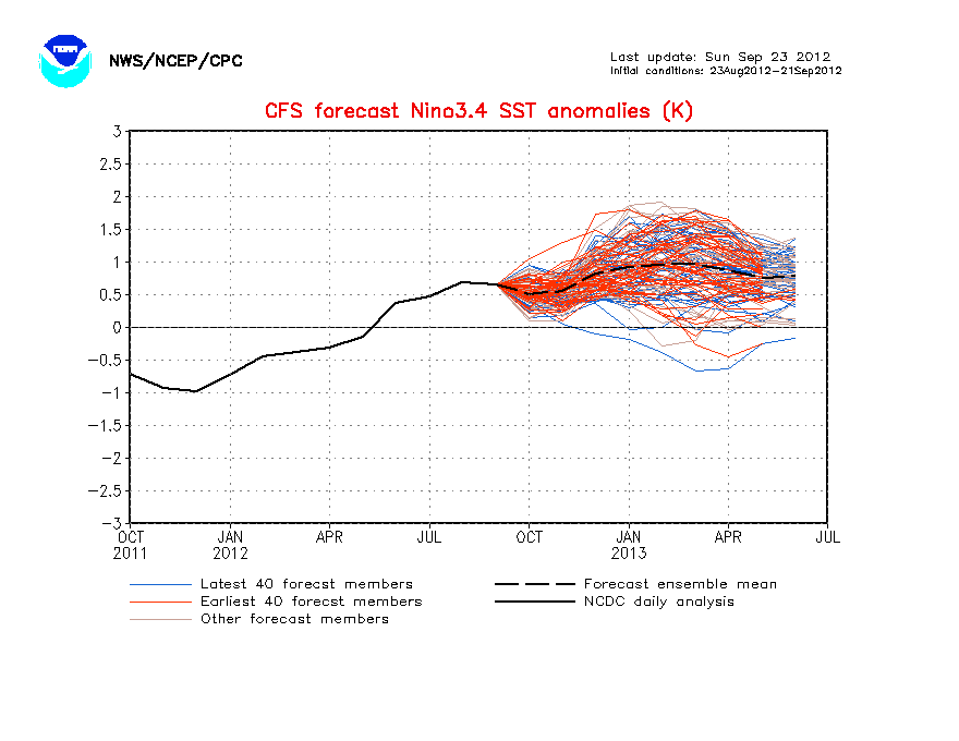
The CFS model goes even more quicker towards La Nina than anytime before. I dont think ENSO will fall that quick but the consensus of the models is very telling and can't be ignored that La Nina arrives as most models forecast. Here are the 80 ensemble members of the CFS model that shows the latest forecasts in blue.

Image
0 likes   
Visit the Caribbean-Central America Weather Thread where you can find at first post web cams,radars
and observations from Caribbean basin members Click Here

meteorologyman
Category 2
Category 2
Posts: 541
Joined: Wed Mar 15, 2006 6:48 pm
Location: Florida, Kissimmee/St.CLoud

Re: ENSO Updates

#1363 Postby meteorologyman » Wed May 05, 2010 2:42 pm

This is not a forecast and should be used as such!

I know in previous posts that number of name storms have been compared between ENSO's and La-Nina's and somtimes Regular ENSO proves to be the worst.

(Oppinion) Though I think this year's La Nina is going to be different if we get into LaNina. When LaNina forms usually the Atlantic water warms, shear winds decrease, and moisture increases. However that has already occured and still is occuring without the presence of LaNina and some records (SST's) have already been broken. I think LaNina is going to enhance hurricane activity towards the max whatever that is. This year is going to be like a new foot print like 2004, and 2005 was.
0 likes   

User avatar
cycloneye
Admin
Admin
Posts: 145308
Age: 68
Joined: Thu Oct 10, 2002 10:54 am
Location: San Juan, Puerto Rico

Re: ENSO Updates=CPC May advisory=La Nina a great possibility

#1364 Postby cycloneye » Thu May 06, 2010 8:10 am

Climate Prediction Center 5/6/10 May Advisory=Neutral by June,Growing possibiity of La Nina developing during second half of 2010

CPC is agressive in this May Advisory saying about a growing chance of having La Nina by late summer.


http://www.cpc.ncep.noaa.gov/products/a ... odisc.html


Synopsis: A transition to ENSO-neutral conditions is expected by June 2010, which will continue into the Northern Hemisphere summer 2010.

El Niño weakened during April 2010 as positive surface temperature (SST) anomalies decreased across the equatorial Pacific Ocean. However, SST anomalies still exceeded +0.5oC across most of the Pacific at the end of the month (Fig. 1 and Fig. 2). Since the end of February, subsurface heat content anomalies (average temperatures in the upper 300m of the ocean, Fig. 3) have decreased steadily in association with the expansion and strengthening of below-average temperatures at depth (25-200m; Fig. 4). Also, enhanced convection developed over Indonesia, while suppressed convection strengthened and expanded over the tropical Pacific, south of the equator (Fig. 5). The low-level equatorial trade winds remained near-average, and anomalous upper-level westerly winds prevailed over the central Pacific during much of April. Collectively, these oceanic and atmospheric anomalies reflect a weakening El Niño.

Nearly all models predict decreasing SST anomalies in the Niño-3.4 region through the Northern Hemisphere summer 2010 (Fig. 6). Most models predict a transition to ENSO-neutral conditions during April-June 2010, followed by ENSO-neutral conditions through the end of the year. However, by July-September 2010, the envelope of model solutions includes a significant number (nearly a third) indicating the onset of La Niña conditions. Even though ENSO-neutral conditions are most likely during the second half of the year, the general tendency of the models in recent months has been toward increasingly negative SST anomalies in the Niño-3.4 region. These forecasts, in addition to various oceanic and atmospheric indicators, indicate a growing possibility of La Niña developing during the second half of 2010.
0 likes   
Visit the Caribbean-Central America Weather Thread where you can find at first post web cams,radars
and observations from Caribbean basin members Click Here

User avatar
KWT
Category 5
Category 5
Posts: 31415
Joined: Tue Aug 17, 2004 11:02 am
Location: UK!!!

#1365 Postby KWT » Thu May 06, 2010 11:59 am

Will be interesting to see what happens, I can't see anything beyond perhaps a 1995 type event, whilst there are some signals out there that certainly support a La Nina, other factors, esp over the Indian Ocean right now really are not at all condusive.

So a bit of a toughie to call.
0 likes   
Personal Forecast Disclaimer:
The posts in this forum are NOT official forecast and should not be used as such. They are just the opinion of the poster and may or may not be backed by sound meteorological data. They are NOT endorsed by any professional institution or storm2k.org. For official information, please refer to the NHC and NWS products

User avatar
Macrocane
Category 5
Category 5
Posts: 4218
Age: 36
Joined: Sun May 24, 2009 5:35 pm
Location: El Salvador

Re: ENSO Updates

#1366 Postby Macrocane » Thu May 06, 2010 1:04 pm

meteorologyman wrote:This is not a forecast and should be used as such!

I think LaNina is going to enhance hurricane activity towards the max whatever that is. This year is going to be like a new foot print like 2004, and 2005 was.


La Niña tends to enhance hurricane activity during the inactive period of the AMO but during the active period (since 1995) La Niña and Neutral seasons have produced similar numbers and actually La Niña years have been slightly less active than Neutral ones.
0 likes   

User avatar
cycloneye
Admin
Admin
Posts: 145308
Age: 68
Joined: Thu Oct 10, 2002 10:54 am
Location: San Juan, Puerto Rico

Re: ENSO=CPC May advisory=Growing possibility of La Nina

#1367 Postby cycloneye » Thu May 06, 2010 2:20 pm

The Australian model POAMA stays at Neutral all the way thru December but decends to cold Neutral by August.

Image
0 likes   
Visit the Caribbean-Central America Weather Thread where you can find at first post web cams,radars
and observations from Caribbean basin members Click Here

User avatar
brunota2003
S2K Supporter
S2K Supporter
Posts: 9476
Age: 34
Joined: Sat Jul 30, 2005 9:56 pm
Location: Stanton, KY...formerly Havelock, NC
Contact:

Re: Re:

#1368 Postby brunota2003 » Thu May 06, 2010 6:19 pm

cycloneye wrote:
brunota2003 wrote:The 90 day SOI is -2.97...looks like give it another 3 days, tops, and it will be in the positives!


Down to -2.00


Daily SOI

http://www.longpaddock.qld.gov.au/Seaso ... SOIValues/

-1.02 in tonight's update. The daily crashed, just like the stock market did!
0 likes   

User avatar
KWT
Category 5
Category 5
Posts: 31415
Joined: Tue Aug 17, 2004 11:02 am
Location: UK!!!

#1369 Postby KWT » Thu May 06, 2010 7:03 pm

I think the Australian models are going to be closer to the mark, I still think at least the weeklies will probably push into the La Nina category but not sure the tri-monthly gets there, at least during the meat of the hurricane season.
0 likes   
Personal Forecast Disclaimer:
The posts in this forum are NOT official forecast and should not be used as such. They are just the opinion of the poster and may or may not be backed by sound meteorological data. They are NOT endorsed by any professional institution or storm2k.org. For official information, please refer to the NHC and NWS products

User avatar
cycloneye
Admin
Admin
Posts: 145308
Age: 68
Joined: Thu Oct 10, 2002 10:54 am
Location: San Juan, Puerto Rico

Re: ENSO Updates

#1370 Postby cycloneye » Fri May 07, 2010 5:50 am

The Daily SOI Index has gone negative today. Lets see if this trend continues or is a normal up and down thing. See the data 2 posts above.
0 likes   
Visit the Caribbean-Central America Weather Thread where you can find at first post web cams,radars
and observations from Caribbean basin members Click Here

User avatar
cycloneye
Admin
Admin
Posts: 145308
Age: 68
Joined: Thu Oct 10, 2002 10:54 am
Location: San Juan, Puerto Rico

Re: ENSO Updates

#1371 Postby cycloneye » Fri May 07, 2010 10:54 am

You can see how the cooler waters has expanded while the warm waters shrink. There are still some warm waters left east of 120W but with time they will go away.

Image
0 likes   
Visit the Caribbean-Central America Weather Thread where you can find at first post web cams,radars
and observations from Caribbean basin members Click Here

User avatar
cycloneye
Admin
Admin
Posts: 145308
Age: 68
Joined: Thu Oct 10, 2002 10:54 am
Location: San Juan, Puerto Rico

Re: ENSO Updates

#1372 Postby cycloneye » Sat May 08, 2010 8:17 am

The updated data of this graphic shows how the cooler waters have reached the surface and expanding at El Nino 3.4. However,east of 120W there are still warm waters at El Nino 1-2 and 3.

Image
0 likes   
Visit the Caribbean-Central America Weather Thread where you can find at first post web cams,radars
and observations from Caribbean basin members Click Here

jinftl
Category 5
Category 5
Posts: 4312
Joined: Tue Aug 31, 2004 4:47 pm
Location: fort lauderdale, fl

Re: ENSO Updates

#1373 Postby jinftl » Sat May 08, 2010 11:37 pm

Great stats! Thanks for posting.

What is interesting is that looking at the seasons from 1995-2008, it is the enso neutral seasons that have averaged the highest damage $ per season, followed by el nino season, with la nina seasons averaging the lowest in terms of $ of damage!!! This reminds us that it is not the # of landfalling storms necessarily that indicate how damaging a season was.....it comes down to location location location of landfalls.

If 2010 is a neutral season, if the last 15 years have been any indication, it will be a season that sees multi-billions of dollars of damage i am afraid.

Damage done per season in billions of $ adjusted for inflation to 2010 $ (except 2007 & 2008 seasons are unadjusted for inflation)

el nino
1997 $0.150
2002 $3.150
2004 $57.500
2006 $0.540
avg $15.335


la nina
1995 $13.000
1998 $16.000
1999 $7.700
2000 $1.510
2007 $3.000
avg $8.242


neutral
1996 $7.000
2001 $8.700
2003 $5.200
2005 $144.000
2008 $47.534
avg $42.487

(if you remove 2005 from the calculation, neutral seasons still average the highest in terms of $ damage....$17.1 billion)


brunota2003 wrote:Luckily, it seems that Neutral years have the least number of U.S. TC landfalls. There have been 13 total Neutral seasons since 1980 (1980 through 2009), with an average of 3.538 U.S. TC landfalls per year. (Compared to La Nina, with 7 seasons, and an average of 5.571 U.S. TC landfalls per year...and El Nino, with 10 seasons, and an average of 3.7 U.S. TC landfalls per year...with a total of 30 years studied 1980 - 2009)

However, during Neutral years, Florida was hit 76.923% of the 13 years (10 total), Texas was hit 53.846% of the 13 years (7 total), North Carolina was hit 38.461% of the 13 years (5 total), and Louisiana 30.769% of the 13 years (4 total). The other 4 states impacted during Neutral years are: Maryland, Mississippi, South Carolina, and Virginia...all were 15.384% or less each.

Florida and Texas clearly took the brunt of all U.S. TC landfalls during Neutral years (a total of 46 TCs made landfall on the U.S. during the 13 years)...Florida had 14 landfalls (30.434%), Texas had 13 landfalls (28.260%), North Carolina had 7 (15.217%), Louisiana had 6 (13.043%). The rest of the states (Maryland, Mississippi, South Carolina, and Virginia) all had 2 or less landfalls during the 13 Neutral years (4.347% or less each).


Hope some of those stats make sense! While Neutral years are just as active as La Nina years, most of the time they do not produce as many U.S. landfalls as La Nina or El Nino years. Granted, there are always exceptions (ie 2005) and it does only take one system to ruin your day! So nonetheless, everyone should remain prepared and ready.
0 likes   

User avatar
cycloneye
Admin
Admin
Posts: 145308
Age: 68
Joined: Thu Oct 10, 2002 10:54 am
Location: San Juan, Puerto Rico

Re: ENSO Updates

#1374 Postby cycloneye » Sun May 09, 2010 5:32 am

location location location of landfalls


That is the key about the very interesting information posted above this post. It doesn't matter how many form but where will they go.
0 likes   
Visit the Caribbean-Central America Weather Thread where you can find at first post web cams,radars
and observations from Caribbean basin members Click Here

User avatar
cycloneye
Admin
Admin
Posts: 145308
Age: 68
Joined: Thu Oct 10, 2002 10:54 am
Location: San Juan, Puerto Rico

Re: ENSO Updates

#1375 Postby cycloneye » Sun May 09, 2010 7:39 am

brunota2003,the 90 day SOI turns to positive,today at +48.

http://www.longpaddock.qld.gov.au/Seaso ... SOIValues/
0 likes   
Visit the Caribbean-Central America Weather Thread where you can find at first post web cams,radars
and observations from Caribbean basin members Click Here

User avatar
cycloneye
Admin
Admin
Posts: 145308
Age: 68
Joined: Thu Oct 10, 2002 10:54 am
Location: San Juan, Puerto Rico

Re: ENSO Updates

#1376 Postby cycloneye » Sun May 09, 2010 10:35 am

In only one week,the cold subsurface waters in the Pacific have expanded bigtime as you can see in the comparison graphics between Sunday May 2nd and Sunday May 9th. I dont know about the rest of you but I think I can say with confidence "Hasta la Vista El Nino".

Subsurface waters on May 2

Subsurface waters on May 9
0 likes   
Visit the Caribbean-Central America Weather Thread where you can find at first post web cams,radars
and observations from Caribbean basin members Click Here

User avatar
KWT
Category 5
Category 5
Posts: 31415
Joined: Tue Aug 17, 2004 11:02 am
Location: UK!!!

#1377 Postby KWT » Sun May 09, 2010 1:37 pm

Yeah the El nino is pretty much toast, the waters are very close to normal now for the time of year with any lingering traces of El nino pretty much gone.

Now the real question is whether we go La Nina, I actually think for the sake of the US this season a La Nina may not be the worst thing that could happen, I think we've a bigger risk this season if we stay neutral...
0 likes   
Personal Forecast Disclaimer:
The posts in this forum are NOT official forecast and should not be used as such. They are just the opinion of the poster and may or may not be backed by sound meteorological data. They are NOT endorsed by any professional institution or storm2k.org. For official information, please refer to the NHC and NWS products

User avatar
brunota2003
S2K Supporter
S2K Supporter
Posts: 9476
Age: 34
Joined: Sat Jul 30, 2005 9:56 pm
Location: Stanton, KY...formerly Havelock, NC
Contact:

Re: ENSO Updates

#1378 Postby brunota2003 » Sun May 09, 2010 2:09 pm

cycloneye wrote:brunota2003,the 90 day SOI turns to positive,today at +48.

http://www.longpaddock.qld.gov.au/Seaso ... SOIValues/
Yay...I was only 2 days off! Haha...that is definitely a good sign though that El Nino is gone.
0 likes   

User avatar
cycloneye
Admin
Admin
Posts: 145308
Age: 68
Joined: Thu Oct 10, 2002 10:54 am
Location: San Juan, Puerto Rico

Re: ENSO Updates

#1379 Postby cycloneye » Sun May 09, 2010 7:55 pm

What the SOI does now is sort of academic as is way up positive and the waters are cooling fast that I post them only for information to the members. Tonight is at +9.2.

Image
0 likes   
Visit the Caribbean-Central America Weather Thread where you can find at first post web cams,radars
and observations from Caribbean basin members Click Here

User avatar
SouthFloridawx
S2K Supporter
S2K Supporter
Posts: 8346
Age: 46
Joined: Tue Jul 26, 2005 1:16 am
Location: Sarasota, FL
Contact:

Re: ENSO Updates

#1380 Postby SouthFloridawx » Sun May 09, 2010 11:19 pm

SSTA Anomaly Western Hemisphere 5/6/2010:

Image

SSTA Anomaly Western Hemisphere 4/5/2010:

Image
0 likes   


Return to “Talkin' Tropics”

Who is online

Users browsing this forum: Google Adsense [Bot], MEANINGLESS_NUMBERS, StormWeather, Ulf and 39 guests