Severe Weather 5/24/2010

U.S. & Caribbean Weather Discussions and Severe Weather Events

Moderator: S2k Moderators

Forum rules

The posts in this forum are NOT official forecast and should not be used as such. They are just the opinion of the poster and may or may not be backed by sound meteorological data. They are NOT endorsed by any professional institution or STORM2K.

Help Support Storm2K
Message
Author
User avatar
brunota2003
S2K Supporter
S2K Supporter
Posts: 9476
Age: 34
Joined: Sat Jul 30, 2005 9:56 pm
Location: Stanton, KY...formerly Havelock, NC
Contact:

Re:

#81 Postby brunota2003 » Mon May 24, 2010 1:57 pm

Dave wrote:Be back later....going to go hang a phone in a tree.

Someone calling you that you dont want to talk to, hm?

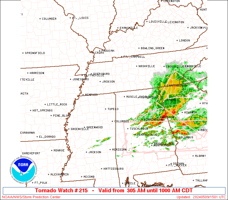
The cells in Texas certainly look *interesting*, but I don't think they have enough to try to go tornado warned.
0 likes   

User avatar
Texas Snowman
Storm2k Moderator
Storm2k Moderator
Posts: 6179
Joined: Fri Jan 25, 2008 11:29 am
Location: Denison, Texas

Re: Re:

#82 Postby Texas Snowman » Mon May 24, 2010 1:58 pm

thetruesms wrote:
cwachal wrote:1710 100 4 W PLUMMER RED LAKE MN 4792 9613 (FGF)

1738 175 2 N GERMANTOWN SHELBY TN 3512 8979 GOLF BALL SIZED HAIL AT GERMANTOWN PARKWAY AND TRINITY ROAD (MEG)

1744 175 5 SSW WESKAN WALLACE KS 3879 10200 (GLD)

pretty good hail size already
I should call my aunt and see if she got anything good :lol:


Truesms, you got a funny definition of "good" ! :wink:
0 likes   
The above post and any post by Texas Snowman is NOT an official forecast and should not be used as such. It is just the opinion of the poster and may or may not be backed by sound meteorological data. It is NOT endorsed by any professional institution including storm2k.org. For official information, please refer to NWS products.

cwachal

#83 Postby cwachal » Mon May 24, 2010 2:01 pm

1816 GERING SCOTTS BLUFF NE 4183 10367 (CYS)

Tornado Report
0 likes   

cwachal

#84 Postby cwachal » Mon May 24, 2010 2:01 pm

1750 275 S GERING SCOTTS BLUFF NE 4183 10367 GOLFBALL TO BASEBALL SIZED JHAIL O0N SOUTH SIDE OF GERING BETWEEN 1150 AND NOON MDT. (CYS)
1752 200 2 WSW WESKAN WALLACE KS 3885 10199 HAIL BROKE A TRACTOR WINDSHIELD (GLD)
1755 100 3 NW MITCHELL SCOTTS BLUFF NE 4197 10385 (CYS)
1759 175 10 NNE FORT STOCKTON PECOS TX 3102 10282 GOLF BALL SIZE HAIL REPORTED 10 MILES NNE OF FORT STOCKTON ALONG FARM TO MARKET ROAD 1053. (MAF)
1803 100 15 N GUYMON TEXAS OK 3690 10148 (AMA)
1812 100 GUYMON TEXAS OK 3669 10148 (AMA)
1814 200 2 SE SCOTTSBLUFF SCOTTS BLUFF NE 4185 10363 (CYS)
1820 100 S AGATE SIOUX NE 4241 10378 1 INCH HAIL JUST SOUTH OF AGATE ALONG HIGHWAY 29. (CYS)
1836 100 RULETON SHERMAN KS 3934 10188 RELAYED BY SHERMAN COUNTY DISPATCH (GLD)

more hail reports
0 likes   

cwachal

#85 Postby cwachal » Mon May 24, 2010 2:08 pm

WFUS53 KBIS 241904
TORBIS
NDC045-047-051-241930-
/O.NEW.KBIS.TO.W.0002.100524T1904Z-100524T1930Z/

BULLETIN - EAS ACTIVATION REQUESTED
TORNADO WARNING
NATIONAL WEATHER SERVICE BISMARCK ND
204 PM CDT MON MAY 24 2010

THE NATIONAL WEATHER SERVICE IN BISMARCK HAS ISSUED A

* TORNADO WARNING FOR...
SOUTHWESTERN LAMOURE COUNTY IN SOUTHEAST NORTH DAKOTA...
SOUTHEASTERN LOGAN COUNTY IN SOUTHEAST NORTH DAKOTA...
NORTHEASTERN MCINTOSH COUNTY IN SOUTHEAST NORTH DAKOTA...

* UNTIL 230 PM CDT

* AT 202 PM CDT...NATIONAL WEATHER SERVICE DOPPLER RADAR INDICATED A
SEVERE THUNDERSTORM CAPABLE OF PRODUCING A TORNADO. THIS DANGEROUS
STORM WAS LOCATED 10 MILES NORTHEAST OF ASHLEY...OR 59 MILES
SOUTHWEST OF JAMESTOWN...AND MOVING NORTH AT 30 MPH.

* LOCATIONS IMPACTED INCLUDE...
FREDONIA.

PRECAUTIONARY/PREPAREDNESS ACTIONS...

TAKE COVER NOW. MOVE TO AN INTERIOR ROOM ON THE LOWEST FLOOR OF A
STURDY BUILDING. AVOID WINDOWS. IF IN A MOBILE HOME...A VEHICLE OR
OUTDOORS...MOVE TO THE CLOSEST SUBSTANTIAL SHELTER AND PROTECT
YOURSELF FROM FLYING DEBRIS.

&&

LAT...LON 4650 9929 4646 9896 4604 9911 4607 9936
TIME...MOT...LOC 1904Z 190DEG 28KT 4614 9921

$$
PJA
0 likes   

cwachal

#86 Postby cwachal » Mon May 24, 2010 2:24 pm

WFUS53 KFGF 241920
TORFGF
MNC069-089-NDC067-099-241945-
/O.NEW.KFGF.TO.W.0005.100524T1920Z-100524T1945Z/

BULLETIN - EAS ACTIVATION REQUESTED
TORNADO WARNING
NATIONAL WEATHER SERVICE EASTERN ND/GRAND FORKS ND
220 PM CDT MON MAY 24 2010

THE NATIONAL WEATHER SERVICE IN GRAND FORKS HAS ISSUED A

* TORNADO WARNING FOR...
SOUTHWESTERN KITTSON COUNTY IN NORTHWEST MINNESOTA...
WESTERN MARSHALL COUNTY IN NORTHWEST MINNESOTA...
SOUTHEASTERN PEMBINA COUNTY IN NORTHEAST NORTH DAKOTA...
EASTERN WALSH COUNTY IN NORTHEAST NORTH DAKOTA...

* UNTIL 245 PM CDT

* AT 217 PM CDT...NATIONAL WEATHER SERVICE DOPPLER RADAR INDICATED A
SEVERE THUNDERSTORM CAPABLE OF PRODUCING A TORNADO. THE STORM WAS
LOCATED 2 MILES SOUTHWEST OF GRAFTON...MOVING TO THE NORTHEAST AT
45 MPH.

* THE TORNADIC STORM WILL BE NEAR...
GRAFTON AROUND 225 PM CDT.
BIG WOODS AND OAKWOOD AROUND 225 PM CDT.
HERRICK AROUND 235 PM CDT.
ARGYLE AND DRAYTON AROUND 240 PM CDT.
MATTSON AND ROBBIN AROUND 245 PM CDT.

FOR MOTORISTS ON INTERSTATE 29...THE TORNADIC STORM WILL BE
BETWEEN...MILE MARKER 183 AROUND 235 PM CDT...AND MILE MARKER 191
AROUND 245 PM CDT...

PRECAUTIONARY/PREPAREDNESS ACTIONS...

IF YOU ARE IN THE PATH OF THIS TORNADO ABANDON CARS AND MOBILE HOMES
FOR A STURDY BUILDING.

&&

LAT...LON 4872 9709 4825 9674 4820 9754 4846 9762
TIME...MOT...LOC 1920Z 226DEG 38KT 4842 9742

$$

JK
0 likes   

cwachal

Re: Severe Weather 5/24/2010

#87 Postby cwachal » Mon May 24, 2010 2:24 pm

Image


URGENT - IMMEDIATE BROADCAST REQUESTED
TORNADO WATCH NUMBER 215
NWS STORM PREDICTION CENTER NORMAN OK
205 PM CDT MON MAY 24 2010

THE NWS STORM PREDICTION CENTER HAS ISSUED A
TORNADO WATCH FOR PORTIONS OF

NORTHWEST MINNESOTA
SOUTH CENTRAL AND EASTERN NORTH DAKOTA

EFFECTIVE THIS MONDAY AFTERNOON AND EVENING FROM 205 PM UNTIL
1000 PM CDT.

TORNADOES...HAIL TO 2.5 INCHES IN DIAMETER...THUNDERSTORM WIND
GUSTS TO 70 MPH...AND DANGEROUS LIGHTNING ARE POSSIBLE IN THESE
AREAS.

THE TORNADO WATCH AREA IS APPROXIMATELY ALONG AND 110 STATUTE
MILES EAST AND WEST OF A LINE FROM 65 MILES SOUTH SOUTHEAST OF
BISMARCK NORTH DAKOTA TO 25 MILES NORTH NORTHWEST OF THIEF RIVER
FALLS MINNESOTA. FOR A COMPLETE DEPICTION OF THE WATCH SEE THE
ASSOCIATED WATCH OUTLINE UPDATE (WOUS64 KWNS WOU5).

REMEMBER...A TORNADO WATCH MEANS CONDITIONS ARE FAVORABLE FOR
TORNADOES AND SEVERE THUNDERSTORMS IN AND CLOSE TO THE WATCH
AREA. PERSONS IN THESE AREAS SHOULD BE ON THE LOOKOUT FOR
THREATENING WEATHER CONDITIONS AND LISTEN FOR LATER STATEMENTS
AND POSSIBLE WARNINGS.

OTHER WATCH INFORMATION...CONTINUE...WW 212...WW 213...WW 214...

DISCUSSION...THE SURFACE WARM FRONT CONTINUES TO MOVE NWD INTO SRN
ND AND NW MN IN ADVANCE OF THE EJECTING MIDLEVEL TROUGH AND SURFACE
LOW APPROACHING THE CENTRAL HIGH PLAINS. GIVEN THE BOUNDARY LAYER
DEWPOINTS NEAR 70 F AND SOME SURFACE HEATING S OF THE
FRONT...MODERATE INSTABILITY /MLCAPE NEAR 2500 J PER KG/ WILL
CONTINUE TO SPREAD NWD INTO SRN/ERN ND THIS AFTERNOON.
MEANWHILE...DEEP-LAYER AND LOW-LEVEL VERTICAL SHEAR ARE FAVORABLE
FOR SUPERCELLS ALONG THE WARM FRONT. A FEW TORNADOES WILL BE
POSSIBLE THIS AFTERNOON/EVENING...ESPECIALLY ALONG THE BOUNDARY...AS
CONVECTION INCREASES AND SPREADS NEWD FROM SD INTO ND.
OTHERWISE...LARGE HAIL AND DAMAGING WINDS WILL BE LIKELY WITH THE
STRONGER STORMS.

AVIATION...TORNADOES AND A FEW SEVERE THUNDERSTORMS WITH HAIL
SURFACE AND ALOFT TO 2.5 INCHES. EXTREME TURBULENCE AND SURFACE
WIND GUSTS TO 60 KNOTS. A FEW CUMULONIMBI WITH MAXIMUM TOPS TO
500. MEAN STORM MOTION VECTOR 22040.
0 likes   

cwachal

Re: Severe Weather 5/24/2010

#88 Postby cwachal » Mon May 24, 2010 2:26 pm

Probabilities on the Tornado Watch

Tornadoes
Probability of 2 or more tornadoes
Mod (60%)

Probability of 1 or more strong (F2-F5) tornadoes
Mod (30%)


Wind
Probability of 10 or more severe wind events
Mod (40%)

Probability of 1 or more wind events > 65 knots
Mod (30%)


Hail
Probability of 10 or more severe hail events
Mod (60%)

Probability of 1 or more hailstones > 2 inches
Mod (30%)


Combined Severe Hail/Wind
Probability of 6 or more combined severe hail/wind events
High (90%)
0 likes   

cwachal

#89 Postby cwachal » Mon May 24, 2010 2:29 pm

http://www.severestudios.com/cgi-bin/pl ... on&uid=140


TORNADO ON THE GROUND


LARGE TORNADO ON THE GROUND!!!!
0 likes   

User avatar
Bunkertor
Category 5
Category 5
Posts: 3397
Joined: Tue May 09, 2006 3:48 pm

#90 Postby Bunkertor » Mon May 24, 2010 2:31 pm

0 likes   

cwachal

Re: Severe Weather 5/24/2010

#91 Postby cwachal » Mon May 24, 2010 2:32 pm

WWUS53 KUNR 241927
SVSUNR

SEVERE WEATHER STATEMENT
NATIONAL WEATHER SERVICE RAPID CITY SD
127 PM MDT MON MAY 24 2010

SDC093-137-242000-
/O.CON.KUNR.TO.W.0006.000000T0000Z-100524T2000Z/
ZIEBACH SD-MEADE SD-
127 PM MDT MON MAY 24 2010

...A TORNADO WARNING REMAINS IN EFFECT FOR NORTHEASTERN MEADE AND
SOUTHWESTERN ZIEBACH COUNTIES UNTIL 200 PM MDT...

AT 125 PM MDT...NATIONAL WEATHER SERVICE DOPPLER RADAR WAS TRACKING A
CONFIRMED TORNADO. THIS TORNADO WAS LOCATED 5 MILES SOUTHEAST OF
PLAINVIEW...OR 33 MILES SOUTH OF FAITH...MOVING NORTH AT 40 MPH.

LOCATIONS IMPACTED INCLUDE...
PLAINVIEW...HOWES...MARCUS AND RED SCAFFOLD.

PRECAUTIONARY/PREPAREDNESS ACTIONS...

TAKE COVER NOW. MOVE TO AN INTERIOR ROOM ON THE LOWEST FLOOR OF A
STURDY BUILDING. AVOID WINDOWS. IF IN A MOBILE HOME...A VEHICLE OR
OUTDOORS...MOVE TO THE CLOSEST SUBSTANTIAL SHELTER AND PROTECT
YOURSELF FROM FLYING DEBRIS.

&&

LAT...LON 4499 10168 4453 10196 4453 10199 4451 10200
4447 10210 4449 10228 4503 10233
TIME...MOT...LOC 1927Z 186DEG 33KT 4456 10211

$$

SCHILD
0 likes   

User avatar
Bunkertor
Category 5
Category 5
Posts: 3397
Joined: Tue May 09, 2006 3:48 pm

#92 Postby Bunkertor » Mon May 24, 2010 2:32 pm

Image
0 likes   

cwachal

#93 Postby cwachal » Mon May 24, 2010 2:33 pm

http://www.severestudios.com/cgi-bin/pl ... ter&uid=84


TORNADO ON THE GROUND ON THIS VID as well
0 likes   

User avatar
Texas Snowman
Storm2k Moderator
Storm2k Moderator
Posts: 6179
Joined: Fri Jan 25, 2008 11:29 am
Location: Denison, Texas

Re:

#94 Postby Texas Snowman » Mon May 24, 2010 2:34 pm

cwachal wrote:http://www.severestudios.com/cgi-bin/player.pl?username=andy.gabrielson&uid=140


TORNADO ON THE GROUND


LARGE TORNADO ON THE GROUND!!!!


:eek: :eek: :eek: That small developing twister looks like it just passed right through/over his car!!!!
0 likes   
The above post and any post by Texas Snowman is NOT an official forecast and should not be used as such. It is just the opinion of the poster and may or may not be backed by sound meteorological data. It is NOT endorsed by any professional institution including storm2k.org. For official information, please refer to NWS products.

User avatar
Texas Snowman
Storm2k Moderator
Storm2k Moderator
Posts: 6179
Joined: Fri Jan 25, 2008 11:29 am
Location: Denison, Texas

Re: Re:

#95 Postby Texas Snowman » Mon May 24, 2010 2:36 pm

Texas Snowman wrote:
cwachal wrote:http://www.severestudios.com/cgi-bin/player.pl?username=andy.gabrielson&uid=140


TORNADO ON THE GROUND


LARGE TORNADO ON THE GROUND!!!!


:eek: :eek: :eek: That small developing twister looks like it just passed right through/over his car!!!!


Large tornado on the ground again with that cell...
0 likes   
The above post and any post by Texas Snowman is NOT an official forecast and should not be used as such. It is just the opinion of the poster and may or may not be backed by sound meteorological data. It is NOT endorsed by any professional institution including storm2k.org. For official information, please refer to NWS products.

cwachal

Re: Re:

#96 Postby cwachal » Mon May 24, 2010 2:36 pm

Texas Snowman wrote:
cwachal wrote:http://www.severestudios.com/cgi-bin/player.pl?username=andy.gabrielson&uid=140


TORNADO ON THE GROUND


LARGE TORNADO ON THE GROUND!!!!


:eek: :eek: :eek: That small developing twister looks like it just passed right through/over his car!!!!


that is not a small tornado it just passed maybe a hundred yards in front of him with the width being about 2x the width of the road
0 likes   

User avatar
Bunkertor
Category 5
Category 5
Posts: 3397
Joined: Tue May 09, 2006 3:48 pm

#97 Postby Bunkertor » Mon May 24, 2010 2:37 pm

Dammit tree :double:
0 likes   

cwachal

#98 Postby cwachal » Mon May 24, 2010 2:38 pm

6 inch diameter trees are blocking the road he just got out and moved the tree off the road
0 likes   

User avatar
Texas Snowman
Storm2k Moderator
Storm2k Moderator
Posts: 6179
Joined: Fri Jan 25, 2008 11:29 am
Location: Denison, Texas

Re: Re:

#99 Postby Texas Snowman » Mon May 24, 2010 2:39 pm

cwachal wrote:
Texas Snowman wrote:
cwachal wrote:http://www.severestudios.com/cgi-bin/player.pl?username=andy.gabrielson&uid=140


TORNADO ON THE GROUND


LARGE TORNADO ON THE GROUND!!!!


:eek: :eek: :eek: That small developing twister looks like it just passed right through/over his car!!!!


that is not a small tornado it just passed maybe a hundred yards in front of him with the width being about 2x the width of the road


No, I know that what is on there now is not a small tornado.

But I swear about four or five minutes ago when the twister WASN'T on the ground, he was filming the rotating wall cloud and suddenly a small, rope like twister dropped down to the ground to his left and passed RIGHT OVER HIM!!!

There was a brief interuption in the video feed when that happened.
0 likes   
The above post and any post by Texas Snowman is NOT an official forecast and should not be used as such. It is just the opinion of the poster and may or may not be backed by sound meteorological data. It is NOT endorsed by any professional institution including storm2k.org. For official information, please refer to NWS products.

cwachal

Re: Severe Weather 5/24/2010

#100 Postby cwachal » Mon May 24, 2010 2:39 pm

WWUS53 KUNR 241938
SVSUNR

SEVERE WEATHER STATEMENT
NATIONAL WEATHER SERVICE RAPID CITY SD
138 PM MDT MON MAY 24 2010

SDC093-137-242000-
/O.CON.KUNR.TO.W.0006.000000T0000Z-100524T2000Z/
ZIEBACH SD-MEADE SD-
138 PM MDT MON MAY 24 2010

...A TORNADO WARNING REMAINS IN EFFECT FOR NORTHEASTERN MEADE AND
WEST CENTRAL ZIEBACH COUNTIES UNTIL 200 PM MDT...

AT 134 PM MDT...NATIONAL WEATHER SERVICE DOPPLER RADAR AND STORM
SPOTTERS WERE TRACKING A LARGE AND EXTREMELY DANGEROUS TORNADO. THIS
TORNADO WAS LOCATED NEAR PLAINVIEW...OR 28 MILES SOUTH OF FAITH...
MOVING NORTH AT 40 MPH.


LOCATIONS IMPACTED INCLUDE...
HIGHWAY 73 BETWEEN HOWES AND FAITH.

PRECAUTIONARY/PREPAREDNESS ACTIONS...

TO REPEAT...A LARGE...EXTREMELY DANGEROUS AND POTENTIALLY DEADLY
TORNADO IS ON THE GROUND. TO PROTECT YOUR LIFE...TAKE COVER NOW. MOVE
TO AN INTERIOR ROOM ON THE LOWEST FLOOR OF A STURDY BUILDING. AVOID
WINDOWS. IF IN A MOBILE HOME...A VEHICLE OR OUTDOORS...MOVE TO THE
CLOSEST SUBSTANTIAL SHELTER AND PROTECT YOURSELF FROM FLYING DEBRIS.

&&

LAT...LON 4499 10168 4459 10210 4459 10220 4503 10233
TIME...MOT...LOC 1937Z 176DEG 33KT 4465 10213

$$

SCHILD
0 likes   


Return to “USA & Caribbean Weather”

Who is online

Users browsing this forum: No registered users and 12 guests