EPAC : EX TROPICAL DEPRESSION AGATHA

Moderator: S2k Moderators

Message
Author
User avatar
cycloneye
Admin
Admin
Posts: 145277
Age: 68
Joined: Thu Oct 10, 2002 10:54 am
Location: San Juan, Puerto Rico

Re: EPAC : INVEST 90E

#41 Postby cycloneye » Wed May 26, 2010 7:57 am

KMIA 261235
CHGE77
TROPICAL CYCLONE GUIDANCE MESSAGE
NWS TPC/NATIONAL HURRICANE CENTER MIAMI FL
1235 UTC WED MAY 26 2010

DISCLAIMER...NUMERICAL MODELS ARE SUBJECT TO LARGE ERRORS.
PLEASE REFER TO NHC OFFICIAL FORECASTS FOR TROPICAL CYCLONE
AND SUBTROPICAL CYCLONE INFORMATION.

EAST PACIFIC OBJECTIVE AIDS FOR

DISTURBANCE INVEST (EP902010) 20100526 1200 UTC

...00 HRS... ...12 HRS... ...24 HRS. .. ...36 HRS...
100526 1200 100527 0000 100527 1200 100528 0000

LAT LON LAT LON LAT LON LAT LON
BAMS 14.2N 95.1W 13.7N 96.3W 12.8N 97.3W 11.9N 98.0W
BAMD 14.2N 95.1W 14.7N 96.3W 15.1N 97.5W 15.3N 98.6W
BAMM 14.2N 95.1W 14.2N 96.5W 14.0N 97.9W 13.4N 99.2W
LBAR 14.2N 95.1W 15.1N 96.1W 16.2N 97.2W 17.3N 97.9W
SHIP 25KTS 32KTS 39KTS 45KTS
DSHP 25KTS 32KTS 39KTS 45KTS

...48 HRS... ...72 HRS... ...96 HRS. .. ..120 HRS...
100528 1200 100529 1200 100530 1200 100531 1200

LAT LON LAT LON LAT LON LAT LON
BAMS 11.4N 98.5W 10.8N 97.5W 10.6N 94.7W 11.0N 92.9W
BAMD 15.5N 99.6W 15.9N 100.9W 17.4N 100.8W 20.4N 98.8W
BAMM 12.9N 100.6W 12.6N 102.4W 12.5N 103.3W 12.6N 103.9W
LBAR 18.6N 97.9W 20.6N 94.5W 21.2N 87.0W 25.6N 76.8W
SHIP 51KTS 55KTS 55KTS 54KTS
DSHP 51KTS 55KTS 55KTS 54KTS

...INITIAL CONDITIONS...
LATCUR = 14.2N LONCUR = 95.1W DIRCUR = 305DEG SPDCUR = 9KT
LATM12 = 13.2N LONM12 = 93.6W DIRM12 = 302DEG SPDM12 = 7KT
LATM24 = 12.5N LONM24 = 92.3W
WNDCUR = 25KT RMAXWD = 20NM WNDM12 = 20KT
CENPRS = 1006MB OUTPRS = 1008MB OUTRAD = 160NM SDEPTH = D
RD34NE = 0NM RD34SE = 0NM RD34SW = 0NM RD34NW = 0NM

Image
0 likes   
Visit the Caribbean-Central America Weather Thread where you can find at first post web cams,radars
and observations from Caribbean basin members Click Here

User avatar
KWT
Category 5
Category 5
Posts: 31415
Joined: Tue Aug 17, 2004 11:02 am
Location: UK!!!

Re: EPAC : INVEST 90E

#42 Postby KWT » Wed May 26, 2010 8:01 am

Evil Jeremy wrote: this could hold over in the Caribbean, or at least send a chunk of tropical energy which can spawn a new system. I don't know about the rest of the 06z models, but I just looked at the GFS, and it doesn't seem to keen on anything organized in the Caribbean though.


Without a doubt this system has to be close to being upgraded, I'd be surprised if we don't have our first TD of the E.PAC season in the enxt 12hrs, esp given the ball of convection.

As for that point there EJ, I don't think thats going to happen now, look how far west the ball of convection is, would have to move east right away now to get into the Carribean, more likely to make it to the BoC, if at all...
0 likes   
Personal Forecast Disclaimer:
The posts in this forum are NOT official forecast and should not be used as such. They are just the opinion of the poster and may or may not be backed by sound meteorological data. They are NOT endorsed by any professional institution or storm2k.org. For official information, please refer to the NHC and NWS products

User avatar
cycloneye
Admin
Admin
Posts: 145277
Age: 68
Joined: Thu Oct 10, 2002 10:54 am
Location: San Juan, Puerto Rico

Re: EPAC : INVEST 90E

#43 Postby cycloneye » Wed May 26, 2010 8:34 am

Visible image.

Image


Infared image.

Image
0 likes   
Visit the Caribbean-Central America Weather Thread where you can find at first post web cams,radars
and observations from Caribbean basin members Click Here

HurricaneJoe22
Category 1
Category 1
Posts: 456
Joined: Wed Sep 08, 2004 12:45 am
Location: Temple, Texas

Re: EPAC : INVEST 90E

#44 Postby HurricaneJoe22 » Wed May 26, 2010 9:48 am

We've been fooled by balls of convection before. That said, I'm not sure why this isn't a code red given the look of it. They even said a depression could form in 24-48 hours.
Last edited by HurricaneJoe22 on Wed May 26, 2010 9:52 am, edited 1 time in total.
0 likes   

User avatar
HURAKAN
Professional-Met
Professional-Met
Posts: 46086
Age: 38
Joined: Thu May 20, 2004 4:34 pm
Location: Key West, FL
Contact:

Re: EPAC : INVEST 90E

#45 Postby HURAKAN » Wed May 26, 2010 9:50 am

HurricaneJoe22 wrote:We've been fooled by balls of convection before. That said, I'm not sure why this isn't a code red given the look of it. They even said a depressed could form in 24-48 hours.


That's when you need QuikSCAT
0 likes   

User avatar
KWT
Category 5
Category 5
Posts: 31415
Joined: Tue Aug 17, 2004 11:02 am
Location: UK!!!

#46 Postby KWT » Wed May 26, 2010 9:51 am

I think it will be a code red next time we get an issue for this system, they went upto 50% chance of formation occuring last timem round so I'd guess it'd be higher again given the ball of convection is pretty sustained.
0 likes   
Personal Forecast Disclaimer:
The posts in this forum are NOT official forecast and should not be used as such. They are just the opinion of the poster and may or may not be backed by sound meteorological data. They are NOT endorsed by any professional institution or storm2k.org. For official information, please refer to the NHC and NWS products

User avatar
cycloneye
Admin
Admin
Posts: 145277
Age: 68
Joined: Thu Oct 10, 2002 10:54 am
Location: San Juan, Puerto Rico

Re: EPAC : INVEST 90E

#47 Postby cycloneye » Wed May 26, 2010 10:06 am

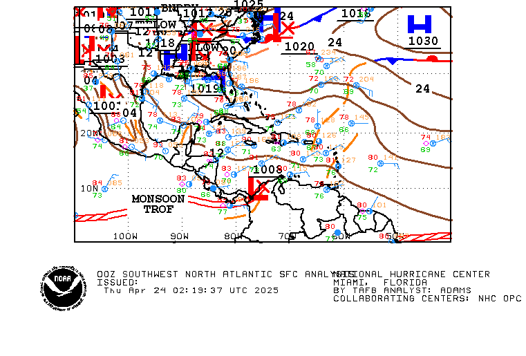
Here is the 12z surface map. It shows the Low is going to move NE.

Image
0 likes   
Visit the Caribbean-Central America Weather Thread where you can find at first post web cams,radars
and observations from Caribbean basin members Click Here

User avatar
HURAKAN
Professional-Met
Professional-Met
Posts: 46086
Age: 38
Joined: Thu May 20, 2004 4:34 pm
Location: Key West, FL
Contact:

#48 Postby HURAKAN » Wed May 26, 2010 10:09 am

:uarrow: Time is of the essence.
0 likes   

User avatar
Macrocane
Category 5
Category 5
Posts: 4218
Age: 36
Joined: Sun May 24, 2009 5:35 pm
Location: El Salvador

Re: EPAC : INVEST 90E

#49 Postby Macrocane » Wed May 26, 2010 10:55 am

This is the rainfall (in mm) in El Salvador between 7:00 am yesterday and 7:00 am today, some places received more than 100 mm/4 inches again:

Image
0 likes   

User avatar
cycloneye
Admin
Admin
Posts: 145277
Age: 68
Joined: Thu Oct 10, 2002 10:54 am
Location: San Juan, Puerto Rico

Re: EPAC : INVEST 90E

#50 Postby cycloneye » Wed May 26, 2010 11:39 am

Deep convection is more prevalent east of what was the last 12z Best track position of 14,2N-95.1W.

Image
0 likes   
Visit the Caribbean-Central America Weather Thread where you can find at first post web cams,radars
and observations from Caribbean basin members Click Here

User avatar
KWT
Category 5
Category 5
Posts: 31415
Joined: Tue Aug 17, 2004 11:02 am
Location: UK!!!

#51 Postby KWT » Wed May 26, 2010 12:14 pm

Convection shifting all over the place at the moment, which isn't really a great thing for a developing system, though I'd still imagine a code red will be issued soon enough...either way may not have a huge amount of time before it reaches Mexico, perhaps the ECM is right with very little development afterall.
0 likes   
Personal Forecast Disclaimer:
The posts in this forum are NOT official forecast and should not be used as such. They are just the opinion of the poster and may or may not be backed by sound meteorological data. They are NOT endorsed by any professional institution or storm2k.org. For official information, please refer to the NHC and NWS products

User avatar
cycloneye
Admin
Admin
Posts: 145277
Age: 68
Joined: Thu Oct 10, 2002 10:54 am
Location: San Juan, Puerto Rico

Re: EPAC : INVEST 90E

#52 Postby cycloneye » Wed May 26, 2010 12:39 pm

Still at Code Orange

TWOEP
TROPICAL WEATHER OUTLOOK
NWS TPC/NATIONAL HURRICANE CENTER MIAMI FL
1100 AM PDT WED MAY 26 2010

FOR THE EASTERN NORTH PACIFIC...EAST OF 140 DEGREES WEST LONGITUDE..

SHOWERS AND THUNDERSTORMS ASSOCIATED WITH A BROAD AREA OF LOW
PRESSURE LOCATED A COUPLE HUNDRED MILES SOUTH OF THE GULF OF
TEHUANTEPEC ARE POORLY ORGANIZED. HOWEVER...ENVIRONMENTAL
CONDITIONS APPEAR TO BE FAVORABLE FOR ADDITIONAL DEVELOPMENT...AND
A TROPICAL DEPRESSION COULD FORM DURING THE NEXT DAY OR TWO AS THE
SYSTEM DRIFTS TOWARD THE NORTH. REGARDLESS OF DEVELOPMENT...THIS
SYSTEM HAS THE POTENTIAL TO PRODUCE LOCALLY HEAVY RAINS AND
FLOODING OVER PORTIONS OF CENTRAL AMERICA DURING THE NEXT FEW DAYS.
THERE IS A MEDIUM CHANCE...50 PERCENT...OF THIS SYSTEM BECOMING A
TROPICAL CYCLONE DURING THE NEXT 48 HOURS.

ELSEWHERE...TROPICAL CYCLONE FORMATION IS NOT EXPECTED DURING THE
NEXT 48 HOURS.

$$
FORECASTER CANGIALOSI/PASCH

0 likes   
Visit the Caribbean-Central America Weather Thread where you can find at first post web cams,radars
and observations from Caribbean basin members Click Here

cwachal

#53 Postby cwachal » Wed May 26, 2010 1:29 pm

is this the system that models have crossing into the w car and forming there as well
0 likes   

User avatar
HURAKAN
Professional-Met
Professional-Met
Posts: 46086
Age: 38
Joined: Thu May 20, 2004 4:34 pm
Location: Key West, FL
Contact:

#54 Postby HURAKAN » Wed May 26, 2010 1:40 pm

After Claudette, 2003, and Fay, 2008, I don't get very excited when I see a nice blob in the tropics!!!

They can fool you so good!!
0 likes   

User avatar
cycloneye
Admin
Admin
Posts: 145277
Age: 68
Joined: Thu Oct 10, 2002 10:54 am
Location: San Juan, Puerto Rico

Re: EPAC : INVEST 90E

#55 Postby cycloneye » Wed May 26, 2010 1:50 pm

18z Best Track

Position more east than this morning's 12z one.

EP, 90, 2010052618, , BEST, 0, 135N, 942W, 25, 1006, DB
0 likes   
Visit the Caribbean-Central America Weather Thread where you can find at first post web cams,radars
and observations from Caribbean basin members Click Here

User avatar
BigA
Professional-Met
Professional-Met
Posts: 1317
Joined: Sun Jul 24, 2005 10:56 pm

Re: EPAC : INVEST 90E

#56 Postby BigA » Wed May 26, 2010 2:23 pm

It looks to me like the blob south of the Gulf of Tehuantepec was associated with a mid level circulation. I think the focus has shifted eastward; that appears to me where the greatest 850 mb vorticity is located.
0 likes   

User avatar
KWT
Category 5
Category 5
Posts: 31415
Joined: Tue Aug 17, 2004 11:02 am
Location: UK!!!

#57 Postby KWT » Wed May 26, 2010 2:44 pm

Well thats where the greatest convergence has been along with the greatest vorticity so will be interesting to witness where this system ends up actually developing.

ECM still not developing it, will be interesting to see whether it can get its act on before it heads inland, what are the other models doing with it...

Either way the energy should head out into the Caribbean/BoC eventually, though at the moment the remains of whatever may or may not form looks like taking the longest way round.
0 likes   
Personal Forecast Disclaimer:
The posts in this forum are NOT official forecast and should not be used as such. They are just the opinion of the poster and may or may not be backed by sound meteorological data. They are NOT endorsed by any professional institution or storm2k.org. For official information, please refer to the NHC and NWS products

User avatar
cycloneye
Admin
Admin
Posts: 145277
Age: 68
Joined: Thu Oct 10, 2002 10:54 am
Location: San Juan, Puerto Rico

Re: EPAC : INVEST 90E

#58 Postby cycloneye » Wed May 26, 2010 5:12 pm

18z GFS has the crossover with a TD in Caribbean.

http://www.nco.ncep.noaa.gov/pmb/nwprod ... loop.shtml
0 likes   
Visit the Caribbean-Central America Weather Thread where you can find at first post web cams,radars
and observations from Caribbean basin members Click Here

User avatar
cycloneye
Admin
Admin
Posts: 145277
Age: 68
Joined: Thu Oct 10, 2002 10:54 am
Location: San Juan, Puerto Rico

Re: EPAC : INVEST 90E

#59 Postby cycloneye » Wed May 26, 2010 7:01 pm

TROPICAL WEATHER OUTLOOK
NWS TPC/NATIONAL HURRICANE CENTER MIAMI FL
500 PM PDT WED MAY 26 2010

FOR THE EASTERN NORTH PACIFIC...EAST OF 140 DEGREES WEST LONGITUDE..

SHOWERS AND THUNDERSTORMS REMAIN POORLY ORGANIZED IN ASSOCIATION
WITH A BROAD AREA OF LOW PRESSURE CENTERED A COUPLE OF HUNDRED
MILES SOUTH OF THE GULF OF TEHUANTEPEC. ENVIRONMENTAL CONDITIONS
STILL FAVOR GRADUAL DEVELOPMENT...AND A TROPICAL DEPRESSION COULD
FORM DURING THE NEXT DAY OR TWO. THE SYSTEM IS EXPECTED TO MOVE
LITTLE OVER THE NEXT COUPLE OF DAYS...AND HAS THE POTENTIAL TO
PRODUCE LOCALLY HEAVY RAINS AND FLOODING OVER PORTIONS OF CENTRAL
AMERICA. THESE RAINS COULD BE ESPECIALLY PERSISTENT OVER EL
SALVADOR...SOUTHERN HONDURAS...AND COASTAL GUATEMALA. THERE IS A
MEDIUM CHANCE...50 PERCENT...OF THIS SYSTEM BECOMING A TROPICAL
CYCLONE DURING THE NEXT 48 HOURS.

ELSEWHERE...TROPICAL CYCLONE FORMATION IS NOT EXPECTED DURING THE
NEXT 48 HOURS.

$$
FORECASTER FRANKLIN/ROBERTS

0 likes   
Visit the Caribbean-Central America Weather Thread where you can find at first post web cams,radars
and observations from Caribbean basin members Click Here

User avatar
cycloneye
Admin
Admin
Posts: 145277
Age: 68
Joined: Thu Oct 10, 2002 10:54 am
Location: San Juan, Puerto Rico

Re: EPAC : INVEST 90E

#60 Postby cycloneye » Wed May 26, 2010 7:54 pm

00z Best Track

EP, 90, 2010052700, , BEST, 0, 128N, 943W, 25, 1006, DB
0 likes   
Visit the Caribbean-Central America Weather Thread where you can find at first post web cams,radars
and observations from Caribbean basin members Click Here


Return to “2010”

Who is online

Users browsing this forum: No registered users and 1 guest