
SUBJ: TROPICAL CYCLONE 03A (PHET) WARNING NR 007
WTIO31 PGTW 020900
1. TROPICAL CYCLONE 03A (PHET) WARNING NR 007
01 ACTIVE TROPICAL CYCLONE IN NORTHIO
MAX SUSTAINED WINDS BASED ON ONE-MINUTE AVERAGE
WIND RADII VALID OVER OPEN WATER ONLY
---
WARNING POSITION:
020600Z --- NEAR 17.7N 60.6E
MOVEMENT PAST SIX HOURS - 310 DEGREES AT 05 KTS
POSITION ACCURATE TO WITHIN 040 NM
POSITION BASED ON CENTER LOCATED BY SATELLITE
PRESENT WIND DISTRIBUTION:
MAX SUSTAINED WINDS - 110 KT, GUSTS 135 KT
WIND RADII VALID OVER OPEN WATER ONLY
RADIUS OF 064 KT WINDS - 035 NM NORTHEAST QUADRANT
035 NM SOUTHEAST QUADRANT
030 NM SOUTHWEST QUADRANT
030 NM NORTHWEST QUADRANT
RADIUS OF 050 KT WINDS - 045 NM NORTHEAST QUADRANT
045 NM SOUTHEAST QUADRANT
035 NM SOUTHWEST QUADRANT
035 NM NORTHWEST QUADRANT
RADIUS OF 034 KT WINDS - 075 NM NORTHEAST QUADRANT
075 NM SOUTHEAST QUADRANT
065 NM SOUTHWEST QUADRANT
065 NM NORTHWEST QUADRANT
REPEAT POSIT: 17.7N 60.6E
---
FORECASTS:
12 HRS, VALID AT:
021800Z --- 18.3N 60.2E
MAX SUSTAINED WINDS - 130 KT, GUSTS 160 KT
WIND RADII VALID OVER OPEN WATER ONLY
RADIUS OF 064 KT WINDS - 040 NM NORTHEAST QUADRANT
040 NM SOUTHEAST QUADRANT
035 NM SOUTHWEST QUADRANT
035 NM NORTHWEST QUADRANT
RADIUS OF 050 KT WINDS - 055 NM NORTHEAST QUADRANT
055 NM SOUTHEAST QUADRANT
045 NM SOUTHWEST QUADRANT
045 NM NORTHWEST QUADRANT
RADIUS OF 034 KT WINDS - 085 NM NORTHEAST QUADRANT
085 NM SOUTHEAST QUADRANT
075 NM SOUTHWEST QUADRANT
075 NM NORTHWEST QUADRANT
VECTOR TO 24 HR POSIT: 340 DEG/ 04 KTS
---
24 HRS, VALID AT:
030600Z --- 19.0N 59.9E
MAX SUSTAINED WINDS - 140 KT, GUSTS 170 KT
WIND RADII VALID OVER OPEN WATER ONLY
RADIUS OF 064 KT WINDS - 045 NM NORTHEAST QUADRANT
045 NM SOUTHEAST QUADRANT
040 NM SOUTHWEST QUADRANT
040 NM NORTHWEST QUADRANT
RADIUS OF 050 KT WINDS - 060 NM NORTHEAST QUADRANT
060 NM SOUTHEAST QUADRANT
050 NM SOUTHWEST QUADRANT
050 NM NORTHWEST QUADRANT
RADIUS OF 034 KT WINDS - 090 NM NORTHEAST QUADRANT
090 NM SOUTHEAST QUADRANT
080 NM SOUTHWEST QUADRANT
080 NM NORTHWEST QUADRANT
VECTOR TO 36 HR POSIT: 350 DEG/ 05 KTS
---
36 HRS, VALID AT:
031800Z --- 20.0N 59.7E
MAX SUSTAINED WINDS - 140 KT, GUSTS 170 KT
WIND RADII VALID OVER OPEN WATER ONLY
RADIUS OF 064 KT WINDS - 045 NM NORTHEAST QUADRANT
045 NM SOUTHEAST QUADRANT
040 NM SOUTHWEST QUADRANT
040 NM NORTHWEST QUADRANT
RADIUS OF 050 KT WINDS - 060 NM NORTHEAST QUADRANT
060 NM SOUTHEAST QUADRANT
050 NM SOUTHWEST QUADRANT
050 NM NORTHWEST QUADRANT
RADIUS OF 034 KT WINDS - 090 NM NORTHEAST QUADRANT
090 NM SOUTHEAST QUADRANT
080 NM SOUTHWEST QUADRANT
080 NM NORTHWEST QUADRANT
VECTOR TO 48 HR POSIT: 020 DEG/ 05 KTS
---
EXTENDED OUTLOOK:
48 HRS, VALID AT:
040600Z --- 21.0N 60.1E
MAX SUSTAINED WINDS - 140 KT, GUSTS 170 KT
WIND RADII VALID OVER OPEN WATER ONLY
RADIUS OF 064 KT WINDS - 045 NM NORTHEAST QUADRANT
045 NM SOUTHEAST QUADRANT
040 NM SOUTHWEST QUADRANT
040 NM NORTHWEST QUADRANT
RADIUS OF 050 KT WINDS - 060 NM NORTHEAST QUADRANT
060 NM SOUTHEAST QUADRANT
050 NM SOUTHWEST QUADRANT
050 NM NORTHWEST QUADRANT
RADIUS OF 034 KT WINDS - 090 NM NORTHEAST QUADRANT
090 NM SOUTHEAST QUADRANT
080 NM SOUTHWEST QUADRANT
080 NM NORTHWEST QUADRANT
VECTOR TO 72 HR POSIT: 055 DEG/ 07 KTS
---
72 HRS, VALID AT:
050600Z --- 22.7N 62.7E
MAX SUSTAINED WINDS - 110 KT, GUSTS 135 KT
WIND RADII VALID OVER OPEN WATER ONLY
RADIUS OF 064 KT WINDS - 040 NM NORTHEAST QUADRANT
040 NM SOUTHEAST QUADRANT
040 NM SOUTHWEST QUADRANT
035 NM NORTHWEST QUADRANT
RADIUS OF 050 KT WINDS - 055 NM NORTHEAST QUADRANT
055 NM SOUTHEAST QUADRANT
055 NM SOUTHWEST QUADRANT
050 NM NORTHWEST QUADRANT
RADIUS OF 034 KT WINDS - 085 NM NORTHEAST QUADRANT
085 NM SOUTHEAST QUADRANT
085 NM SOUTHWEST QUADRANT
075 NM NORTHWEST QUADRANT
VECTOR TO 96 HR POSIT: 060 DEG/ 14 KTS
---
LONG RANGE OUTLOOK:
NOTE...ERRORS FOR TRACK HAVE AVERAGED NEAR 250 NM
ON DAY 4 AND 350 NM ON DAY 5... AND FOR INTENSITY
NEAR 20 KT EACH DAY.
---
96 HRS, VALID AT:
060600Z --- 25.3N 68.2E
MAX SUSTAINED WINDS - 075 KT, GUSTS 090 KT
WIND RADII VALID OVER OPEN WATER ONLY
DISSIPATING AS A SIGNIFICANT TROPICAL CYCLONE OVER LAND
VECTOR TO 120 HR POSIT: 055 DEG/ 16 KTS
---
120 HRS, VALID AT:
070600Z --- 28.6N 74.2E
MAX SUSTAINED WINDS - 030 KT, GUSTS 040 KT
WIND RADII VALID OVER OPEN WATER ONLY
DISSIPATED AS A SIGNIFICANT TROPICAL CYCLONE OVER LAND
---
REMARKS:
020900Z POSITION NEAR 17.8N 60.5E.
MAXIMUM SIGNIFICANT WAVE HEIGHT AT 020600Z IS 22 FEET.
NEXT WARNINGS AT 021500Z, 022100Z, 030300Z AND 030900Z.
//
BT
#0001
NNNN
ARABIAN SEA - DEEP DEPRESSION (03A)
Moderator: S2k Moderators
-
jconsor
- Professional-Met

- Posts: 581
- Joined: Mon Jun 30, 2008 9:31 pm
- Location: Jerusalem, Israel
- Contact:
Re: ARABIAN SEA -SEVERE CYCLONIC STORM PHET (03A)
ECMWF, NOGAPS and GFS all trended toward a stronger subtropical ridge over India and a more westward motion in the next 2 days. NOGAPS and GFS now show Phet making landfall over Oman with no real recurvature.
The ECMWF has been the most consistent model and continues to indicate a landfall just east of Karachi, Pakistan. However, it has trended slower and now the landfall is delayed until Saturday night.
The ECMWF has been the most consistent model and continues to indicate a landfall just east of Karachi, Pakistan. However, it has trended slower and now the landfall is delayed until Saturday night.
0 likes


Wow thats really quite impressive, we could see some sort of Wilma type event in that the system reaches cat-5, makes landfall and weaken then strengthens again as it gets taken ENE again, exact track though looks tough.
In some ways though an Oman landfall would be a better thing to allow some weakening in an area that hasn't got a lot of land...
Still not all that shocking that its become a monster...
In some ways though an Oman landfall would be a better thing to allow some weakening in an area that hasn't got a lot of land...
Still not all that shocking that its become a monster...
0 likes
Personal Forecast Disclaimer:
The posts in this forum are NOT official forecast and should not be used as such. They are just the opinion of the poster and may or may not be backed by sound meteorological data. They are NOT endorsed by any professional institution or storm2k.org. For official information, please refer to the NHC and NWS products
The posts in this forum are NOT official forecast and should not be used as such. They are just the opinion of the poster and may or may not be backed by sound meteorological data. They are NOT endorsed by any professional institution or storm2k.org. For official information, please refer to the NHC and NWS products
-
salmon123
- Tropical Storm

- Posts: 100
- Age: 45
- Joined: Mon Apr 28, 2008 1:56 pm
- Location: karachi pakistan
- Contact:
ARB 02/2010/14 Dated: 02.06.2010
Time of issue: 1400 hours IST
Sub: Very severe cyclonic storm, ‘PHET’ over westcentral Arabian Sea.
The severe cyclonic storm, “PHET” over westcentral Arabian Sea remained practically stationary, intensified into a very severe cyclonic storm and lay centred at 1130 hrs IST of today, 02nd June 2010 near latitude 17.50N and long. 61.00E, about 1200 km west-southwest of Mumbai, 1060 km southwest of Naliya (Kutch, Gujarat), 1100 km southwest of Karachi (Pakistan) and 600 km south-southeast of Sur (Oman).
The current environmental condition and Numerical Weather Prediction (NWP) models suggest that the system would intensify further and move slowly in a north-northwesterly/northerly direction for next 24 hours, close to Oman coast and then recurve northeastwards towards Pakistan & adjoining Gujarat coast, skirting Oman coast.
Based on latest analysis with NWP models and other conventional techniques, estimated track and intensity of the system are given below:
Date/Time(IST)
Position (lat. 0N/ long. 0E)
Sustained maximum surface wind speed (kmph)
02-06-2010/1130
17.5/61.0
120-130 gusting to 140
02-06-2010/1730
18.0/60.5
130-140 gusting to 150
02-06-2010/2330
18.5/60.0
140-150 gusting to 165
03-06-2010/0530
19.0/59.5
150-160 gusting to 175
03-06-2010/1130
19.5/59.5
160-170 gusting to 185
03-06-2010/2330
20.5/59.5
180-200 gusting to 215
04-06-2010/1130
22.5/60.5
200-220 gusting to 235
04-06-.2010/2330
23.5/63.5
200-220 gusting to 235
05-06-.2010/1130
24.5/66.5
200-210 gusting to 225
Under the influence of this system, fairly widespread rainfall with isolated heavy to very heavy falls would commence over coastal areas of Gujarat from 4th June 2010 and increase thereafter. Gale winds with speed reaching 65-75 kmph gusting 85 kmph would commence along and off Gujarat coast from 4th June 2010 and increase gradually.
Sea condition will be very high to phenomenal over north Arabian Sea and along and off Gujarat coast from 3rd June 2010. Fishermen are advised not venture into the sea. Fishermen who are in the open sea should return to the coast by 3rd evening.
Next bulletin will be issued at 1730 hrs IST of 02nd June 2010.
0 likes

Re: ARABIAN SEA -SEVERE CYCLONIC STORM PHET (03A)
Now it appears like the severe cyclone would make landfall in OMAN on the extreme east coast. Then again head in to the sea.
0 likes

Re: ARABIAN SEA -SEVERE CYCLONIC STORM PHET (03A)
vjyanand wrote:Now it appears like the severe cyclone would make landfall in OMAN on the extreme east coast. Then again head in to the sea.
That's not currently in either the IMD or JTWC forecast tracks.
0 likes
-
P.K.

- Professional-Met
- Posts: 5149
- Joined: Thu Sep 23, 2004 5:57 pm
- Location: Watford, England
- Contact:
Re: ARABIAN SEA -SEVERE CYCLONIC STORM PHET (03A)
Of note the latest IMD forecast has it reaching just below Super Cyclonic Storm status (120kts+) now.
0 likes
The IMD has Phet up to a Very Severe Cyclonic Storm as of 0600z.
FKIN20 VIDP 021034
TC ADVISORY
DTG: 20100602/0600Z
TCAC: NEW DELHI
TC: PHET
NR: 5
PSN: N1730 E06100
MOV: NW 7 KT
C: 980 HPA
MAX WIND: 65KT
FCST PSN+6HR: 02/0600Z N1800 E06030
FCST MAX WIND+6HR: 70 KT
FCST PSN+12HR: 02/1200Z N1830 E06000
FCST MAX WIND+12HR: 75 KT
FCST PSN+18HR: 02/1800Z N1900 E05930
FCST MAX WIND+18HR: 80 KT
FCST PSN+24HR: 03/0000Z N1930 E05930
FCST MAX WIND+24HR: 90 KT
NEXT MSG: 20100602/1200Z
0 likes
Re:
salmon123 wrote:hmm Chacor whats your experience says ?
This storm is remarkably analogous to Gonu in 2007, but it's interesting to note that with Gonu it was almost always obvious from near the start that it would hit Oman. With Phet it's still a big question, but no doubt latest forecasts have been trending westwards. I wouldn't rule out landfall in Oman but I wouldn't put money on it either.
0 likes
-
salmon123
- Tropical Storm
- Posts: 100
- Age: 45
- Joined: Mon Apr 28, 2008 1:56 pm
- Location: karachi pakistan
- Contact:
Re: Re:
Chacor wrote:salmon123 wrote:hmm Chacor whats your experience says ?
This storm is remarkably analogous to Gonu in 2007, but it's interesting to note that with Gonu it was almost always obvious from near the start that it would hit Oman. With Phet it's still a big question, but no doubt latest forecasts have been trending westwards. I wouldn't rule out landfall in Oman but I wouldn't put money on it either.
thanks Chacor
0 likes


THE SEVERE CYCLONIC STORM, “PHET” OVER WESTCENTRAL ARABIAN SEA REMAINED PRACTICALLY STATIONARY, INTENSIFIED INTO A VERY SEVERE CYCLONIC STORM AND LAY CENTRED AT 1130 HRS IST OF TODAY, 02ND JUNE 2010 NEAR LATITUDE 17.50N AND LONG. 61.00E, ABOUT 1200 KM WEST-SOUTHWEST OF MUMBAI, 1060 KM SOUTHWEST OF NALIYA (KUTCH, GUJARAT), 1100 KM SOUTHWEST OF KARACHI (PAKISTAN) AND 600 KM SOUTH-SOUTHEAST OF SUR (OMAN).
SUSTAINED MAXIMUM SURFACE WIND SPEED IS ESTIMATED TO BE ABOUT 65 KNOTS. THE STATE OF THE SEA IS PHENOMENAL AROUND THE SYSTEM CENTRE. THE ESTIMATED CENTRAL PRESSURE IS ABOUT 980 HPA.
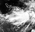
SATELLITE IMAGERY INDICATES RAGGED EYE OF THE SYSTEM. THE DIAMETER OF THE EYE OF THE SYSTEM IS ABOUT 12 KM. THE EYE TEMPERATURE IS -650C. THE INTENSITY OF THE SYSTEM IS T4.0 ASSOCIATED BROKEN/SOLID INTENSE TO VERY INTENSE CONVECTION OBSERVED OVER AREA BETWEEN LAT. 13.00 N TO 20.00 N AND LONG. 54.00 TO 62.00 E. THE LOWEST CLOUD TOP TEMPERATURE (CTT) DUE TO CONVECTION IS ABOUT -800C IN ASSOCIATION WITH THE SYSTEM.
VERTICAL WIND SHEAR OF HORIZONTAL WIND OVER THE REGION IS BETWEEN 05-10 KNOTS. THE SYSTEM LIES TO THE SOUTH OF TROPOSPHERIC RIDGE, WHICH ROUGHLY RUNS ALONG 20.00 N OVER THE REGION. THE RELATIVE VORTICITY AT 850 HPA LEVEL AND UPPER LEVEL DIVERGENCE ARE ALSO FAVOURABLE FOR FURTHER INTENSIFICATION.
THE CURRENT ENVIRONMENTAL CONDITIONS AND NUMERICAL WEATHER PREDICTION MODELS SUGGEST THAT THE SYSTEM WOULD INTENSIFY FURTHER AND MOVE SLOWLY IN A NORTH-NORTHWESTERLY/NORTHERLY DIRECTION FOR NEXT 24 HOURS CLOSE TO OMAN COAST AND THEN RECURVE NORTHEASTWARDS TOWARDS PAKISTAN AND ADJOINING GUJARAT COASTS, SKIRTING OMAN COAST UNDER THE INFLUENCE OF THE APPROACHING TROUGH IN MID-LATITUDE WESTERLIES AT 500 HPA LEVEL.
GALE WINDS WITH SPEED REACHING 120-130 KMPH GUSTING TO 140 KMPH WOULD COMMENCE ALONG AND OFF OMAN COAST BY THE EVENING OF TODAY 2ND JUNE. IT IS LIKELY TO INCREASE GRADUALLY BECOMING 170-190 KMPH BY 3RD JUNE EVENING AND 210-220 KMPH BY 4TH JUNE MORNING. SEA CONDITIONS WILL BE PHENOMENAL ALONG AND OFF OMAN COAST.
SUSTAINED MAXIMUM SURFACE WIND SPEED IS ESTIMATED TO BE ABOUT 65 KNOTS. THE STATE OF THE SEA IS PHENOMENAL AROUND THE SYSTEM CENTRE. THE ESTIMATED CENTRAL PRESSURE IS ABOUT 980 HPA.
SATELLITE IMAGERY INDICATES RAGGED EYE OF THE SYSTEM. THE DIAMETER OF THE EYE OF THE SYSTEM IS ABOUT 12 KM. THE EYE TEMPERATURE IS -650C. THE INTENSITY OF THE SYSTEM IS T4.0 ASSOCIATED BROKEN/SOLID INTENSE TO VERY INTENSE CONVECTION OBSERVED OVER AREA BETWEEN LAT. 13.00 N TO 20.00 N AND LONG. 54.00 TO 62.00 E. THE LOWEST CLOUD TOP TEMPERATURE (CTT) DUE TO CONVECTION IS ABOUT -800C IN ASSOCIATION WITH THE SYSTEM.
VERTICAL WIND SHEAR OF HORIZONTAL WIND OVER THE REGION IS BETWEEN 05-10 KNOTS. THE SYSTEM LIES TO THE SOUTH OF TROPOSPHERIC RIDGE, WHICH ROUGHLY RUNS ALONG 20.00 N OVER THE REGION. THE RELATIVE VORTICITY AT 850 HPA LEVEL AND UPPER LEVEL DIVERGENCE ARE ALSO FAVOURABLE FOR FURTHER INTENSIFICATION.
THE CURRENT ENVIRONMENTAL CONDITIONS AND NUMERICAL WEATHER PREDICTION MODELS SUGGEST THAT THE SYSTEM WOULD INTENSIFY FURTHER AND MOVE SLOWLY IN A NORTH-NORTHWESTERLY/NORTHERLY DIRECTION FOR NEXT 24 HOURS CLOSE TO OMAN COAST AND THEN RECURVE NORTHEASTWARDS TOWARDS PAKISTAN AND ADJOINING GUJARAT COASTS, SKIRTING OMAN COAST UNDER THE INFLUENCE OF THE APPROACHING TROUGH IN MID-LATITUDE WESTERLIES AT 500 HPA LEVEL.
GALE WINDS WITH SPEED REACHING 120-130 KMPH GUSTING TO 140 KMPH WOULD COMMENCE ALONG AND OFF OMAN COAST BY THE EVENING OF TODAY 2ND JUNE. IT IS LIKELY TO INCREASE GRADUALLY BECOMING 170-190 KMPH BY 3RD JUNE EVENING AND 210-220 KMPH BY 4TH JUNE MORNING. SEA CONDITIONS WILL BE PHENOMENAL ALONG AND OFF OMAN COAST.
0 likes
-
bvigal

- S2K Supporter

- Posts: 2276
- Joined: Sun Jul 24, 2005 8:49 am
- Location: British Virgin Islands
- Contact:
Re: ARABIAN SEA -SEVERE CYCLONIC STORM PHET (03A)
Looks nasty! Salmon, sure hope it doesn't hit you in Karachi! But unfortunately, it has to hit somewhere... with a storm this intense, conditions will deteriorate long before landfall.
0 likes
Who is online
Users browsing this forum: No registered users and 43 guests