ATL : INVEST 92L - DISCUSSION

Moderator: S2k Moderators

Message
Author
User avatar
ROCK
Category 5
Category 5
Posts: 9483
Age: 54
Joined: Tue Aug 17, 2004 7:30 am
Location: Kemah, Texas

Re: ATL : INVEST 92L

#21 Postby ROCK » Sat Jun 12, 2010 5:47 pm

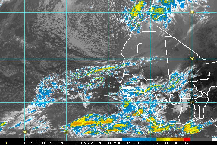
Vortex wrote:After analyzing some of the Hi-Res satellite images this evening it certainly appears as though this system is becoming better organized. In fact latest images clearly depict deep convection firing over what appears to be the developing center.


agree..here is another closeup..

http://oiswww.eumetsat.org/IPPS/html/MS ... /index.htm
0 likes   

User avatar
Ivanhater
Storm2k Moderator
Storm2k Moderator
Posts: 11153
Age: 38
Joined: Fri Jul 01, 2005 8:25 am
Location: Pensacola

Re: ATL : INVEST 92L

#22 Postby Ivanhater » Sat Jun 12, 2010 5:51 pm

Looking good...

Image
0 likes   
Michael

User avatar
cycloneye
Admin
Admin
Posts: 143867
Age: 68
Joined: Thu Oct 10, 2002 10:54 am
Location: San Juan, Puerto Rico

Re: ATL : INVEST 92L

#23 Postby cycloneye » Sat Jun 12, 2010 5:53 pm

Ivanhater wrote:Looking good...

Image


Ivan,is that image at the NRL site as 92L is still not there?
0 likes   
Visit the Caribbean-Central America Weather Thread where you can find at first post web cams,radars
and observations from Caribbean basin members Click Here

User avatar
Ivanhater
Storm2k Moderator
Storm2k Moderator
Posts: 11153
Age: 38
Joined: Fri Jul 01, 2005 8:25 am
Location: Pensacola

Re: ATL : INVEST 92L

#24 Postby Ivanhater » Sat Jun 12, 2010 6:02 pm

Luis, Good question. That image was posted on another site and use to loop, now its not. Let me post another loop.

Image
Last edited by Ivanhater on Sat Jun 12, 2010 6:02 pm, edited 1 time in total.
0 likes   
Michael

RL3AO
Moderator-Pro Met
Moderator-Pro Met
Posts: 16308
Joined: Thu Jun 14, 2007 10:03 pm
Location: NC

#25 Postby RL3AO » Sat Jun 12, 2010 6:02 pm

I'd be stunned if it developed, but anything can happen.
0 likes   

User avatar
ROCK
Category 5
Category 5
Posts: 9483
Age: 54
Joined: Tue Aug 17, 2004 7:30 am
Location: Kemah, Texas

Re: ATL : INVEST 92L

#26 Postby ROCK » Sat Jun 12, 2010 6:08 pm

Ivan, you guys are also under the gun if you get something come your way...Your storm surge multiplier for AL,MS, and FL Panhandle is around 1.0-1.5....cant even imagine a IKE like surge pushing all that oil into the coastal communities....
0 likes   

Dean4Storms
S2K Supporter
S2K Supporter
Posts: 6358
Age: 62
Joined: Sun Aug 31, 2003 1:01 pm
Location: Miramar Bch. FL

Re: ATL : INVEST 92L

#27 Postby Dean4Storms » Sat Jun 12, 2010 6:10 pm

Very impressive wave. Decent convection and some rotation. If the convection retains overnight then we could have a player IMO.
0 likes   

User avatar
Ivanhater
Storm2k Moderator
Storm2k Moderator
Posts: 11153
Age: 38
Joined: Fri Jul 01, 2005 8:25 am
Location: Pensacola

Re: ATL : INVEST 92L

#28 Postby Ivanhater » Sat Jun 12, 2010 6:18 pm

ROCK wrote:Ivan, you guys are also under the gun if you get something come your way...Your storm surge multiplier for AL,MS, and FL Panhandle is around 1.0-1.5....cant even imagine a IKE like surge pushing all that oil into the coastal communities....


I hear that Rock, it's been sometime since the horrific surge from Ivan. Bad thing about this season , it looks like many coastal cities and communities are going to be under the gun. High tomorrow is 99 for an unusual early summer heat wave. Gulf is baking!
0 likes   
Michael

User avatar
Ivanhater
Storm2k Moderator
Storm2k Moderator
Posts: 11153
Age: 38
Joined: Fri Jul 01, 2005 8:25 am
Location: Pensacola

Re: ATL : INVEST 92L

#29 Postby Ivanhater » Sat Jun 12, 2010 6:21 pm

What is the date?!

Image
0 likes   
Michael

User avatar
Gustywind
Category 5
Category 5
Posts: 12334
Joined: Mon Sep 03, 2007 7:29 am
Location: Baie-Mahault, GUADELOUPE

#30 Postby Gustywind » Sat Jun 12, 2010 6:36 pm

Image
0 likes   

User avatar
cycloneye
Admin
Admin
Posts: 143867
Age: 68
Joined: Thu Oct 10, 2002 10:54 am
Location: San Juan, Puerto Rico

Re: ATL : INVEST 92L

#31 Postby cycloneye » Sat Jun 12, 2010 6:39 pm

ABNT20 KNHC 122338
TWOAT
TROPICAL WEATHER OUTLOOK
NWS TPC/NATIONAL HURRICANE CENTER MIAMI FL
800 PM EDT SAT JUN 12 2010

FOR THE NORTH ATLANTIC...CARIBBEAN SEA AND THE GULF OF MEXICO...

A BROAD AREA OF LOW PRESSURE LOCATED ABOUT 750 MILES SOUTHWEST OF
THE CAPE VERDE ISLANDS IS SHOWING SOME SIGNS OF ORGANIZATION THIS
EVENING. SLOW DEVELOPMENT OF THIS SYSTEM IS POSSIBLE OVER THE NEXT
COUPLE OF DAYS AS THE LOW MOVES TOWARD THE WEST-NORTHWEST AT 10 TO
15 MPH. THERE IS A LOW CHANCE...20 PERCENT...OF THIS SYSTEM
BECOMING A TROPICAL CYCLONE DURING THE NEXT 48 HOURS.

ELSEWHERE...TROPICAL CYCLONE FORMATION IS NOT EXPECTED DURING THE
NEXT 48 HOURS.

$$
FORECASTER BLAKE

Image
0 likes   
Visit the Caribbean-Central America Weather Thread where you can find at first post web cams,radars
and observations from Caribbean basin members Click Here

User avatar
Gustywind
Category 5
Category 5
Posts: 12334
Joined: Mon Sep 03, 2007 7:29 am
Location: Baie-Mahault, GUADELOUPE

#32 Postby Gustywind » Sat Jun 12, 2010 6:48 pm

:uarrow:
Image
0 likes   

User avatar
x-y-no
Category 5
Category 5
Posts: 8359
Age: 64
Joined: Wed Aug 11, 2004 12:14 pm
Location: Fort Lauderdale, FL

#33 Postby x-y-no » Sat Jun 12, 2010 6:53 pm

I'd be real pleased to see the HWRF/GFDL scenario verify - NW movement, quick intensification - a nice little fishy hurricane to start the season. :)

I expect it to stay more southerly and weaker, though.
0 likes   

User avatar
AdamFirst
S2K Supporter
S2K Supporter
Posts: 2491
Age: 36
Joined: Thu Aug 14, 2008 10:54 am
Location: Port Saint Lucie, FL

#34 Postby AdamFirst » Sat Jun 12, 2010 6:53 pm

A (legitimate) Cape Verde invest in early June.

It's gonna be a long year folks.
0 likes   
Dolphins Marlins Canes Golden Panthers HEAT
Andrew 1992 - Irene 1999 - Frances 2004 - Jeanne 2004 - Wilma 2005 - Fay 2008 - Isaac 2012 - Matthew 2016 - Irma 2017 - Dorian 2019 - Ian 2022 - Nicole 2022 - Milton 2024

User avatar
Ivanhater
Storm2k Moderator
Storm2k Moderator
Posts: 11153
Age: 38
Joined: Fri Jul 01, 2005 8:25 am
Location: Pensacola

Re: ATL : INVEST 92L

#35 Postby Ivanhater » Sat Jun 12, 2010 7:01 pm

Impressive development today

6 hours ago

Image

Now

Image

Image
0 likes   
Michael

Dean4Storms
S2K Supporter
S2K Supporter
Posts: 6358
Age: 62
Joined: Sun Aug 31, 2003 1:01 pm
Location: Miramar Bch. FL

Re:

#36 Postby Dean4Storms » Sat Jun 12, 2010 7:03 pm

x-y-no wrote:I'd be real pleased to see the HWRF/GFDL scenario verify - NW movement, quick intensification - a nice little fishy hurricane to start the season. :)

I expect it to stay more southerly and weaker, though.


I don't know, way too early to say if they verified that this would be a fish.
0 likes   

User avatar
wxman57
Moderator-Pro Met
Moderator-Pro Met
Posts: 22951
Age: 67
Joined: Sat Jun 21, 2003 8:06 pm
Location: Houston, TX (southwest)

Re: ATL : INVEST 92L

#37 Postby wxman57 » Sat Jun 12, 2010 7:16 pm

I'm enjoying my last weekend off until December...

Although I don't think that this system will make it (develop), it's a bad sign as far as the seasonal forecasts verifying. Bad meaning the forecasts will probably verify.
0 likes   

User avatar
x-y-no
Category 5
Category 5
Posts: 8359
Age: 64
Joined: Wed Aug 11, 2004 12:14 pm
Location: Fort Lauderdale, FL

Re: Re:

#38 Postby x-y-no » Sat Jun 12, 2010 7:19 pm

Dean4Storms wrote:
x-y-no wrote:I'd be real pleased to see the HWRF/GFDL scenario verify - NW movement, quick intensification - a nice little fishy hurricane to start the season. :)

I expect it to stay more southerly and weaker, though.


I don't know, way too early to say if they verified that this would be a fish.


They have it gaining a lot of latitude fast and there will be a weakness ahead for a developed system to turn into, so I'm pretty confident that scenario would mean fish storm.
0 likes   

CrazyC83
Professional-Met
Professional-Met
Posts: 34001
Joined: Tue Mar 07, 2006 11:57 pm
Location: Deep South, for the first time!

#39 Postby CrazyC83 » Sat Jun 12, 2010 7:25 pm

Has there ever been a true Cape Verde storm in June?
0 likes   

User avatar
brunota2003
S2K Supporter
S2K Supporter
Posts: 9476
Age: 34
Joined: Sat Jul 30, 2005 9:56 pm
Location: Stanton, KY...formerly Havelock, NC
Contact:

#40 Postby brunota2003 » Sat Jun 12, 2010 7:28 pm

I will admit that this is pretty cool to watch, with it being so far out. Hopefully it'll develop into a small storm for us all to track and refresh our memories after nearly a year off since we last really had something to track (and stay a fishy!)
0 likes   


Return to “2010”

Who is online

Users browsing this forum: No registered users and 57 guests